Overview
|
Sunday, April 9th was an unseasonably warm day across the area with a warm front bisecting Upper Michigan. During the afternoon hours, an elongated area of training showers and thunderstorms developed along this frontal boundary across central and eastern portions of Upper Michigan. Later Sunday night into Monday, with little southward movement, the warm front continued to initiate convection across northern Wisconsin as moisture began to lift back north. This convection then moved across central portions of Upper Michigan bringing large hail and damaging straight-line winds of 70-80 mph. The strongest winds were focused from Republic into Negaunee in Marquette County as the convection grew upscale into a bow echo. At one point, over 5,000 residences and businesses were without power due to sporadic to widespread power outages from Republic into Negaunee. |
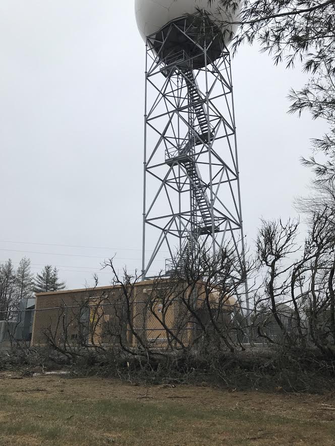 Rotted, large tree snapped and fell just on the north of the Doppler radar at the NWS office in the Negaunee Township. |
Wind & Hail:
Wind
While limited observations directly sampled the straight-line damaging winds across Marquette County, significant damage was reported with numerous large trees uprooted, power poles and transmission lines snapped, as well as property damage from Republic into Neagunee. Based on the damage, straight-line damaging winds were estimated to be around 80 mph at their peak in the Ishpeming area.
| Location | Wind Speeds (mph) |
| National Weather Service, Negaunee Township | 71 |
 |
 |
 |
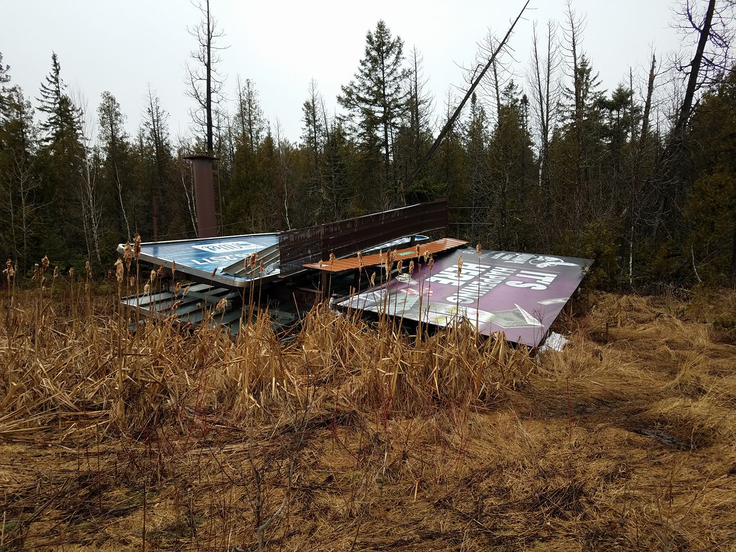 |
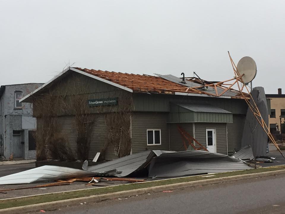
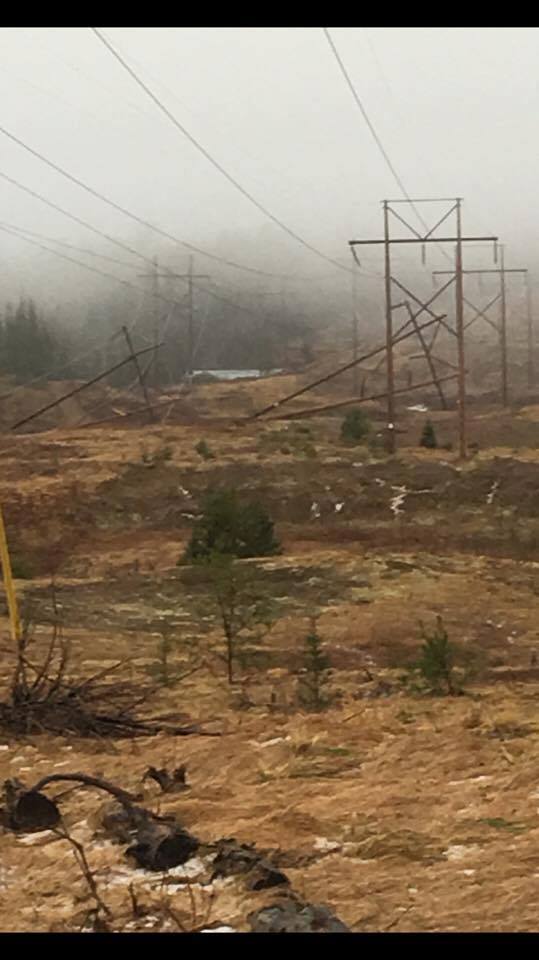
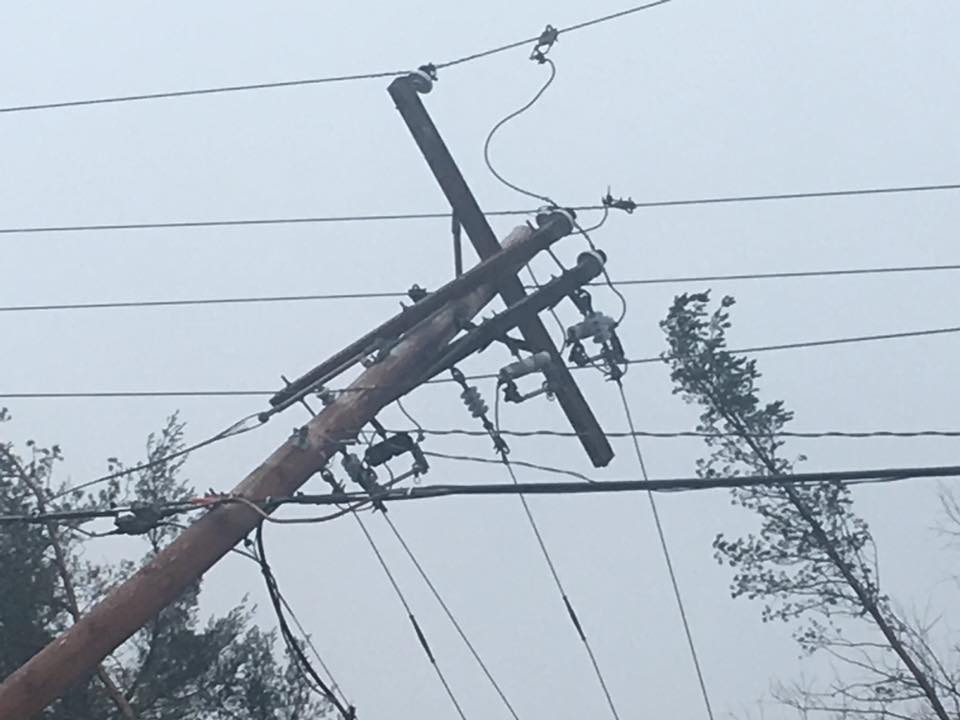
| Roof damage to Edward Jones in Ishpeming. Photo courtesy of TV 6. | Damage high-tension transition lines west of Ishpeming, near Aspen Ridge Middle School. Photo courtesy of TV 6. | Downed power lines in Ishpeming. Photo courtesy of ABC 10. | Billboard blown over along U.S. 41 in Negaunee. Photo courtesy of WJMN. |
 |
 |
 |
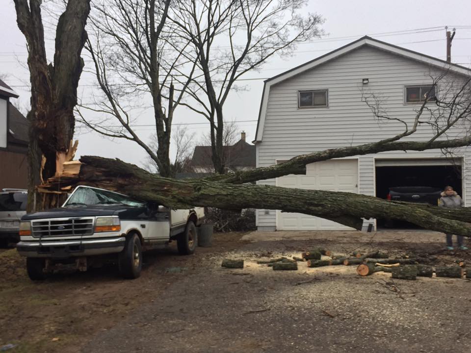 |
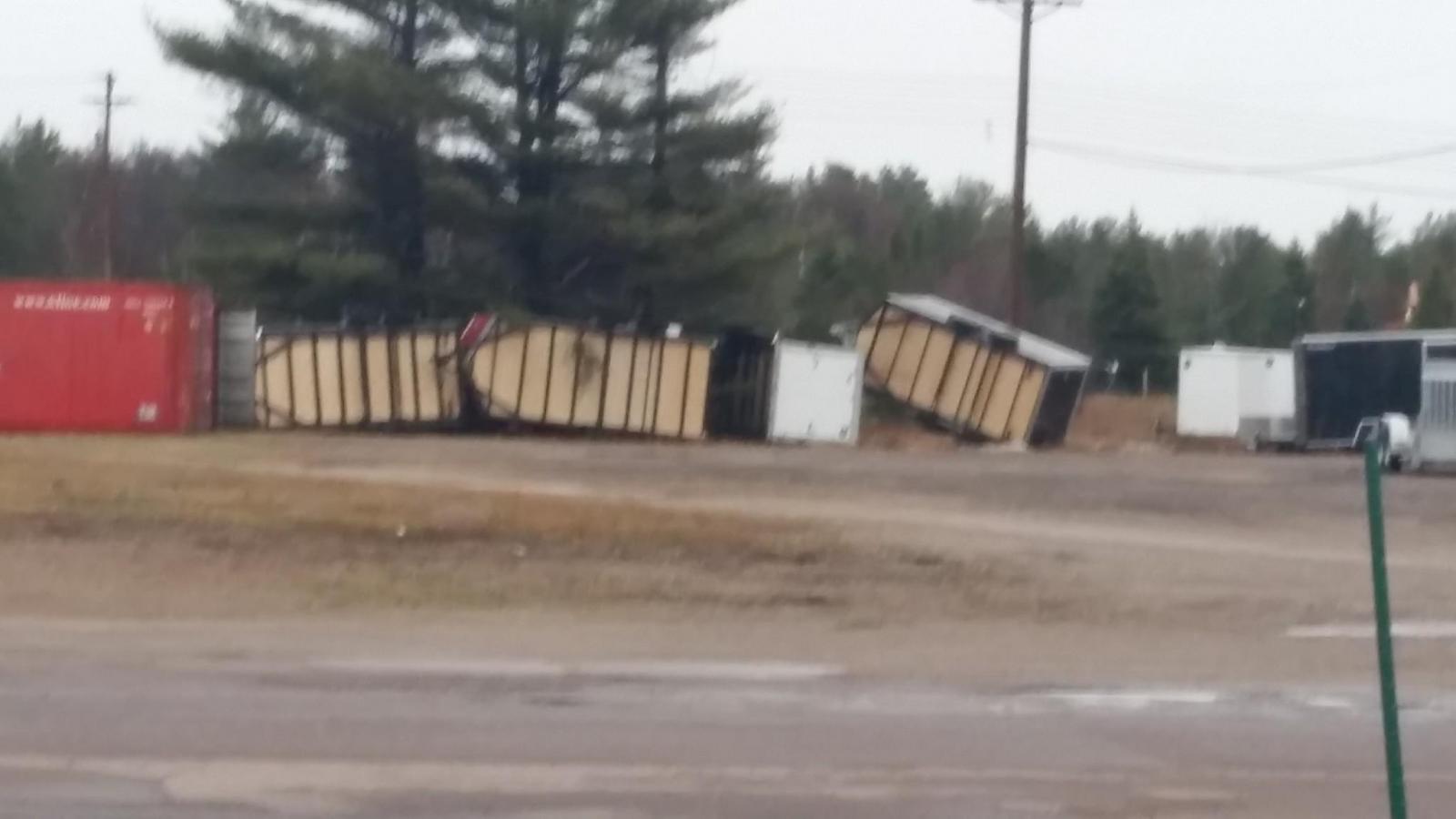
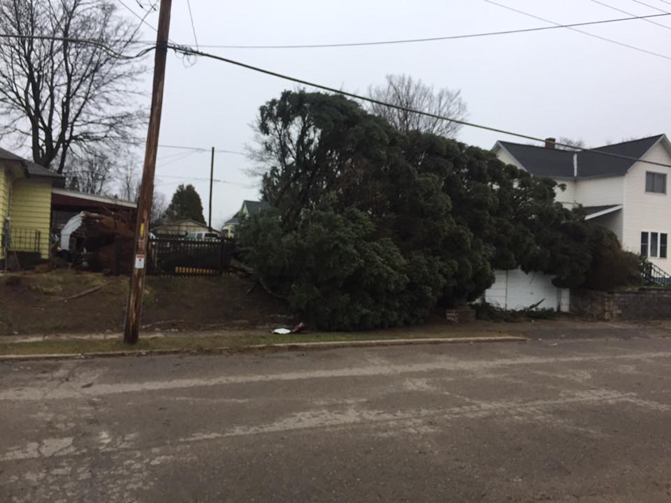
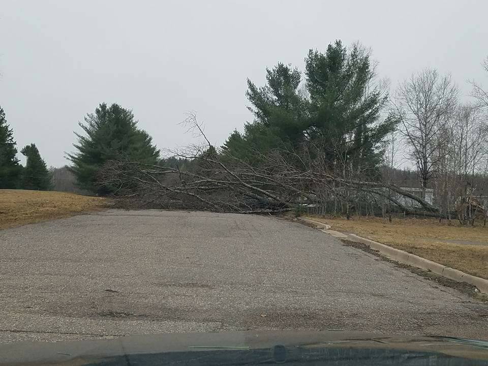
| Flipped trailers in Negaunee Township. Photo courtesy of TV 6. | Large tree uprooted in Ishpeming. Photo courtesy of TV 6. | One of many images showing large trees down across Republic. Photo courtesy of Sarah Wheeler. | Large tree snapped in Ishpeming. Photo courtesy of TV 6. |
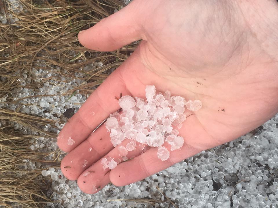
Hail
Many locations reported accumulating hail with sizes small than 1 inch. See the table below for hailstone's that met or exceeded 1 inch.
| Location | Hail Size (inch) |
| 1 WNW Iron Mountain | 1.00 |
| 5 NW Bewabic State Park |
1.00 |
| Gwinn | 1.00 |
| 3 NNE Little Lake | 1.75 |
 |
 |
| Photo courtesy of TV 6. | Photo courtesy of ABC 10. |
Radar:
 |
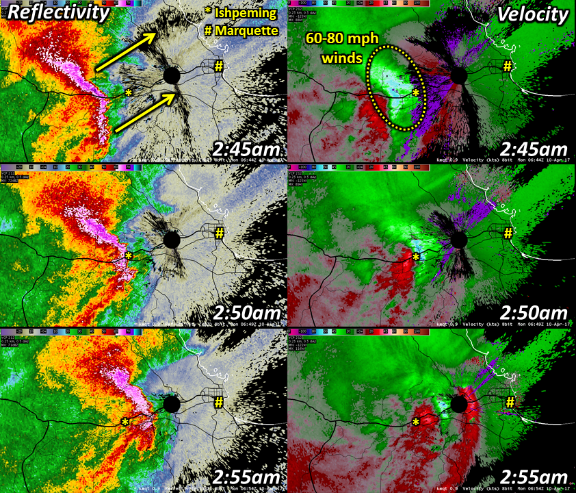 |
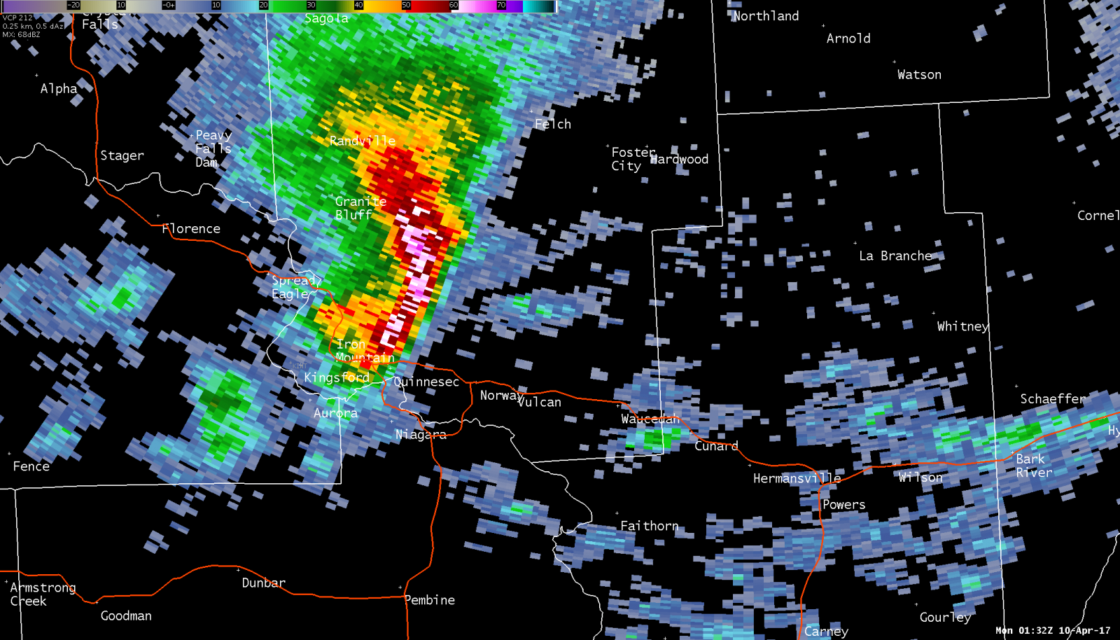
| Storm that moved into south central Upper Michigan and dropped nickel to quarter size hail NW of Iron Mountain around 9:25 pm EDT Sunday, April 9th. | 0.5 degree reflectivity and velocity from the NWS radar showing the evolution of 60-80 mph winds associated with a bow echo as it came into Ishpeming during the early morning hours on Monday, April 10th. |
 |
Media use of NWS Web News Stories is encouraged! Please acknowledge the NWS as the source of any news information accessed from this site. |
|

