Marquette, MI
Weather Forecast Office
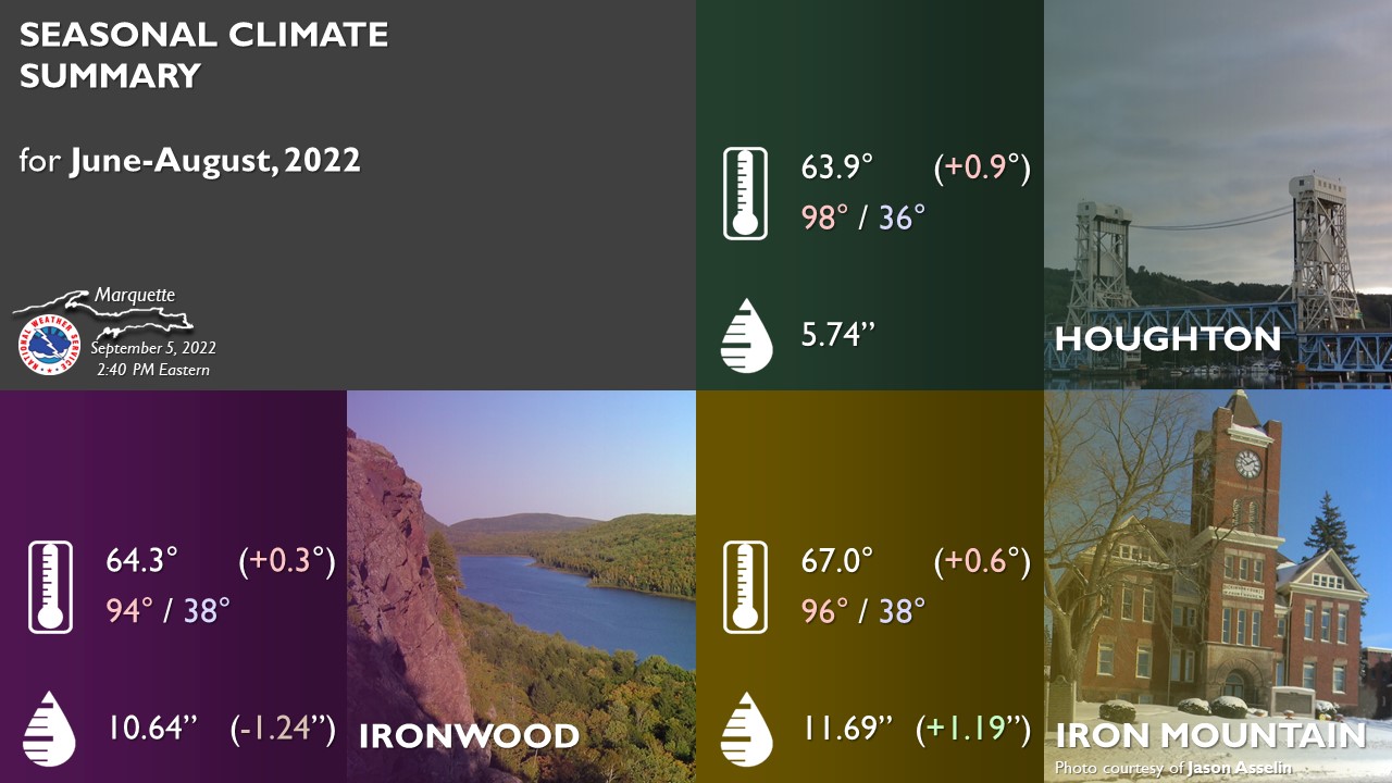
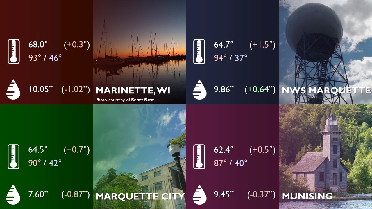
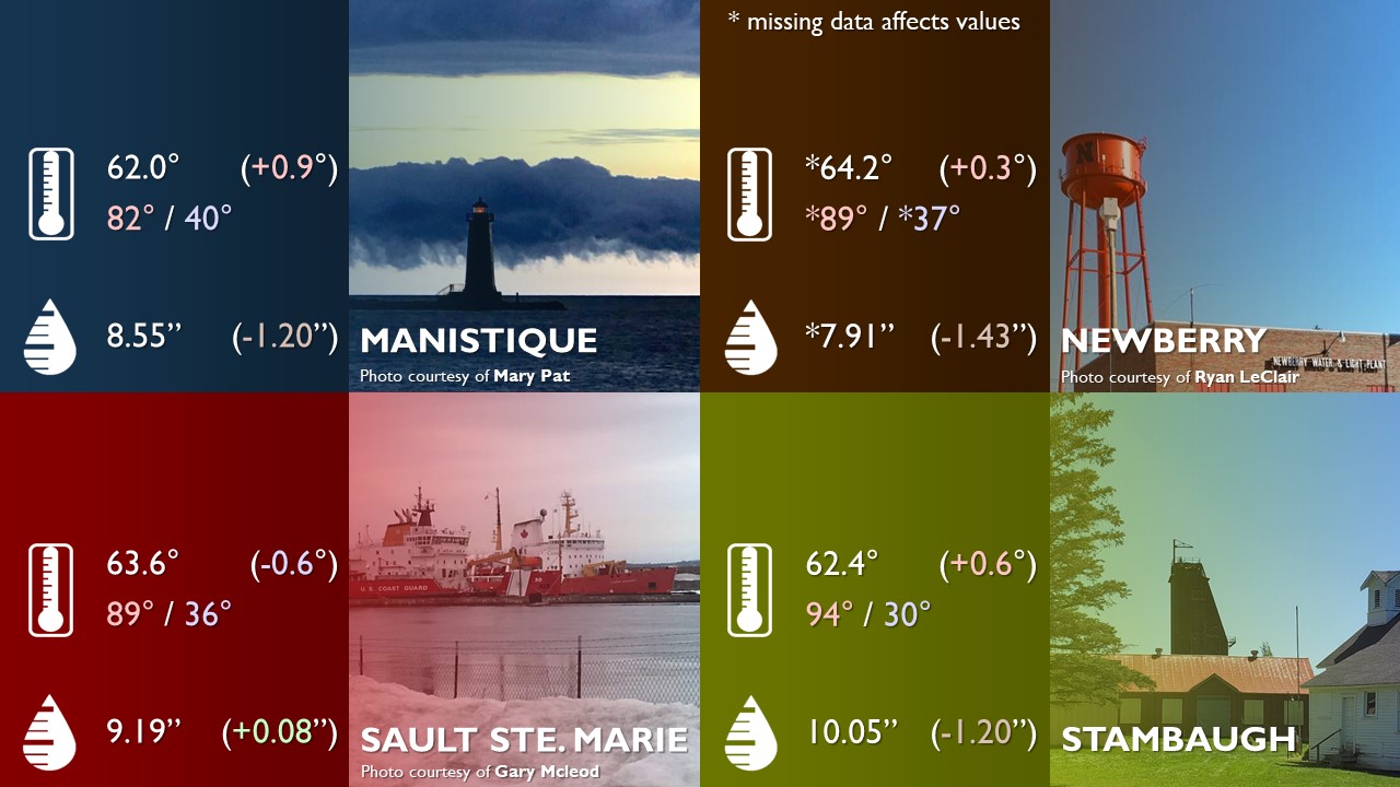
Meteorological summer is officially over and most locations observed a slightly warmer and drier June through August than normal, but generally closer to normal than last summer was. The hottest temperature observed was 98°F at Houghton on June 20th and the coldest temperature was 30°F at Stambaugh on June 4th. The largest single-day rainfall was 2.65 inches in Ironwood on July 4th. See the images below for more information.
US Dept of Commerce
National Oceanic and Atmospheric Administration
National Weather Service
Marquette, MI
112 Airpark Drive South
Negaunee, MI 49866
906-475-5212
Comments? Questions? Please Contact Us.

