Overview of Late-Season Winter Storm April 12-13, 2020
|
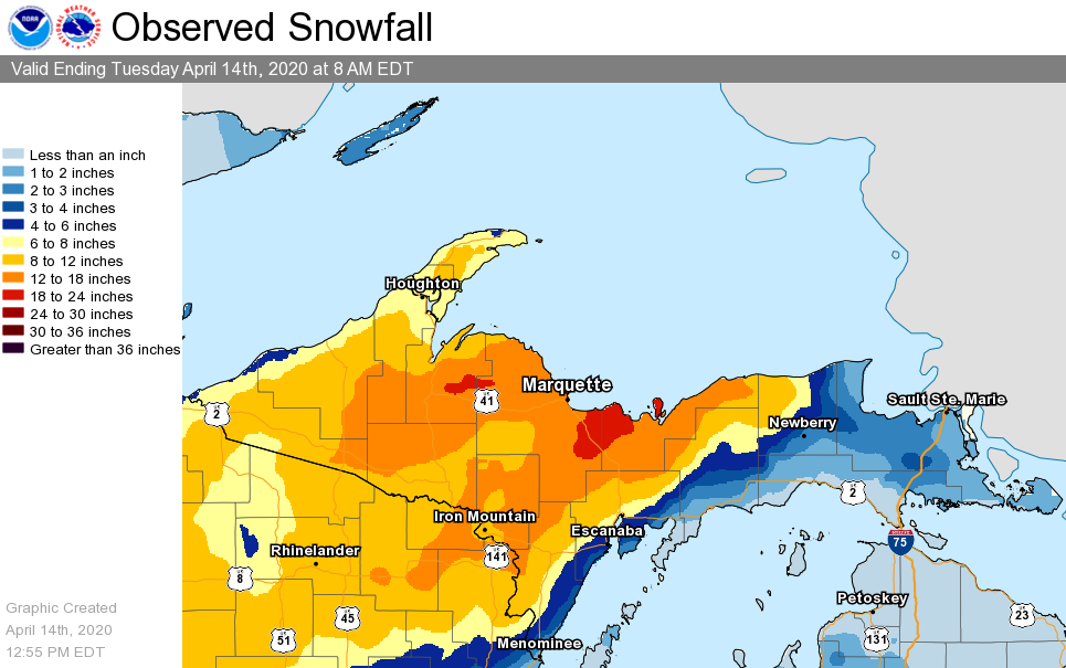
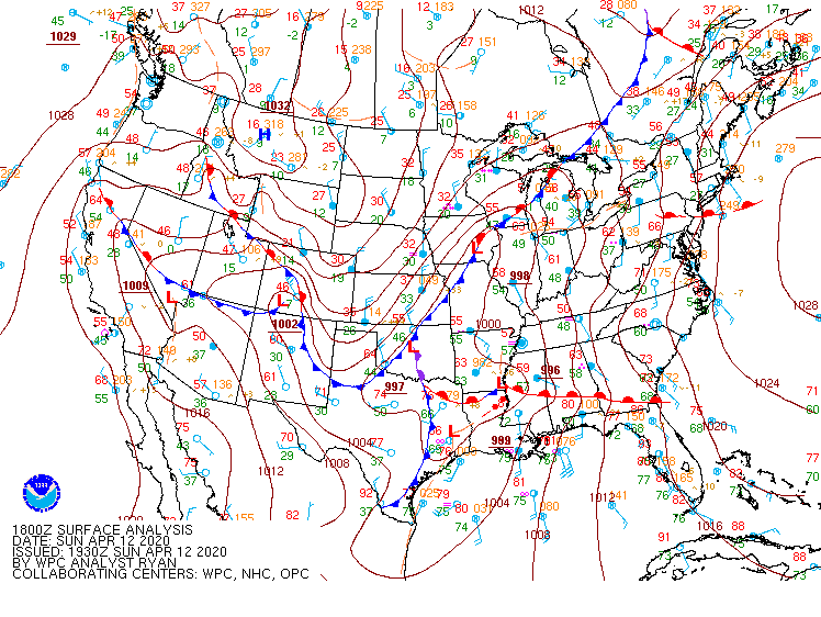
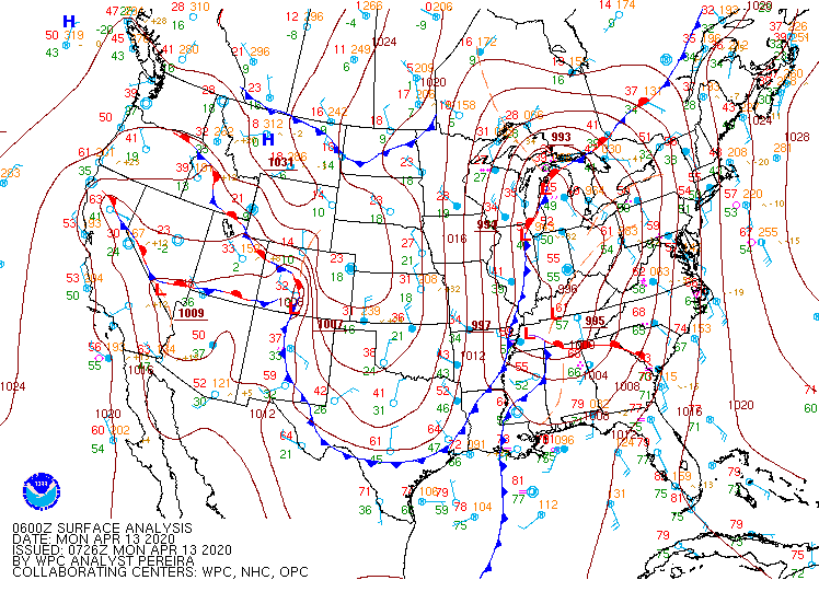
An area of low pressure lifted northeast across the Great Lakes Region, deepening as it traversed lower Michigan Sunday night through Monday, before exiting into Ontario. This is a favorable storm track for parts of central Upper Michigan to see accumulating snow and strong winds. This event in particular featured two main waves of snow. The first wave arrived late Sunday into Monday morning as impressive large-scale lift and warm air advection lifting across eastern Upper Michigan. While widespread snow developed with this first round, the heaviest snow focused across central parts of the Upper Peninsula where a strengthening baroclinic zone setup and pivoted Sunday night into early Monday morning. Communities along the Lake Michigan shoreline across south-central Upper Michigan saw significantly lower amounts of snow as rain mixed in with snow. Across eastern parts of Upper Michigan, temperatures warmed above freezing Sunday night, favoring mostly all rain. At most, a few locations out east saw a dusting of snow by daybreak Monday. Through the mid-morning hours on Monday, the system began to exit the region and widespread snow came to an end. Colder air wrapping in behind the system and lingering large-scale lift favored the transition over to lake-enhanced snow, mostly confined to the north and northwest wind snow belts. These lake-enhanced snow persisted through much of the day, with strong north to northwest winds. By Monday evening, lake-enhanced snow tapered off with one lingering, strong dominant lake-effect snow band that impacted areas east of Munising. |
Visit this link to review local storm reports from this event. |
Snow & Winds
 |
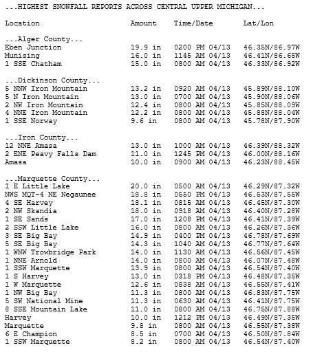 |
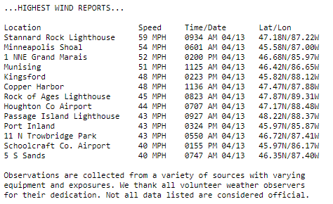
| Highest wind reports | Highest snowfall reports from central Upper Michigan |
Photos & Impacts
 |
 |
 |
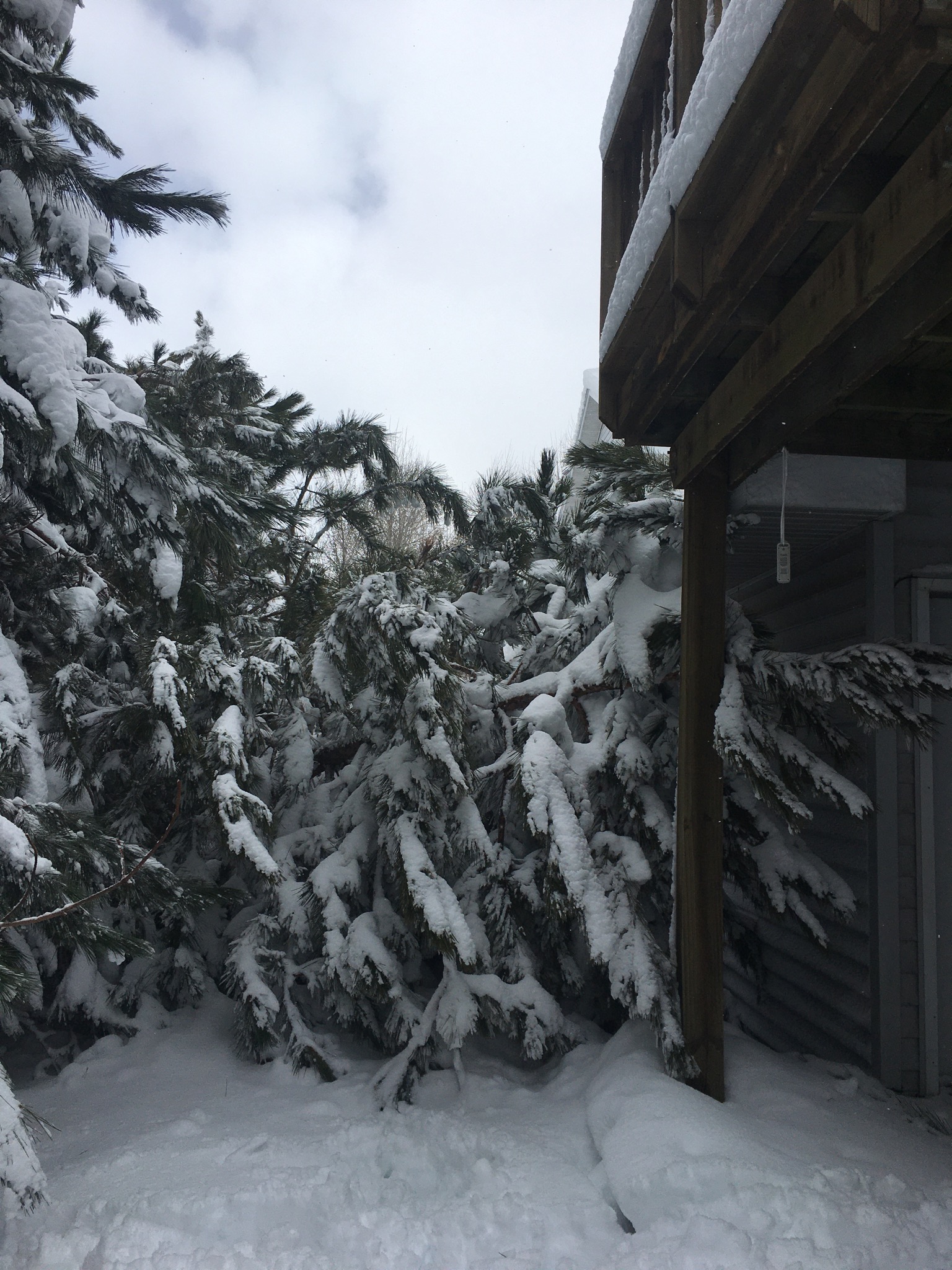
| Tree Damage in the Harvey area (NWS Employee) |
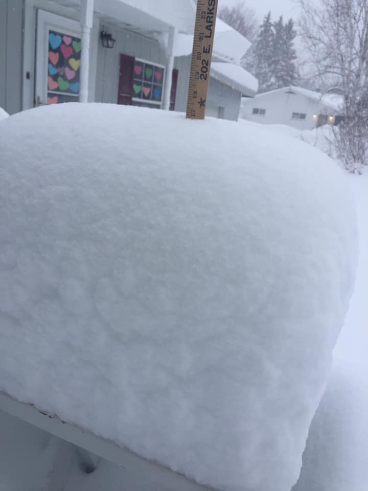
8 am Snowfall of 17'' in the Eben Junction area (Susan Swaim) |
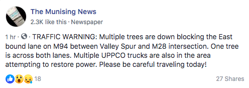
Reports of trees down near Munsing, Michigan (The Munising News Facebook Page) |
Track of the Surface Low
 |
 |
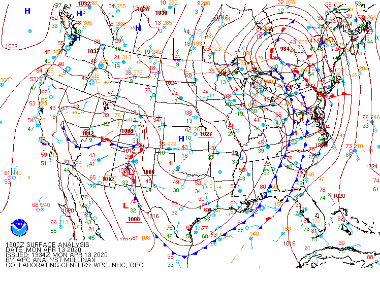 |
| Surface Map, 2 pm Sunday, April 12th | Surface Map, 2 am Monday, April 13th | Surface Map, 2 pm Monday April 13th |
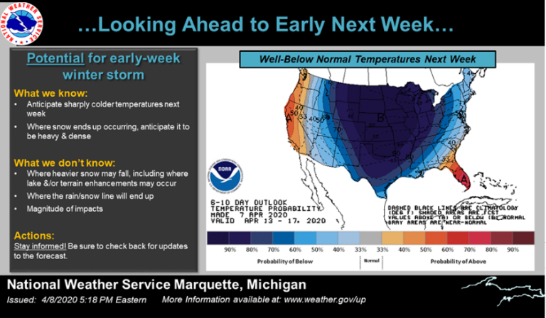
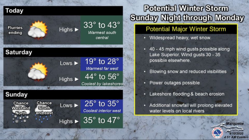
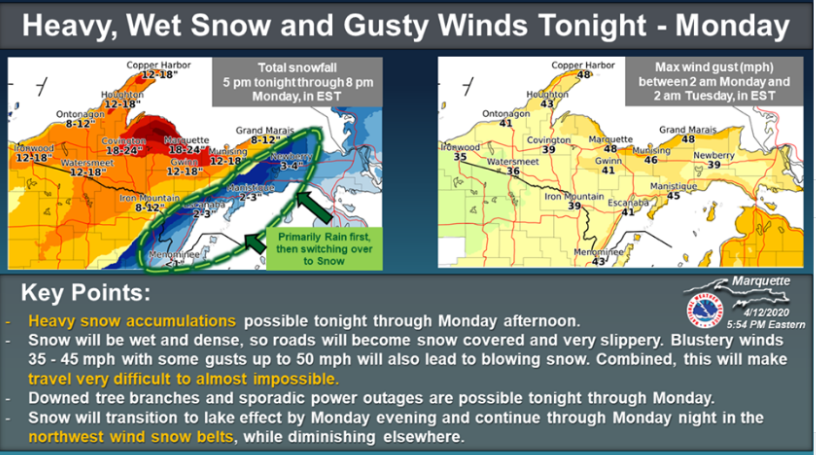
Social Media Messaging:
 |
 |
| First mentions of the potential winter storm on Wednesday, April 8th. | Messaging continued through the end of the week, with some potential impacts being highlighted on the morning of Friday, April 10th. |
 |
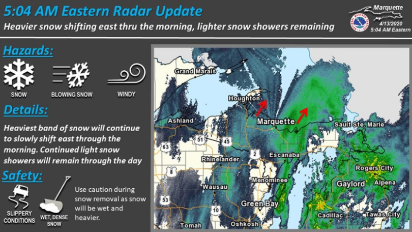 |
| Messaging continued over the weekend, with a highlight on forecast snowfall amounts and expected strong winds on the evening of Sunday, April 12th. | As the event was unfolding, social media radar updates and impacts where updated on the morning and afternoon of Monday, April 13th. |
Forecast Product/Headline Messaging:
| Event Messaging | Day/Time |
| Mentions of winter storm potential in the Hazardous Weather Outlook | April 8 |
| Special Weather Statement issued highlighting the potential winter storm |
April 9 |
| Winter Storm Watch and Gale/Storm Watches issued | April 10 |
| Winter Storm Watches Upgraded to Warnings | April 11 |
| Gale/Storm Watches Upgraded to Warnings, Minor adjustments to Winter Storm Headlines, Issuance of Lakeshore Flood Warnings along Lake Superior | April 12 |
Summaries from other NWS Offices
 |
Media use of NWS Web News Stories is encouraged! Please acknowledge the NWS as the source of any news information accessed from this site. |
|