HOME
FORECAST
Local
Graphical
Aviation
Marine
Rivers and Lakes
Hurricanes
Severe Weather
Fire Weather
Sunrise/Sunset
Long Range Forecasts
Climate Prediction
Space Weather
PAST WEATHER
Past Weather
Astronomical Data
Certified Weather Data
SAFETY
INFORMATION
Wireless Emergency Alerts
Weather-Ready Nation
Brochures
Cooperative Observers
Daily Briefing
Damage/Fatality/Injury Statistics
Forecast Models
GIS Data Portal
NOAA Weather Radio
Publications
SKYWARN Storm Spotters
StormReady
TsunamiReady
Service Change Notices
EDUCATION
NEWS
SEARCH
Search For
NWS
All NOAA
ABOUT
About NWS
Organization
For NWS Employees
National Centers
Careers
Contact Us
Glossary
Social Media
NWS Transformation
Local forecast by
"City, St" or ZIP code
Sorry, the location you searched for was not found. Please try another search.
Multiple locations were found. Please select one of the following:
Location Help
News Headlines
NOAA Weather Radio User Survey (Open until May 28, 2026)
Customize Your
Weather.gov
Enter Your City, ST or ZIP Code
Remember Me
LOADING...
Marquette, MI
Weather Forecast Office
NWS Marquette Aviation: Snow and Ice
Weather.gov
>
Marquette, MI
> NWS Marquette Aviation: Snow and Ice
Current Hazards
Experimental Graphical Hazardous Weather Outlook
Storm and Precipitation Reports
Outlooks
Submit a Storm Report
Current Conditions
Satellite
Local Ice Accumulation Reports
Local Snowfall Reports
Observed Precipitation
Snowfall Analysis
Observations
Local Storm Reports
Radar
Local Enhanced Radar
Local Standard Radar (low bandwidth)
Regional Standard Radar (low bandwidth)
Forecasts
Experimental Probabilistic Quantitative Precipitation Forecast
Experimental Heat Risk
Fire Weather
Winter Weather
Forecast Discussion
Hourly Forecasts
Rivers and Lakes
National Water Prediction Service (NWPS)
Climate and Past Weather
Drought
Local
Event Summaries
NOAA Climate Service
Local Programs
Publications
Blog
Current Obs and Weather
WFO MQT Observation
Winter Weather
Marine Hazardous Outook
Great Lakes Marine
Aviation
Beach Forecast
Isle Royale Recreational Forecast
Local Climate Information
Edmund Fitzgerald
Storm Spotter Training Schedule
Today in History
Additional Links
Observations & TAFs
Ceiling & Visibility
Icing / Turb. / Wind
Precipitation
Additional Links
Current Observations
Radar
Satellite
NWS Marquette TAF Page
Aviation Forecast Discussion
Current Ceiling/Visibility
IFR AIRMETs
Localized Aviation MOS Product (LAMP)
Icing
Wind and Turbulence
Significant Weather Charts
PIREPS
AIRMETS/SIGMETS
Precipitation
Convective Forecasts
Thunderstorms
Winter Weather Monitor
Snow and Ice
WPC Winter Page
Home Page
Standard Briefing Aid **Unofficial**
National Home Page
NWS Marquette Home Page
Graphical Forecast
Forecast Discussion
NOAA Weather Radio
Brief Weather Lessons
FAA Home Page
NOTAMs
Canadian Aviation Weather
Snowfall Potential
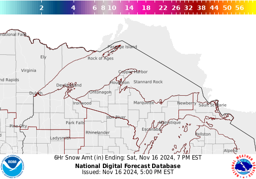
NWS Marquette 6-hourly Forecast Snowfall Amounts
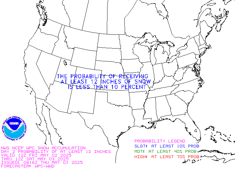
Weather Prediction Center Probability of Snow Amounts
Day 1
≥ 4"
≥ 8"
≥ 12"
Day 2
≥ 4"
≥ 8"
≥ 12"
Day 3
≥ 4"
≥ 8"
≥ 12"
Weather Prediction Center Probability of Snow Amounts
Updates Every 6 Hours. This is an experimental product and may not be available at all times
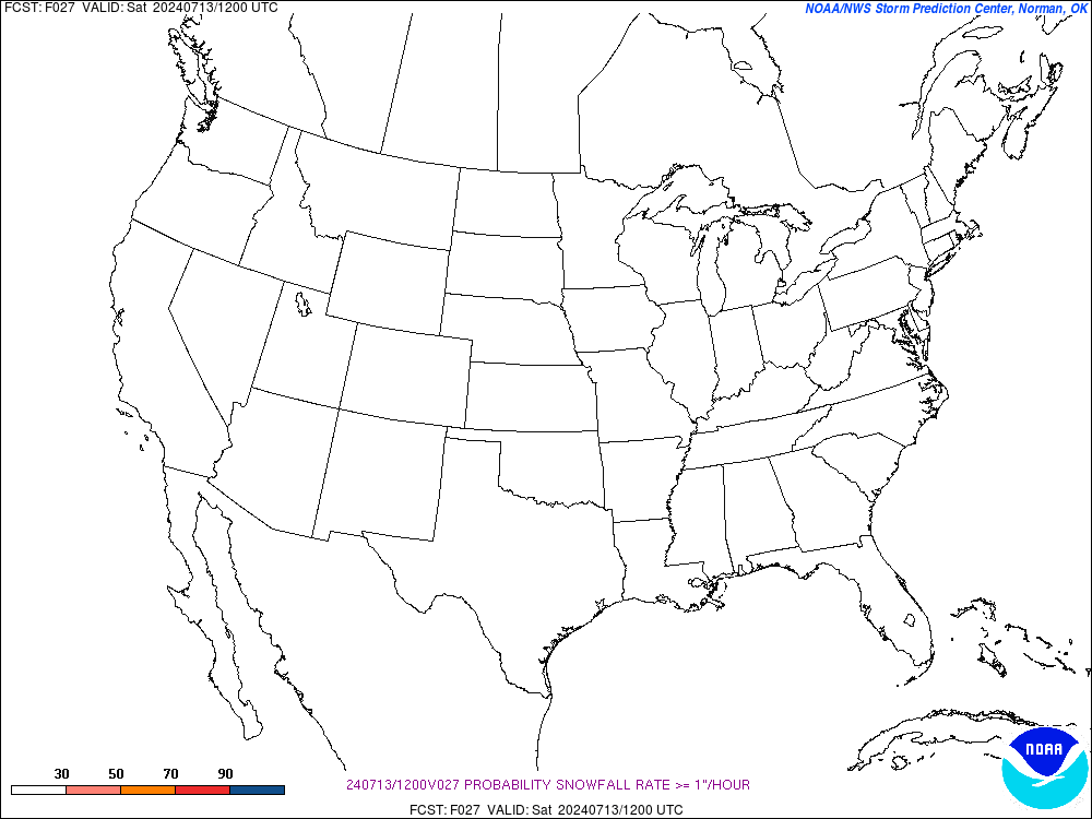
Modeled Probability of snow ≥1"/hr
Hr 3
Hr 6
Hr 9
Hr 12
Hr 15
Hr 18
Hr 21
Hr 24
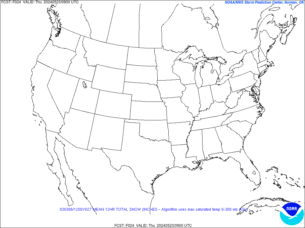
6hr Snowfall (Model Average)
Hr 3
Hr 6
Hr 9
Hr 12
Hr 15
Hr 18
Hr 21
Hr 24
12hr Snowfall (Model Average)
Hr 3
Hr 6
Hr 9
Hr 12
Hr 15
Hr 18
Hr 21
Hr 24
Current Modeled Snow Depth
Snow Depth
Snow Water Equivalent
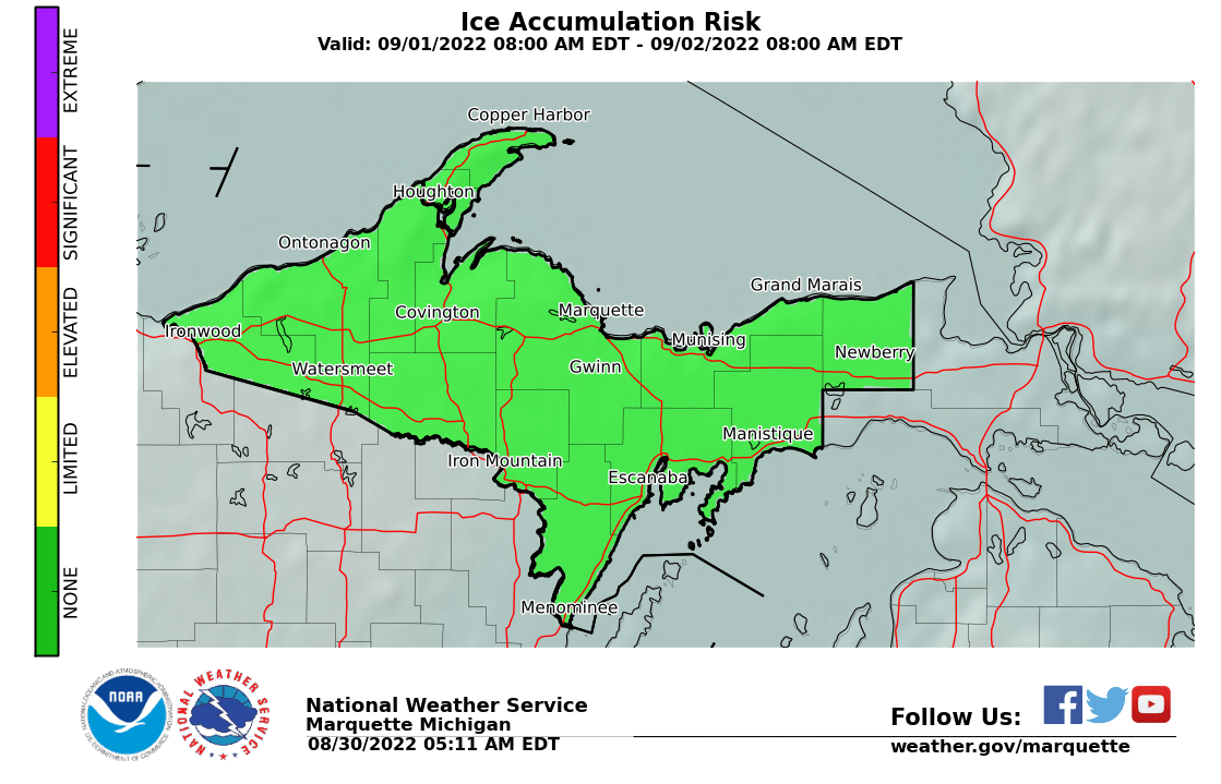
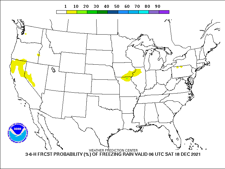
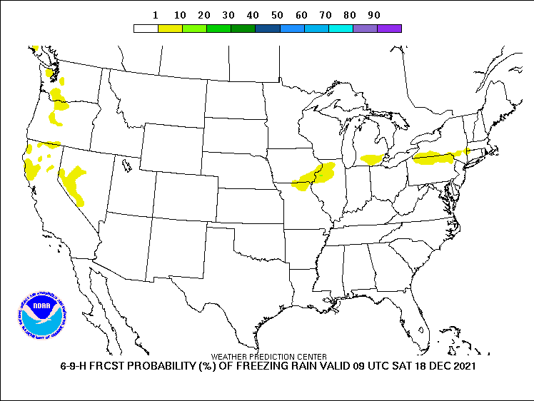
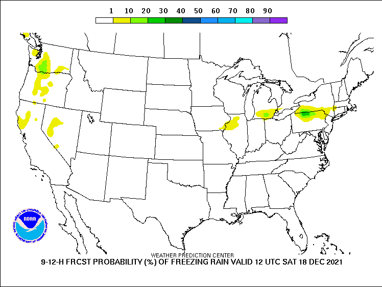
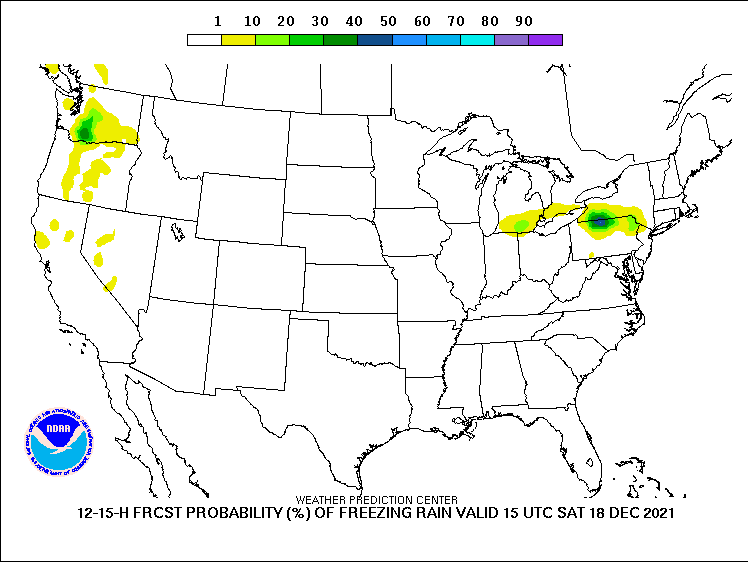
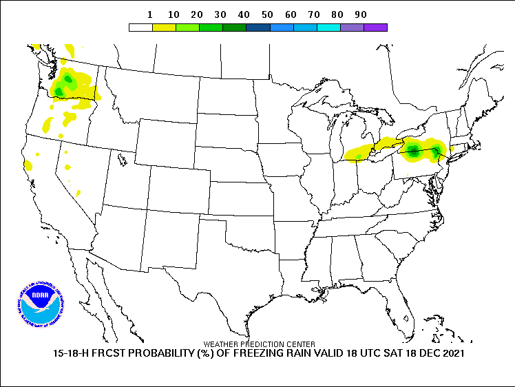
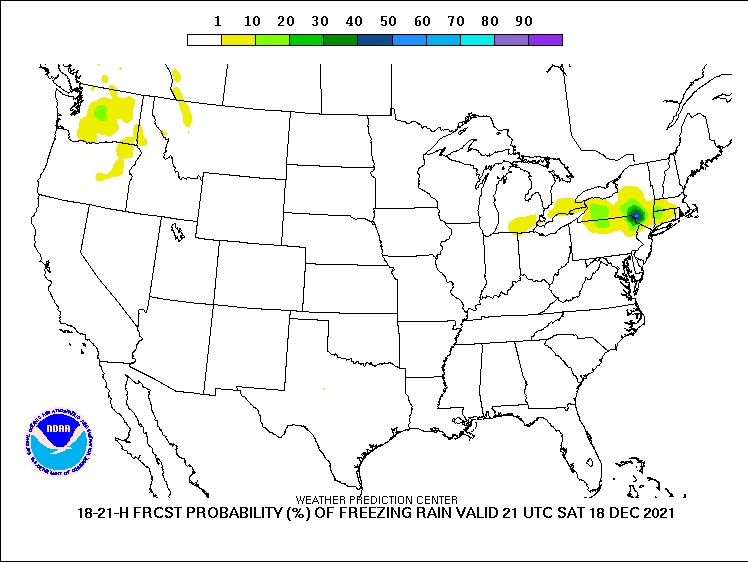
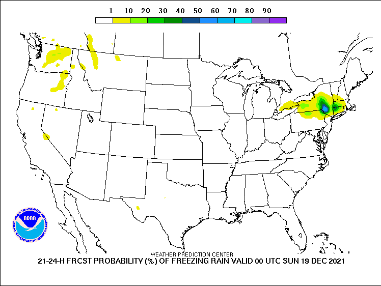
Freezing Rain Potential
Risk Level
Definition
None
No freezing rain or drizzle
Limited
Very light freezing rain or drizzle with no accumulation
Elevated
Freezing rain or drizzle with accumulation < 1/4 inch
Significant
Freezing rain with accumulation of 1/4 inch to < 1 inch
Extreme
Freezing rain with accumulation ≥ 1 inch
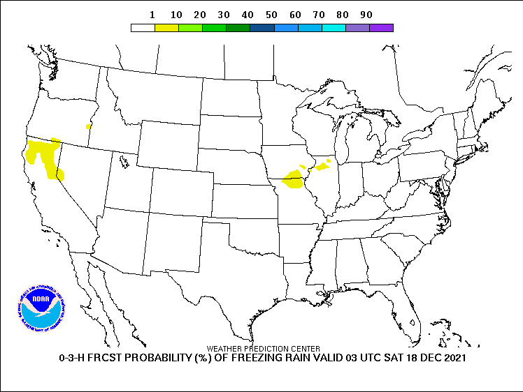
WPC Probability of
Any
Freezing Rain
Hr 3
Hr 6
Hr 9
Hr 12
Hr 15
Hr 18
Hr 21
Hr 24
Follow us on X
Follow us on Facebook
Follow us on YouTube
MQT RSS Feed