
Scattered severe storms are expected in the Midwest this afternoon/tonight, with another threat possible in the central/southern Plains. Late-season snow is expected over parts of the central Rockies including the Denver Metro into Wednesday. Severe thunderstorms are expected Tuesday and Wednesday across Texas and the mid-South, with threats of damaging winds, large hail, tornadoes, and flooding. Read More >
Overview
|
Multiple rounds of very heavy rain fell across much of the western portions of Upper Michigan during the 2018 Father's Day weekend (June 15th - 17th). The hardest-hit area was in Houghton County, MI, in which widespread rain amounts of 3 to almost 7 inches were measured, causing massive amounts of damage to the City of Houghton and surrounding areas.
|
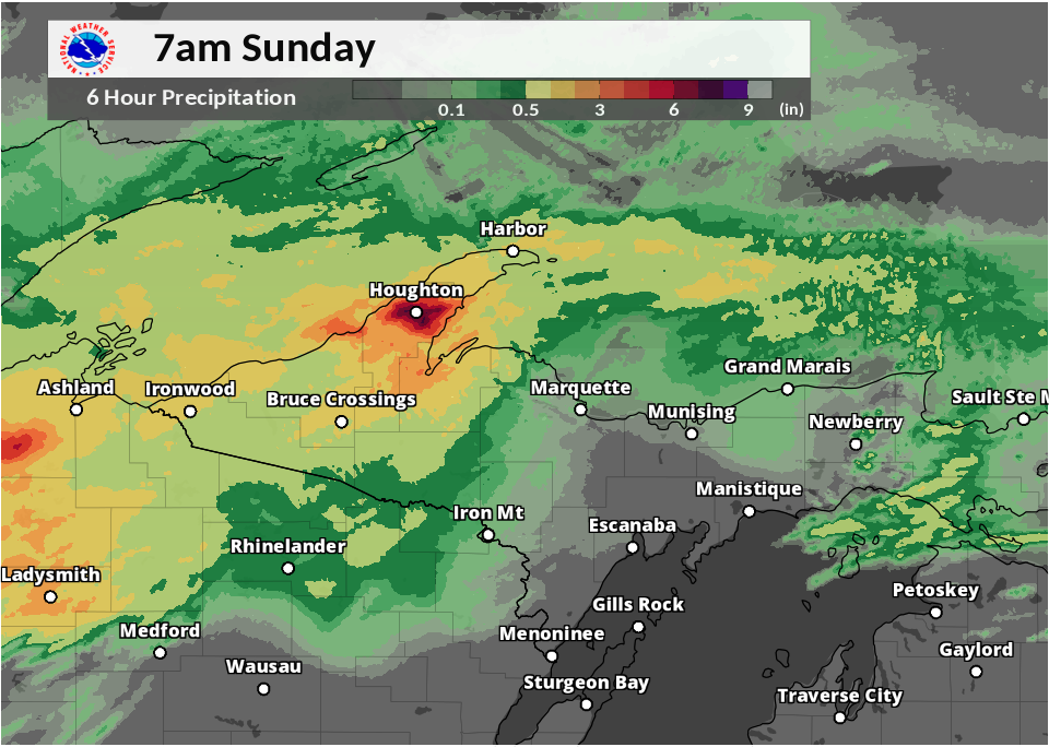 MRMS Gage Corrected Radar Estimates of Rain in the Early Morning June 17th |
Flooding
Extensive flooding was reported in Houghton County the morning of June 17th, 2018. Many roads have been washed out from Lake Linden through Dollar Bay, Hancock, and Houghton. Up to 7 inches of rain fell in the area between 11pm and 8am, with the majority of the rainfall coming in the 2am to 5am time frame.
Hydrographs
 |
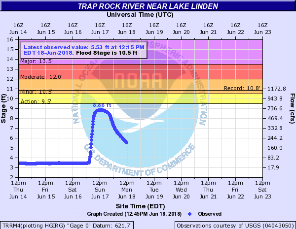 |
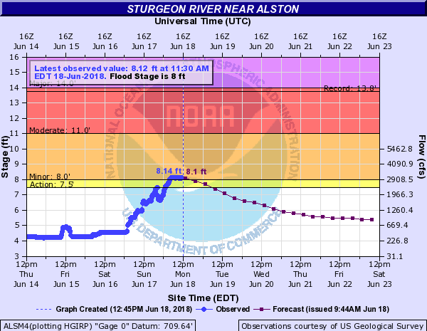
| Rising river levels on the Sturgeon River near Alston. As of 12pm EDT on June 18th, 2018. | Crest on the Trap Rock River near Lake Linden. As of 12pm EDT on June 18th, 2018. |
Radar
 |
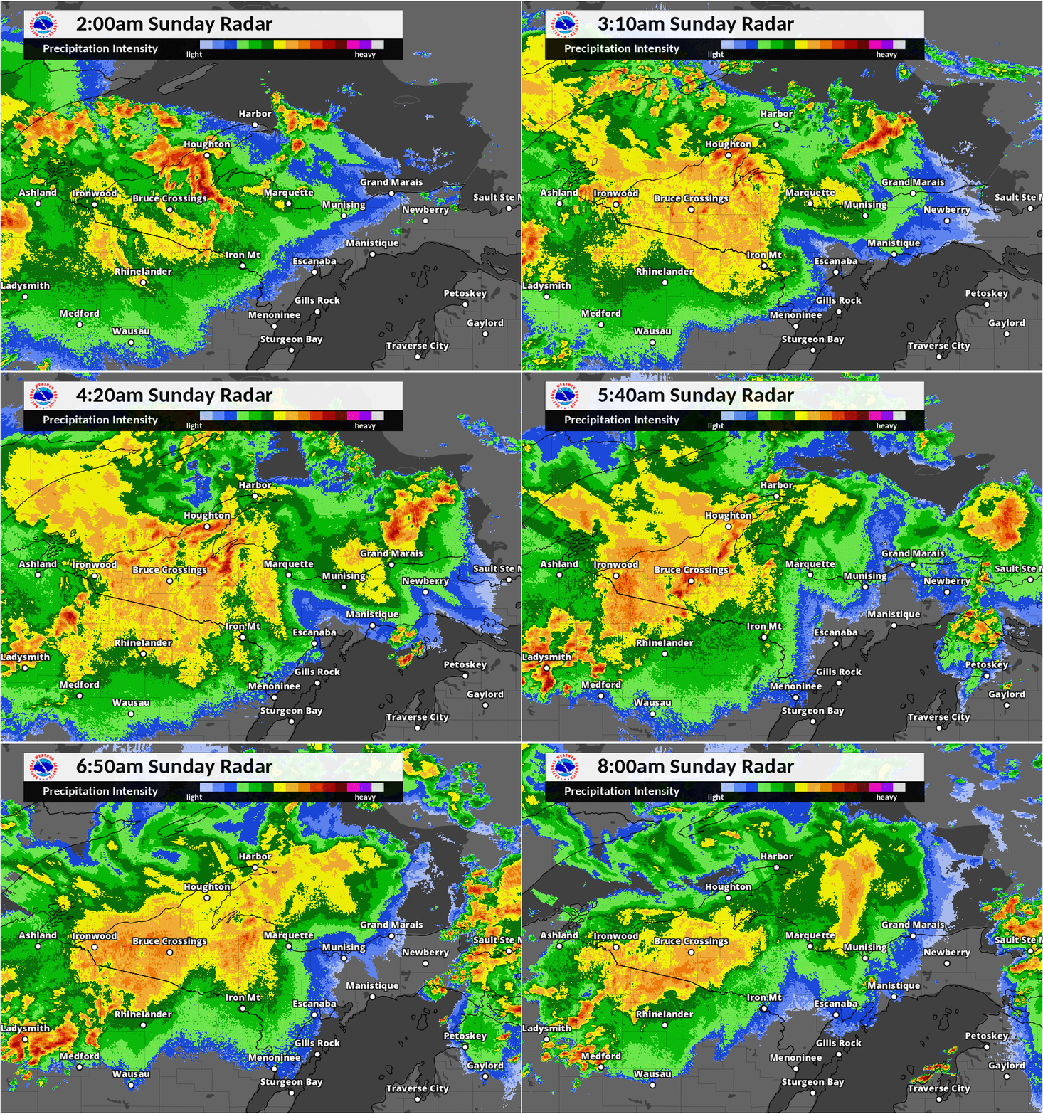 |
| Base reflectivity (at the 1.3 degree tilt) radar loop from 11pm through 9am EDT Sunday, June 17th | MRMS (radar) composite reflectivity loop from 2am through 8am EDT Sunday, June 17th |
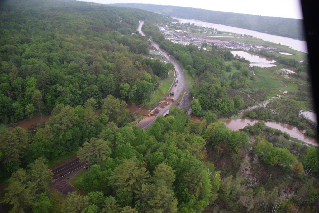
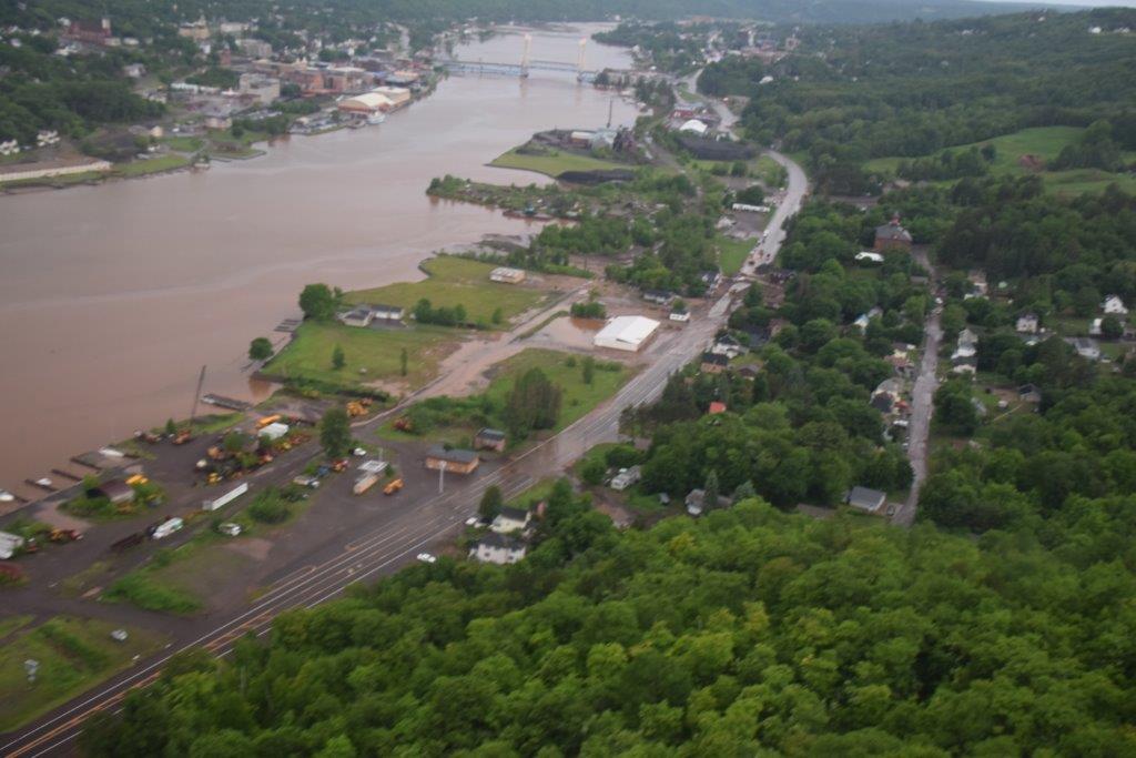
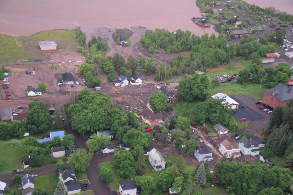
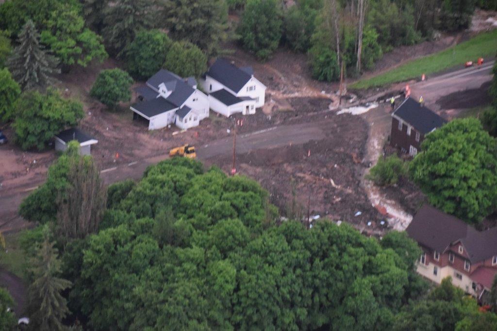
Michigan State Police Aerial Survey (City of Houghton & surrounding areas)
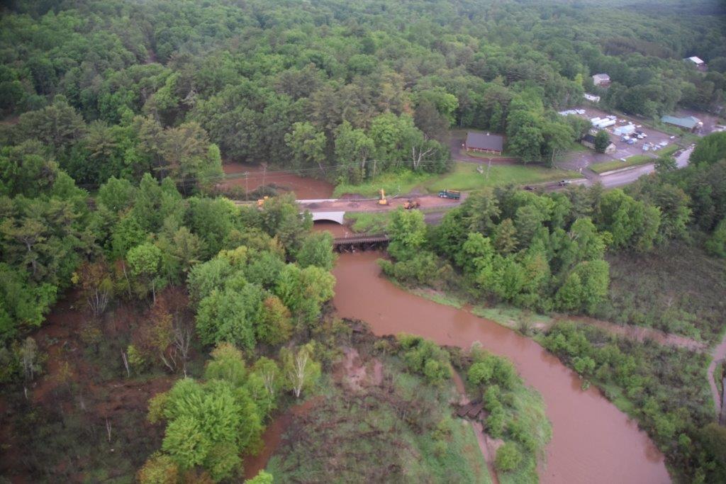 |
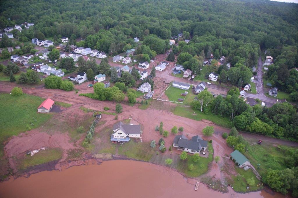 |
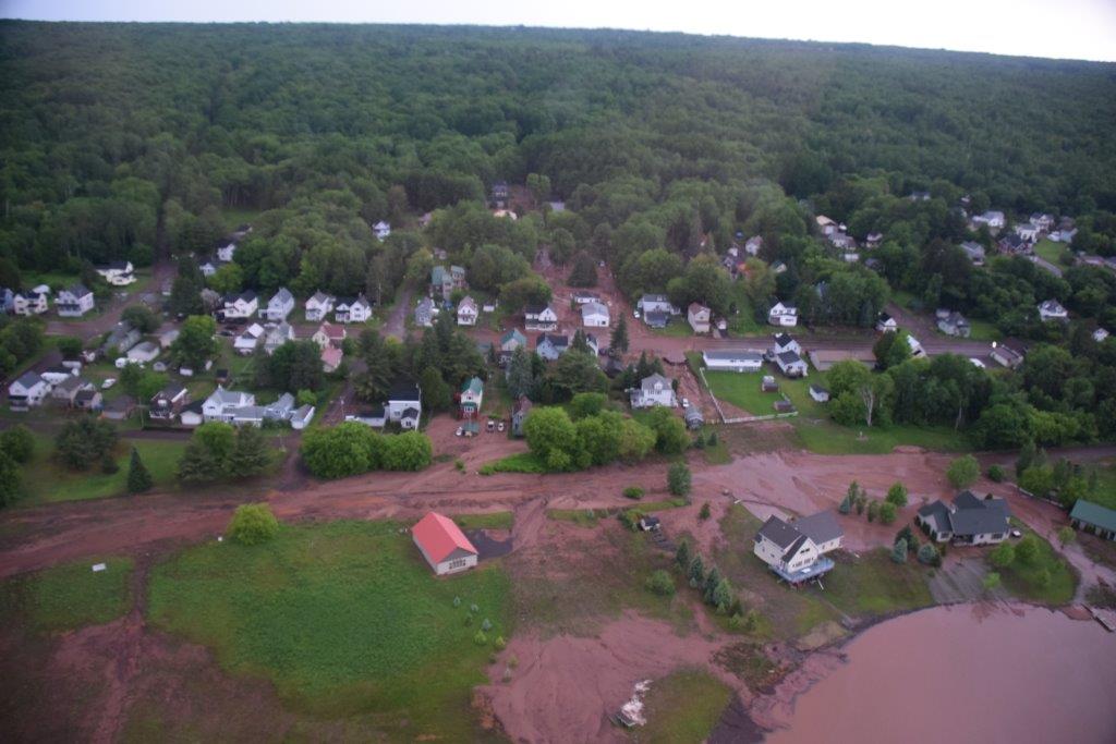 |
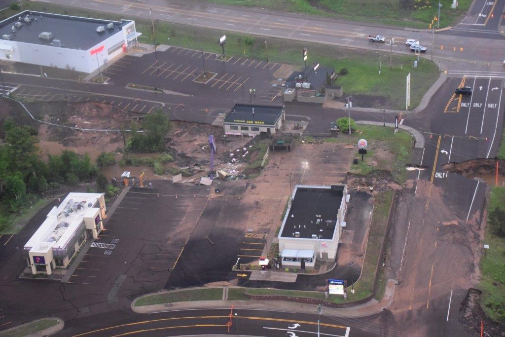 |
| US-41 at the Pilgrim River Bridge | Torch Lake Spruce St. & Tamarack St. Hubbell, MI |
Torch Lake Spruce St. & Tamarack St. Hubbell, MI |
Taco Bell/Burger King/Wilderness Car Wash W. Sharon Ave. between Ridge Rd. & Razorback Dr. |
 |
 |
 |
 |
| US-41 at the Pilgrim River Bridge | Portage Canal Lift Bridge Downtown Houghton, MI |
Portage Canal M-26 (Royce Rd.) between Burt St. & Arcadian St. Hancock, MI |
M-26 (Royce Rd.) at Ripley St. Hancock, MI |
Photos & Video
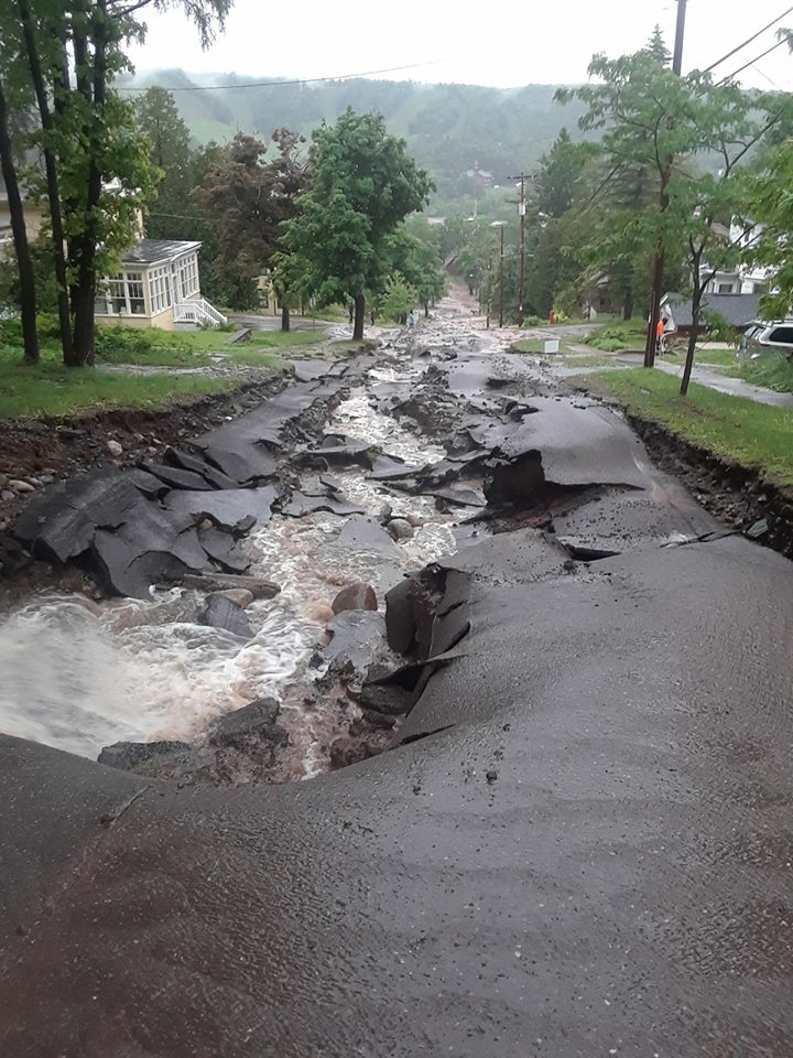 |
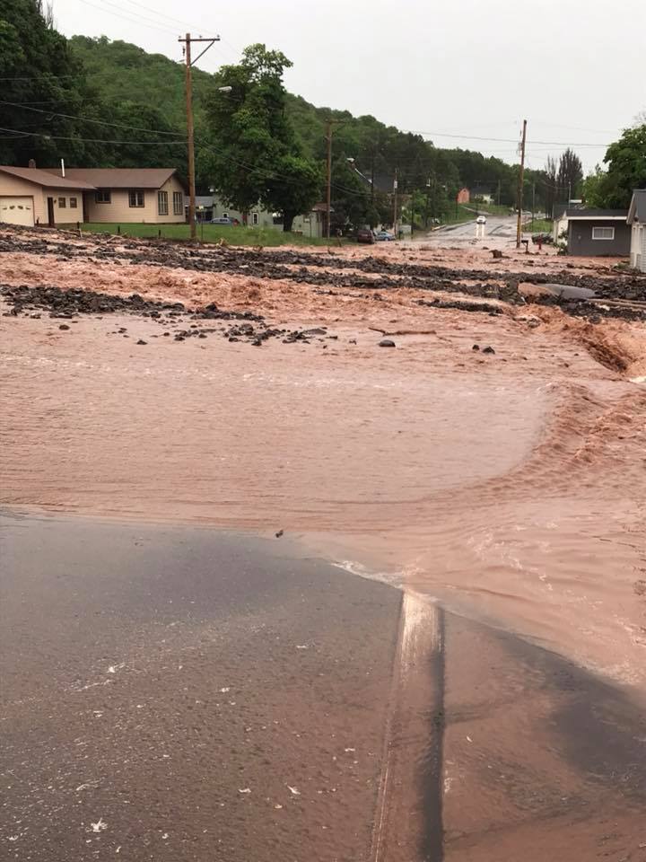 |
 |
 |
| Agate St. Houghton (Melissa Lubinski) |
Royce Rd. Ripley (Bruce Joyal) |
Sharon Ave Houghton |
Cemetary Rd (Richard Schreiner) |
 |
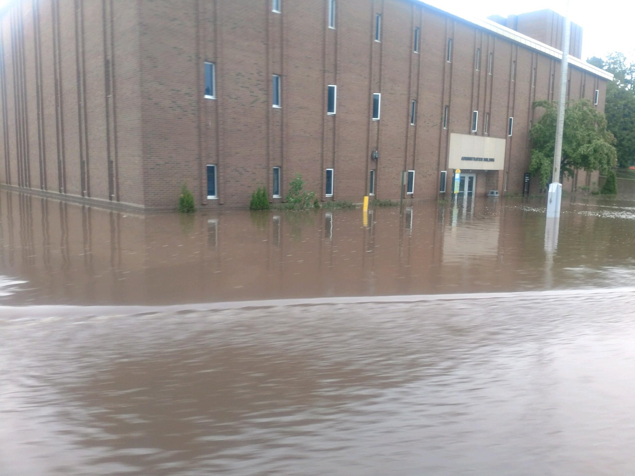 |
 |
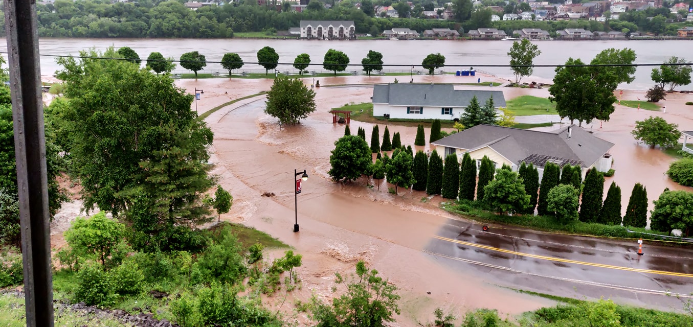 |
| Paradise Rd at Pilgrim River | Michigan Tech Campus (Michigan Tech) |
Near Portage Canal (Christopher Edwards) |
Portage Canal (Christopher Edwards) |
Meteorology
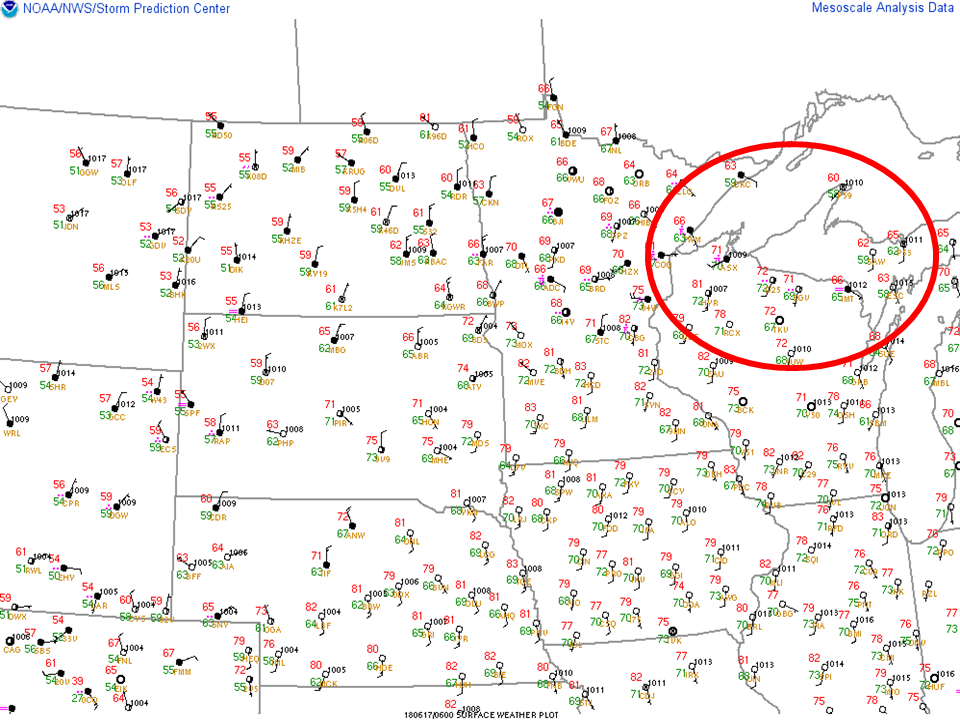
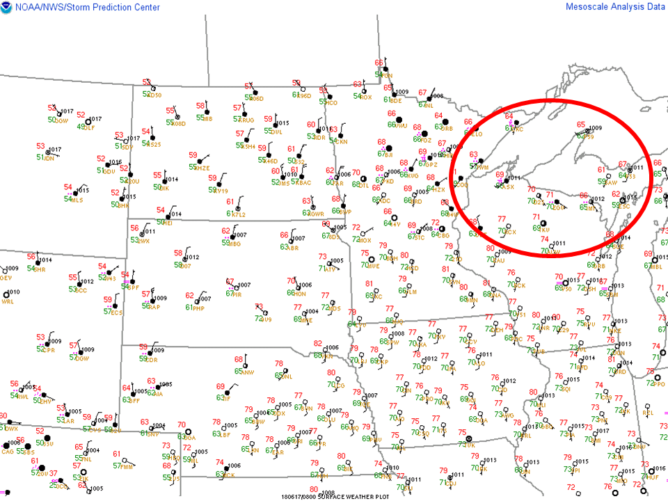
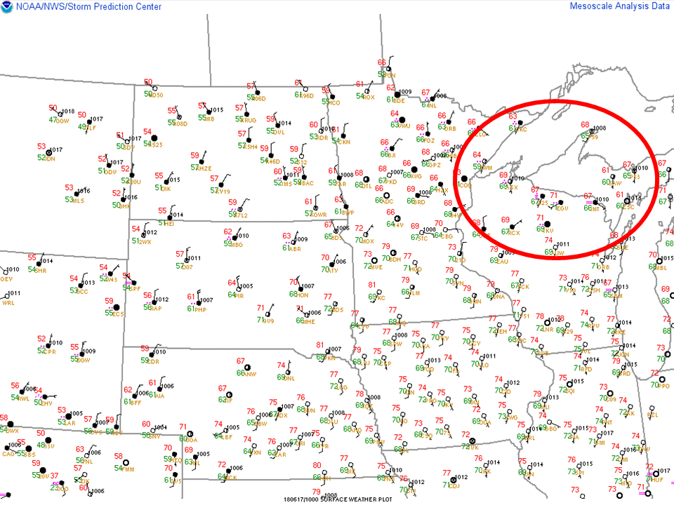
There are various atmospheric conditions that are more conducive to producing heavy rain events than others, and the atmosphere leading up to the flash flooding event across the Keweenaw Peninsula early in the morning of June 16th was certainly supporting this. The atmosphere had become moisture rich, with a quasi-stationary frontal boundary and placement of upper level ridging. This all produced an ideal environment for some areas to receive heavy rainfall. The images below are a simple snapshot at various times prior and during the heavy rainfall event.
 |
 |
 |
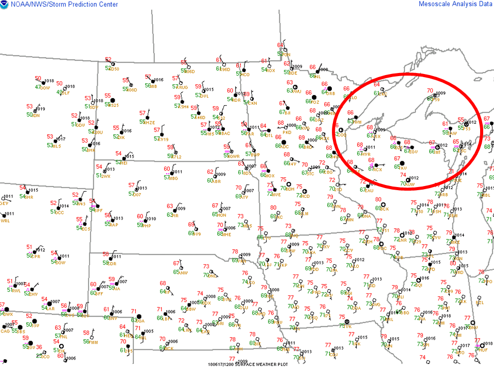 |
| Surface Observations: 6Z (2AM EDT) | Surface Observations: 8Z (4AM EDT) | Surface Observations: 10Z (6AM EDT) | Surface Observations: 12Z (8AM EDT) |
Within the red circle (above images) the surface observations across Northern Wisconsin indicated dewpoints (Td's) green values, were in excess of 65 degrees. Which indicates considerable low-level moisture present within the atmosphere.
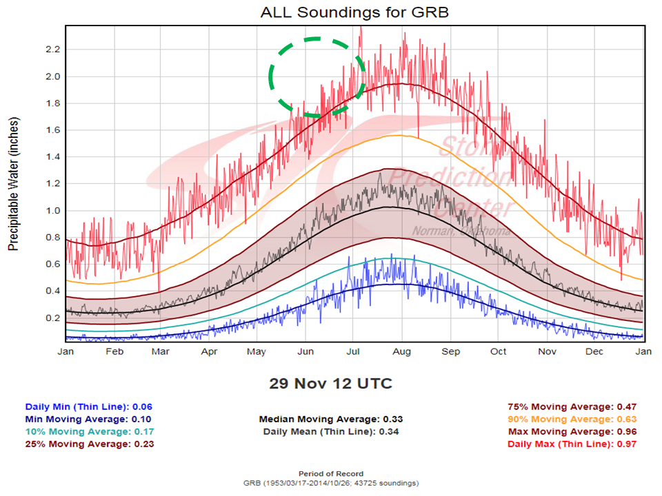
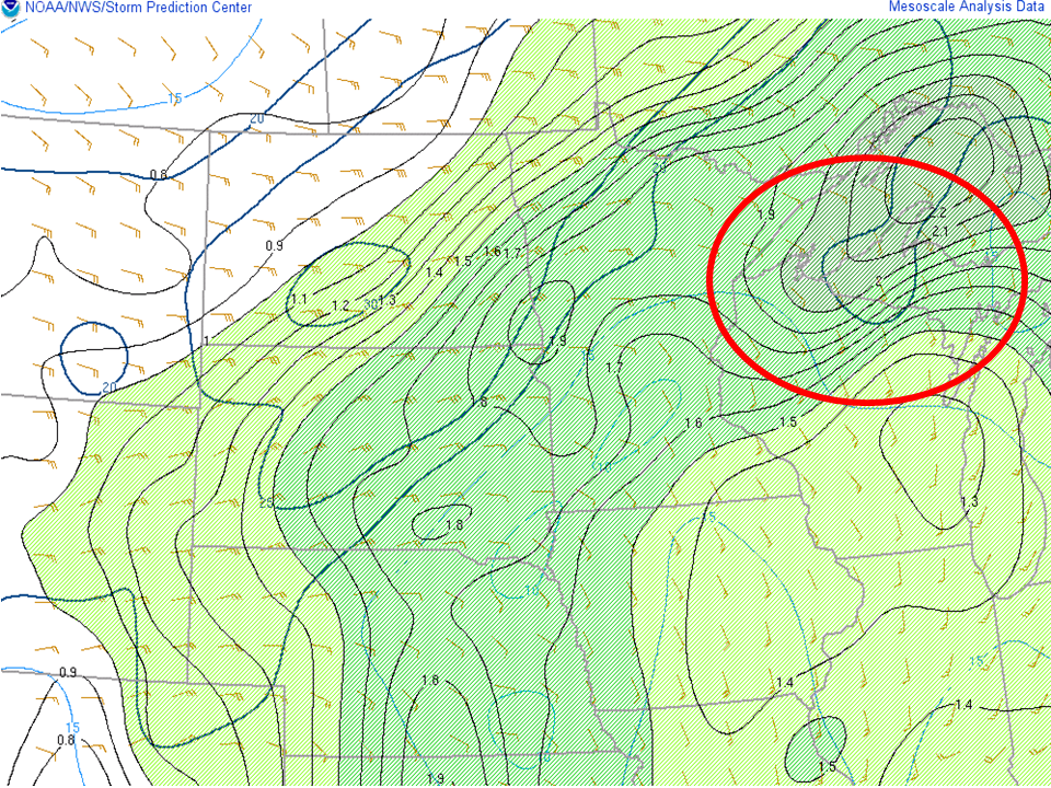
In addition to analyzing the surface conditions, it is critical to understand the location and movement of upstream (west/southwest) systems that could potentially bring thunderstorms and heavy rainfall to the region. A few of the parameters early Sunday morning that indicated a heavy rain potential were the precipitable water values. Upper air soundings are conducted at the NWS-Green Bay office, and below is in image depicting annual precipitable water values. Within the image, the dashed circle, indicates the observed PWAT values that were present across much of the Western Upper Peninsula, including the Keweenaw Peninsula.
 |
|
Precipitable Water Climatology from KGRB Upper Air Data (dashed green circle shows what values were like across Western Upper Peninsula of Michigan) |
 |
 |
 |
 |
|
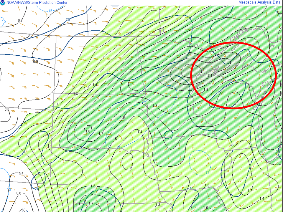
PWAT Values (shaded)/0-2KM Storm Relative Winds: 6Z |
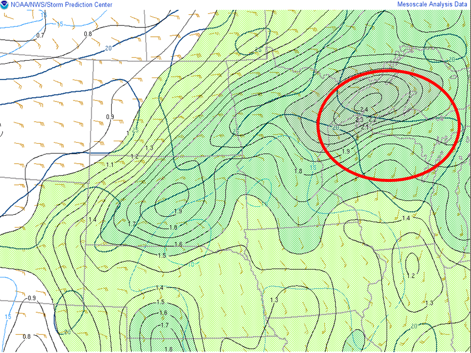
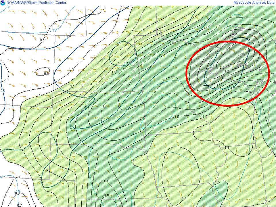
PWAT Values (shaded)/0-2KM Storm Relative Winds: 8Z | PWAT Values (shaded)/0-2KM Storm Relative Winds: 10Z | PWAT Values (shaded)/0-2KM Storm Relative Winds: 12Z |
Analysis of the surface observations indicated PWAT values in excess of 2", which based on the prior climatology image (data from KGRB) would indicate considerable moisture present from late Saturday night through Sunday morning.
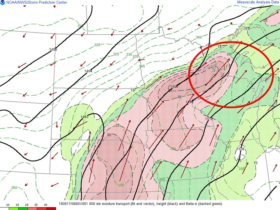 |
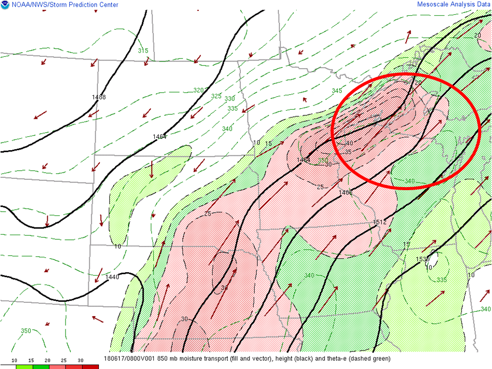 |
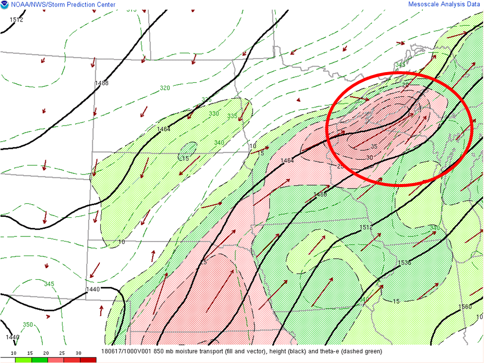 |
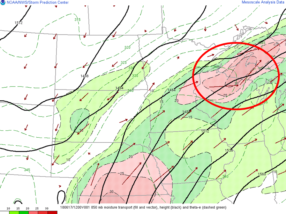 |
| 850hPa moisture transport (shaded/vector), theta-e (dashed green): 6Z | 850hPa moisture transport (shaded/vector), theta-e (dashed green): 8Z | 850hPa moisture transport (shaded/vector), theta-e (dashed green): 10Z | 850hPa moisture transport (shaded/vector), theta-e (dashed green): 12Z |
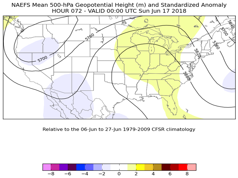
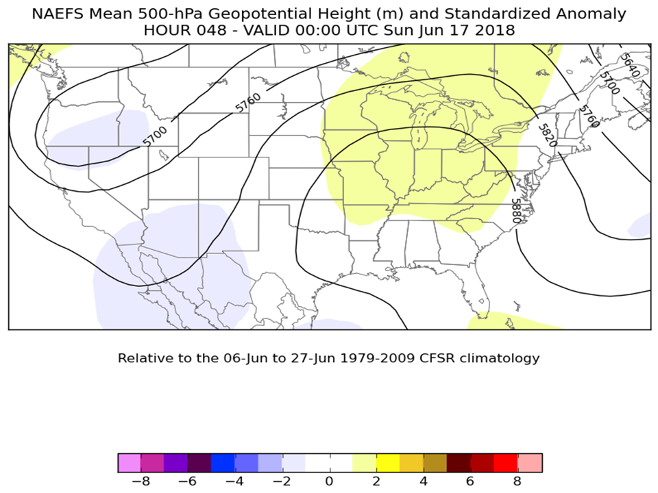
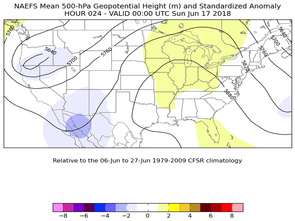
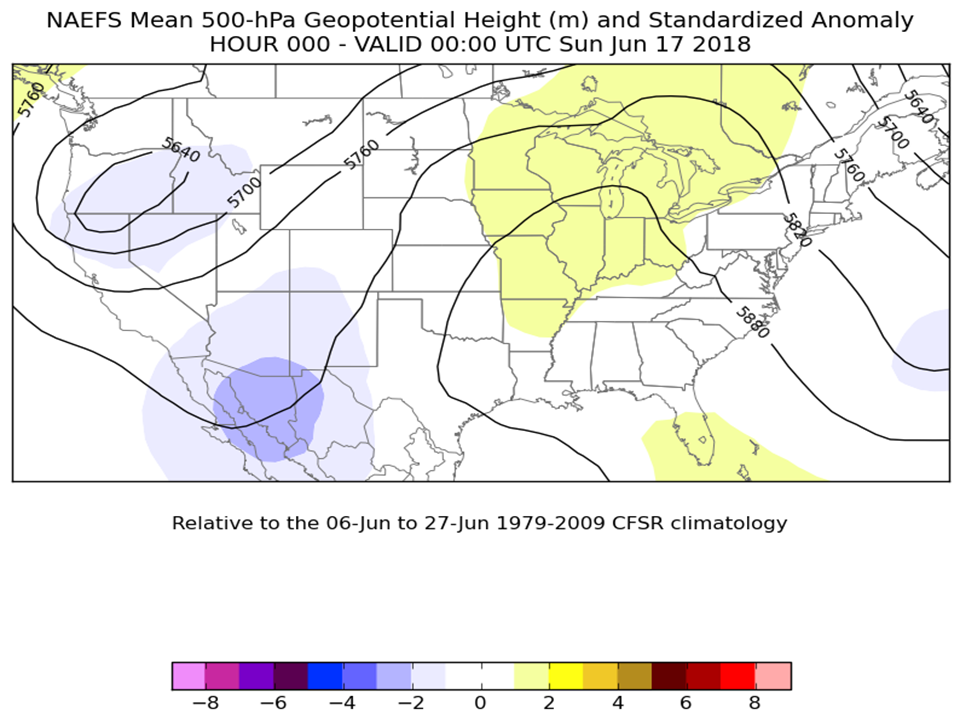
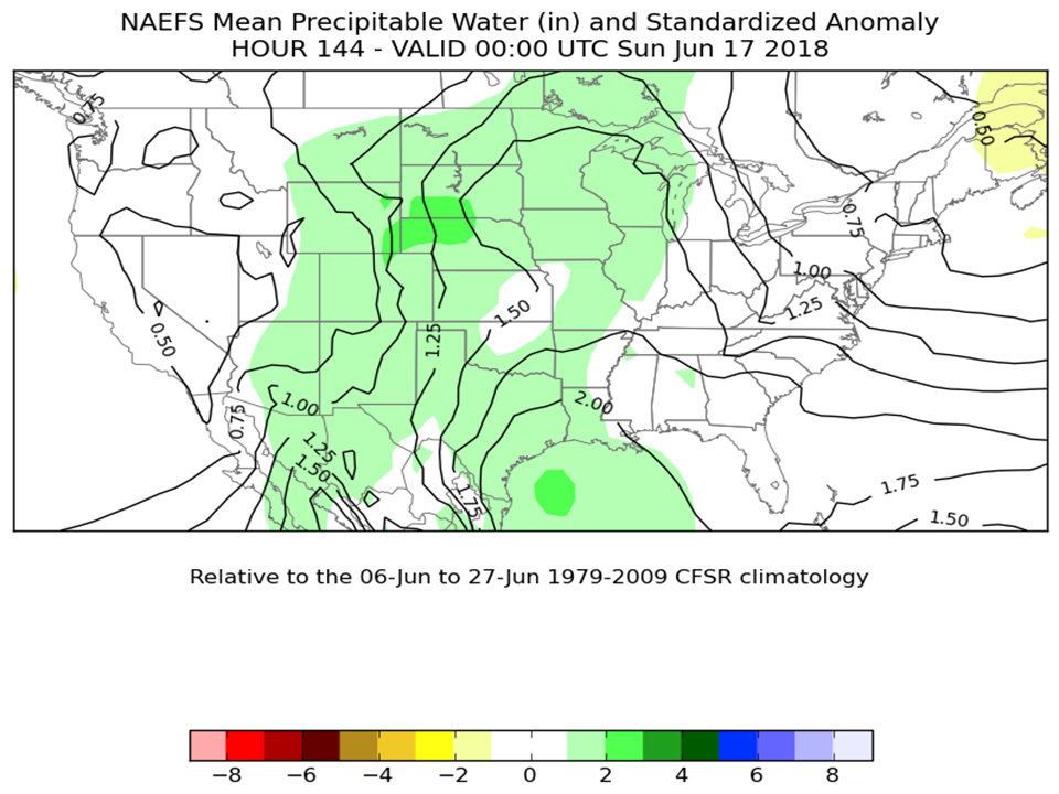
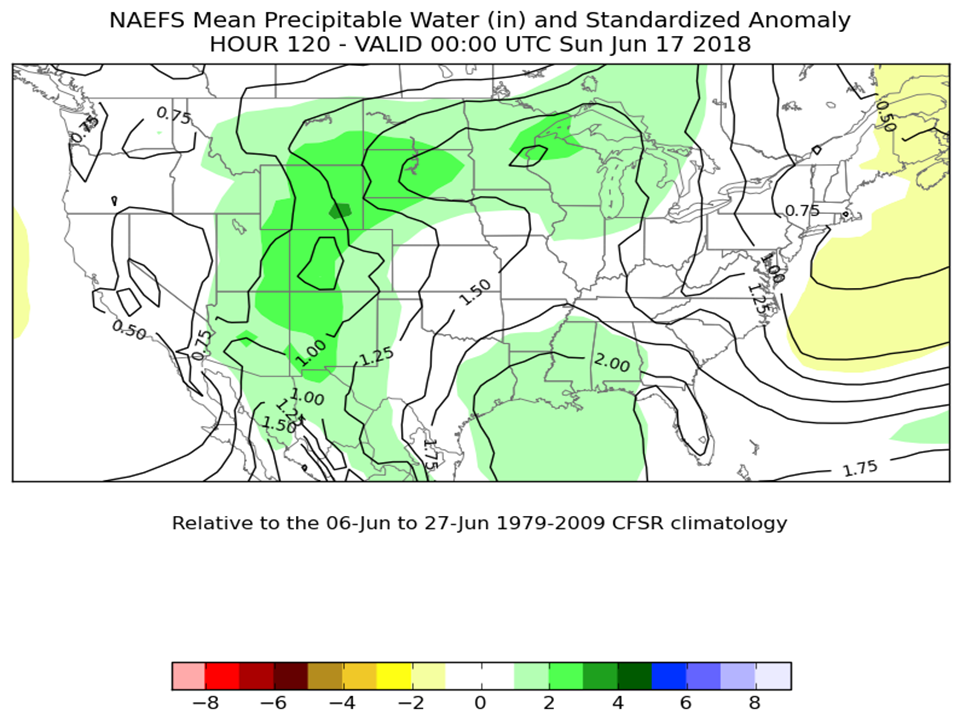
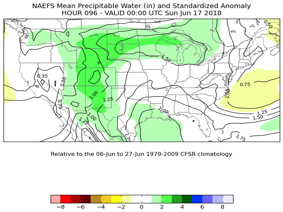
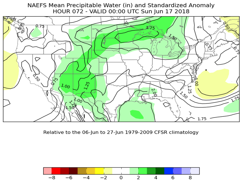
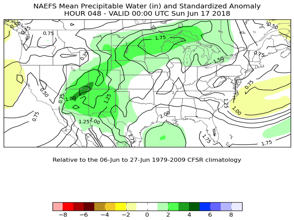
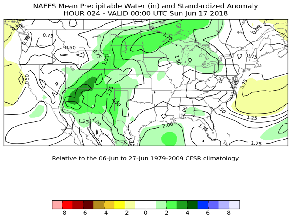
In addition to analyzing the atmosphere a few hours prior, we also look at the atmospheric pattern from days before. Frequently there is a signal that indicates the potential for heavy rain or possible convection to develop. In the summer months a 500hPa ridge tends to develop across the mid-sections of the CONUS, in this case it was across the Ohio and Tennessee Valley's. Images below indicate the upper air pattern from several days prior to the event.
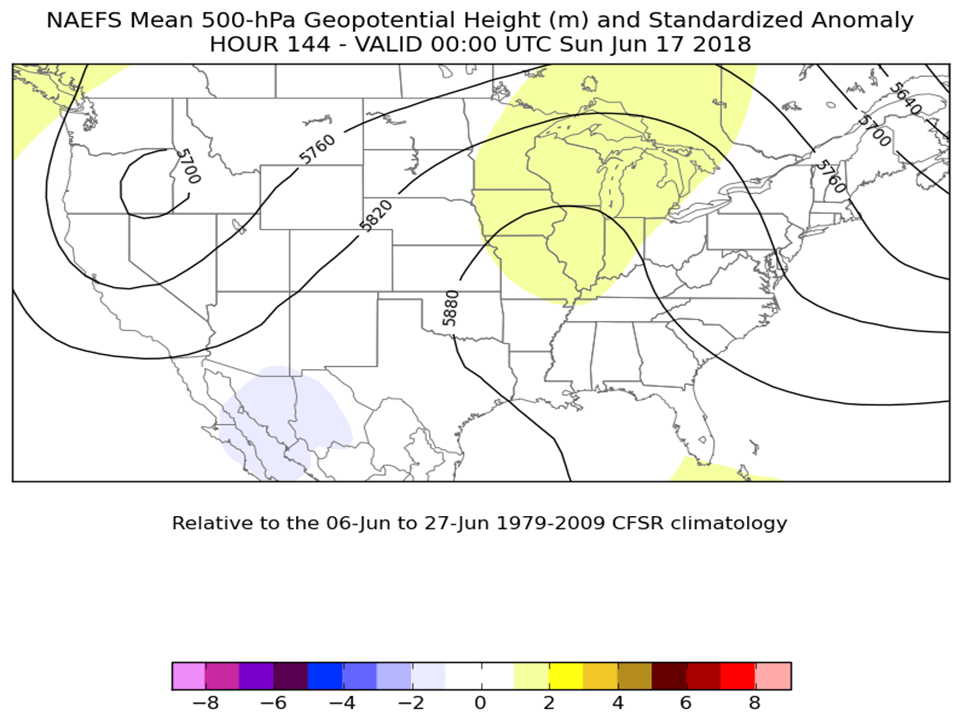 |
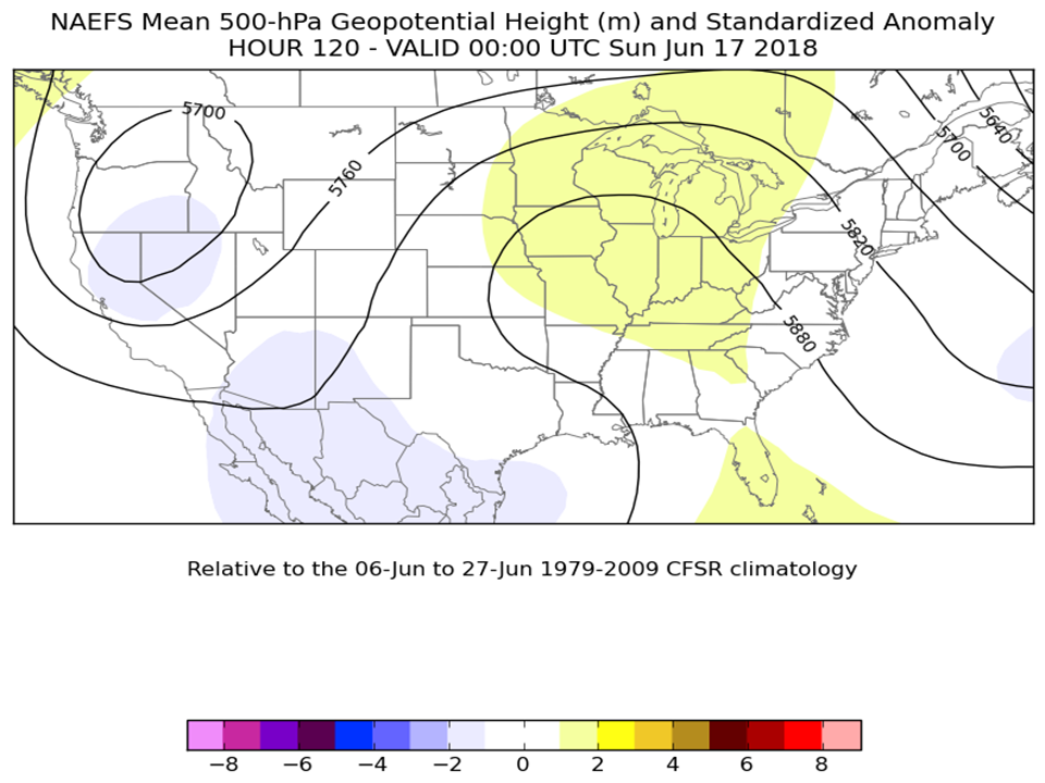 |
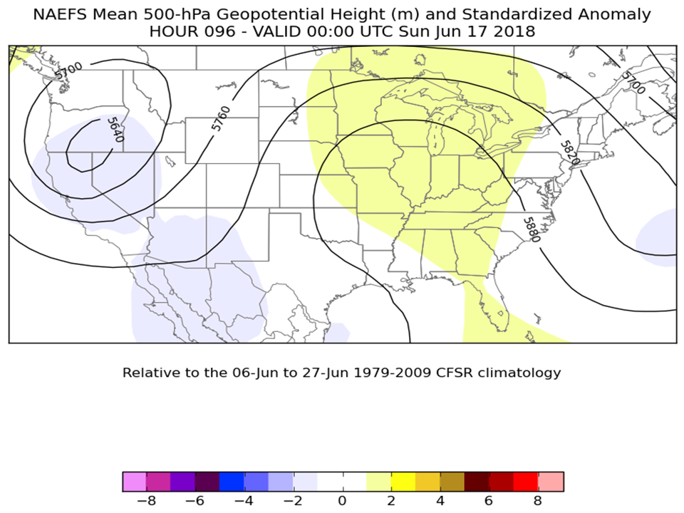 |
 |
 |
 |
 |
|
 |
 |
 |
 |
 |
 |
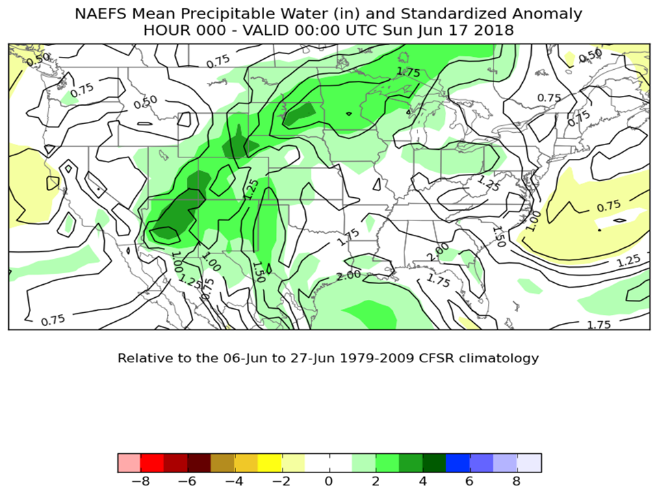 |
Images above show the evolution of the predicted 500hPa ridge, along with the atmospheric moisture setup. The timeline spans the length of 144hrs prior to the flooding event through hour 00hr. The deeper green images depict the higher moisture content feeding northwest from Texas into the Central Plains, then stretching northeast through the Upper Midwest (Upper Peninsula of Michigan).
Storm Reports
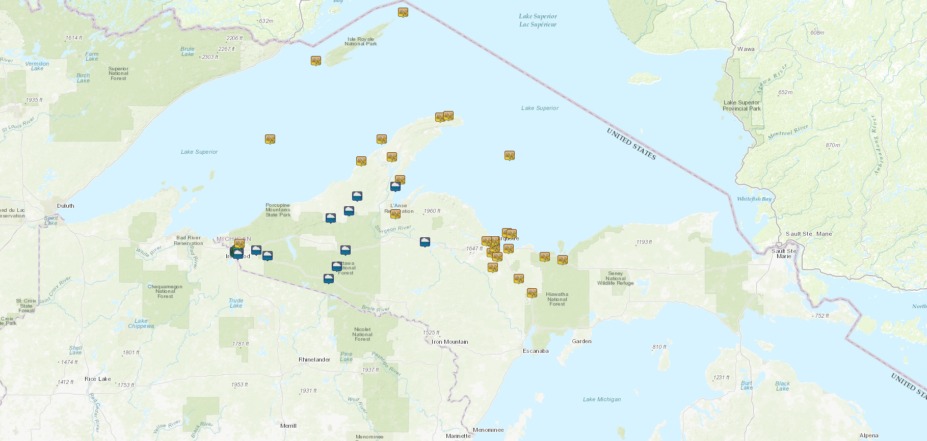
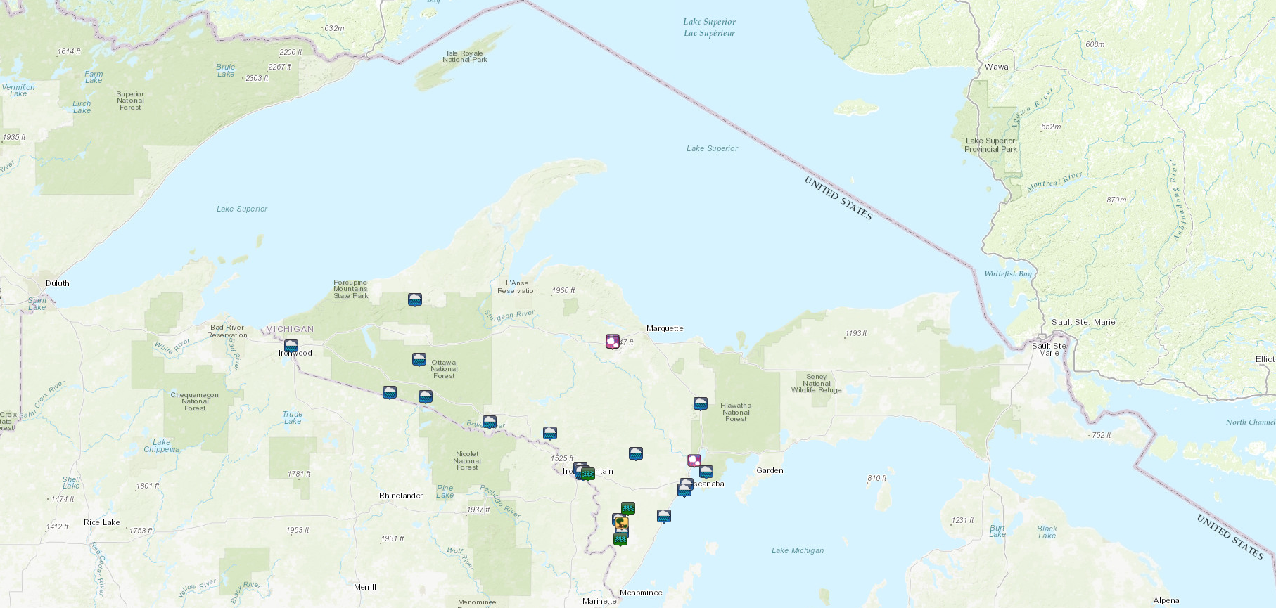
Click on the captions below to access the interactive storm reports map.
 |
 |
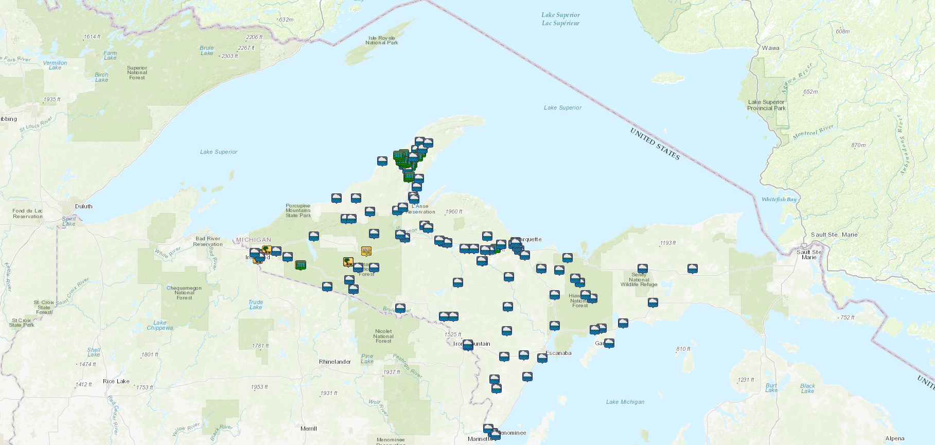 |
| June 15th Local Storm Reports | June 16th Local Storm Reports | June 17th - 18th Local Storm Reports |
Precipitation Totals
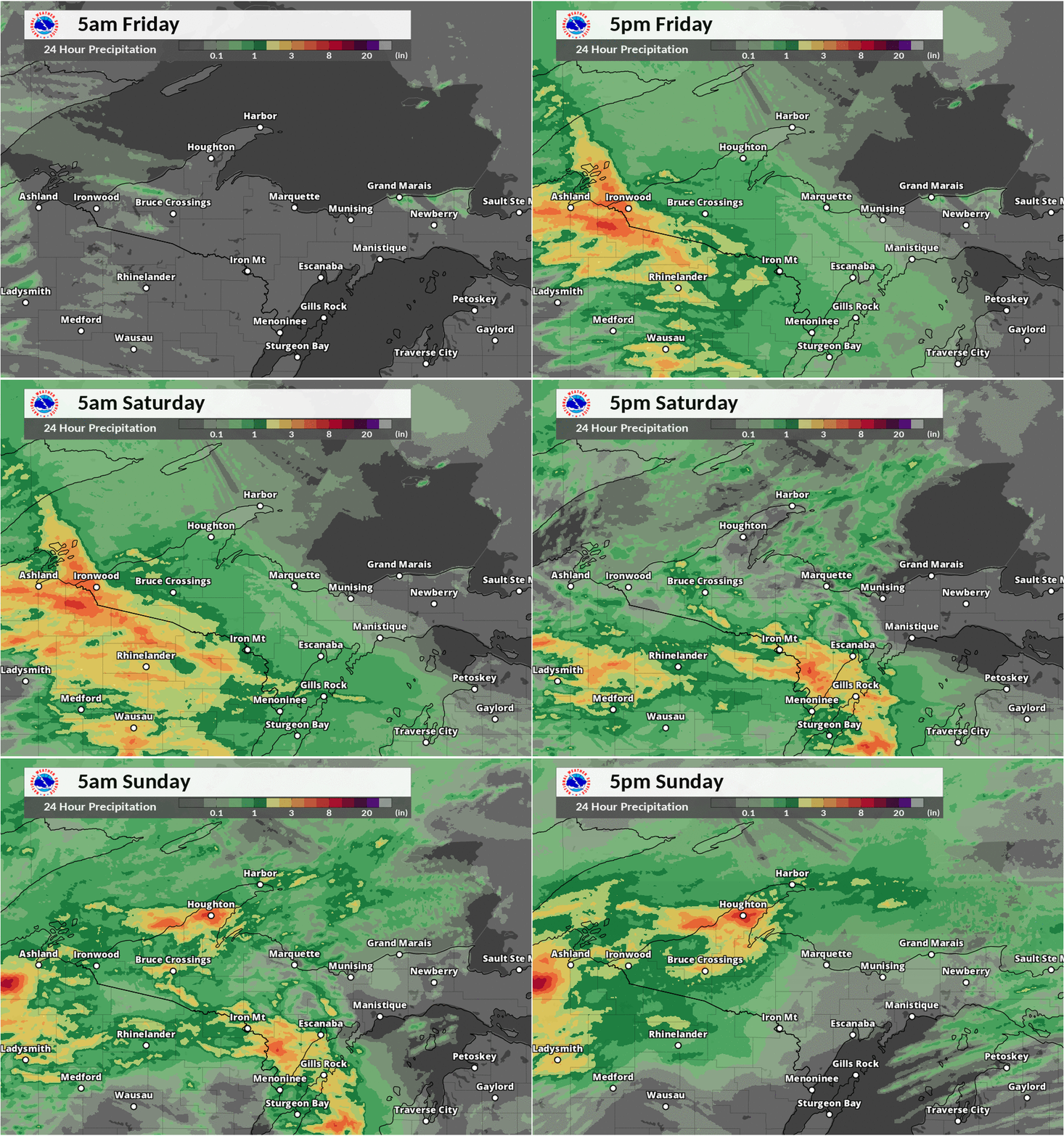 |
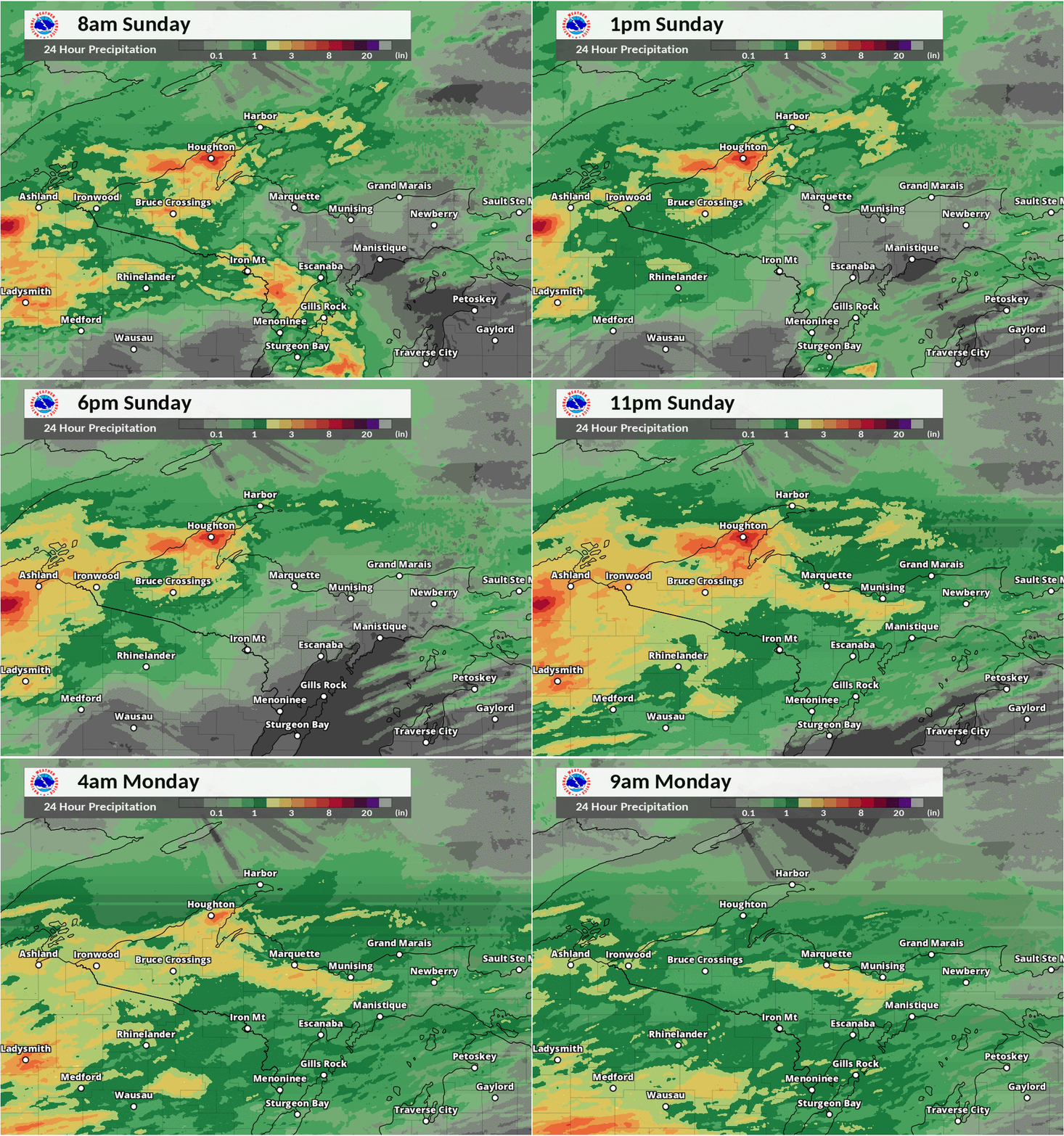 |
| 24-hour accumulating rainfall 5am EDT Friday, June 15th through 5pm EDT Sunday, June 17th |
24-hour accumulating rainfall 8am EDT Sunday, June 17th through 9am EDT Monday, June 18th |
24 Hour Rain Reports Through Sunday Morning
1 ENE Hancock                6.72 in   0757 AM 06/17   47.14N/88.58W
1 W Houghton                 6.30 in   0846 AM 06/17   47.11N/88.59W
1 SW Laurium                 6.22 in   0717 AM 06/17   47.22N/88.46W
1 E Houghton                 6.06 in   0800 AM 06/17   47.11N/88.53W
2 SSE Houghton               6.00 in   1020 AM 06/17   47.08N/88.55W
Hancock                      6.00 in   0600 AM 06/17   47.13N/88.60W
1 NE Hancock                 5.20 in   0844 AM 06/17   47.14N/88.59W
Freda                        4.50 in   0855 AM 06/17   47.14N/88.82W
Houghton Co. Airport         4.41 in   0401 AM 06/17   47.17N/88.49W
2 ESE Laurium                3.15 in   1052 AM 06/17   47.23N/88.39W
2 NE Arnheim                 3.11 in   0719 AM 06/17   46.95N/88.45W
2 E Laurium                  3.11 in   0715 AM 06/17   47.23N/88.39W
7 E Chassell                 2.94 in   0700 AM 06/17   47.01N/88.38W
3 SSW Pelkie                 2.67 in   0713 AM 06/17   46.78N/88.66W
Kearsarge                    2.28 in   0800 AM 06/17   47.28N/88.42W
6 E Mass City                2.12 in   0718 AM 06/17   46.77N/88.95W
Ontonagon                    2.10 in   0800 AM 06/17   46.87N/89.31W
8 N Kenton                   2.10 in   0656 AM 06/17   46.61N/88.91W
1 E Trout Creek              1.96 in   0719 AM 06/17   46.48N/88.99W
Daggett                      1.75 in   1254 PM 06/16   45.46N/87.60W
Herman                       1.75 in   0800 AM 06/17   46.65N/88.33W
1 ESE Rockland               1.56 in   0722 AM 06/17   46.72N/89.15W
5 ESE Chassell               1.50 in   0355 AM 06/17   47.01N/88.43W
5 ESE Paulding               1.42 in   0645 AM 06/17   46.36N/89.08W
4 NNW Watton                 1.37 in   0703 AM 06/17   46.60N/88.63W
Paulding                     1.36 in   0800 AM 06/17   46.40N/89.18W
Wakefield                    1.29 in   0722 AM 06/17   46.48N/89.95W
1 NNW Keweenaw Bay           1.28 in   0509 AM 06/17   46.88N/88.49W
Watersmeet                   1.25 in   0737 AM 06/17   46.27N/89.17W
6 N Greenland                1.20 in   0800 AM 06/17   46.87N/89.10W
1 WSW Rockland               1.17 in   0715 AM 06/17   46.72N/89.21W
3 NNE Watton                 1.14 in   0745 AM 06/17   46.58N/88.58W
 |
Media use of NWS Web News Stories is encouraged! Please acknowledge the NWS as the source of any news information accessed from this site. |
 |