A storm tracking across the southern U.S. will continue to bring areas of heavy thunderstorms with risks for severe weather and excessive rainfall from Texas to Florida through this weekend. While much of this rainfall will be beneficial to the drought, excessive rainfall may bring areas of flash and urban flooding. Read More >
This Page is Under Construction
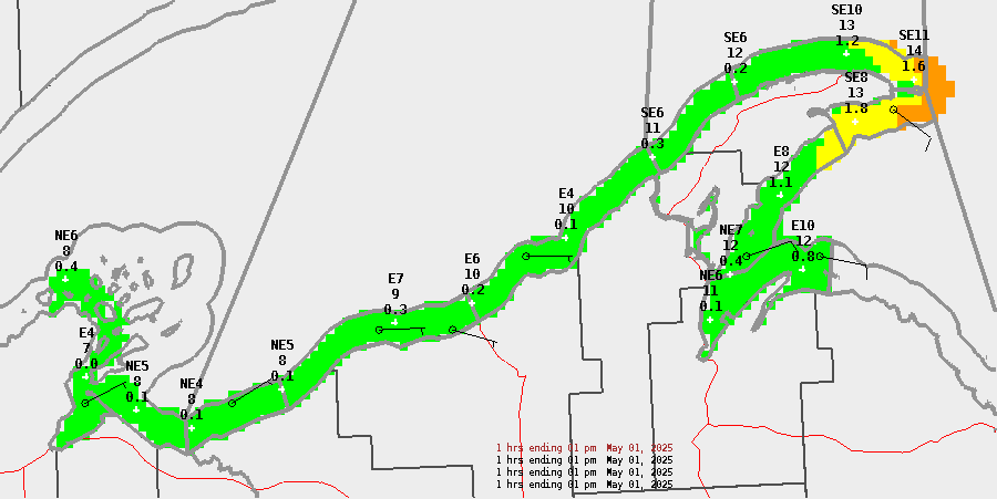
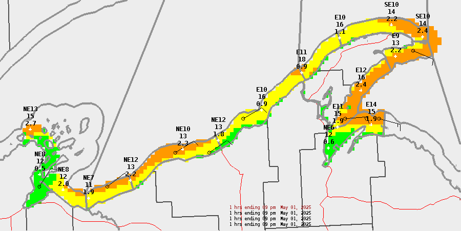
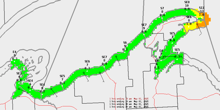
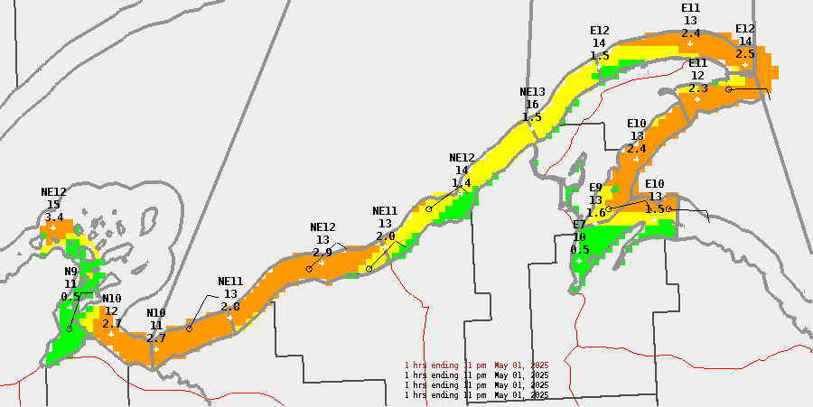
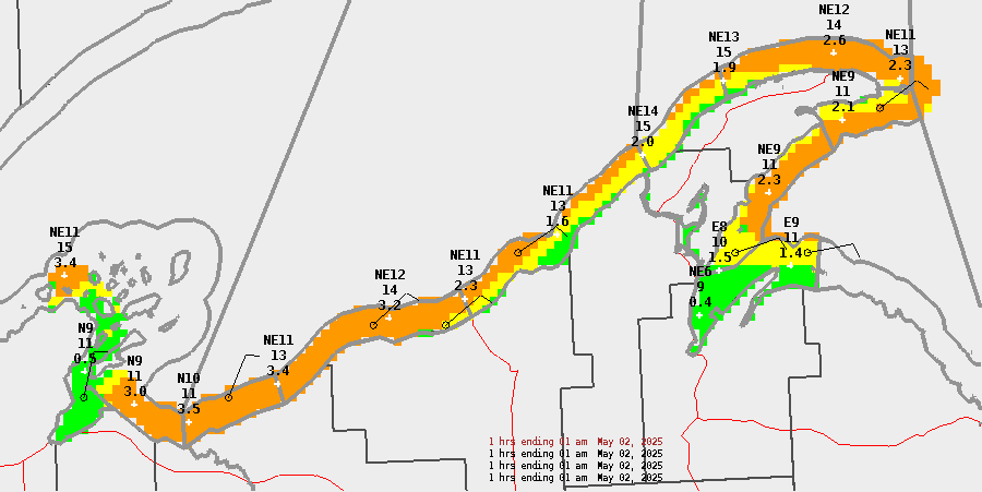
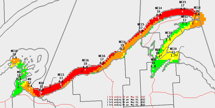
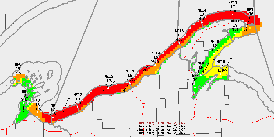
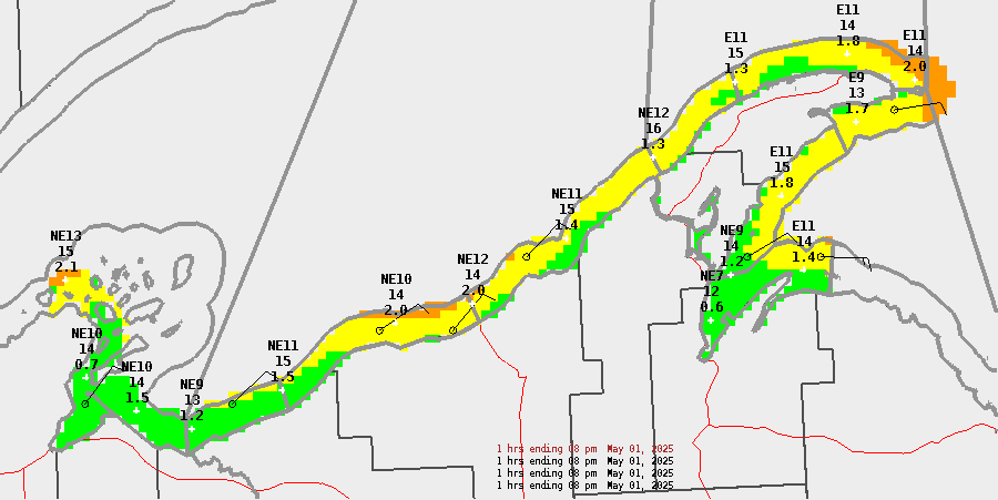
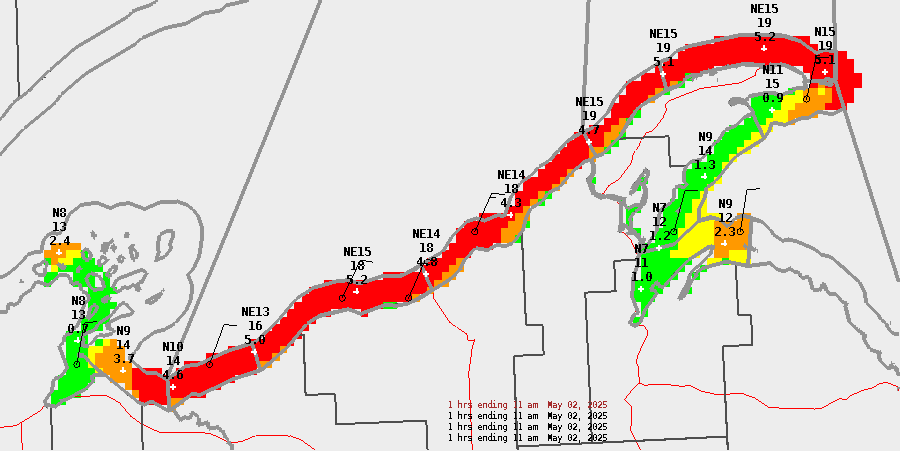
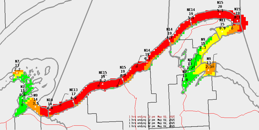
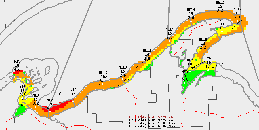
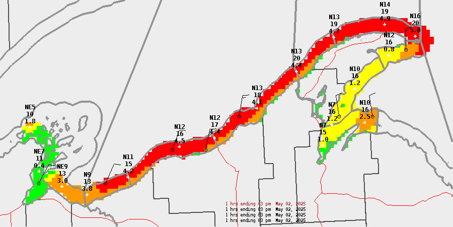
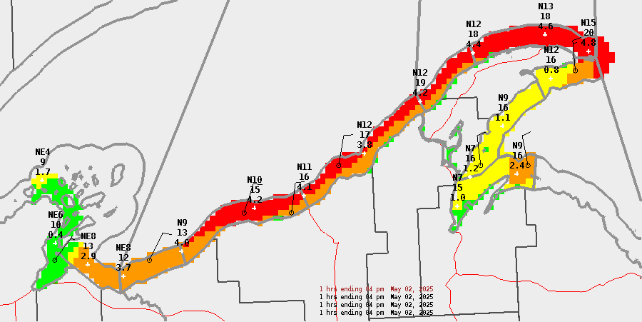
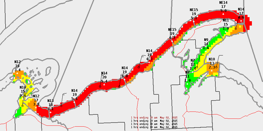
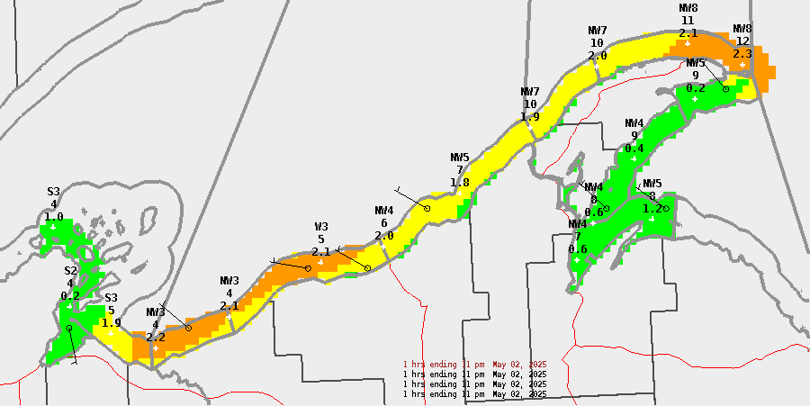
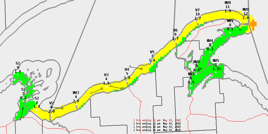
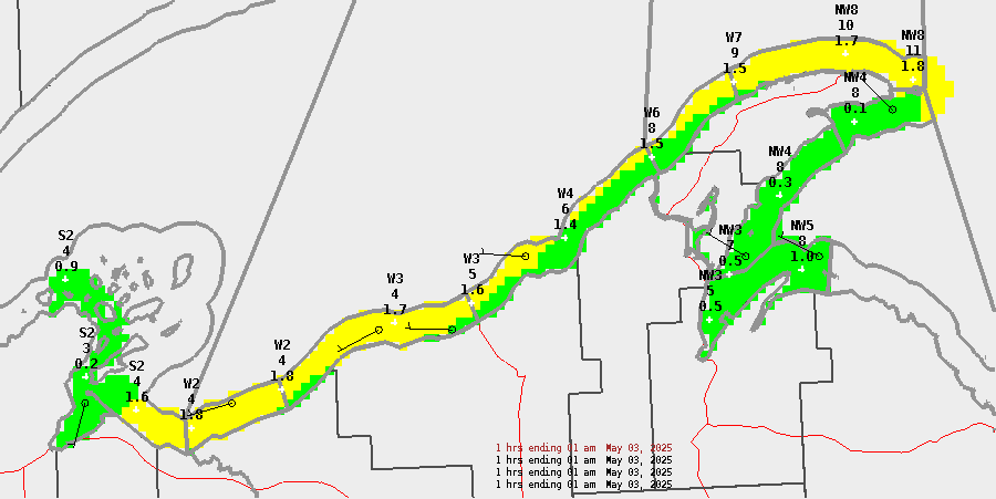
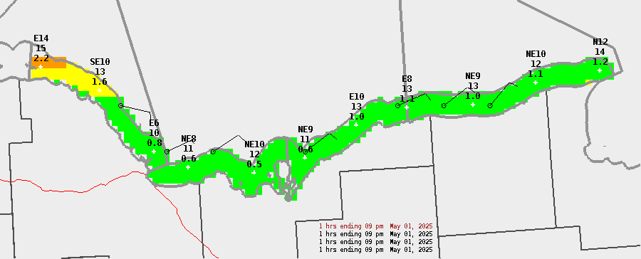
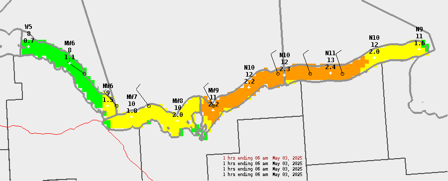
Western Lake Superior
| Today | Tonight | Sunday | Sunday Night | ||||||||||||||||||||||||||||||||||||||||||||
| 8a | 9a | 10a | 11a | 12p | 1p | 2p | 3p | 4p | 5p | 6p | 7p | 8p | 9p | 10p | 11p | 12a | 1a | 2a | 3a | 4a | 5a | 6a | 7a | 8a | 9a | 10a | 11a | 12p | 1p | 2p | 3p | 4p | 5p | 6p | 7p | 8p | 9p | 10p | 11p | 12a | 1a | 2a | 3a | 4a | 5a | 6a | 7a |
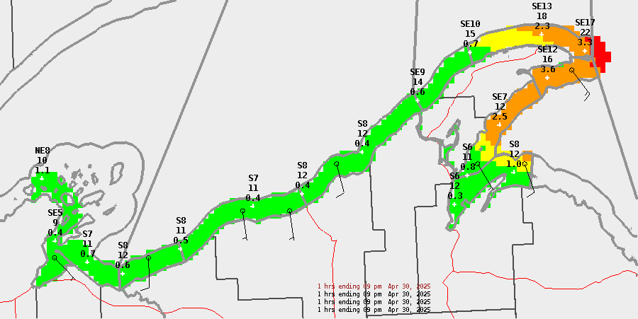
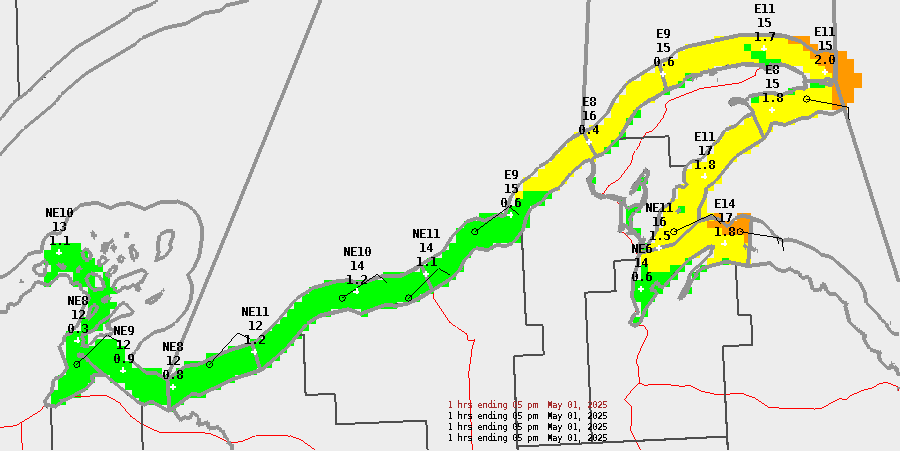
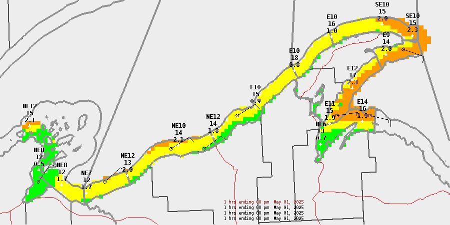
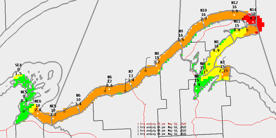
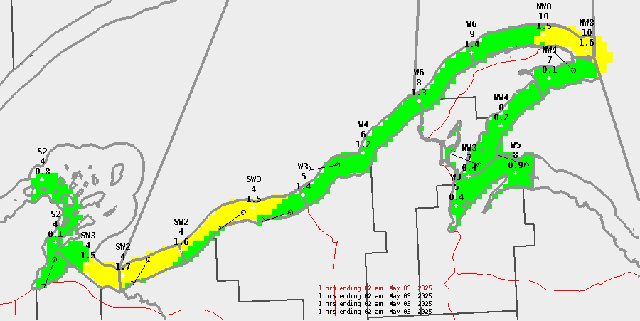
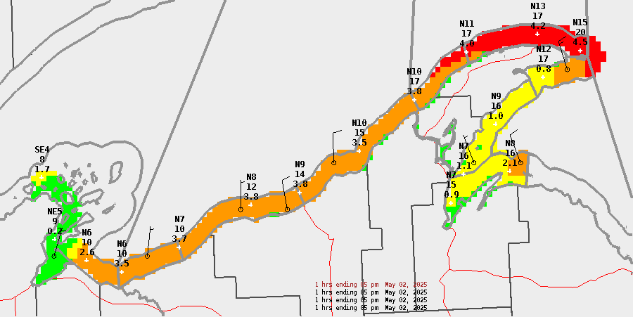
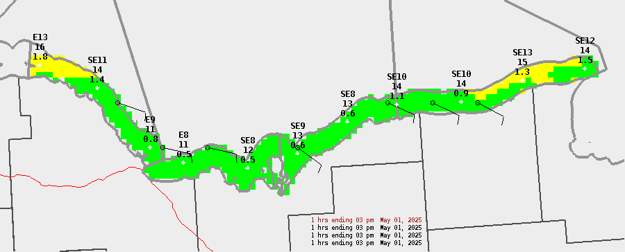
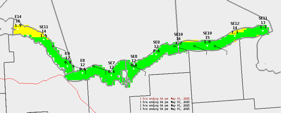
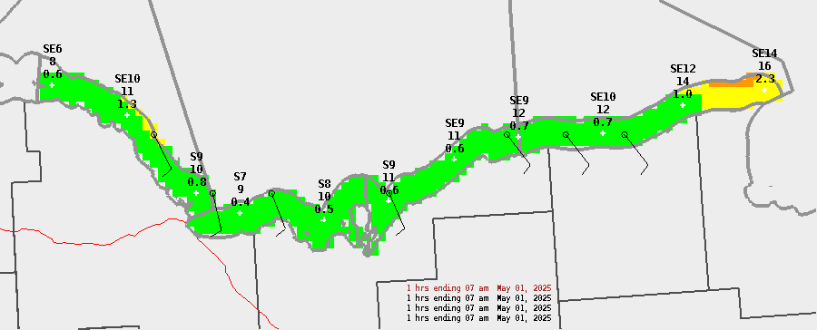
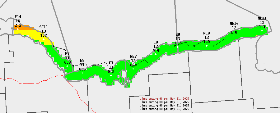
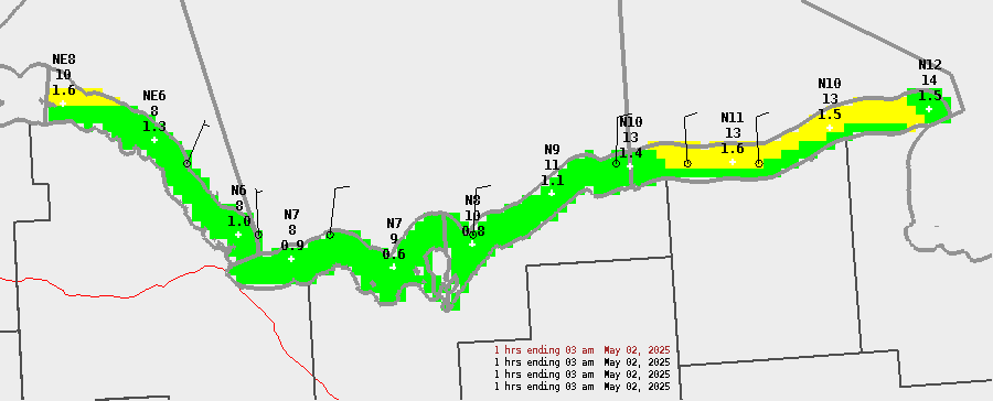
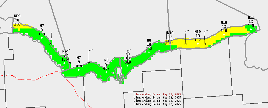
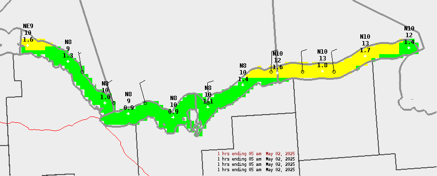
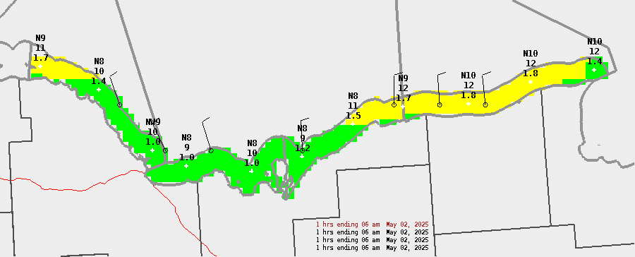
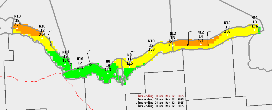
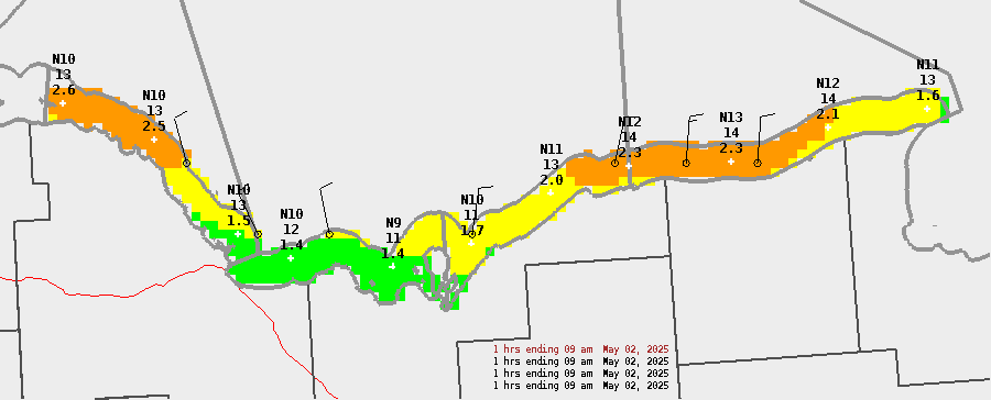
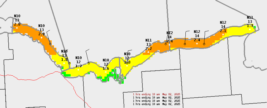
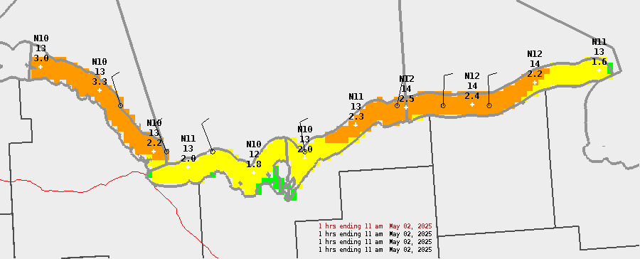
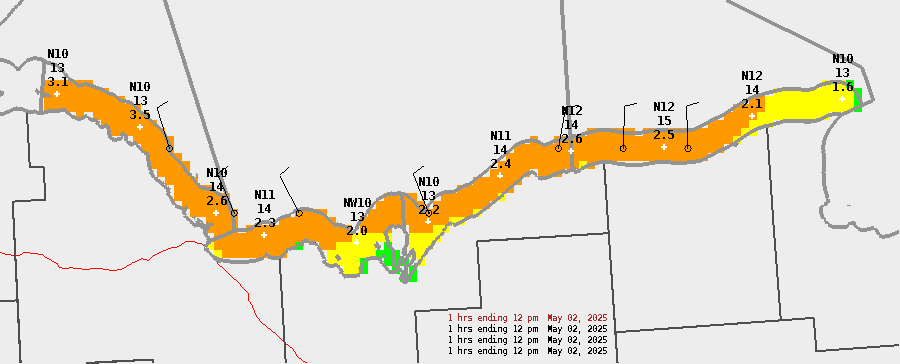
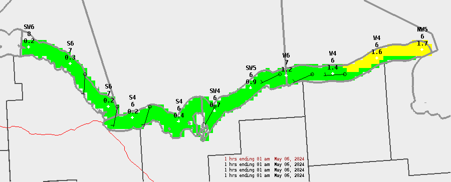
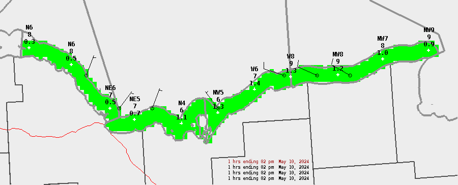
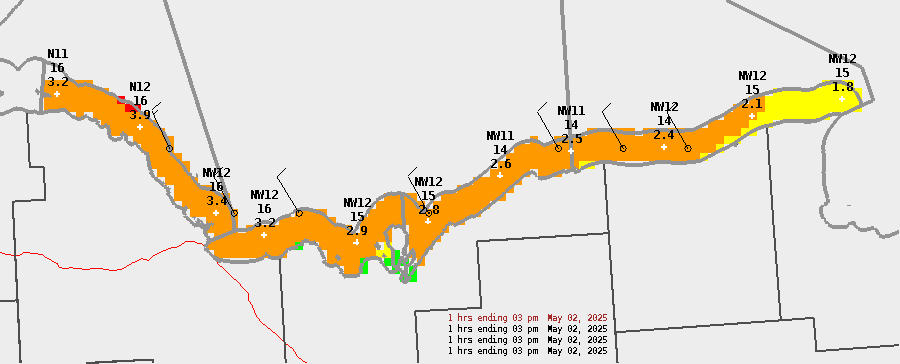
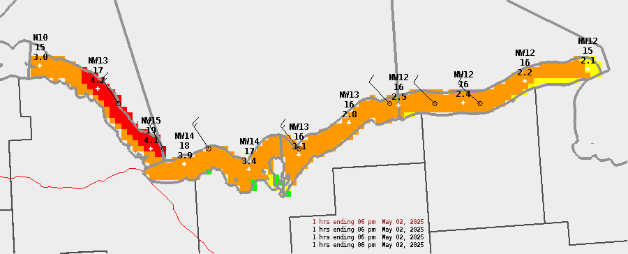
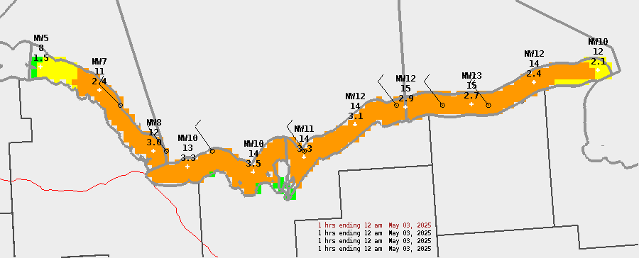
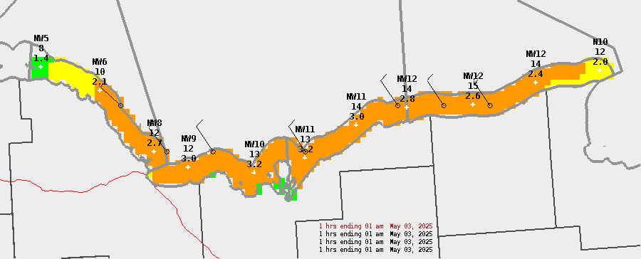
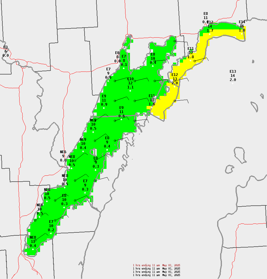
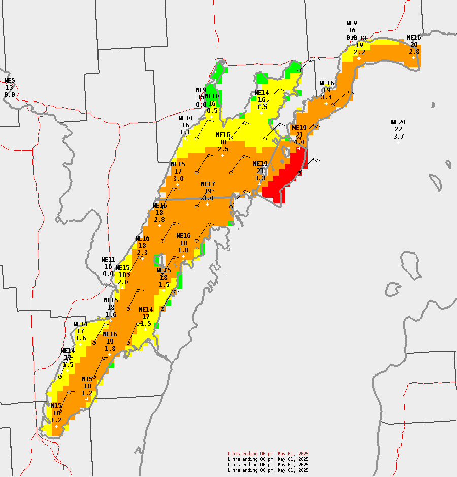
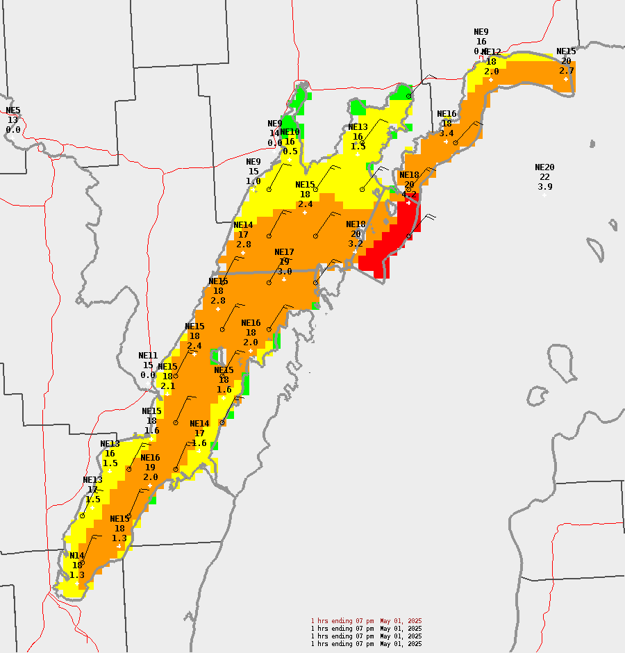
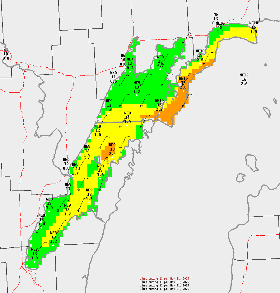
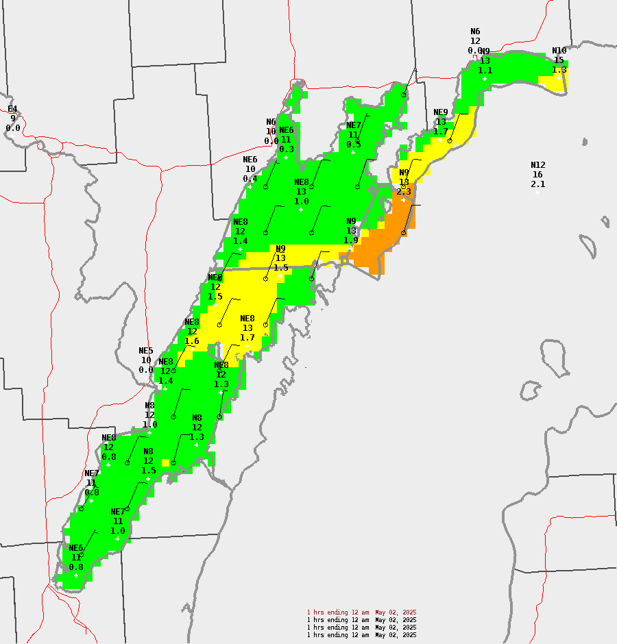
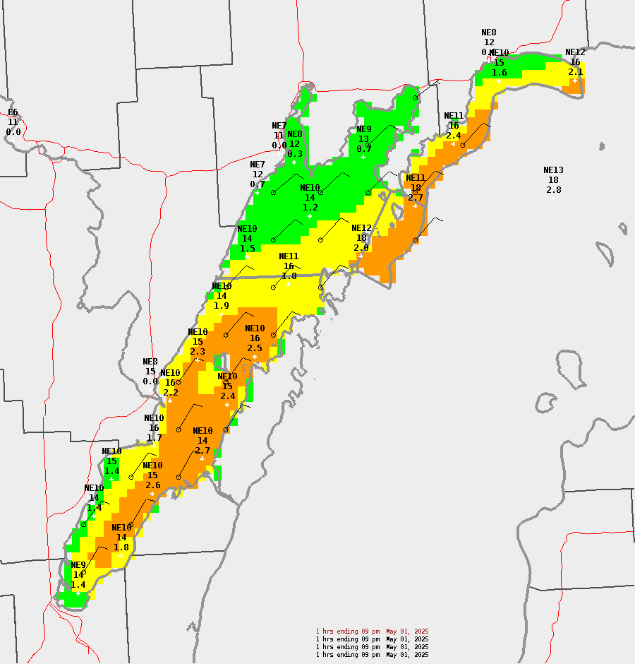
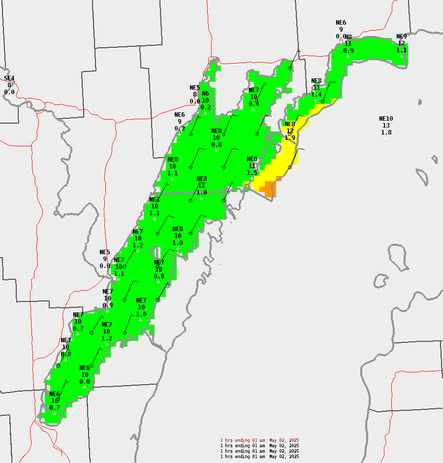
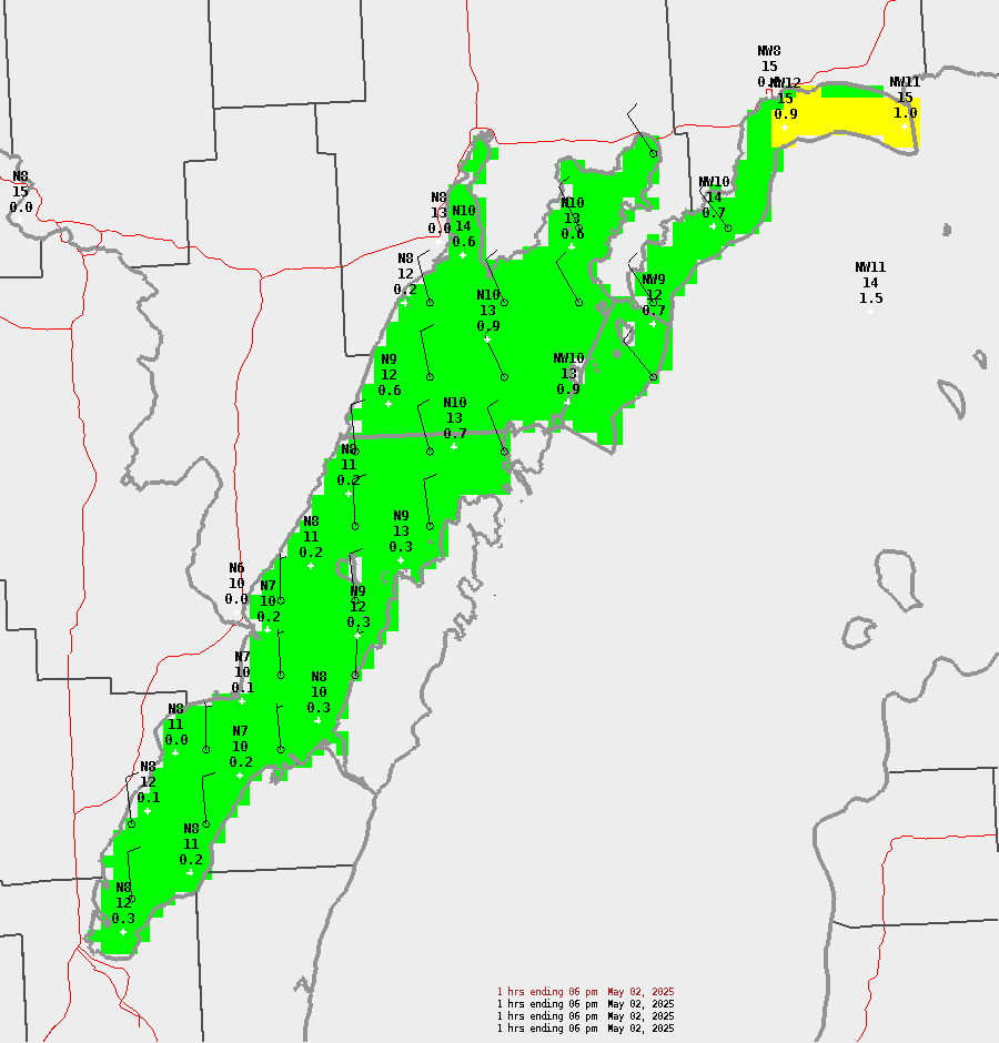
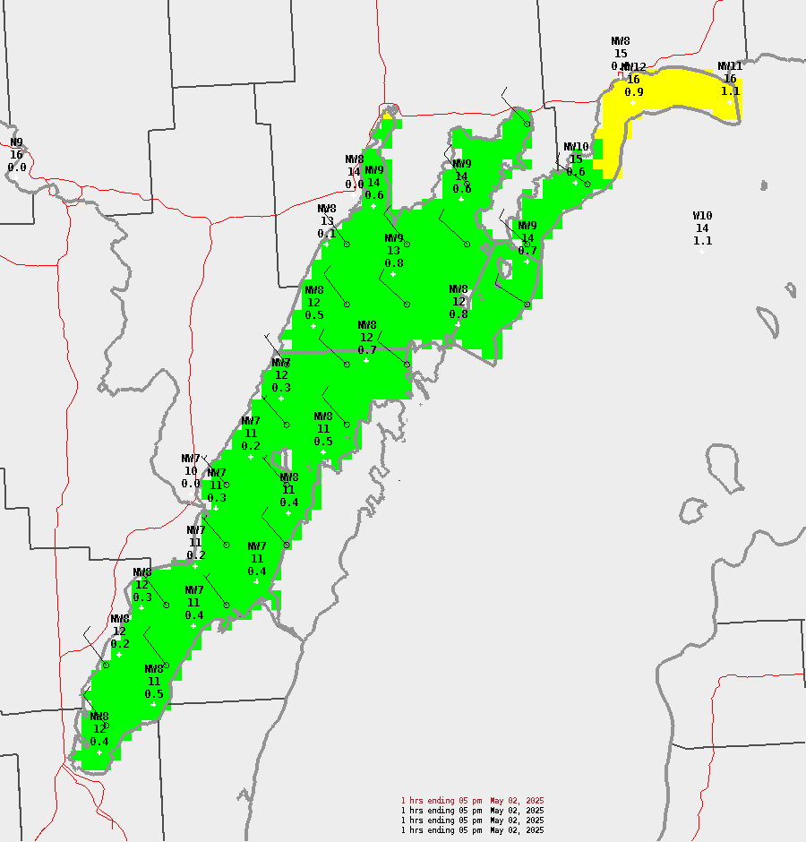
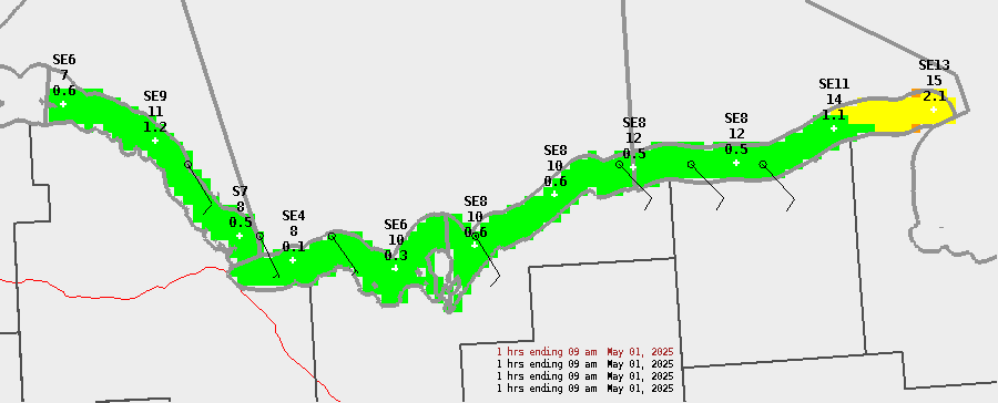
Sample points represent (from top to bottom): Wind Direction and Speed (kts), Wind Gust (kts), and Wave Height (ft)
| Marine Hazards Legend | |||
| Threat | Sustained Wind Speed (kts) | Wind Gust (kts) | Wave Height (ft) |
| None | < 15 | < 15 | < 2 |
| Limited | 15-23 knots | 15-23 knots | 2-3.9 ft |
| Elevated | 24-33 knots | 24-33 knots | 4-6.9 ft |
| Significant | ≥ 34 knots | ≥ 34 knots | ≥ 7 ft |
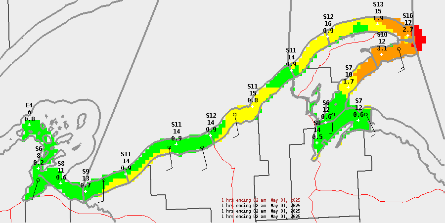
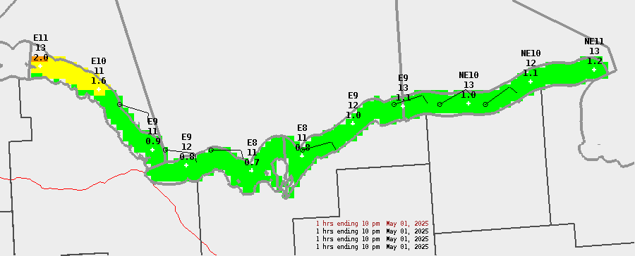
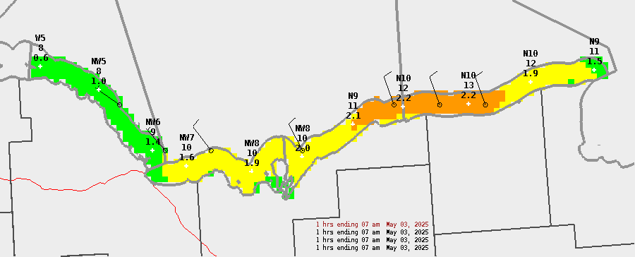
Eastern Lake Superior
| Today | Tonight | Sunday | Sunday Night | ||||||||||||||||||||||||||||||||||||||||||||
| 8a | 9a | 10a | 11a | 12p | 1p | 2p | 3p | 4p | 5p | 6p | 7p | 8p | 9p | 10p | 11p | 12a | 1a | 2a | 3a | 4a | 5a | 6a | 7a | 8a | 9a | 10a | 11a | 12p | 1p | 2p | 3p | 4p | 5p | 6p | 7p | 8p | 9p | 10p | 11p | 12a | 1a | 2a | 3a | 4a | 5a | 6a | 7a |
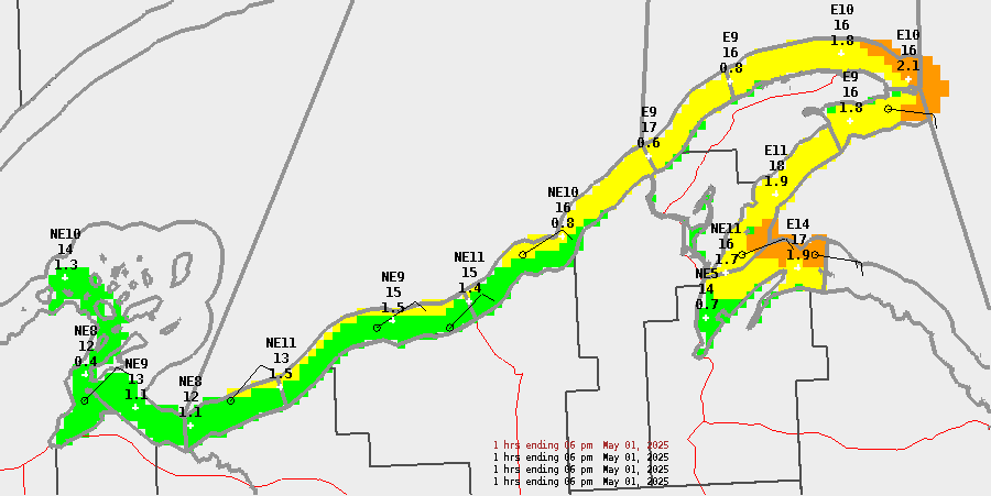
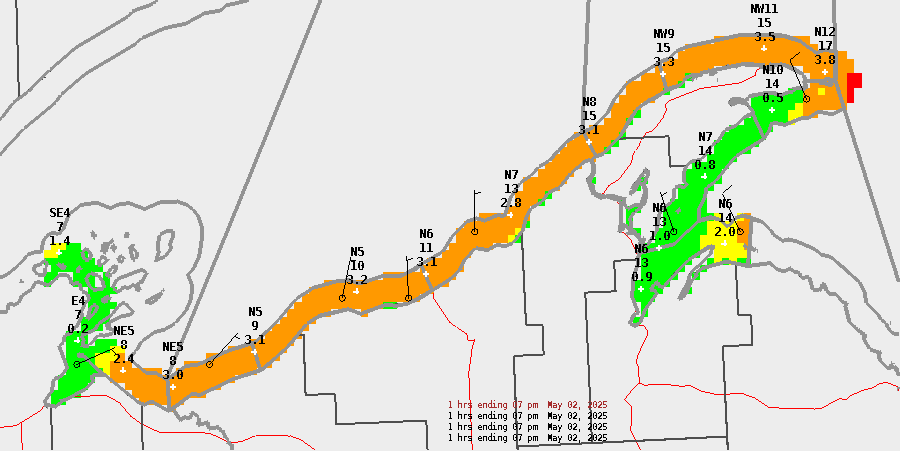
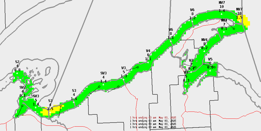
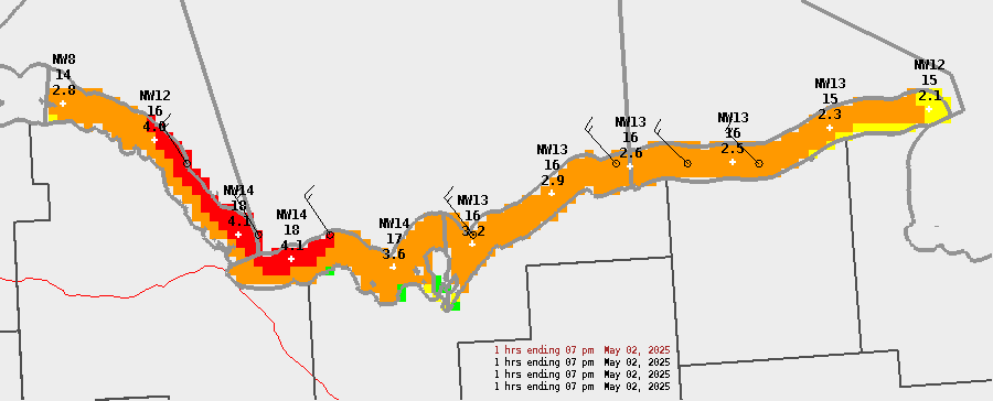
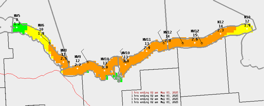
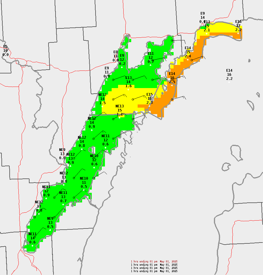
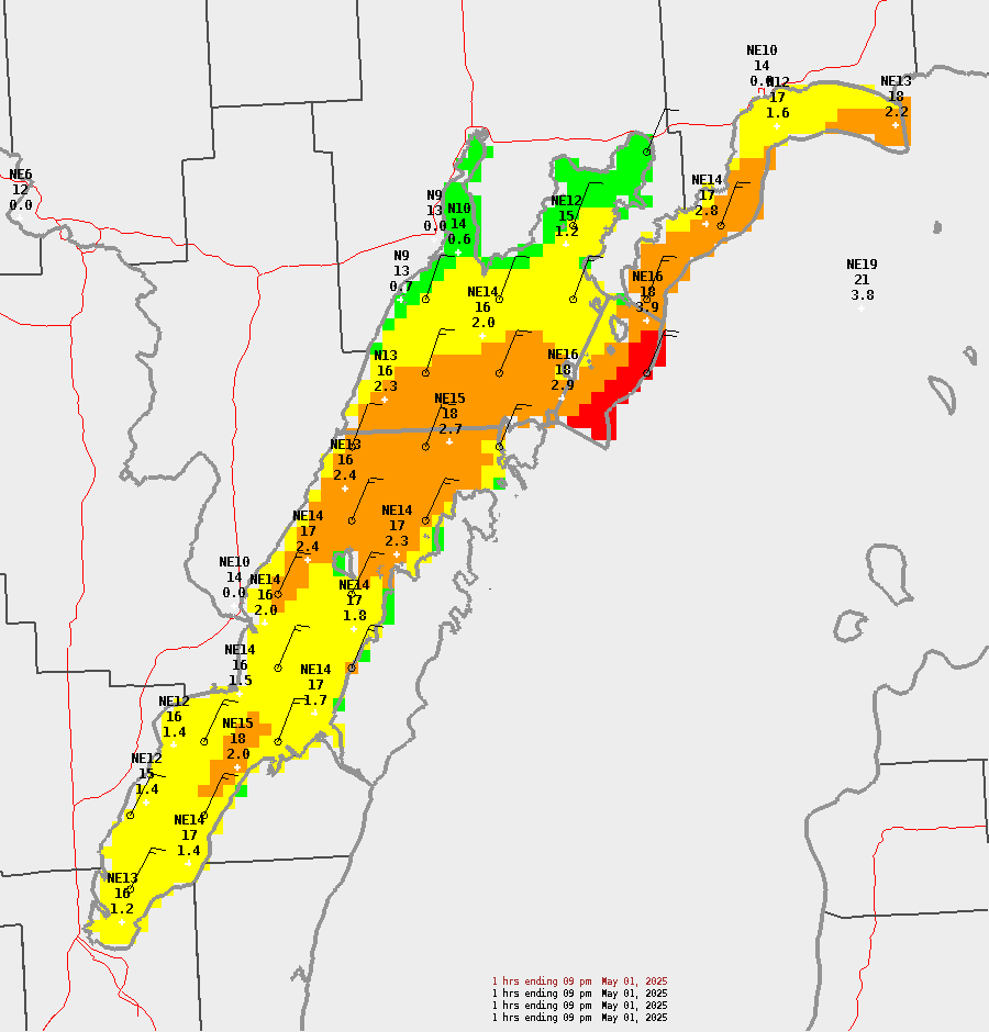
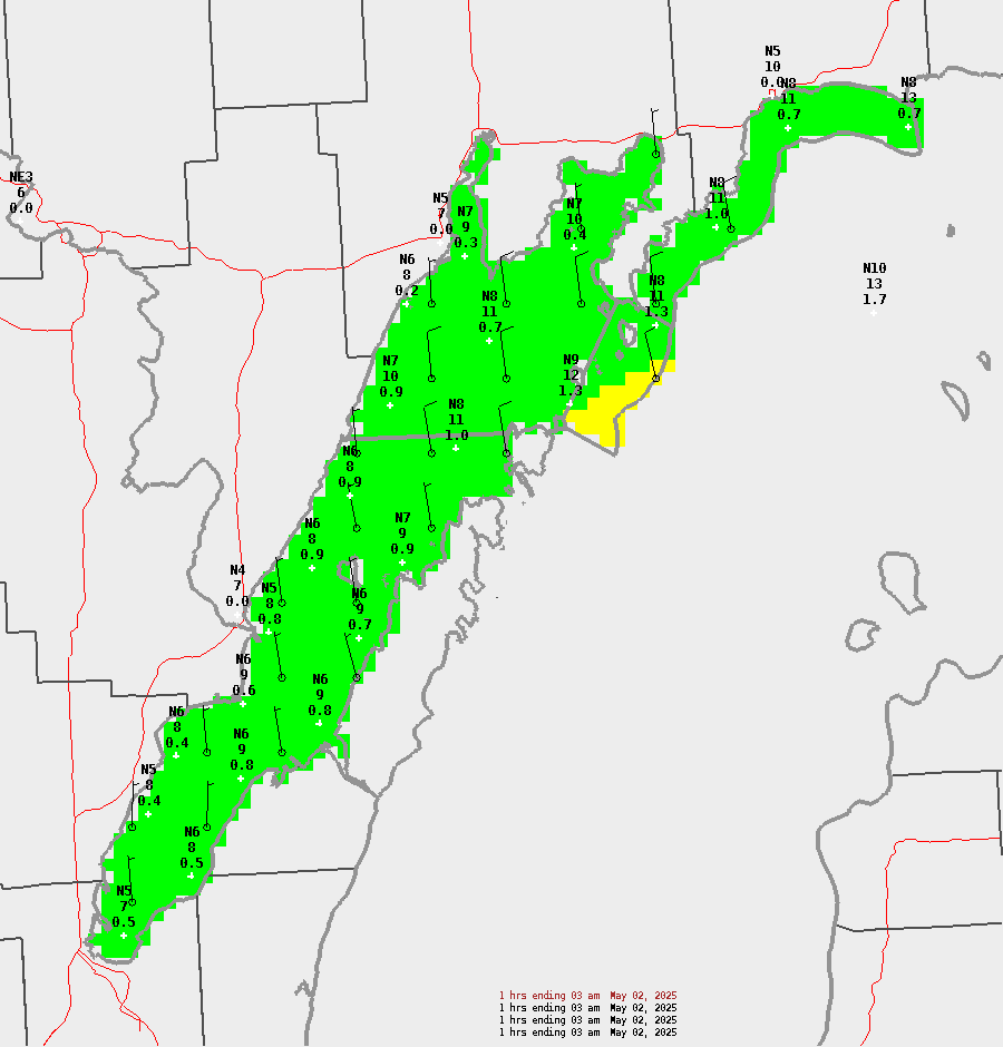
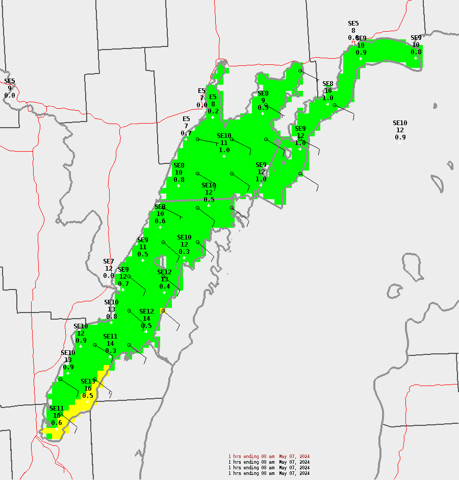
Sample points represent (from top to bottom): Wind Direction and Speed (kts), Wind Gust (kts), and Wave Height (ft)
| Marine Hazards Legend | |||
| Threat | Sustained Wind Speed (kts) | Wind Gust (kts) | Wave Height (ft) |
| None | < 15 | < 15 | < 2 |
| Limited | 15-23 knots | 15-23 knots | 2-3.9 ft |
| Elevated | 24-33 knots | 24-33 knots | 4-6.9 ft |
| Significant | ≥ 34 knots | ≥ 34 knots | ≥ 7 ft |
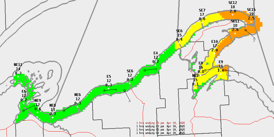
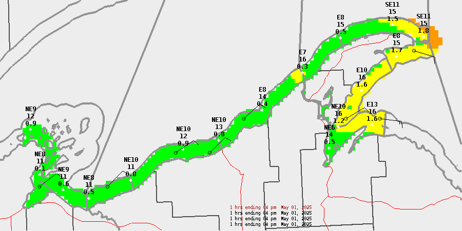
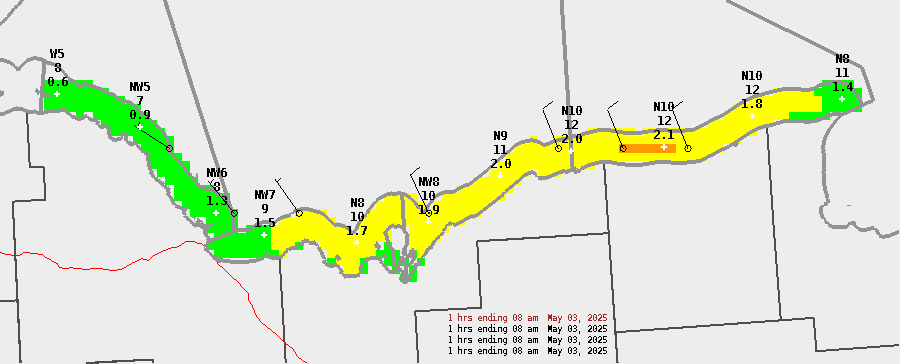
Northwestern Lake Michigan
| Today | Tonight | Sunday | Sunday Night | ||||||||||||||||||||||||||||||||||||||||||||
| 8a | 9a | 10a | 11a | 12p | 1p | 2p | 3p | 4p | 5p | 6p | 7p | 8p | 9p | 10p | 11p | 12a | 1a | 2a | 3a | 4a | 5a | 6a | 7a | 8a | 9a | 10a | 11a | 12p | 1p | 2p | 3p | 4p | 5p | 6p | 7p | 8p | 9p | 10p | 11p | 12a | 1a | 2a | 3a | 4a | 5a | 6a | 7a |

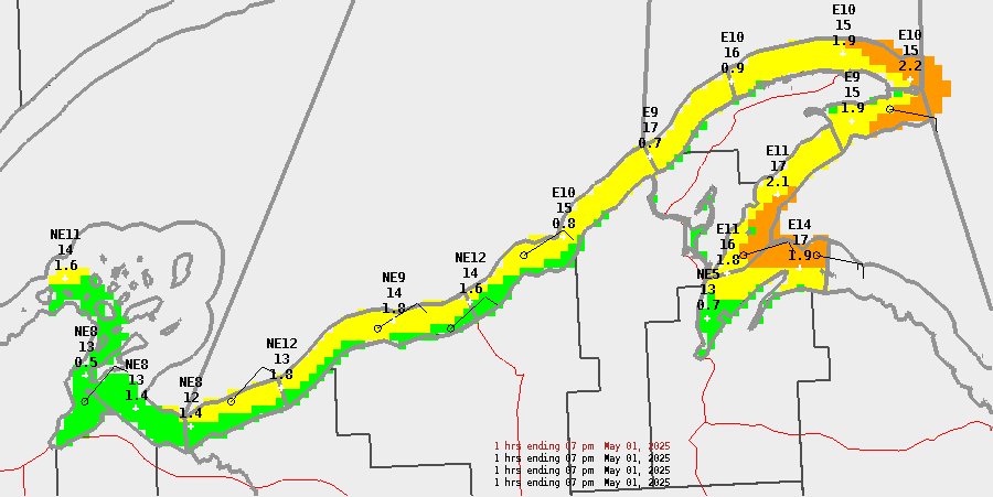
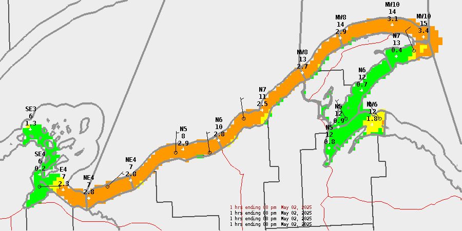
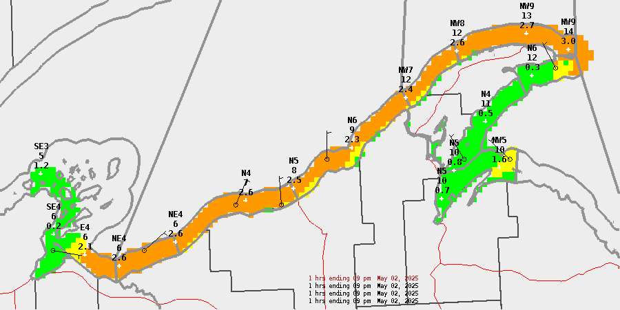
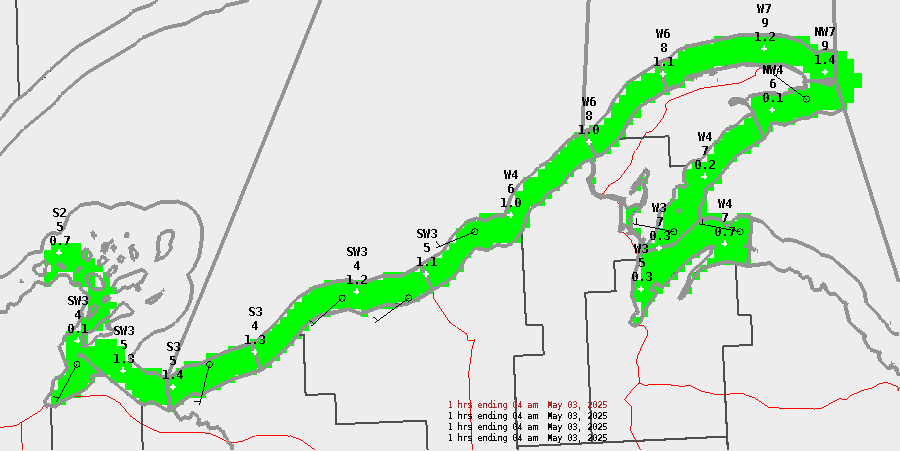
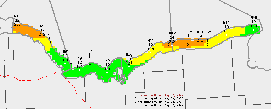
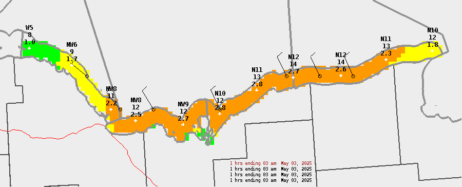
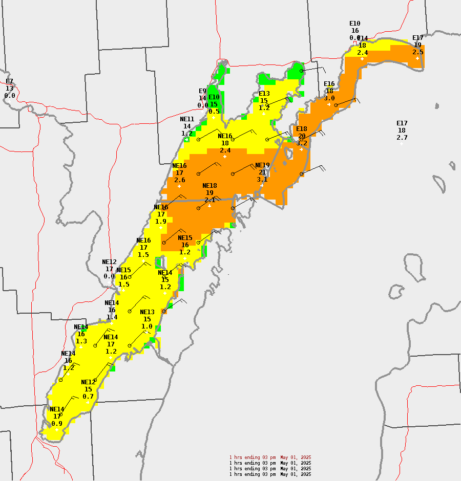
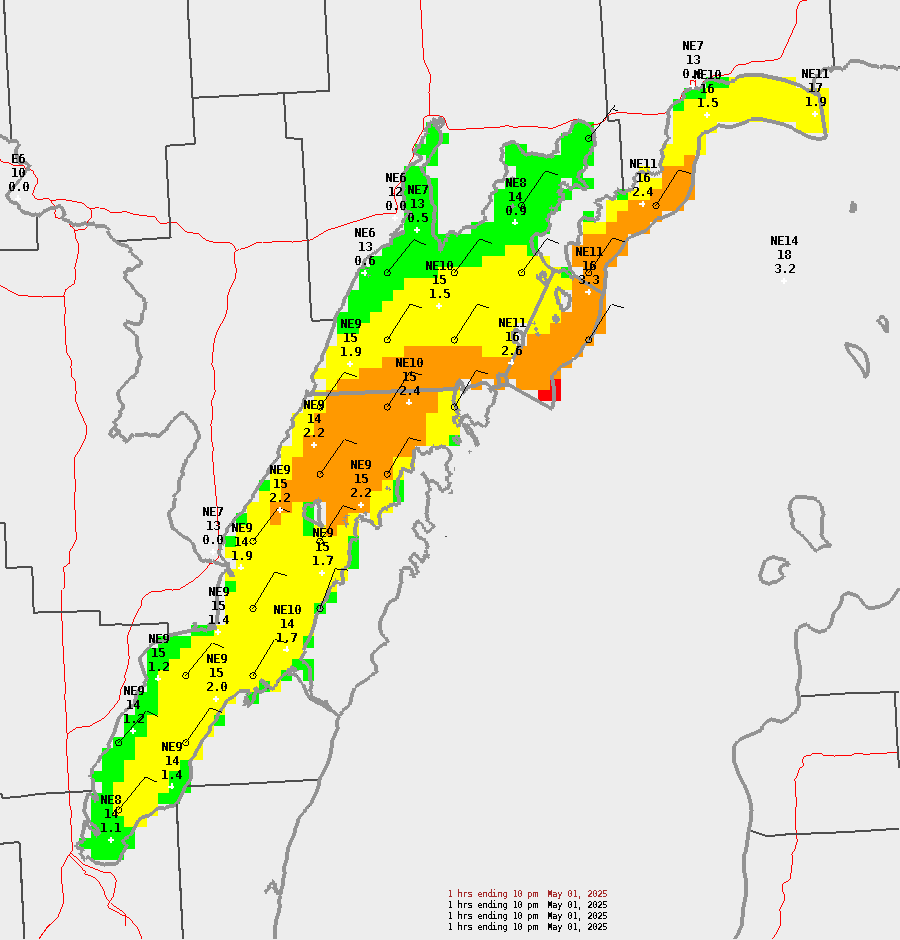
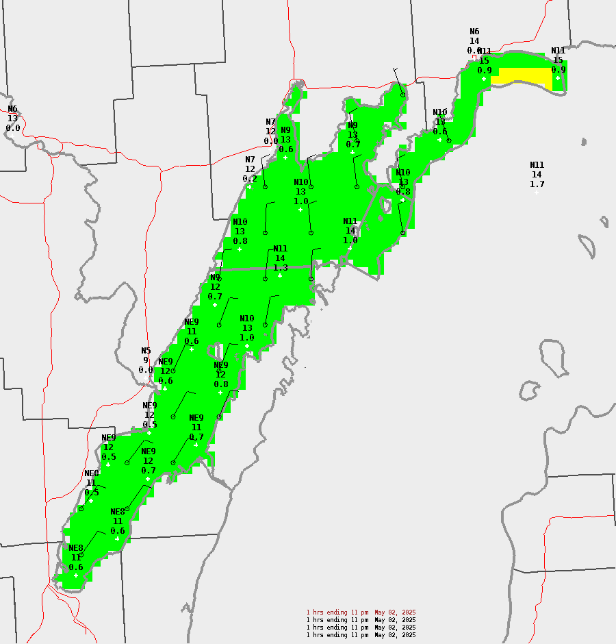
Sample points represent (from top to bottom): Wind Direction and Speed (kts), Wind Gust (kts), and Wave Height (ft)
| Marine Hazards Legend | |||
| Threat | Sustained Wind Speed (kts) | Wind Gust (kts) | Wave Height (ft) |
| None | < 15 | < 15 | < 2 |
| Limited | 15-23 knots | 15-23 knots | 2-3.9 ft |
| Elevated | 24-33 knots | 24-33 knots | 4-6.9 ft |
| Significant | ≥ 34 knots | ≥ 34 knots | ≥ 7 ft |