
A cold front in the East will bring showers and thunderstorms and much cooler temperatures from the Northeast into the Southeast. The Southwest, centered around New Mexico, will continue to see showers and thunderstorms, where there maybe isolated flash flooding. Tropical moisture will bring a multi-day period of thunderstorms and locally heavy rainfall across the Southwest beginning Thursday. Read More >
Last Map Update: Wed, Oct 8, 2025 at 6:40:20 am PDT
|
Text Product Selector (Selected product opens in current window)
|
|


 San Francisco Radar
 Sacramento Radar
 Satellite
 Weather Map
 Local Graphical Forecast
 U.S. Graphical Forecasts
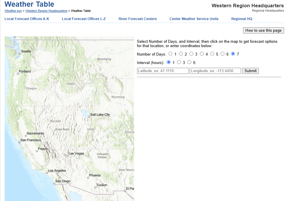 Forecast Weather Tables
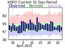 Recent MTR Temperatures
 Fire Weather
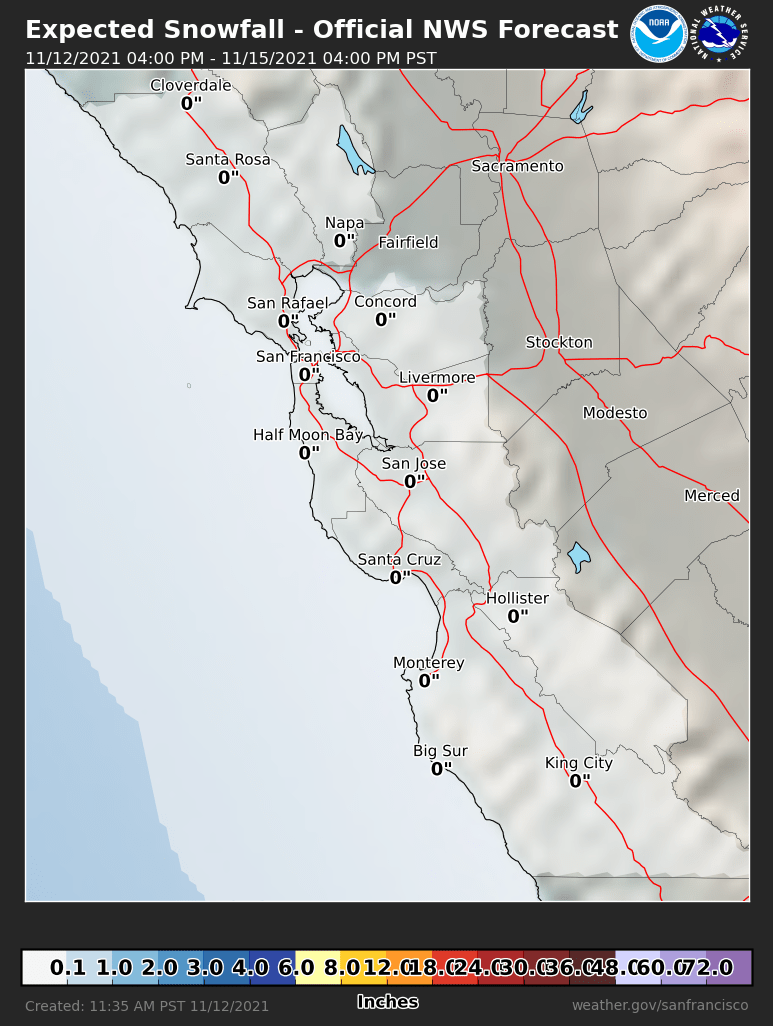 Probabilistic Snowfall Forecasts
 Heat Risk Link