
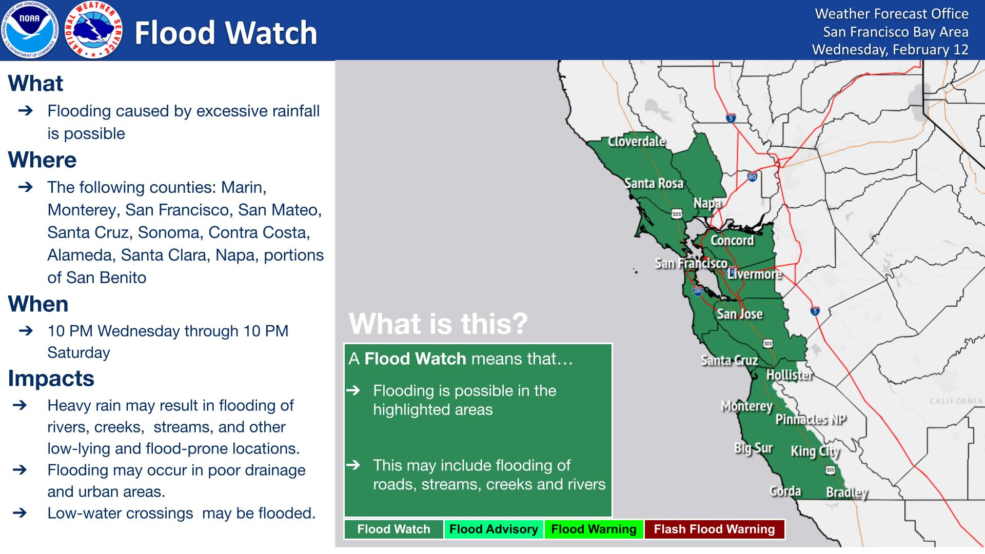
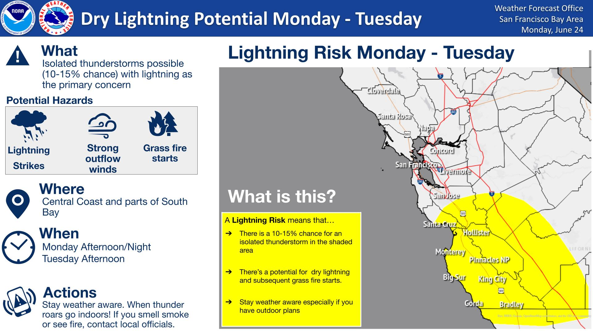
Showers, along with a few strong to severe thunderstorms, are expected from the Great Lakes, New England and southward into the Ohio and Tennessee Valleys. In the wake of this system, a stronger storm is expected to track from the Pacific Northwest, Plains and through the Eastern U.S. this weekend. Strong winds, showers and a larger drop in temperatures are expected this weekend into Monday. Read More >
Last Map Update: Sun, Nov 9, 2025 at 8:48:11 am PST
|
Text Product Selector (Selected product opens in current window)
|
|


 San Francisco Radar
 Sacramento Radar
 Satellite
 Weather Map
 Local Graphical Forecast
 U.S. Graphical Forecasts
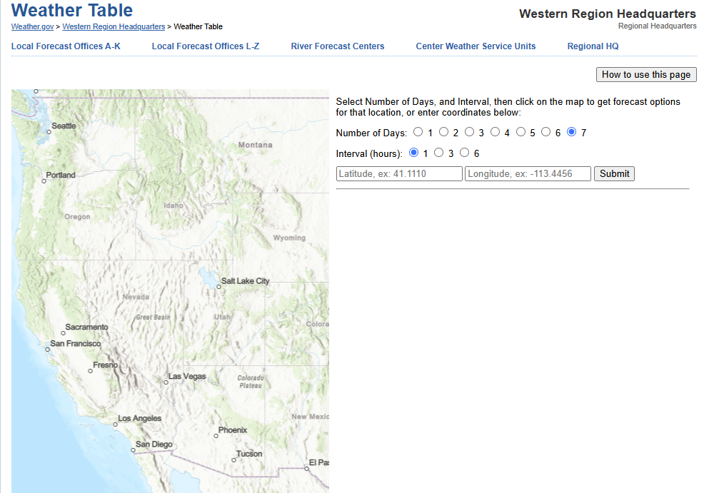 Forecast Weather Tables
 Recent MTR Temperatures
 Fire Weather
 Probabilistic Snowfall Forecasts
 Heat Risk Link