
Scattered severe thunderstorms capable of damaging wind gusts and hail are forecast across the Northeast U.S. and North Dakota today. Heavy to excessive rainfall is possible over eastern New Mexico into western Texas and over the western Florida peninsula today. Critical fire weather conditions will persist today over parts of the interior Northwest and Great Basin. Read More >
Last Map Update: Thu, Jul 3, 2025 at 2:02:13 pm PDT


|
Text Product Selector (Selected product opens in current window)
|
|


 San Francisco Radar
 Sacramento Radar
 Satellite
 Weather Map
 Local Graphical Forecast
 U.S. Graphical Forecasts
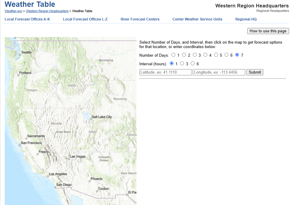 Forecast Weather Tables
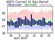 Recent MTR Temperatures
 Fire Weather
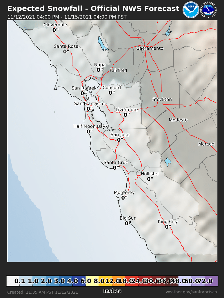 Probabilistic Snowfall Forecasts
 Heat Risk Link