National Weather Service United States Department of Commerce

Highest Severe Thunderstorm Threat Centered Over the Mid-Mississippi Valley Thursday

Strong to severe thunderstorms capable of damaging wind gusts, large hail, and perhaps a couple tornadoes, are likely Thursday from parts of the lower Ohio Valley into the southern Plains. An Enhanced Risk (Level 3 of 5) outlook has been issued. Further north, a warm front will bring areas of rain showers to portions of the Great Lakes and Northeast U.S. Read More >

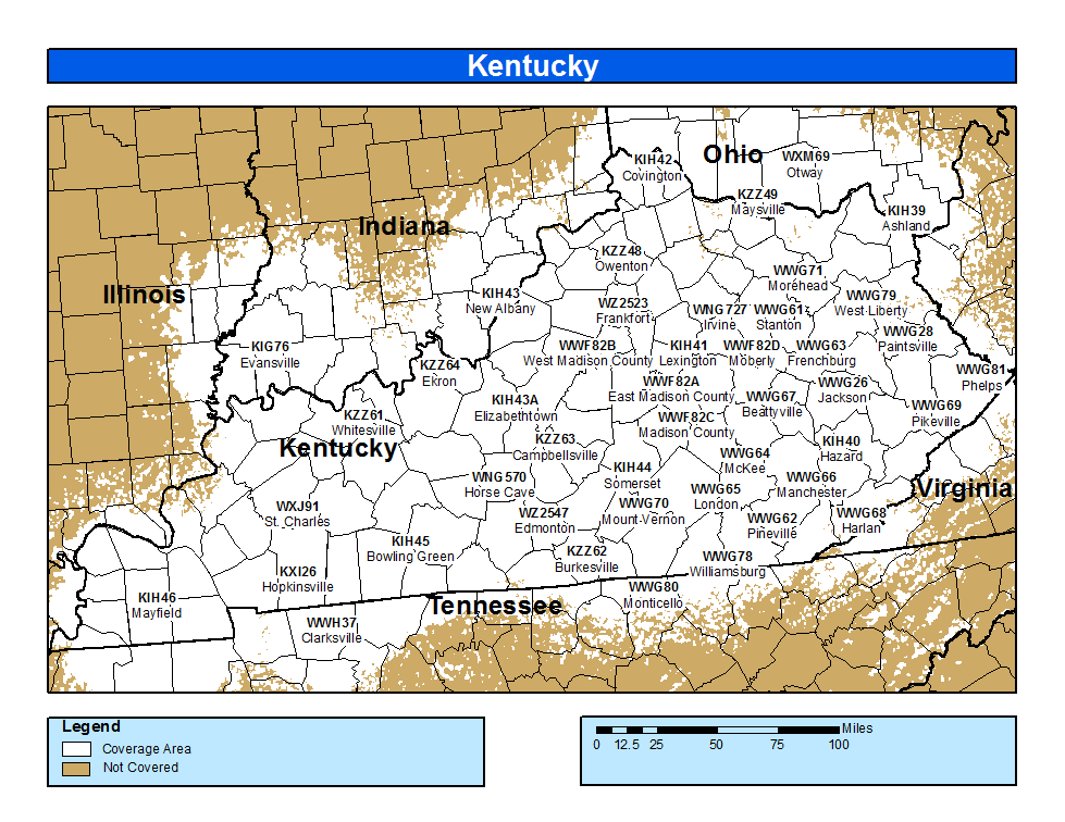
NWR Coverage


USA MAP


Coverage Map Notes

The coverage statistics and maps are calculated using a computer model and station data assuming ideal conditions. Coverage may be 5 to 10 percent below the computer predicted coverage for the following reasons:

  • The computer model is sensitive to antenna performance. Antenna performance is a function of local conditions, causing signals to be stronger signal level in some directions than others.
  • Placement of NWR antennas is dictated by the tower owner, which may result in a less than ideal set up.
  • The antenna may be affected by nearby structures or bodies of water.
  • In some special instances, the antenna may have been intentionally adjusted to be "directional" and provide better coverage to a specific area to the detriment of other areas.
  • Because of variations in local site conditions, the performance of an individual transmitter and antenna may be less than predicted or expected.
  • Seasonal environmental conditions, such as icing or heavy rain, affect performance of a transmitter station and its various components, particularly those subject to continuous weather exposure.
  • The coverage maps are shown in a single color format, which relates to an estimated signal level.
    • White: Signal level of greater than 18dBuV: Reliable coverage