
Deep tropical moisture will lead to widespread showers and thunderstorms capable of producing flash flooding through early next week over the Southwest and Four Corners. A coastal storm is expected to develop off the southeast U.S. coast tonight and is expected to strengthen and bring flooding, dangerous rip currents, gusty winds and heavy rain up much of the East Coast through early next week. Read More >
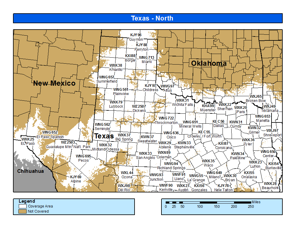
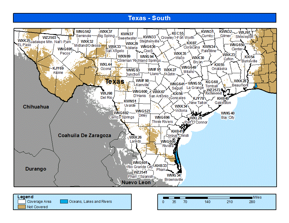
Coverage Map Notes
The coverage statistics and maps are calculated using a computer model and station data assuming ideal conditions. Coverage may be 5 to 10 percent below the computer predicted coverage for the following reasons:

