Overview
|
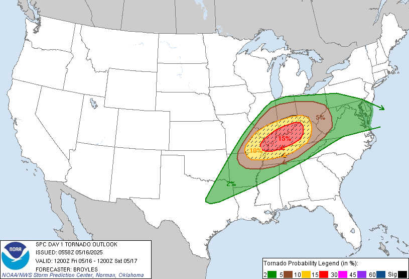
A significant severe thunderstorm and tornado outbreak impacted our region during the afternoon and evening on May 16th. Discrete supercells formed across southern Missouri and Illinois during the afternoon and moved east. These storms produced numerous tornadoes, many of which were strong to violent, along with very large hail. Several locations observed multiple severe storms since the initial storms developed well ahead of the cold front while another round formed right ahead of it. Eventually, upscale growth led to a more significant damage wind threat with straight-line winds of 60 to 90 mph occurring across portions of western Kentucky between 8 and 10 PM. In the days following the event, NWS Damage surveys were conducted and determined that 10 tornadoes occurred across our region. 7 of these were strong (EF-2+) with the highest rated being an EF-4 that ravaged the southern part of Williamson County Illinois (just south of Marion). We issued a rare Tornado Emergency for this storm. This was the highest rated damage from a tornado within one of our 58 counties since the December 10, 2021 violent tornado that struck western Kentucky. There were also two EF-3's with this event, one of which caused 2 fatalities as it struck north of Sikeston, Missouri (Scott County), and the other occurring just south of Morganfield, Kentucky (Union County). Very large hail also was observed from many of these storms, with hailstones of tennis ball to softball sized being reported. Even larger hailstones may have fallen in Ballard County, KY possibly measuring 4" in diameter or larger. The largest documented hailstone on record in our 58 county forecast area is 4.5" set in Todd County back in May of 1995, so this is very close to that. |
Tornadoes
Select a tornado from the table to zoom into the track and view more information. The default table view is limited to 8 tracks, but can be scrolled by a mouse wheel or dynamically expanded. Additionally, the table can fill the entire window by clicking the small circular expanding arrow icon at the very top right of the table and returned to its original size by clicking the button again. The side information panel that opens over the map can be closed using the "X" on the upper right corner of the pop-up. Zoom into the map and click damage points to see detailed information and pictures from the surveys.
|
NOTE: times shown below are local to your device's time zone. |

The Enhanced Fujita (EF) Scale classifies tornadoes into the following categories:
| EF0 Weak 65-85 mph |
EF1 Moderate 86-110 mph |
EF2 Significant 111-135 mph |
EF3 Severe 136-165 mph |
EF4 Extreme 166-200 mph |
EF5 Catastrophic 200+ mph |
 |
|||||
| Tornadoes that fail to impact any ratable structures on the EF-Scale are rated EF-Unknown (EF-U) | |||||
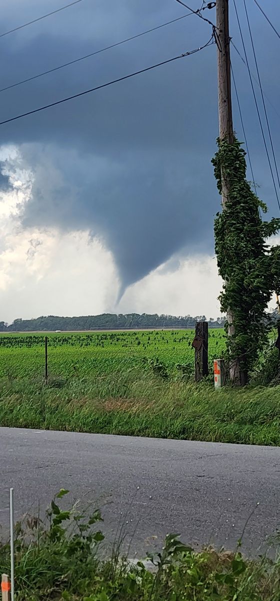
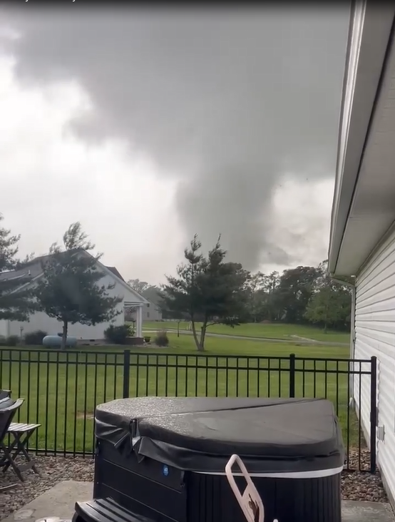
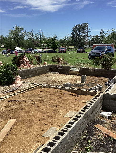
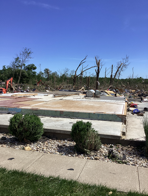
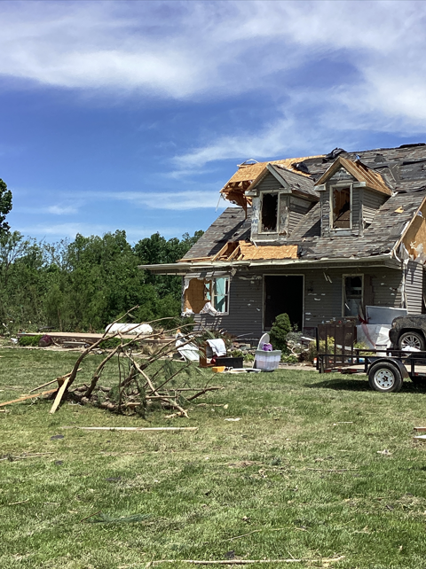
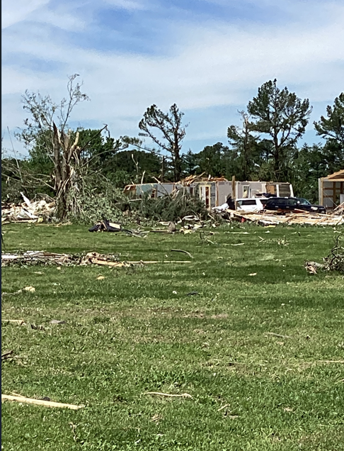
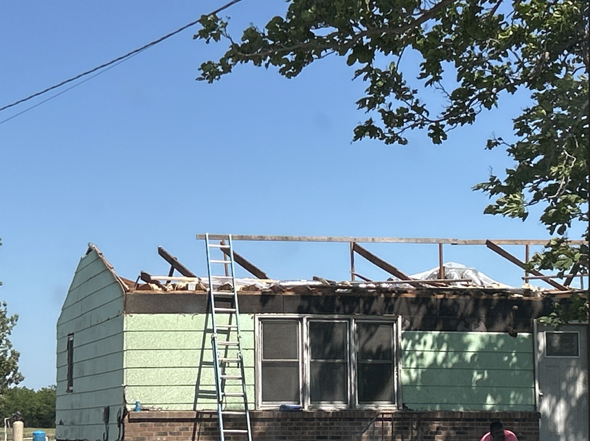
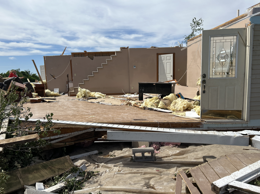
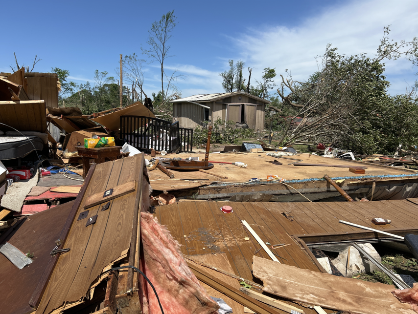
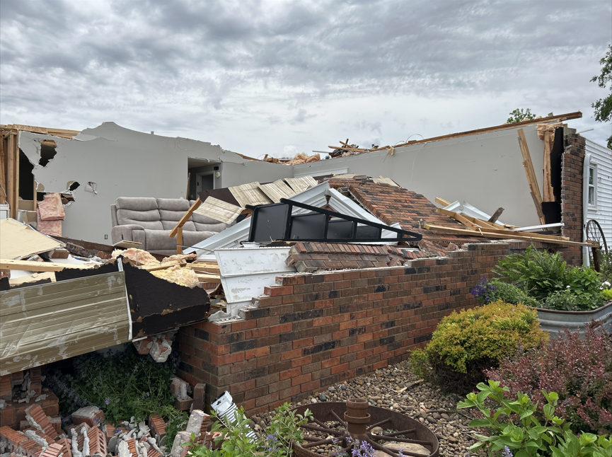
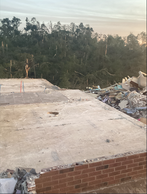
Photos
 |
 |
 |
 |
| Tornado north of Sikeston, MO courtesy of Eric Matthews | Tornado north of Sikeston, MO courtesy of Beau Dodson | Tornado south of Marion, IL courtesy of Mary Jo McCurdy | Tornado near Morganfield, KY courtesy of Lee Baird |
 |
 |
 |
 |
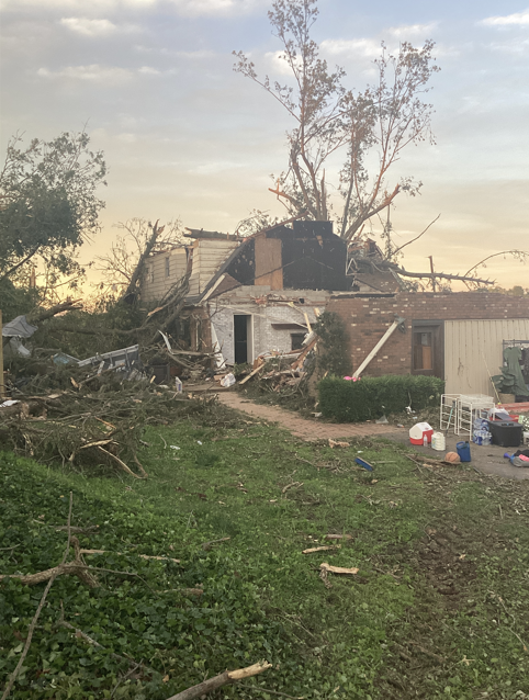
| NWS Damage Survey - Williamson County IL EF-4 Tornado | NWS Damage Survey - Williamson County IL EF-4 Tornado | NWS Damage Survey - Williamson County IL EF-4 Tornado | NWS Damage Survey - Williamson County IL EF-4 Tornado |
 |
 |
 |
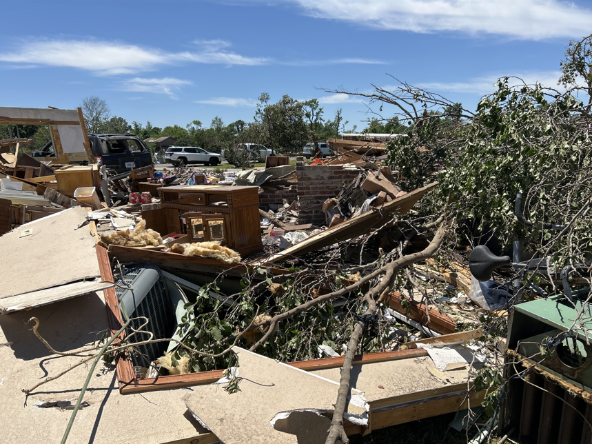 |
| NWS Damage Survey - Scott & Stoddard Counties MO EF-3 Tornado | NWS Damage Survey - Scott & Stoddard Counties MO EF-3 Tornado | NWS Damage Survey - Scott & Stoddard Counties MO EF-3 Tornado | NWS Damage Survey - Scott & Stoddard Counties MO EF-3 Tornado |
 |
 |
 |
 |
| NWS Damage Survey - Union County KY EF-3 Tornado | NWS Damage Survey - Union County KY EF-3 Tornado | NWS Damage Survey - Union County KY EF-3 Tornado | NWS Damage Survey - Union County KY EF-3 Tornado |
Hail
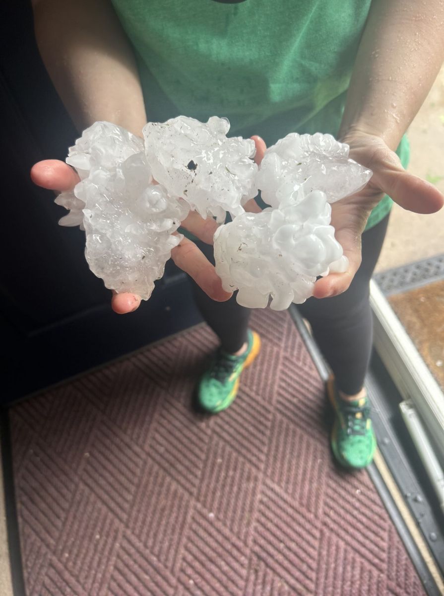
Large hail ranging from golf ball to softball sized occurred with several of these storms. Further analysis will need to be done to determine if some of the hailstones, particularly in Ballard County Kentucky, were possibly larger than 4" in diameter, which may threaten the Kentucky State record for largest hailstone.
 |
 |
 |
 |
| Ballard County KY baseball size hail via Heather Batts | Pulaski County IL (Mounds) baseball sized hail via EM Kenneth Kerley | Livingston County KY (Smithland) golf ball sized hail via Beau Dodson | Jackson County IL (Murphysboro) golf ball sized hail via Brian Manwaring |
Radar
 |
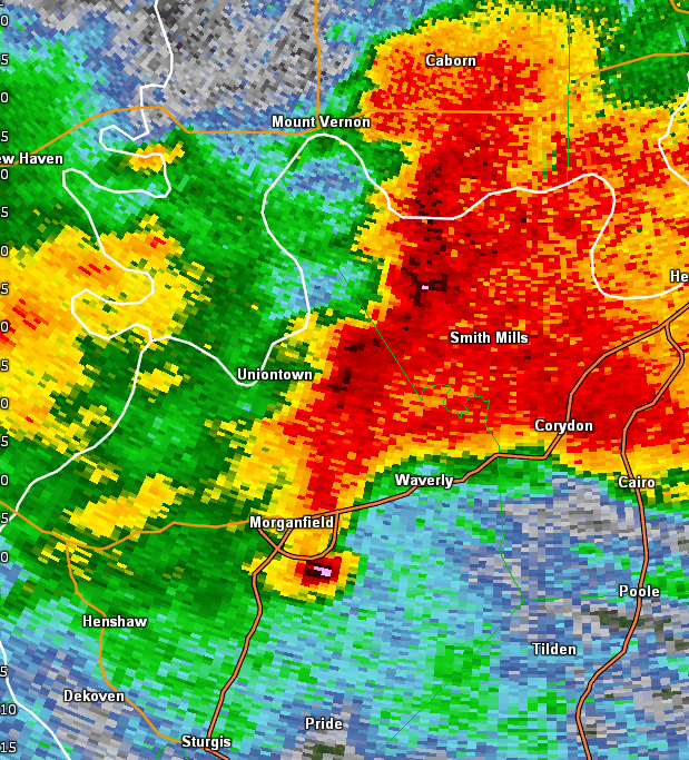 |
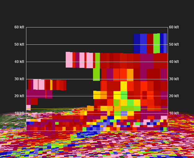 |
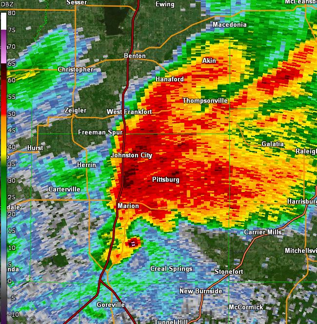
| Radar Reflectivity for the Marion, IL EF-4 Tornado | Radar Reflectivity for the Morganfield, KY EF-3Tornado | Correlation Coefficient of the Marion, IL tornado showing debris being lofted over 20,000 feet up. |
Environment
In the mid levels, there was a 500mb shortwave moving across the Upper Midwest with height falls being realized across our region during the afternoon and evening. 500mb winds increased from 70 to 80 knots as we approached the evening on the 16th. At the same time, the exit region of a pronounced (125 knot) upper level jet was positioned across our area.
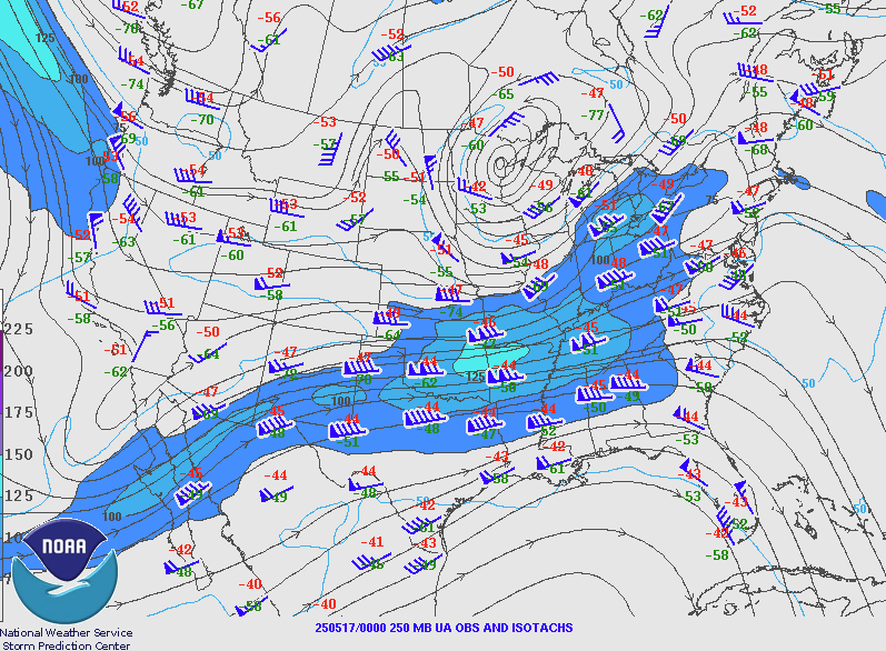 |
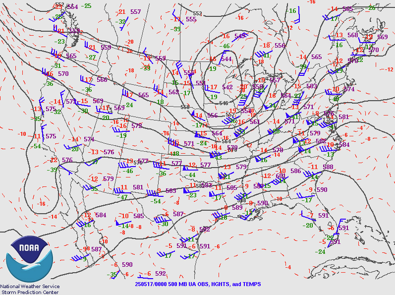 |
 |
| 250mb chart at 7 PM May 16 | 500mb chart at 7 PM May 16 | 500mb chart at 1 PM May 16 |
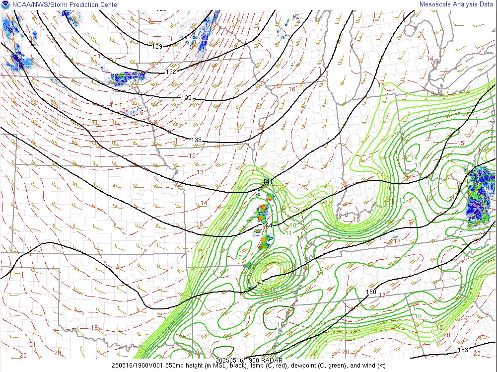
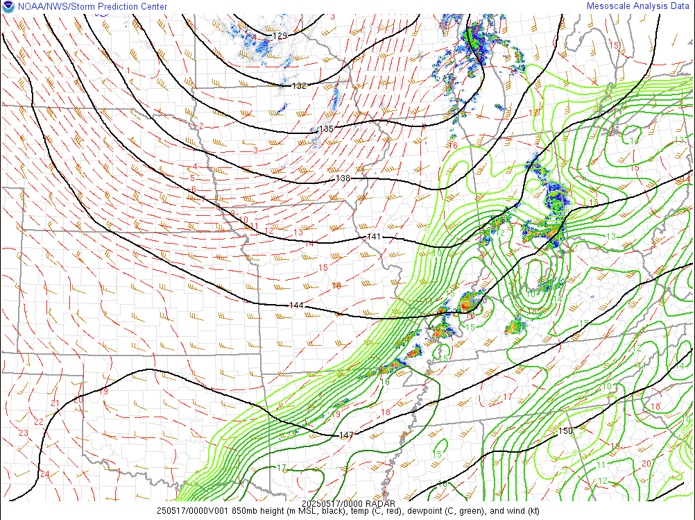
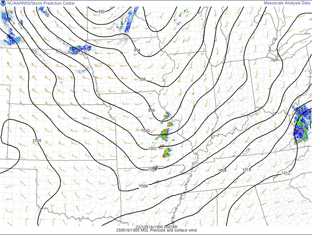
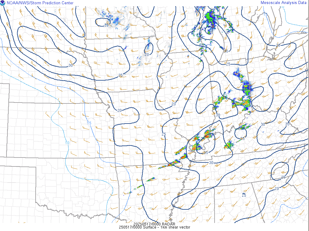
Low level winds increased from 30 to 50 knots from 1 to 7 PM. Meanwhile, at the surface low pressure was oriented across the Upper Midwest with a trailing cold front moving east across Missouri during the afternoon.
 |
 |
 |
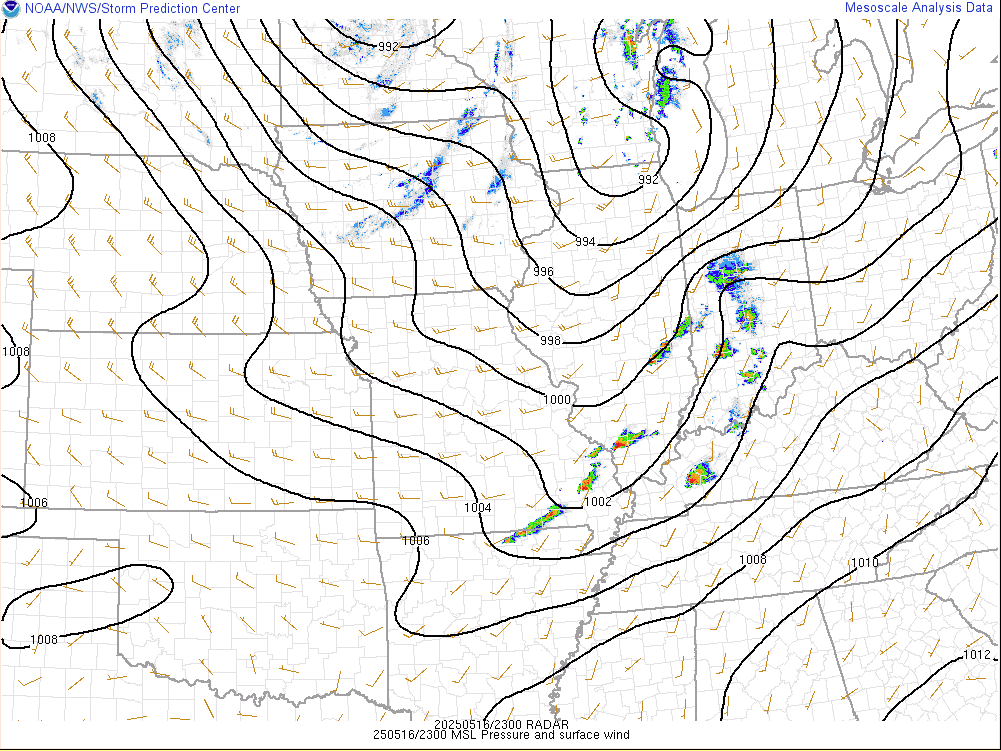 |
| 850mb chart at 2 PM May 16 | 850mb chart at 7 PM May 16 | Surface Map at 2 PM May 16 | Surface Map at 6 PM May 16 |
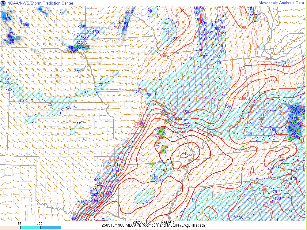
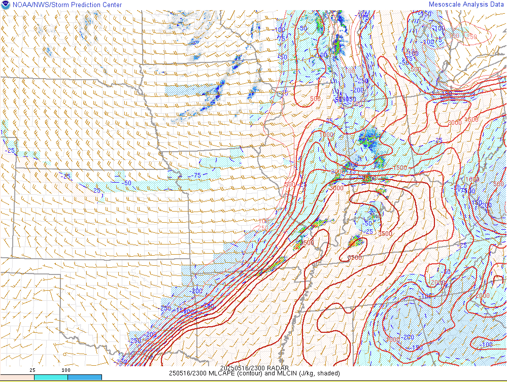
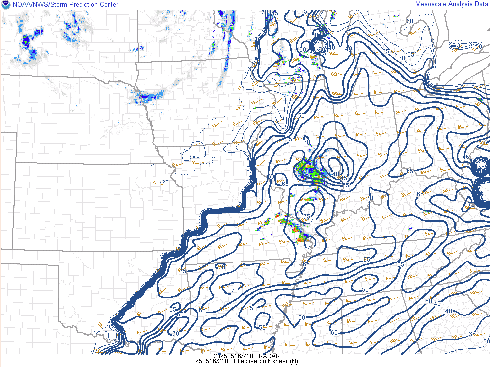
Behind overnight and early morning convection, a good amount of sunshine was realized by late morning and into the afternoon. With dewpoints rising into the lower to mid 70s, the airmass became very unstable with mixed layer CAPE of 3000 to 4000 j/kg being observed. We also had high deep layer shear values of 65 to 70 knots in place.
 |
 |
 |
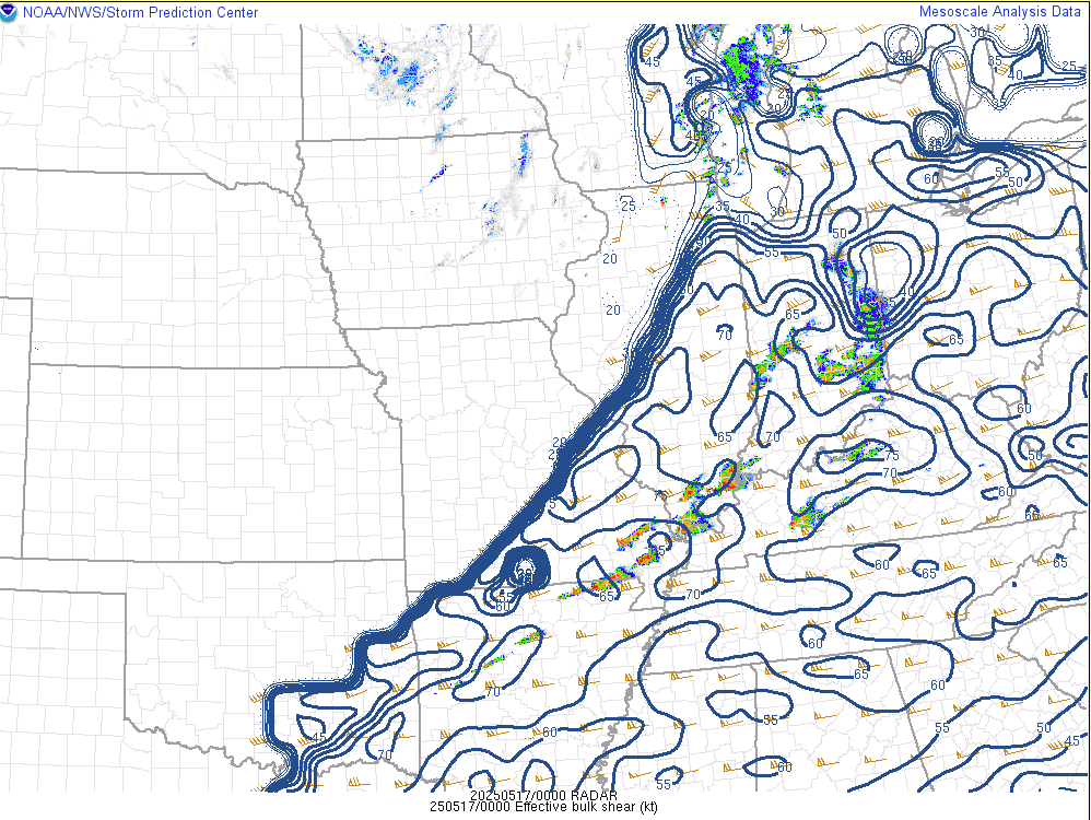 |
| Mixed Layer CAPE (MLCAPE) at 2 PM May 16 | Mixed Layer CAPE (MLCAPE) at 6 PM May 16 | 0-6 km Bulk Shear at 4 PM May 16 | 0-6 km Bulk Shear at 7 PM May 16 |
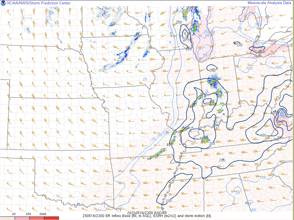
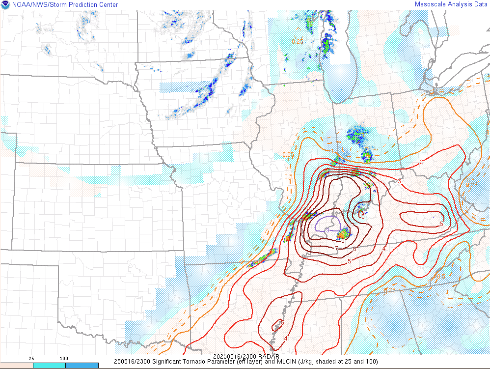
As the low level winds increased, the environment become even more conducive for strong, long-track tornadoes by late afternoon and early evening. The Significant Tornado Parameter (STP) peaked around 9 at 6 PM while effective Storm Relative Helicity (SRH) was over 400 m2/s2.
 |
 |
 |
| 0-1 km Shear at 7 PM May 16 | Effective SRH at 6 PM May 16 | Significant Tornado Parameter at 6 PM May 16 |
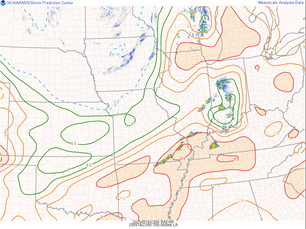
The environment in place was also very conducive for very large hail. Mid level lapse rates exceeded 8 C and the Significant Hail Parameter value of 5 denoted an environment that would support very large hail from any storm. Downdraft CAPE (DCAPE) was also very high, peaking in the 1200-1500 j/kg range. At first storms stayed more discrete with large hail and tornadoes being the biggest threats, but as storms grew upscale and took on more of a linear feature by mid evening, there was some rather significant straight line winds observed across western Kentucky.
 |
 |
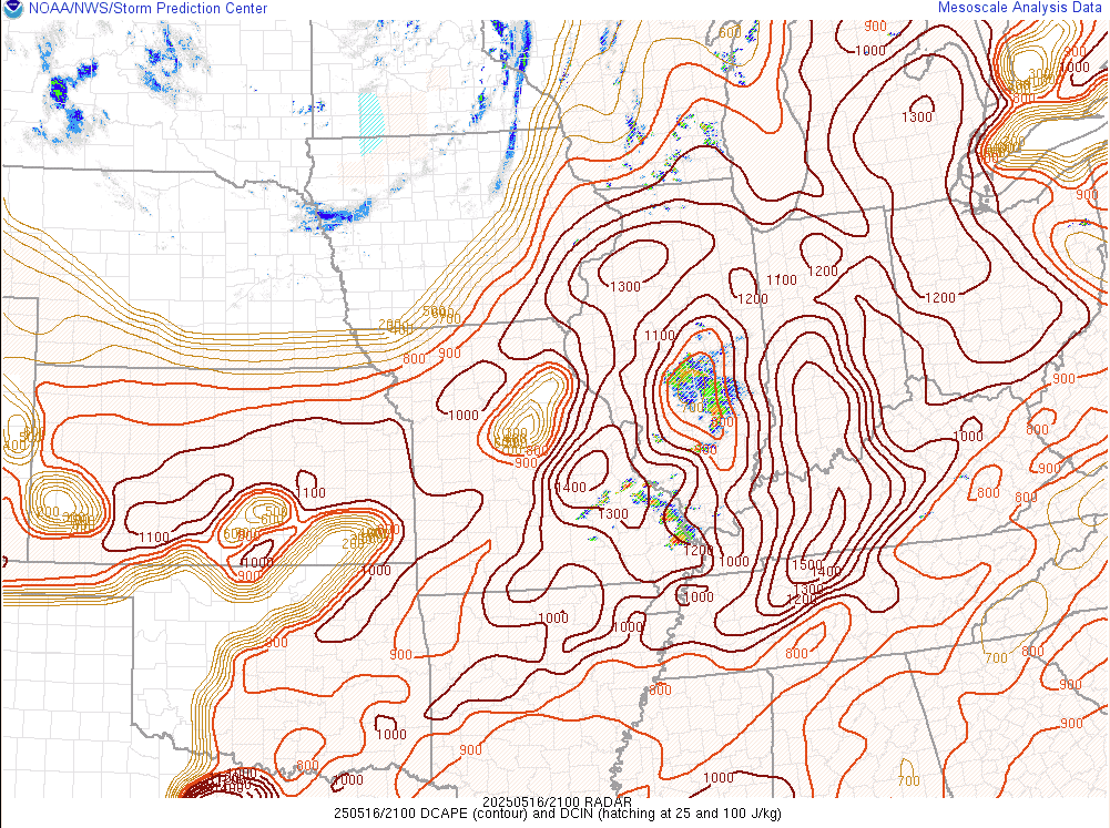 |
| Mid Level Lapse Rates at 6 PM May 16 | Significant Hail Parameter at 3 PM May 16 | Downdraft CAPE (DCAPE) at 4 PM May 16 |
Additional
 |
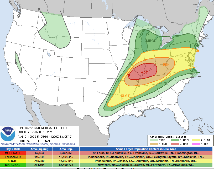 |
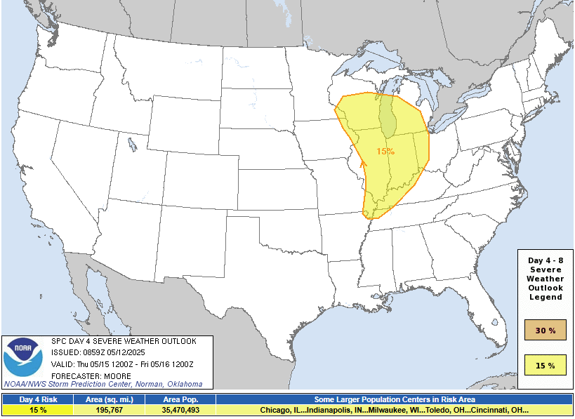
| SPC Day 5 Categorical Outlook | SPC Day 2 Categorical Outlook - Afternoon Update |
 |
 |
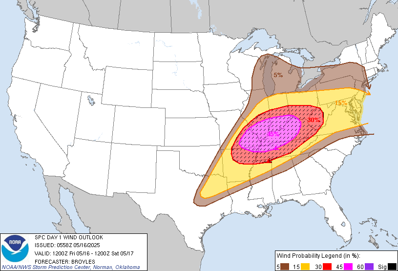 |
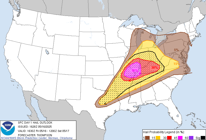
| SPC Day 1 Hail Probabilities Outlook | SPC Day 1 Tornado Probabilities Outlook | SPC Day 1 Wind Probabilities Outlook |
 |
Media use of NWS Web News Stories is encouraged! Please acknowledge the NWS as the source of any news information accessed from this site. |
|

