Overview
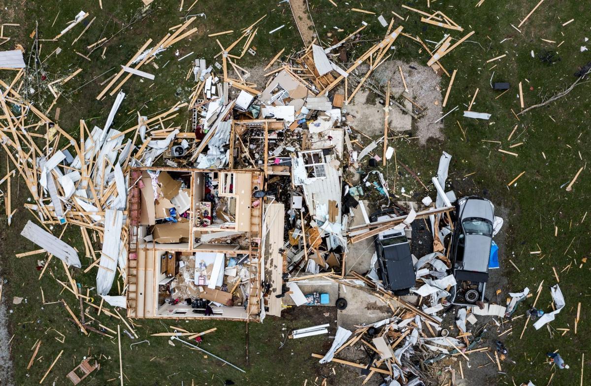
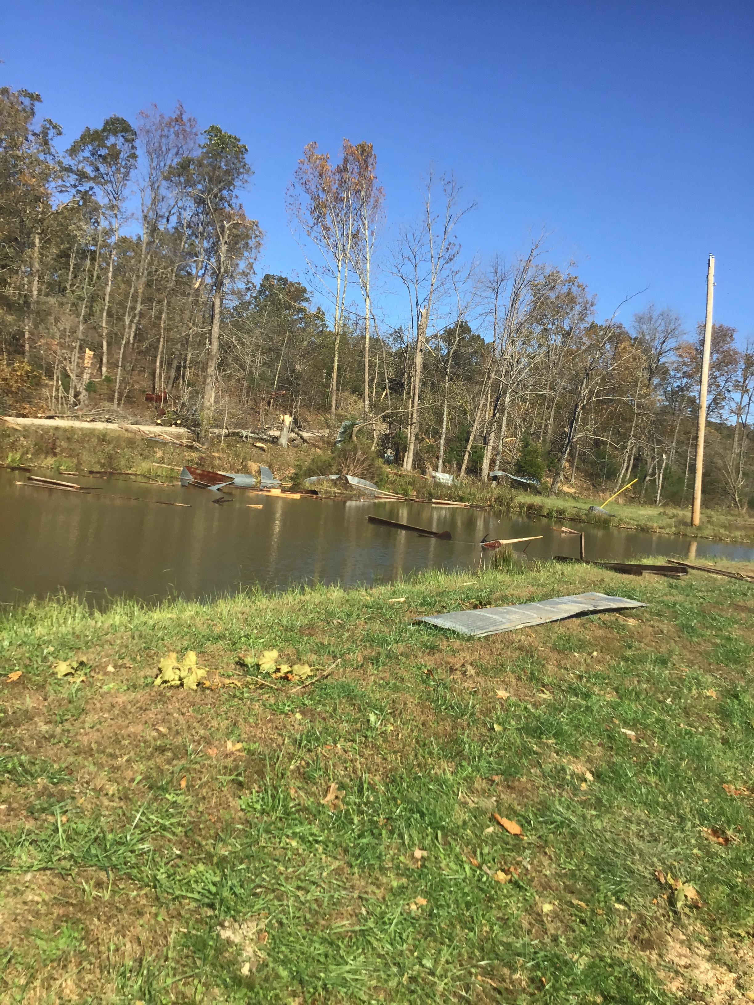
On the evening of Sunday, October 24, 2021, severe thunderstorms produced several long-track tornadoes across southeast Missouri into southwest Illinois. A strong EF-3 tornado did significant damage in Fredericktown, MO, before moving into far western Perry County, MO. Another EF-1 struck southern Perry County around this time. A long track EF-1 tornado also impacted eastern Wayne County into southern Bollinger County in southeast Missouri. For more information on the other strong tornadoes that occurred near Perry County, see this summary created by NWS St. Louis: https://www.weather.gov/lsx/10_24_2021Tornadoes:
|
Tornado - Fredericktown, MO
Track Map 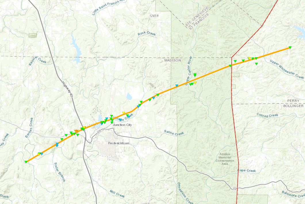 
|
||||||||||||||||
|
Tornado - Zalma, MO
Track Map 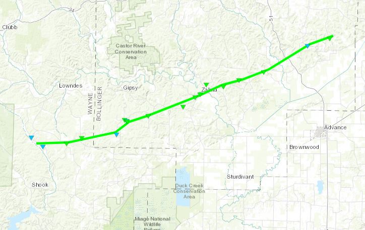
|
||||||||||||||||
|
Tornado - Along J Highway in Perry County, MO
Track Map 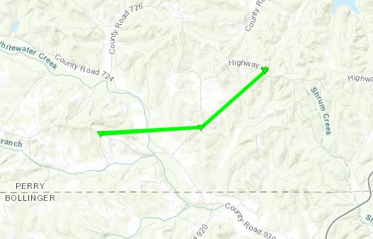
|
||||||||||||||||
The Enhanced Fujita (EF) Scale classifies tornadoes into the following categories:
| EF0 Weak 65-85 mph |
EF1 Moderate 86-110 mph |
EF2 Significant 111-135 mph |
EF3 Severe 136-165 mph |
EF4 Extreme 166-200 mph |
EF5 Catastrophic 200+ mph |
 |
|||||
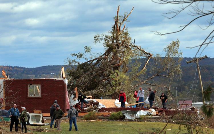
Photos & Video
 |
 |
 |
 |
||
|
|
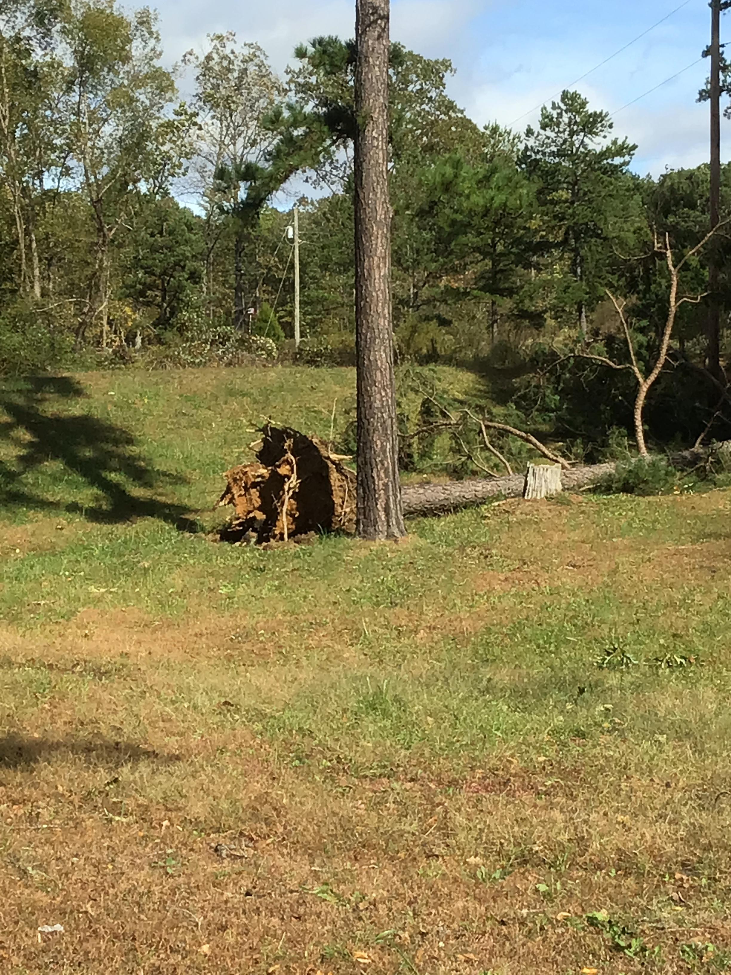
Tree damage along J Highway in Perry County, MO. NWS damage survey. | Tree uprooted in Wayne County, MO. NWS damage survey. |
Radar
Header
 |
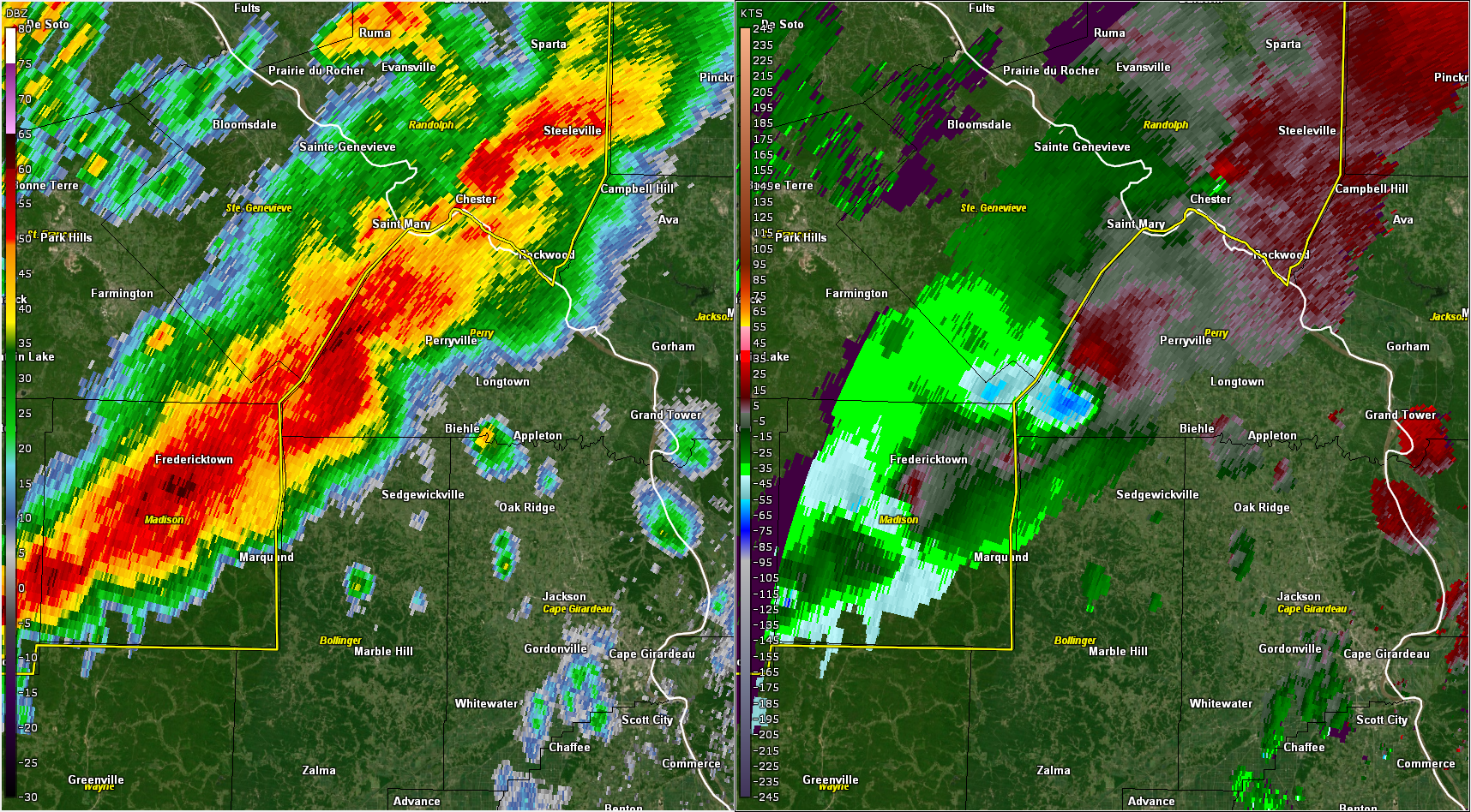 |
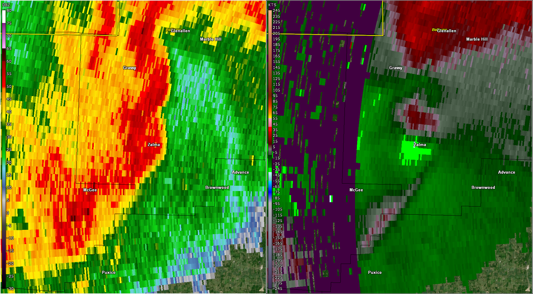 |
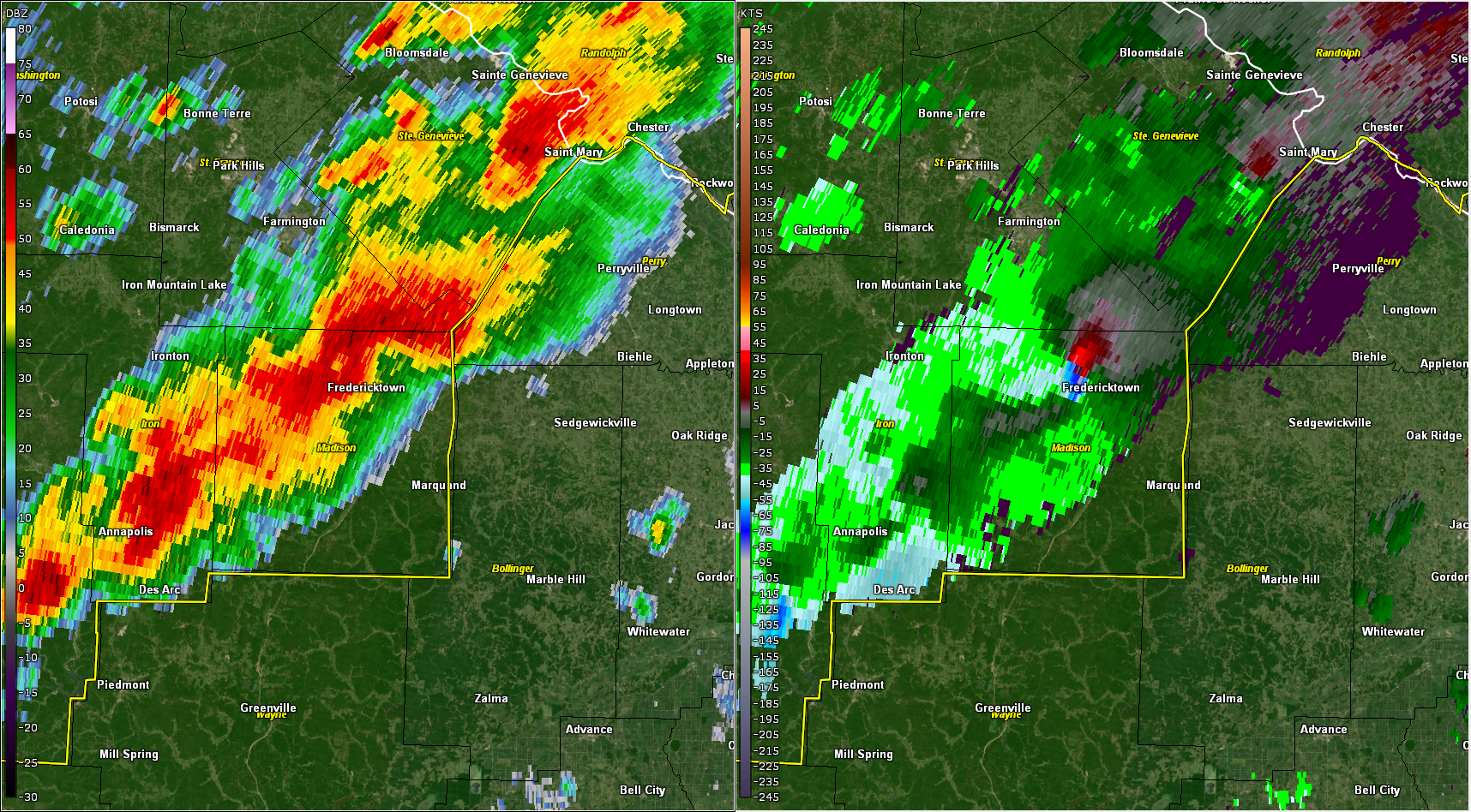
| KPAH WSR-88D base reflectivity (left) and storm relative velocity (right) at 8:56 p.m. while an EF-3 tornado was passing through Fredericktown, MO, in Madison County. | KPAH WSR-88D base reflectivity (left) and storm relative velocity (right) at 9:20 p.m. near the end of the Fredericktown, MO, EF-3's path in western Perry County, MO. | KPAH WSR-88D base reflectivity (left) and storm relative velocity (right) at 11:16 p.m. as an EF-1 tornado was producing damage in Zalma, MO, in Bollinger County. |
 |
Media use of NWS Web News Stories is encouraged! Please acknowledge the NWS as the source of any news information accessed from this site. |
|

