Overview
Numerous severe thunderstorms formed ahead of an approaching cold front across southeast Missouri during the evening hours of Sunday, October 24th, 2021. As the storms moved northeastward, they moved into a moist, energy-rich environment with substantial wind shear in the low and mid-levels. They quickly grew intensified, remaining somewhat isolated as they moved through southeast Missouri and into southwest Illinois. The environment was very favorable for tornadic development, and these storms produced several tornadoes and wind damage as they moved through the area. Two storms produced tornadoes that remained on the ground for significant distances. The tornado that moved through Fredericktown, MO, passing through Madison County into Perry County, was on the ground for 18.9 miles. Another tornado moved from St. Francois County through St. Genevieve County in Missouri into Randolph County in Illinois, staying on the ground for over 40 miles.
For an in depth walkthrough of the event, check out our ArcGIS StoryMap.
Tornadoes
|
Tornado - Fredericktown, MO
Track Map 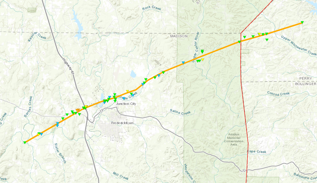 
Downloadable KMZ File |
||||||||||||||||
|
||||||||||||||||
|
Tornado - Coffman, MO
Track Map 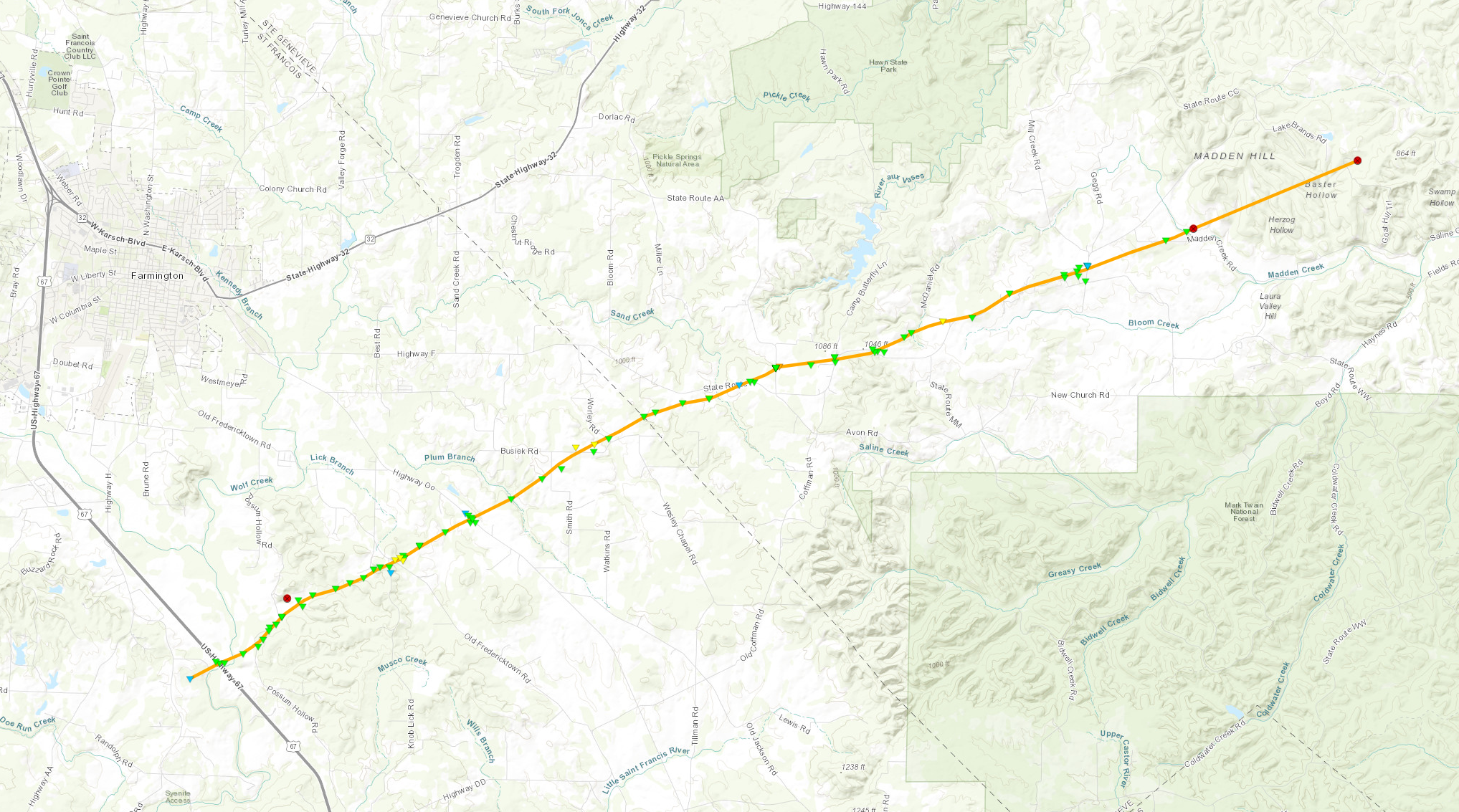
Downloadable KMZ File |
||||||||||||||||
|
||||||||||||||||
|
Tornado - St. Mary, MO/Chester, IL
Track Map 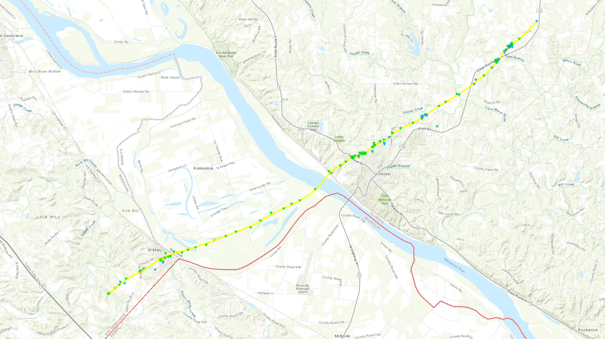
Downloadable KMZ File |
||||||||||||||||
|
||||||||||||||||
|
Tornado - Johnson Shut-Ins S.P., MO
Track Map 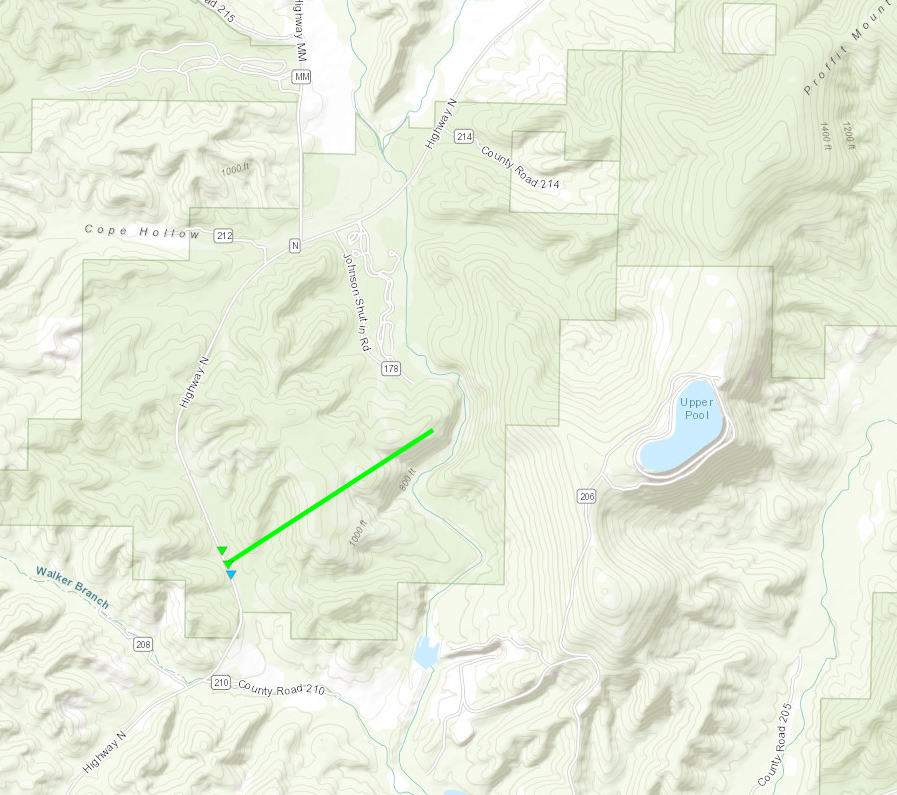
Downloadable KMZ File |
||||||||||||||||
|
||||||||||||||||
|
Tornado - Iron and Madison County MO
Track Map 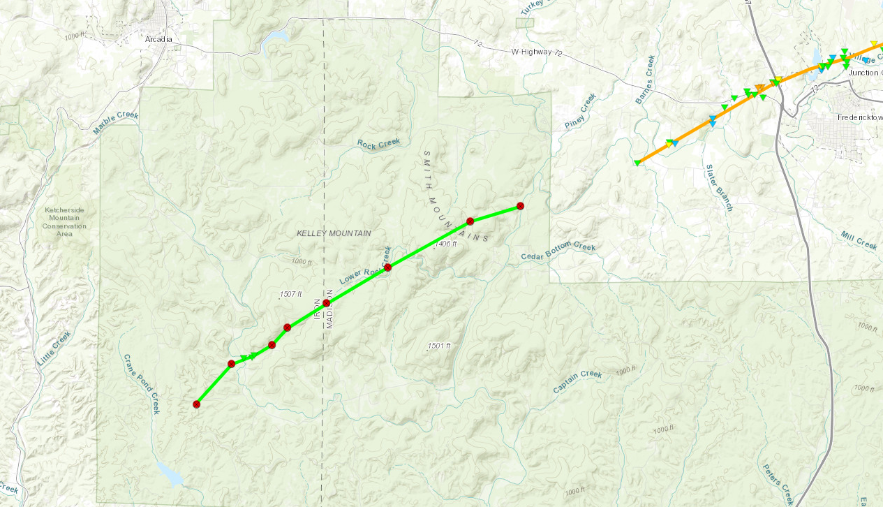
Downloadable KMZ File |
||||||||||||||||
|
||||||||||||||||
|
Tornado - Washington County IL
Track Map 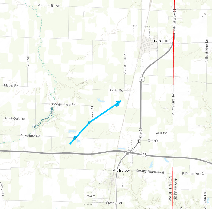
Downloadable KMZ File |
||||||||||||||||
|
||||||||||||||||
The Enhanced Fujita (EF) Scale classifies tornadoes into the following categories:
| EF0 Weak 65-85 mph |
EF1 Moderate 86-110 mph |
EF2 Significant 111-135 mph |
EF3 Severe 136-165 mph |
EF4 Extreme 166-200 mph |
EF5 Catastrophic 200+ mph |
 |
|||||
Photos & Video
Fredericktown Tornado
|
|
|
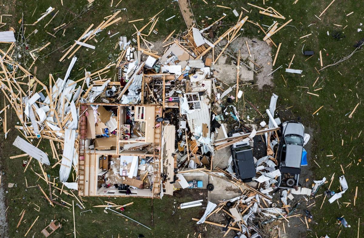 |
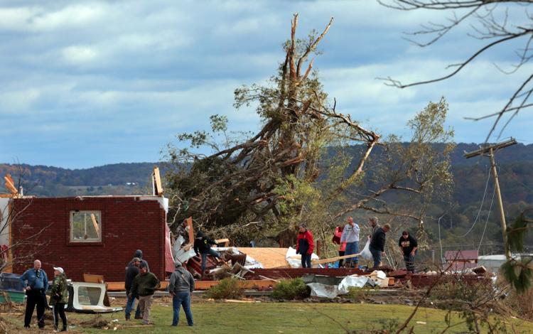
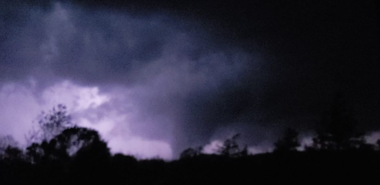
| Significant damage to the Black River Electric Cooperative off of Highway 67 in Fredericktown, MO (STL Post-Dispatch, Robert Cohen) | A picture of the tornado that would eventually hit Fredericktown, MO taken 12 miles east of Arcadia, MO (Facebook, David Carson) | A home significantly damaged by the tornado near Fredericktown, MO (STL Post-Dispatch, Colter Peterson) |
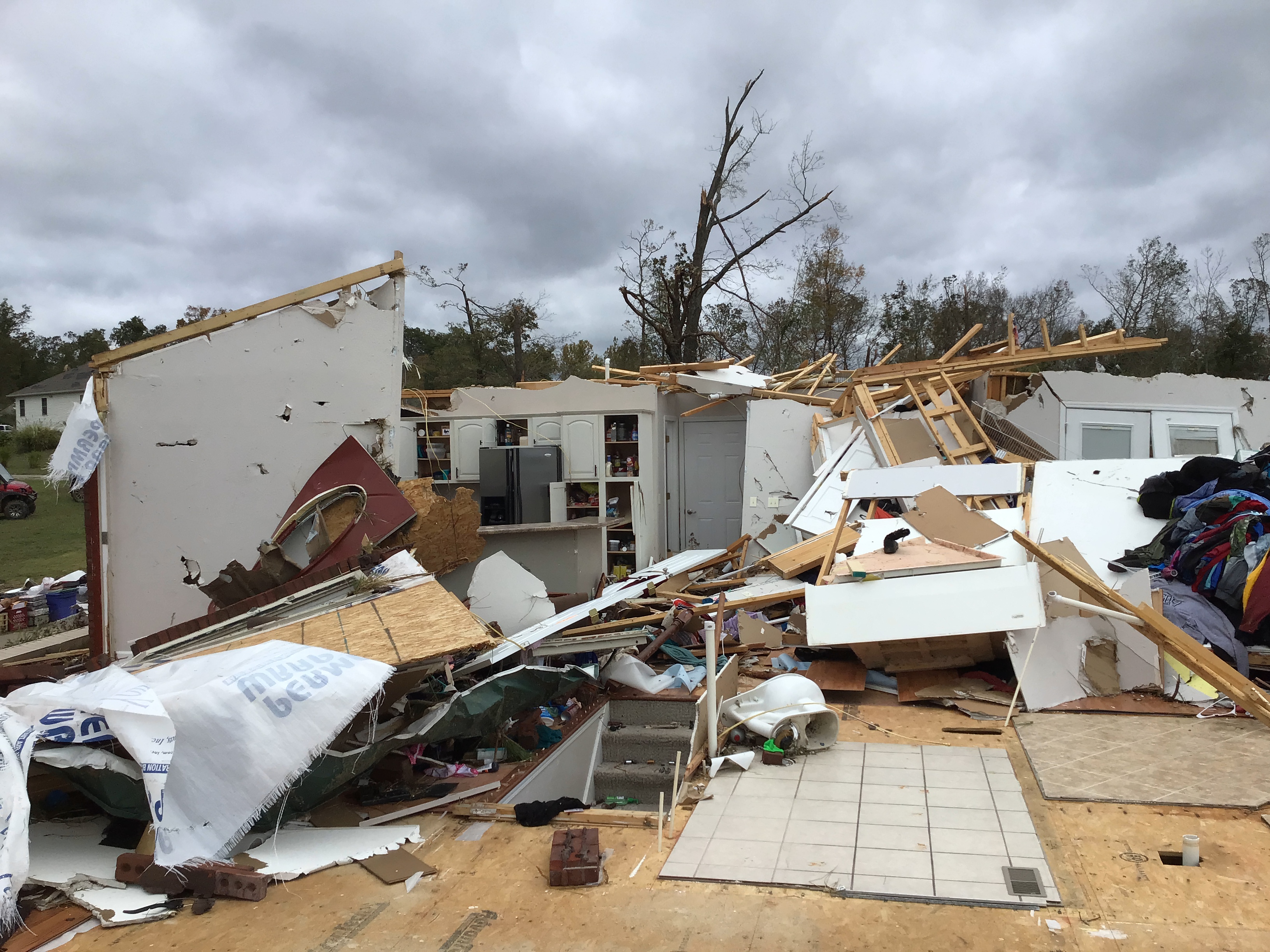 |
 |
 |
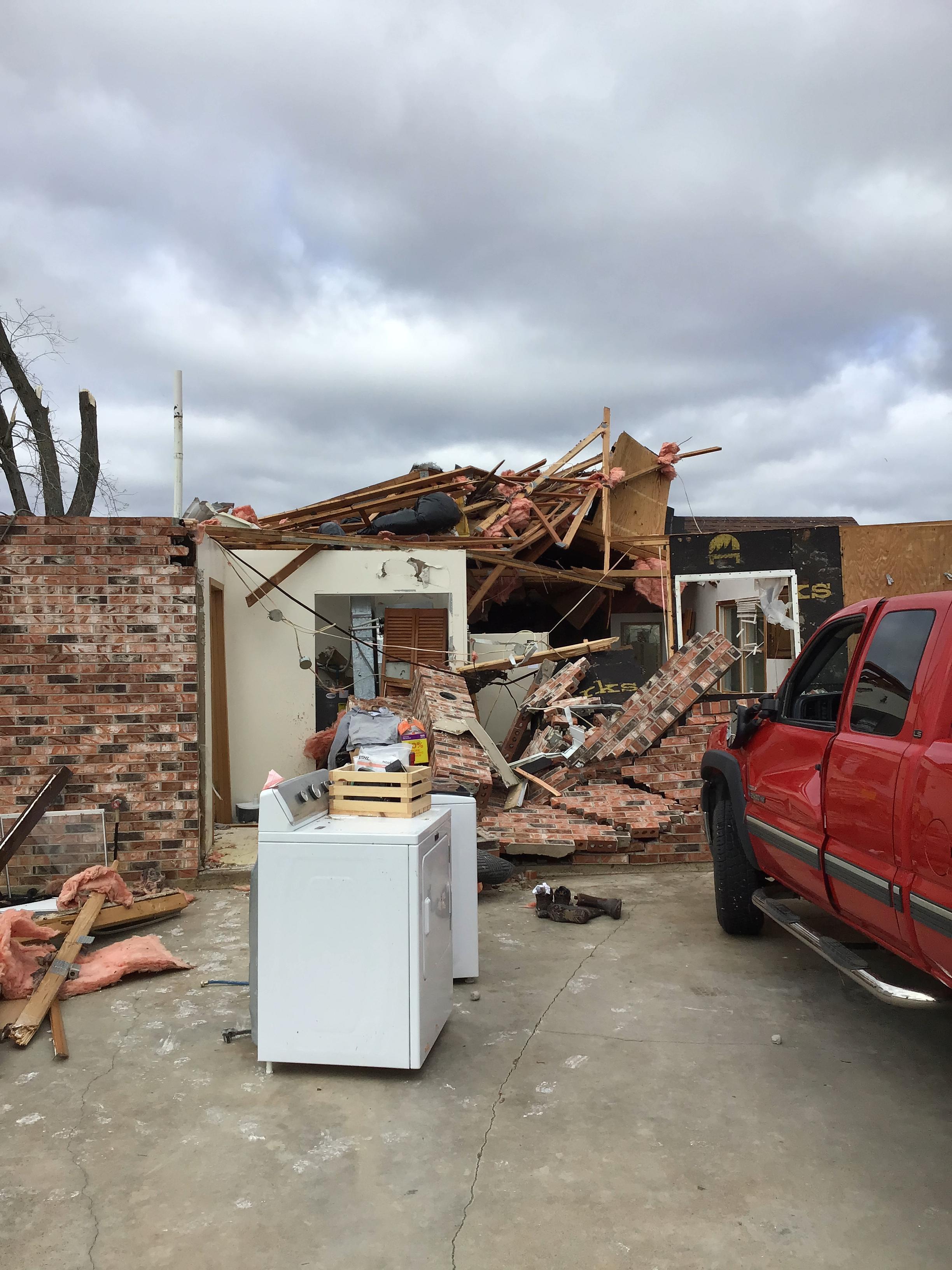
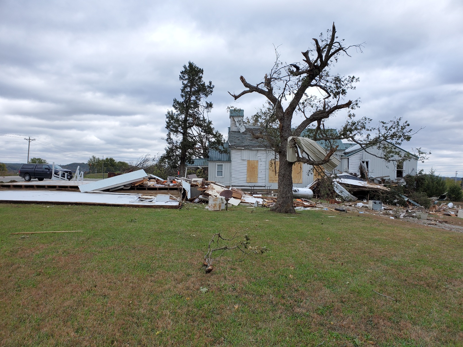
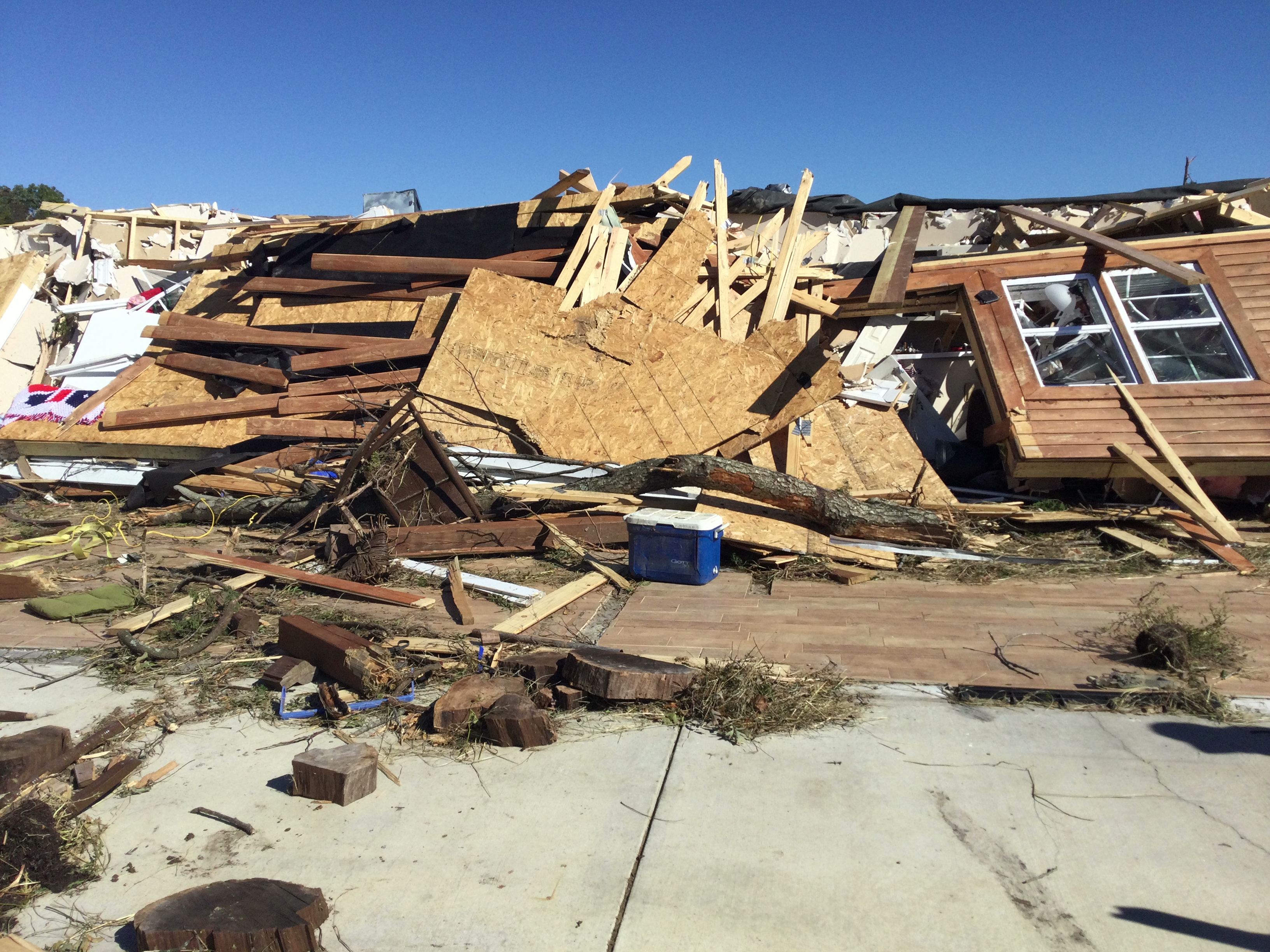
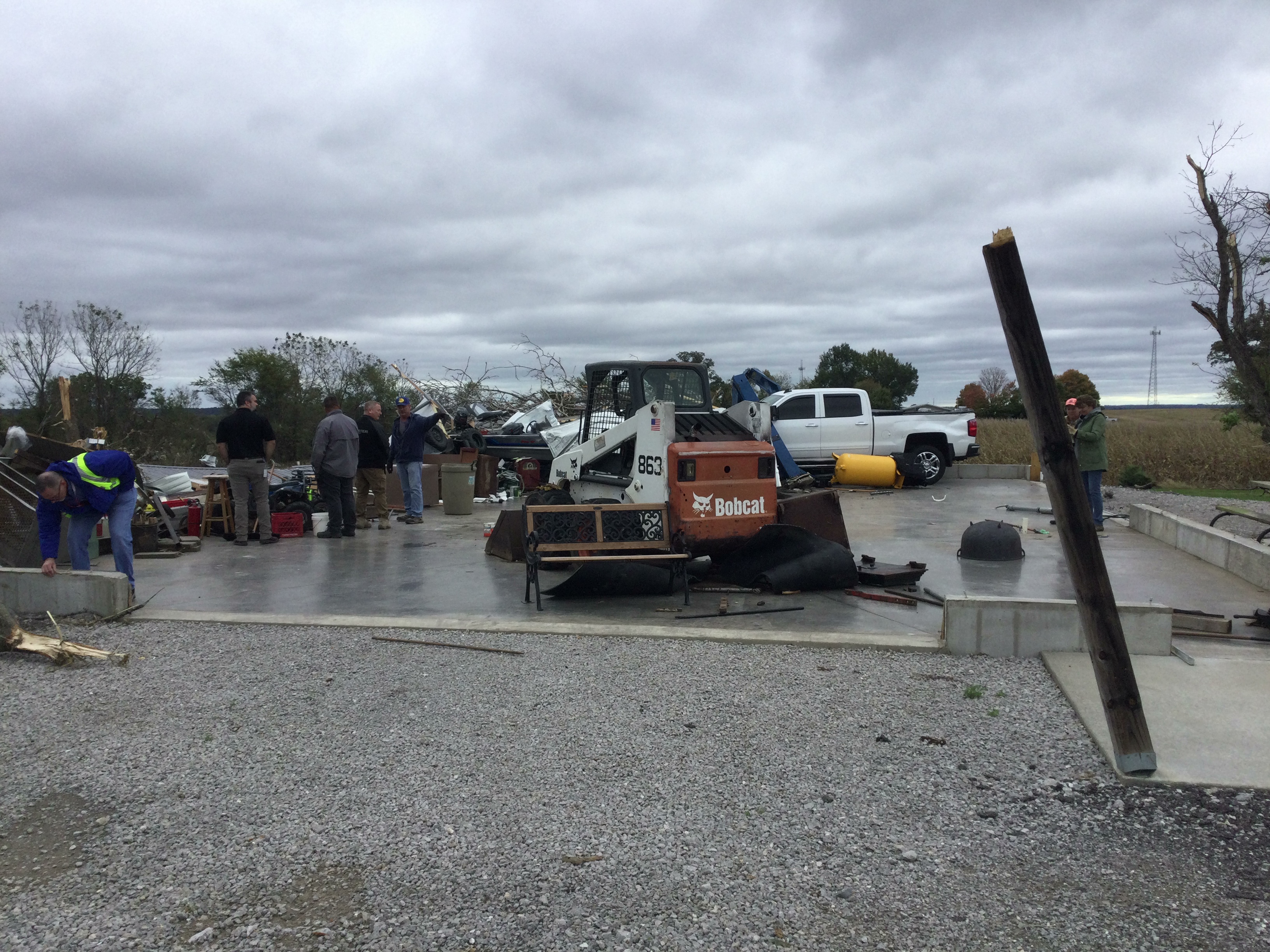
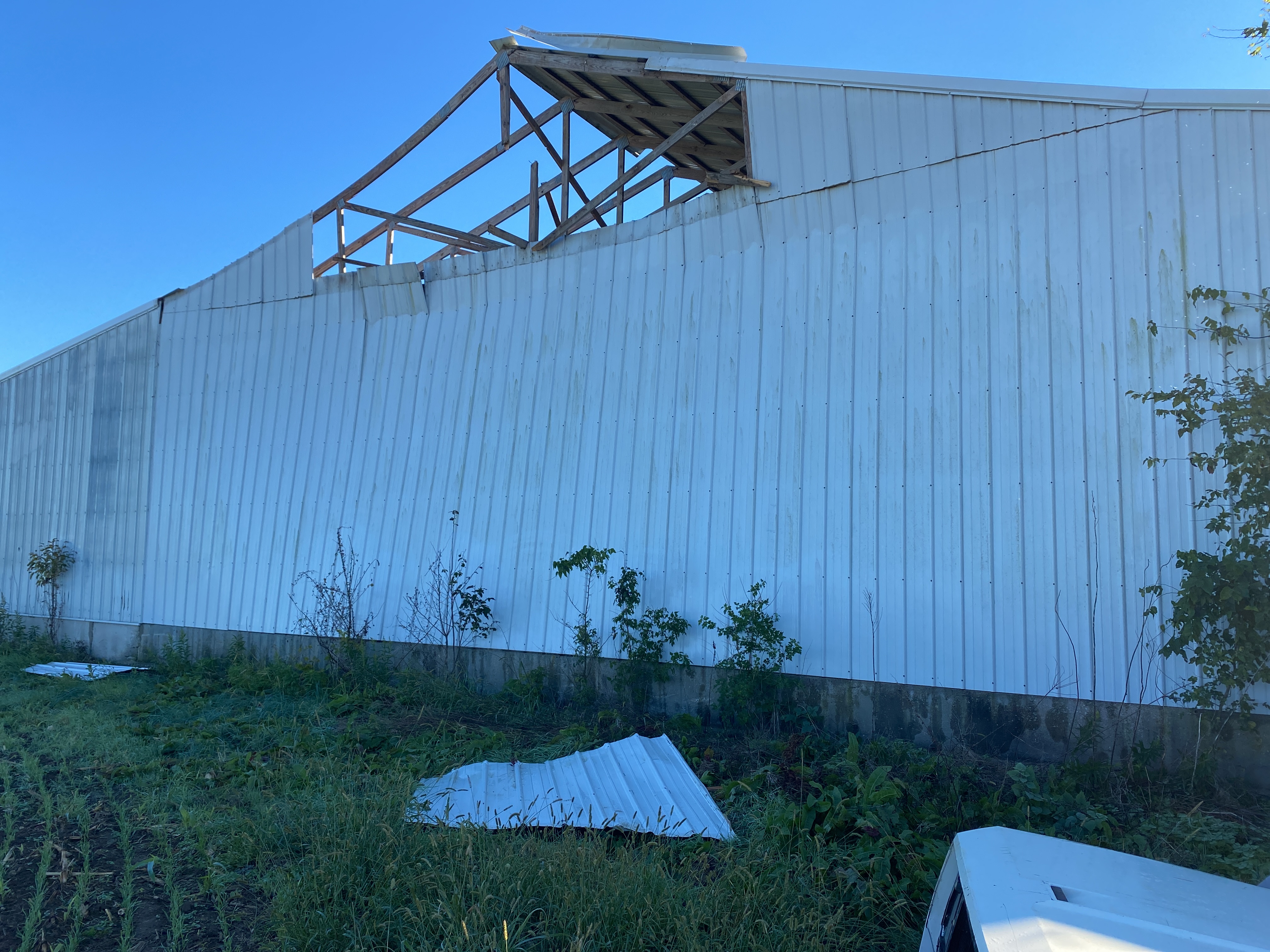
| A house west of Fredericktown is largely destroyed by the tornado. Portions of the kitchen and flooring are still discernable (NWS Storm Survey) | Large sections of a house's roof were torn off, though most walls remained standing north of Fredericktown (NWS Storm Survey) | A storage building was destroyed by the tornado north of Fredericktown near Highway 67 (NWS Storm Survey) |
Coffman, MO/St. Mary, MO/Chester, IL Tornado
 |
 |
 |
 |
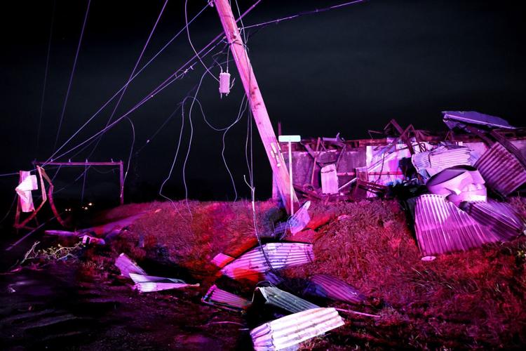
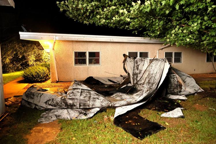
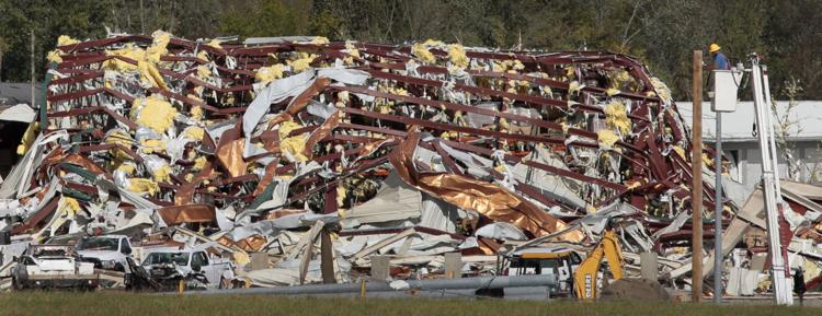
| Significant damage to a home near Coffman, MO (NWS Storm Survey) | A Quonset hut destroyed by a tornado in Bremen, IL (STL Post-Dispatch, David Carson) | A nursing home's roof was damaged by a tornado near Chester, IL (STL Post-Dispatch, David Carson) |
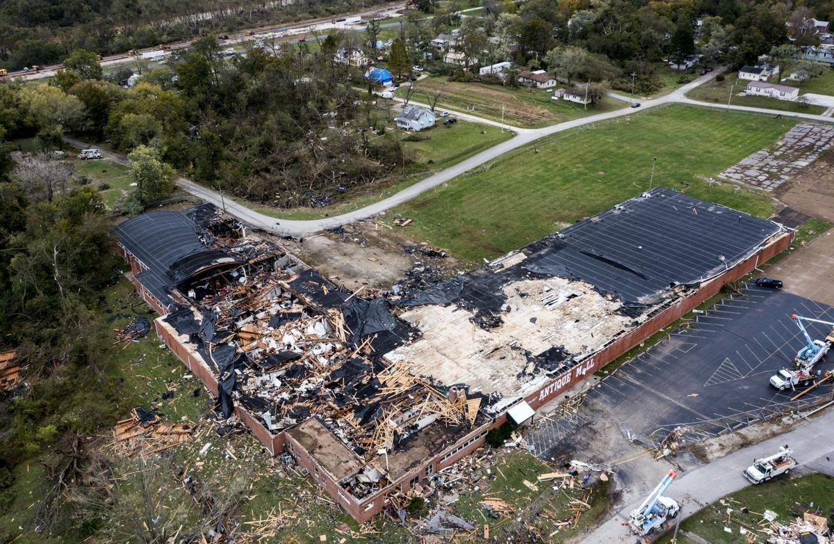
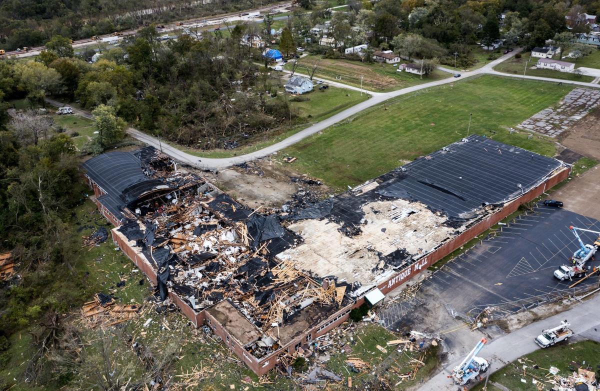
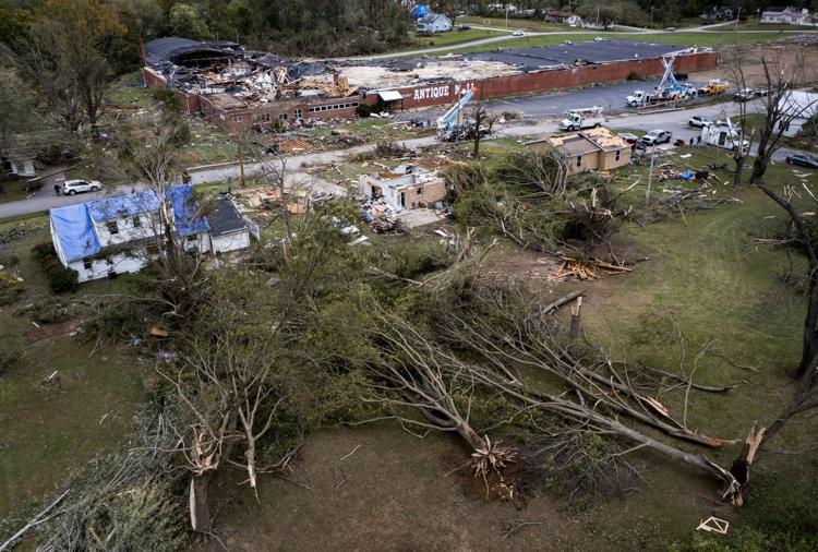
An antique mall was heavily damaged in St. Mary, MO (STL Post-Dispatch, Colter Peterson) |
 |
 |
 |
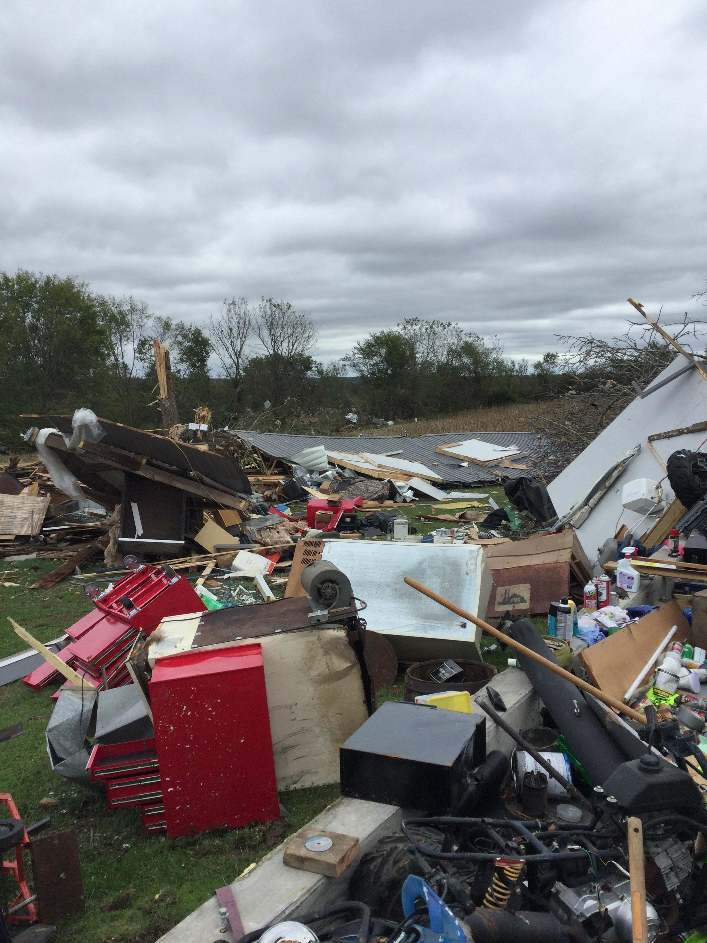 |
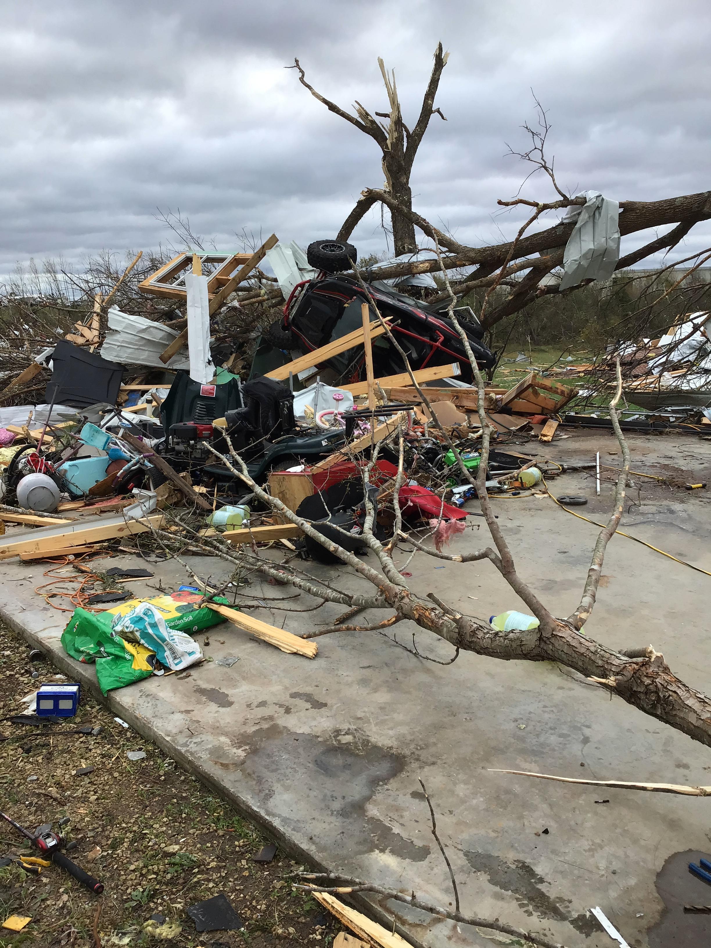
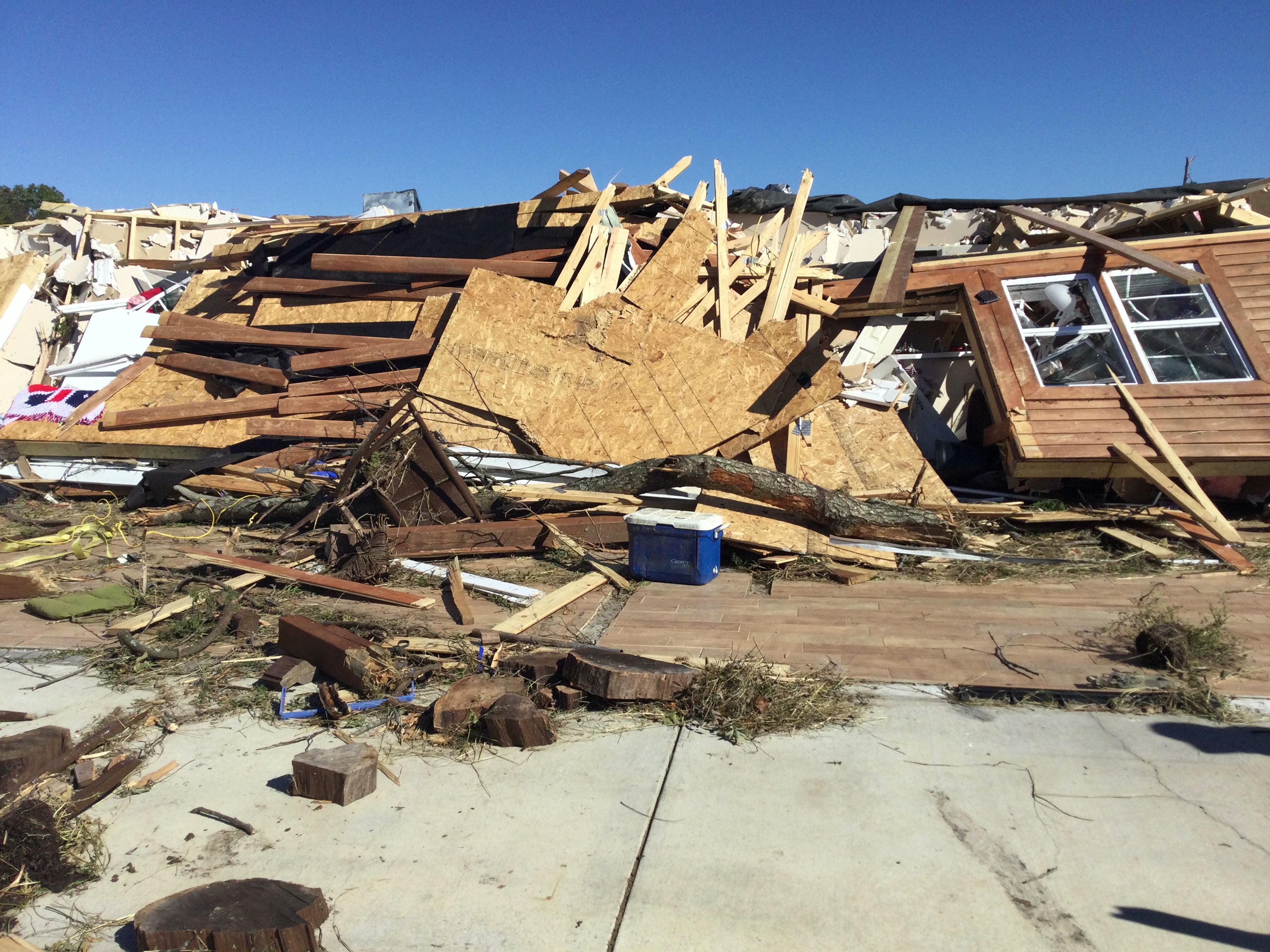
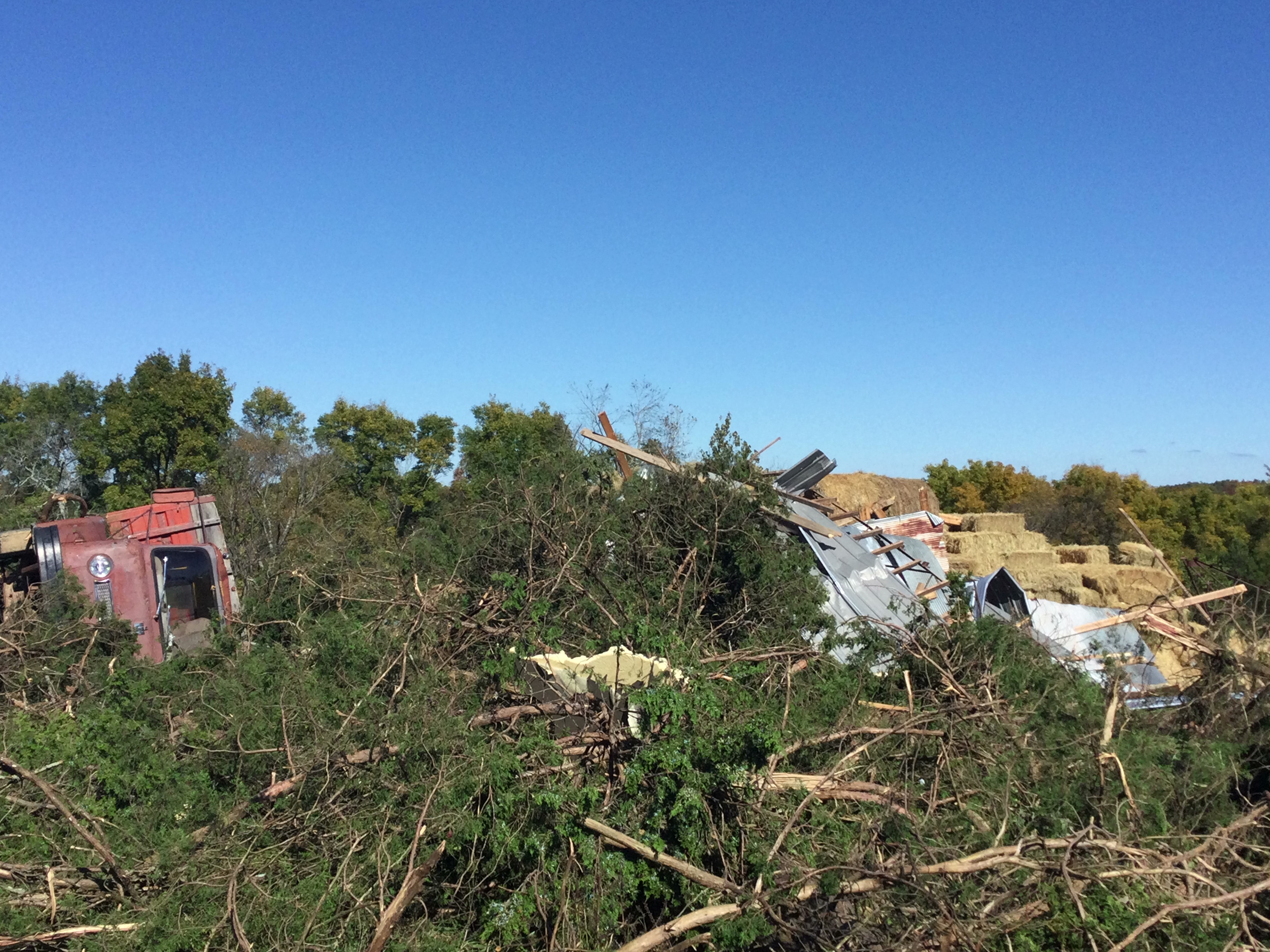
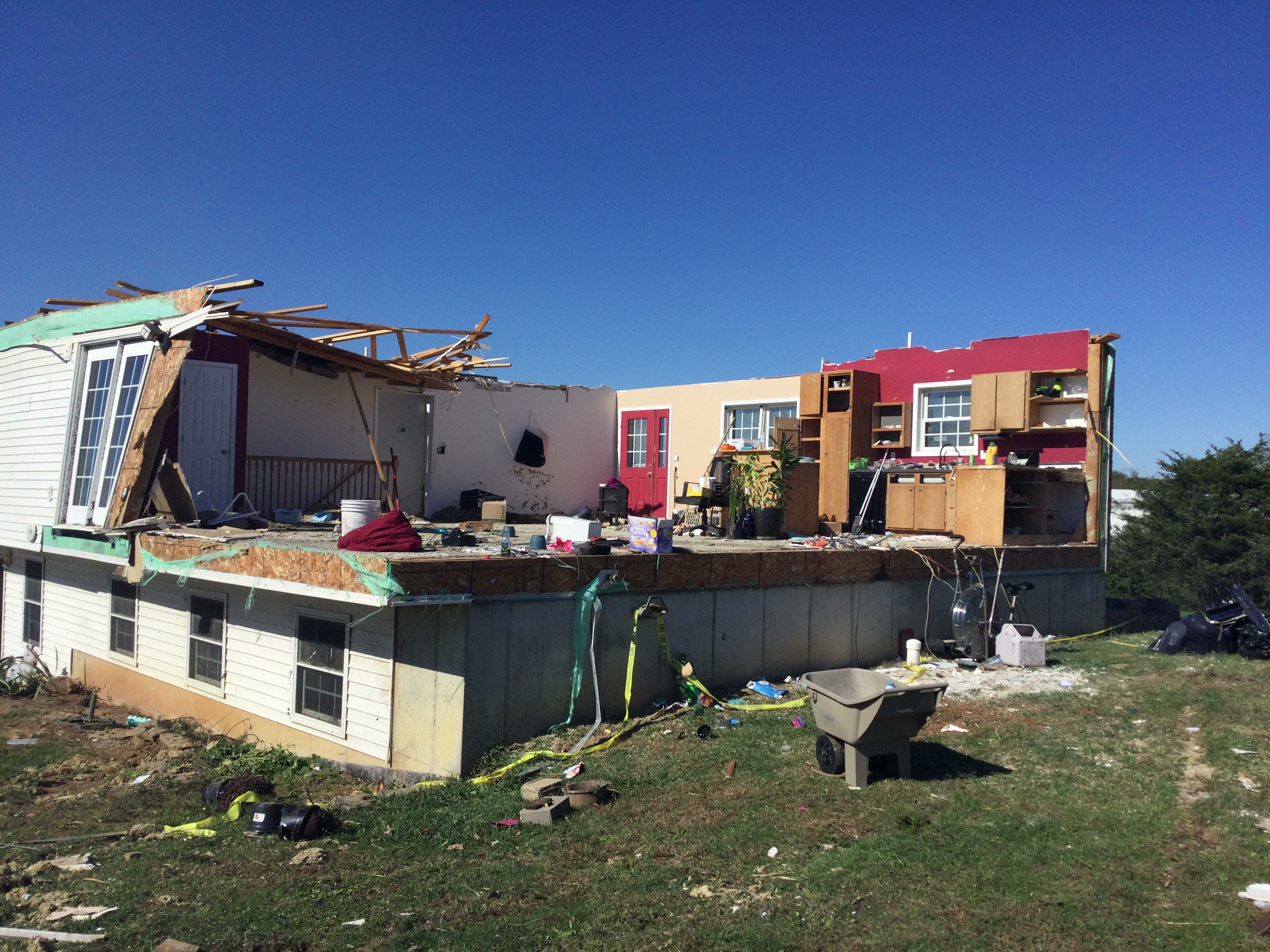
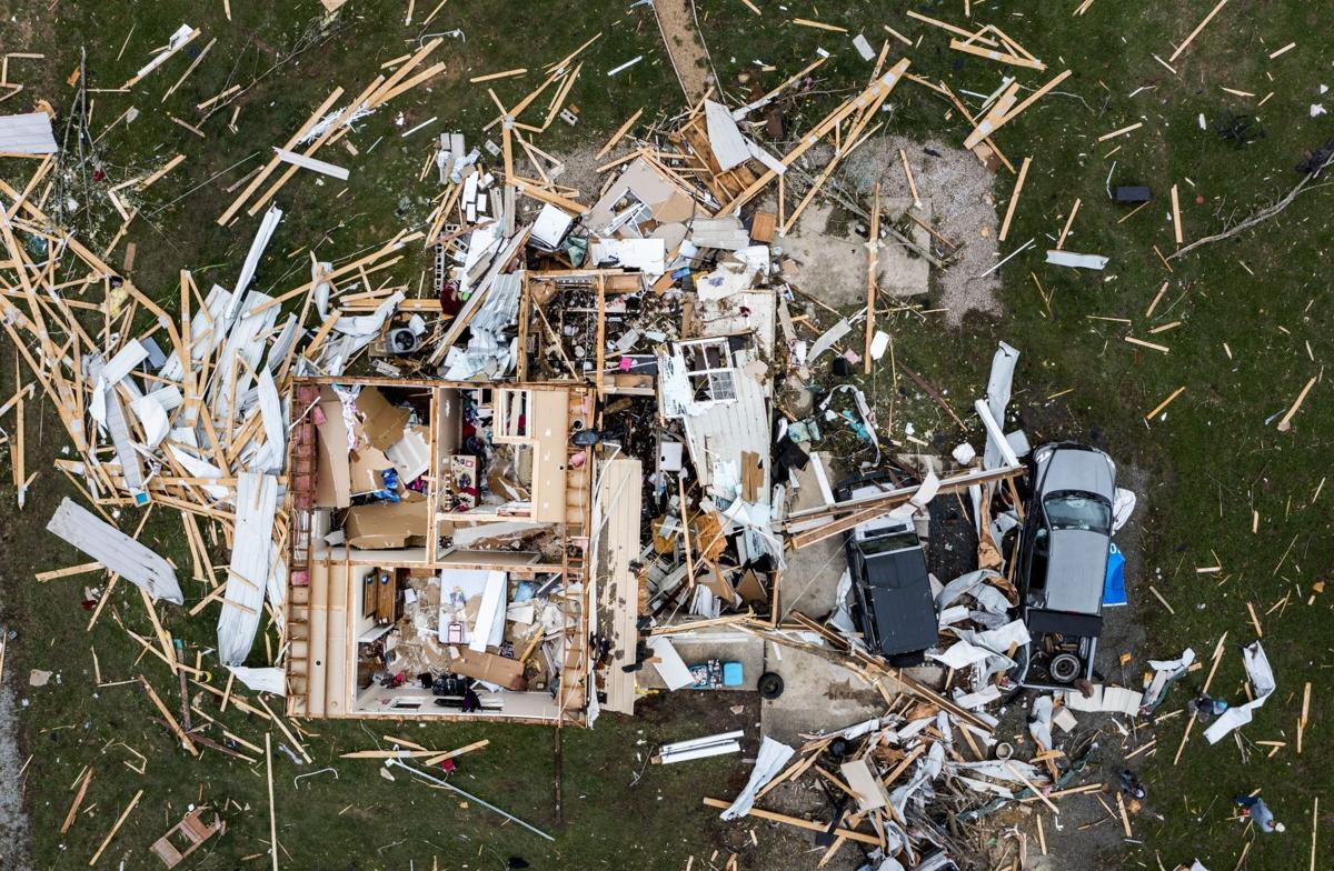
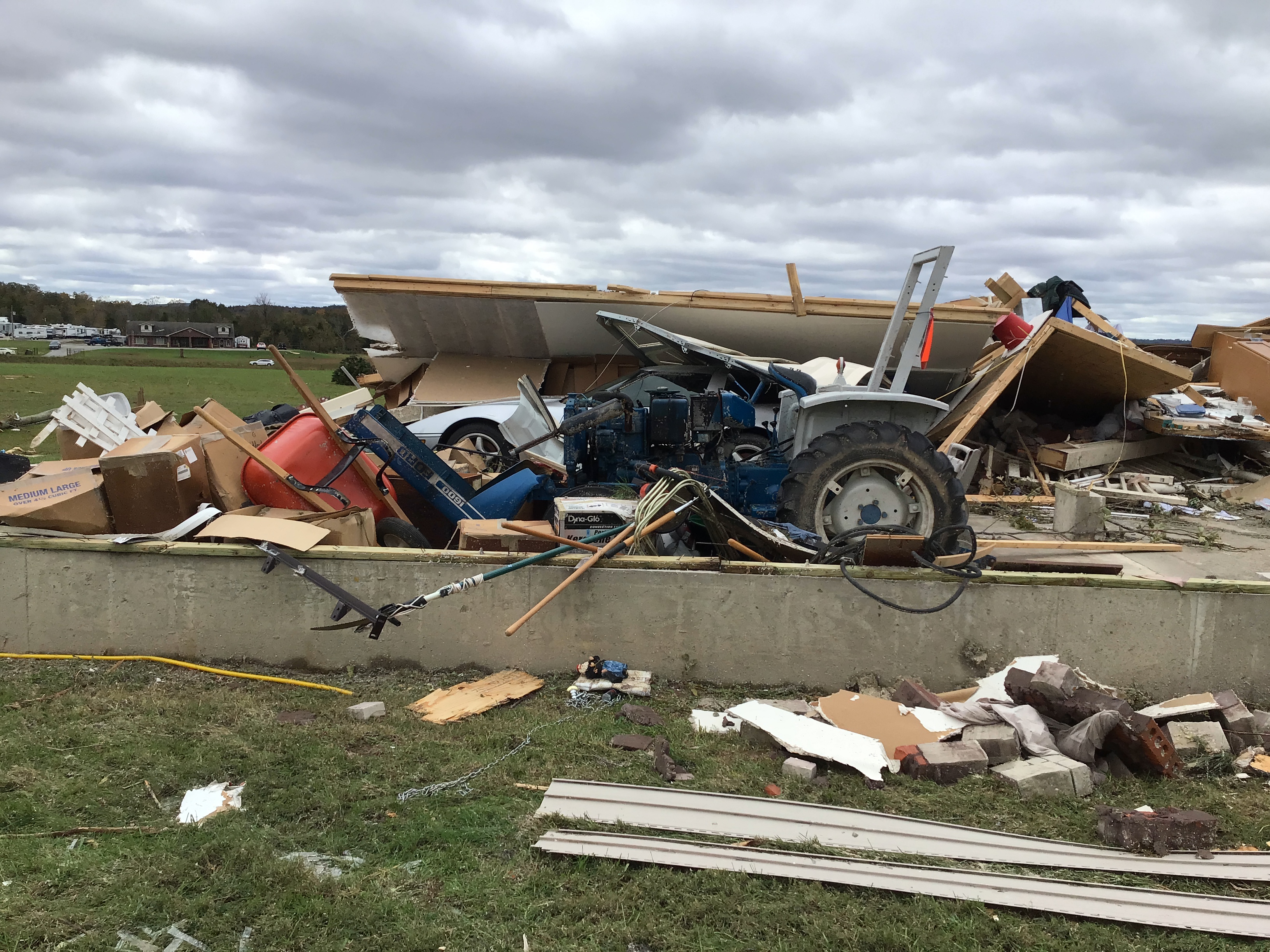
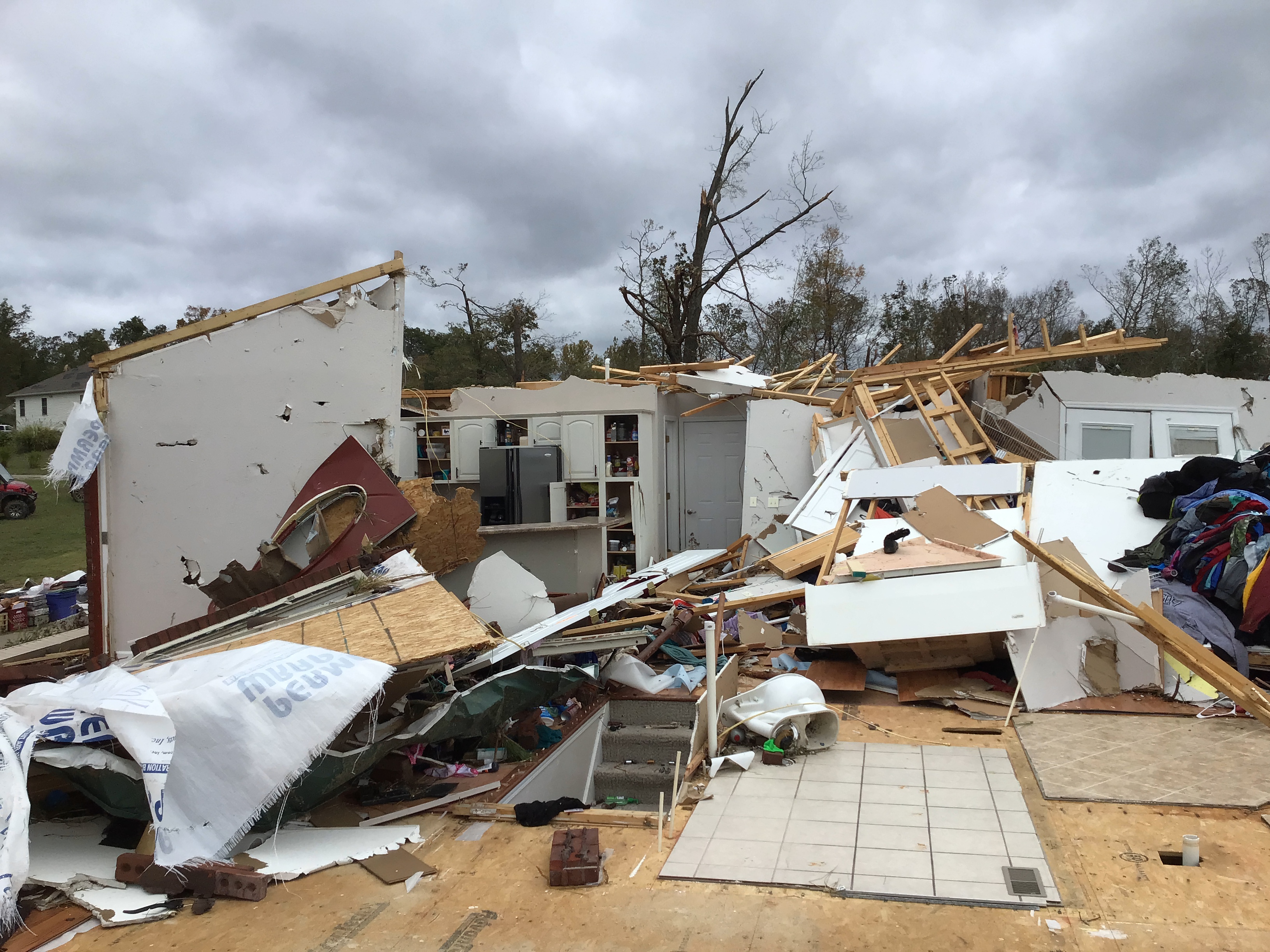
| Trees, a vehicle, and a barn destroyed by the tornado in Liberty Township, MO, southwest of Coffman (NWS Storm Survey) | Walls of a home collapsed and a majority of the structure is either destroyed or heavily damaged southwest of Coffman, MO (NWS Storm Survey) | The tornado tore off the roof and a side of this house in Coffman, MO. Parts of the kitchen and front door remain intact, as well as the basement level (NWS Storm Survey) | A garage was completely destroyed by the tornado in Chester, IL (NWS Storm Survey) |
Radar
|
Fredericktown, MO Tornado
|
Coffman, MO/St. Mary, MO/Chester, IL Tornado
|
| A 4-panel image of radar data from KLSX as a tornado hit Fredericktown, MO at 8:57pm CDT. Clockwise from the top left: 0.5° Reflectivity, 0.5° Storm-Relative Velocity, 0.5° Correlation Coefficient, and 0.5° Differential Reflectivity. Note the strong rotation signature (top-right, reds and blues close together) collocated with lower CC values (bottom left, blue colors) and higher reflectivity values (top left, yellow/red colors), indicating a tornadic debris signature (TDS). | A 4-panel image of radar data from KLSX as a tornado hit St. Mary, MO at 9:09pm CDT and moved toward Chester, IL. Clockwise from the top left: 0.5° Reflectivity, 0.5° Storm-Relative Velocity, 0.5° Correlation Coefficient, and 0.5° Differential Reflectivity. Note the strong rotation signature (top-right, reds and blues close together) collocated with lower CC values (bottom left, blue colors) and higher reflectivity values (top left, yellow/red colors), indicating a tornadic debris signature (TDS). The persistent presence of a TDS (indicating a strong tornado) approaching a populated at night prompted NWS St. Louis to issue a Tornado Emergency for Chester, IL. |
Storm Reports
000
NWUS53 KLSX 281341
LSRLSX

PRELIMINARY LOCAL STORM REPORT...SUMMARY
NATIONAL WEATHER SERVICE ST LOUIS MO
841 AM CDT THU OCT 28 2021

..TIME...   ...EVENT...      ...CITY LOCATION...     ...LAT.LON...
..DATE...   ....MAG....      ..COUNTY LOCATION..ST.. ...SOURCE....
            ..REMARKS..

0500 AM     HEAVY RAIN       3 WNW NEWARK            40.01N 92.03W
10/24/2021  M3.23 INCH       KNOX               MO   MESONET

            MESONET STATION NWKM7 3.0 W NEWARK. THE
            PERIOD OF THE HEAVY RAIN EVENT WAS 24 HOURS.

0515 AM     HEAVY RAIN       1 W QUINCY              39.93N 91.41W
10/24/2021  M2.55 INCH       ADAMS              IL   MESONET

            MESONET STATION UINI2 1.4 W QUINCY. THE
            PERIOD OF THE HEAVY RAIN EVENT WAS 24 HOURS.

0520 AM     HEAVY RAIN       1 ESE PERRY             39.78N 90.73W
10/24/2021  M2.16 INCH       PIKE               IL   MESONET

            MESONET STATION 2436D PERRY. THE PERIOD OF
            THE HEAVY RAIN EVENT WAS 24 HOURS.

0528 AM     HEAVY RAIN       2 ESE QUINCY            39.93N 91.35W
10/24/2021  M3.42 INCH       ADAMS              IL   MESONET

            MESONET STATION FW7893 QUINCY. THE PERIOD OF
            THE HEAVY RAIN EVENT WAS 24 HOURS.

0528 AM     HEAVY RAIN       1 SSE QUINCY            39.92N 91.38W
10/24/2021  M2.86 INCH       ADAMS              IL   MESONET

            MESONET STATION FW3305 QUINCY. THE PERIOD OF
            THE HEAVY RAIN EVENT WAS 24 HOURS.

0530 AM     HEAVY RAIN       1 ENE NOVELTY           40.02N 92.19W
10/24/2021  M4.39 INCH       KNOX               MO   MESONET

            MESONET STATION MOA08 1 ENE NOVELTY. THE
            PERIOD OF THE HEAVY RAIN EVENT WAS 24 HOURS.


0408 PM     TSTM WND DMG     NEW LONDON              39.59N 91.40W
10/24/2021                   RALLS              MO   LAW ENFORCEMENT

            TREE DOWN IN NEW LONDON NEAR THE SHERIFFS
            OFFICE.

0523 PM     TSTM WND DMG     1 NNE PIKE              39.47N 91.03W
10/24/2021                   PIKE               IL   STORM CHASER

            AT LEAST 10 MEDIUM TO SMALL SIZED TREES
            UPROOTED NEAR HIGHWAY 54.

0539 PM     TSTM WND DMG     GRIGGSVILLE             39.71N 90.73W
10/24/2021                   PIKE               IL   LAW ENFORCEMENT

            POWER LINES DOWN IN GRIGGSVILLE. TIME
            ESTIMATED FROM RADAR.

0557 PM     FLASH FLOOD      CLAYTON                 40.03N 90.96W
10/24/2021                   ADAMS              IL   LAW ENFORCEMENT

            MULTIPLE ROADS WASHED OUT IN TOWN OF CLAYTON
            INCLUDING N 1353RD LANE.

0638 PM     TSTM WND DMG     2 ESE GUTHRIE           38.74N 92.06W
10/24/2021                   CALLAWAY           MO   LAW ENFORCEMENT

            TREES DOWN OVER THE ROADWAY.

0640 PM     HAIL             1 WNW JEFFERSON CITY    38.58N 92.20W
10/24/2021  E0.25 INCH       COLE               MO   PUBLIC

            CALLER REPORTS PEA SIZED HAIL.

0645 PM     TSTM WND DMG     2 WSW TEBBETTS          38.61N 92.00W
10/24/2021                   CALLAWAY           MO   LAW ENFORCEMENT

            TREES OVER HIGHWAY 94 AND AA.

0714 PM     TSTM WND DMG     2 ENE PORTLAND          38.72N 91.68W
10/24/2021                   CALLAWAY           MO   LAW ENFORCEMENT

            TREE OVER THE ROAD AT 10591 STATE HIGHWAY
            94.

0718 PM     TSTM WND DMG     NEW FLORENCE            38.91N 91.45W
10/24/2021                   MONTGOMERY         MO   LAW ENFORCEMENT

            TREES DOWN IN NEW FLORENCE.

0731 PM     TSTM WND DMG     4 SSE LOUISIANA         39.39N 91.03W
10/24/2021                   PIKE               MO   TRAINED SPOTTER

            SPOTTER REPORTS A LARGE TREE DOWN IN THEIR
            YARD.

0743 PM     TORNADO          JOHNSON'S SHUT-INS      37.53N 90.85W
10/24/2021                   REYNOLDS           MO   NWS STORM SURVEY

            A TORNADO TOUCHED DOWN JUST OUTSIDE OF
            JOHNSON`S SHUT INS STATE PARK ON HIGHWAY N,
            EAST OF BLACK, MO. THIS TORNADO SNAPPED THE
            TRUNKS OF SEVERAL LARGE TREES ALONG THE ROAD
            BEFORE MOVING INTO THE PARK WHERE IT CAUSED
            WIDESPREAD TREE DAMAGE. PEAK WINDS ARE
            ESTIMATED AT 105 MPH. THE TORNADO TRAVELED
            JUST OVER 1 MILE, AND WAS 100 YARDS WIDE AT
            ITS MAXIMUM WIDTH. THE PERIOD OF THE TORNADO
            EVENT WAS 3 MINUTES.

0823 PM     TORNADO          SAINT MARY              37.88N 89.95W
10/24/2021                   STE. GENEVIEVE     MO   NWS STORM SURVEY

            *** 1 INJ ***
            CORRECTS PREVIOUS TORNADO REPORT FROM SAINT
            MARY. A TORNADO TOUCHED DOWN IN ST. FRANCOIS
            COUNTY AT 8:23 PM AND MOVED NORTHEAST
            THROUGH STE. GENEVIEVE COUNTY AND THROUGH
            ST. MARY, MO. EF-3 DAMAGE WAS SURVEYED IN
            STE GENEVIEVE COUNTY. THE TORNADO CROSSED
            THE MISSISSIPPI RIVER AND CAUSED EF-2 DAMAGE
            IN CHESTER, IL BEFORE LIFTING NORTHEAST OF
            CHESTER OVER AN HOUR AFTER TOUCHING DOWN.
            THE PERIOD OF THE TORNADO EVENT WAS 1 HOUR 5
            MINUTES.

0825 PM     TORNADO          3 SE FARMINGTON         37.75N 90.39W
10/24/2021                   ST. FRANCOIS       MO   TRAINED SPOTTER

            FOUR HOUSES DESTROYED NEAR POSSUM HOLLOW RD
            AND OLD FREDERICKTOWN RD.

0825 PM     TORNADO          2 SSW LIBERTYVILLE      37.68N 90.31W
10/24/2021                   ST. FRANCOIS       MO   LAW ENFORCEMENT

            HOUSE COMPLETELY DESTROYED ON OLD
            FREDERICKTOWN RD; INJURIES UNKNOWN.

0830 PM     TORNADO          6 E CHLORIDE            37.47N 90.59W
10/24/2021                   IRON               MO   NWS STORM SURVEY

            A TORNADO BRIEFLY TOUCHED DOWN ALONG HIGHWAY
            E IN SOUTHERN IRON COUNTY, MO. THIS TORNADO
            UPROOTED SEVERAL TREES AND BROKE BRANCHES ON
            NUMEROUS OTHER TREES. THE TORNADO CONTINUED
            INTO A FIELD WHERE IT DAMAGED A MANUFACTURED
            HOME. AFTER LIFTING, THE STORM THAT PRODUCED
            THIS TORNADO WENT ON TO PRODUCE THE
            FREDERICKTOWN TORNADO. PEAK WINDS ARE
            ESTIMATED AT 95 MPH. THE TORNADO TRAVELED
            0.3 MILES AND HAD A MAXIMUM WIDTH OF 50
            YARDS. THE PERIOD OF THE TORNADO EVENT WAS 1
            MINUTE.

0847 PM     TORNADO          FREDERICKTOWN           37.57N 90.33W
10/24/2021                   MADISON            MO   NWS STORM SURVEY

            *** 1 INJ ***
            A TORNADO TOUCHED DOWN SOUTHWEST OF
            FREDERICKTOWN, MO AT 8:47PM ON 10/24 AND
            TRACKED THROUGH THE TOWN CAUSING UP TO EF-3
            DAMAGE. THE TORNADO TRAVELED 18.9 MILES WITH
            A MAXIMUM WIDTH OF 880 YARDS AND ESTIMATED
            PEAK WINDS OF 150 MPH. THE TORNADO LIFTED
            NORTHEAST OF UPPER WHITEWATER CREEK IN PERRY
            COUNTY, MO. THE PERIOD OF THE TORNADO EVENT
            WAS 28 MINUTES.

0856 PM     TORNADO          FREDERICKTOWN           37.56N 90.29W
10/24/2021                   MADISON            MO   PUBLIC

            TWITTER VIDEO OF DESTROYED CAMPER ON ROAD.

0856 PM     TORNADO          JUNCTION CITY           37.57N 90.30W
10/24/2021                   MADISON            MO   FIRE DEPT/RESCUE

            NUMEROUS TREES UPROOTED/SNAPPED AND POWER
            POLES SNAPPED. SEVERAL METAL ROOFS LIFTED
            OFF OF HOUSES.

0856 PM     TORNADO          FREDERICKTOWN           37.56N 90.30W
10/24/2021                   MADISON            MO   BROADCAST MEDIA

            BLACK RIVER ELECTRIC DAMAGED AS WELL AS A
            STORAGE BUILDING AND LOCAL FIRE STATION IN
            TOWN.

0912 PM     TSTM WND DMG     1 SW ARNOLD             38.41N 90.38W
10/24/2021                   JEFFERSON          MO   PUBLIC

            LARGE TREE DOWN IN THE TOWN OF ARNOLD - VIA
            FACEBOOK.

0912 PM     TSTM WND DMG     ARNOLD                  38.43N 90.38W
10/24/2021                   JEFFERSON          MO   PUBLIC

            A LARGE TREE DOWN IN THE TOWN OF ARNOLD -
            REPORT VIA FACEBOOK.

0916 PM     TORNADO          CHESTER                 37.91N 89.82W
10/24/2021                   RANDOLPH           IL   PUBLIC

            LARGE TREES UPWARDS OF 18 INCHES IN DIAMETER
            HAVE BEEN UPROOTED. SMALL BOATS HAVE BEEN
            BLOWN. TIME ESTIMATED FROM RADAR.

0925 PM     TORNADO          1 E BREMEN              37.97N 89.74W
10/24/2021                   RANDOLPH           IL   TRAINED SPOTTER

            POWER LINES DOWN ALONG ROUTE 150.

0931 PM     TORNADO          2 WNW STEELEVILLE       38.03N 89.70W
10/24/2021                   RANDOLPH           IL   TRAINED SPOTTER

            MACHINE SHED MANGLED AND WIDESPREAD TREE
            DAMAGE. DEBRIS ALSO ON THE ROAD.

0937 PM     TSTM WND DMG     1 SSE SWANSEA           38.53N 89.98W
10/24/2021                   ST. CLAIR          IL   PUBLIC

            LARGE TREE LIMB DOWN ON A FENCE IN SWANSEA,
            IL.

0941 PM     TSTM WND DMG     NEW MINDEN              38.44N 89.37W
10/24/2021                   WASHINGTON         IL   TRAINED SPOTTER

            WIND BLEW CAR OFF ROAD.

0941 PM     TSTM WND DMG     1 SSE O'FALLON          38.58N 89.91W
10/24/2021                   ST. CLAIR          IL   LAW ENFORCEMENT

            TREE BLOCKING DARTMOUTH DR AT WHITEHALL DR.

0944 PM     TSTM WND DMG     1 S SCOTT AFB           38.53N 89.85W
10/24/2021                   ST. CLAIR          IL   PUBLIC

            FACEBOOK REPORT AND PHOTOGRAPHS SHOW ROOF OF
            STORAGE BUILDING AT AIR FORCE BASE STORAGE
            WAS BLOWN EAST ONTO ADJACENT HOUSE ALONG
            STATE ROUTE 161 E NEAR THE INTERSECTION OF
            HANNAH CHASE CT.

0944 PM     TSTM WND GST     1 SE SCOTT AFB          38.53N 89.83W
10/24/2021  M62 MPH          ST. CLAIR          IL   AWOS

            AWOS STATION KBLV SCOTT AIR FORCE BASE.

0944 PM     TSTM WND GST     1 SE SCOTT AFB          38.53N 89.83W
10/24/2021  M62 MPH          ST. CLAIR          IL   AWOS

            AWOS STATION KBLV SCOTT AIR FORCE BASE.

0945 PM     TSTM WND DMG     CHESTER                 37.91N 89.82W
10/24/2021                   RANDOLPH           IL   PUBLIC

            FROM TWITTER: CHESTER HAS LOST ITS FIRE
            HOUSE.

0947 PM     TSTM WND DMG     MASCOUTAH               38.51N 89.81W
10/24/2021                   ST. CLAIR          IL   EMERGENCY MNGR

            POLE BARN LIFTED, FLIPPED, AND LAID ON A
            BUSINESS 30 FT TO THE EAST.

0950 PM     TSTM WND DMG     1 WNW SWANSEA           38.55N 90.01W
10/24/2021                   ST. CLAIR          IL   TRAINED SPOTTER

            REPORTS OF 60 MPH WIND GUSTS, MEDIUM TREE
            BRANCHES DOWN, AND POWER OUTAGES NEAR JOYCE
            DRIVE.

0953 PM     TORNADO          2 NNW RICHVIEW          38.40N 89.19W
10/24/2021                   WASHINGTON         IL   NWS STORM SURVEY

            A WEAK EF0 TORNADO TOUCHED DOWN IN EXTREME
            EASTERN WASHINGTON COUNTY ILLINOIS WEST OF
            THE INTERSECTION OF TOWER AND CHESTNUT ROAD.
            IT TRAVELED NORTHEAST FOR APPROXIMATELY 2
            MILES CAUSING DAMAGE TO TREES AND MINOR
            STRUCTURAL DAMAGE TO A HOUSE AND
            OUTBUILDINGS. THE TORNADO LIFTED SOUTHWEST
            OF THE INTERSECTION OF US HIGHWAY 51 AND
            HOLLY ROAD. DEBRIS FROM THIS TORNADO WAS
            EVIDENT ON RADAR WELL INTO SOUTHERN MARION
            COUNTY AND WAS LIKELY DUE TO THE CORN THAT
            WAS LOFTED. THE MAXIMUM WIDTH OF THE TORNADO
            WAS 100 YARDS AND MAXIMUM WIND SPEED WAS 85
            MPH BASED ON THE DAMAGE THAT OCCURRED. THE
            PERIOD OF THE TORNADO EVENT WAS 2 MINUTES.

0953 PM     TSTM WND DMG     1 S CENTRALIA           38.51N 89.13W
10/24/2021                   MARION             IL   LAW ENFORCEMENT

            A FEW LIMB DOWN ON MAPLE STREET.

0954 PM     TORNADO          2 NW RICHVIEW           38.40N 89.21W
10/24/2021                   WASHINGTON         IL   LAW ENFORCEMENT

            TREES UPROOTED AND SNAPPED NEAR I-64 AT MILE
            MARKER 59.5. LARGE TREE ON RESIDENCE ON
            CHESTNUT ROAD. BARN ROOF RIPPED OFF.

1000 PM     TSTM WND GST     AVISTON                 38.61N 89.61W
10/24/2021  E65 MPH          CLINTON            IL   PUBLIC

            SPOTTER REPORTS ESTIMATED WIND GUST OF 65
            MPH AND PEA SIZED HAIL.

1004 PM     TSTM WND GST     AVISTON                 38.61N 89.61W
10/24/2021  E65 MPH          CLINTON            IL   TRAINED SPOTTER

            SPOTTER REPORTS WIND GUST ESTIMATE OF 65 MPH
            AND PEA SIZED HAIL.


&&

$$
 |
Media use of NWS Web News Stories is encouraged! Please acknowledge the NWS as the source of any news information accessed from this site. |
|



.png)
.png)
 Weather Story
 Weather Map
 Local Radar
 Follow us on X
 Follow us on Facebook
 Follow us on YouTube
 LSX RSS Feed