Overview
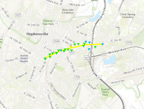
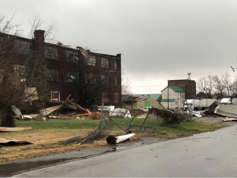
A warm front lifted northward along the KY/TN border New Years Eve into the morning hours on New Years Day. South of the warm front an unstable environment was in place before a cold front swept through the region from the northwest. This caused thunderstorms to develop across our southern counties in west Kentucky overnight and into the morning hours. A couple of tornadoes occurred in our far southeast counties including an EF-2 that struck the downtown area of Hopkinsville, KY shortly after 9 AM.Tornadoes:
|
Tornado #1 - Hopkinsville, KY
|
||||||||||||||||
|
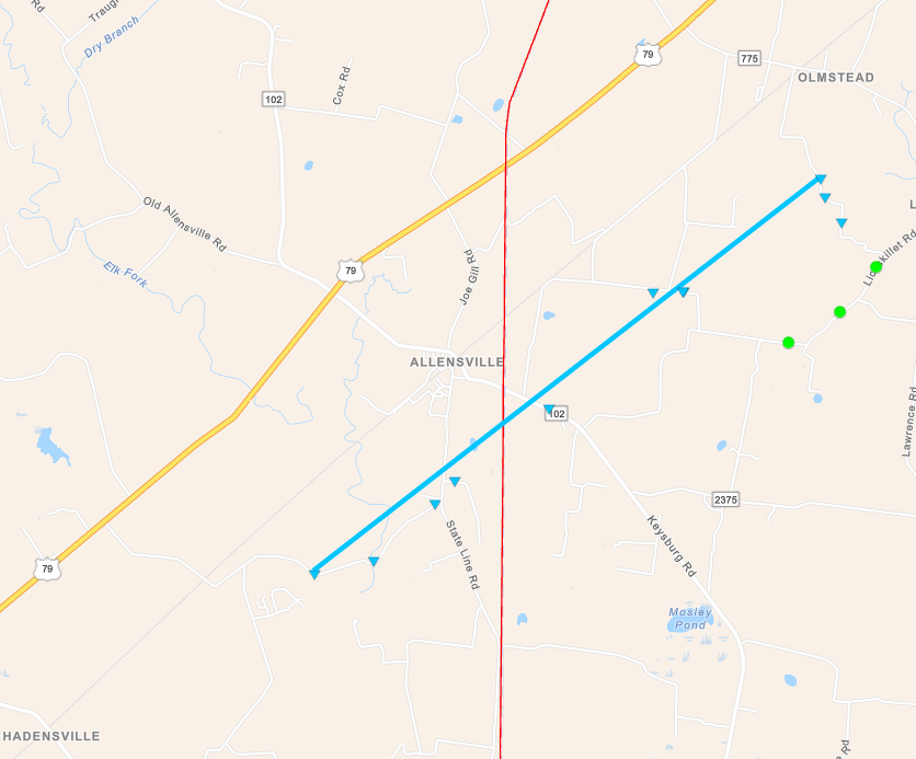
Tornado #2 - Allensville, KY
|
||||||||||||||||
The Enhanced Fujita (EF) Scale classifies tornadoes into the following categories:
| EF0 Weak 65-85 mph |
EF1 Moderate 86-110 mph |
EF2 Significant 111-135 mph |
EF3 Severe 136-165 mph |
EF4 Extreme 166-200 mph |
EF5 Catastrophic 200+ mph |
 |
|||||
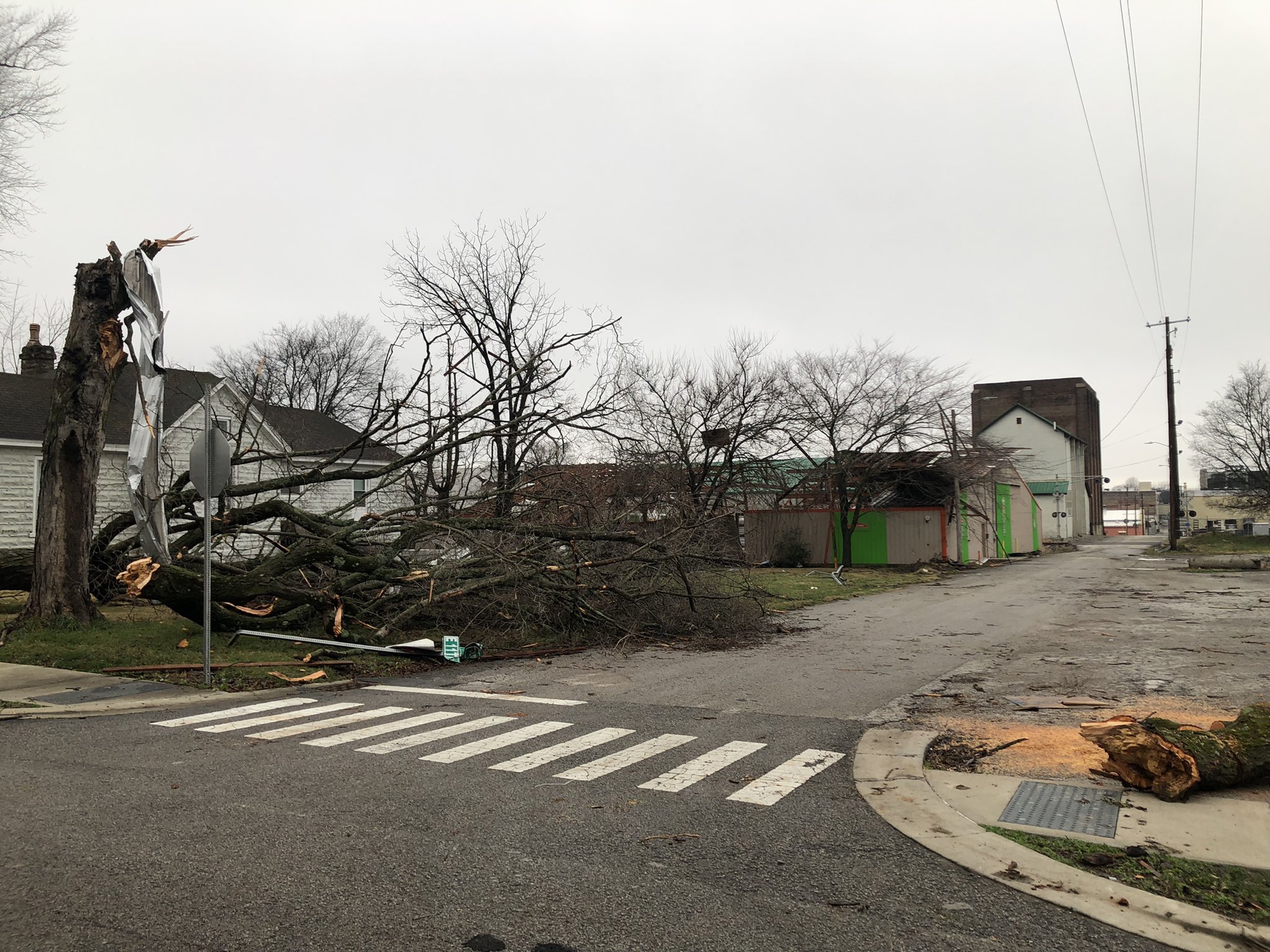
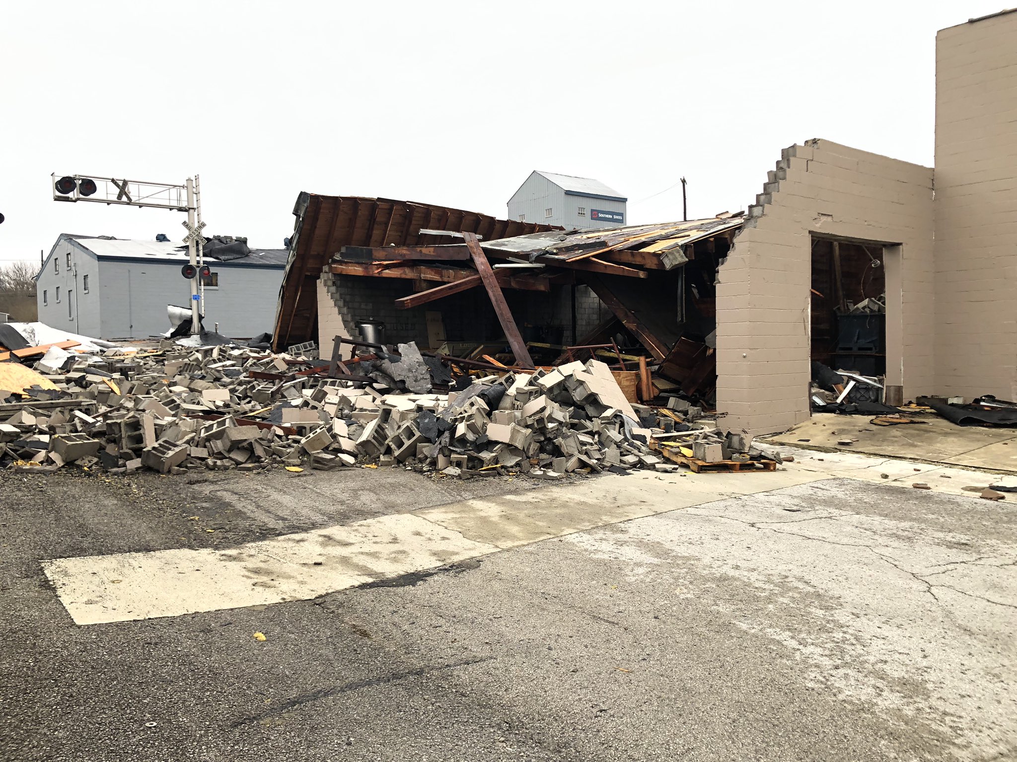
Photos
 |
 |
 |
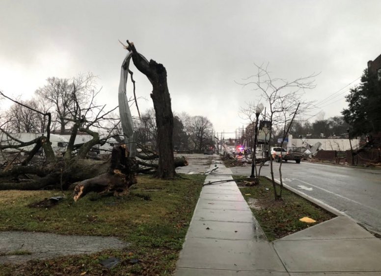 |
| Tornado damage in Hopkinsville, KY via WHOP AM-FM | Tornado damage in Hopkinsville, KY via WHOP AM-FM | Tornado damage in Hopkinsville, KY via Paul Miles | Tornado damage in Hopkinsville, KY via Paul Miles |
 |
Media use of NWS Web News Stories is encouraged! Please acknowledge the NWS as the source of any news information accessed from this site. |
|