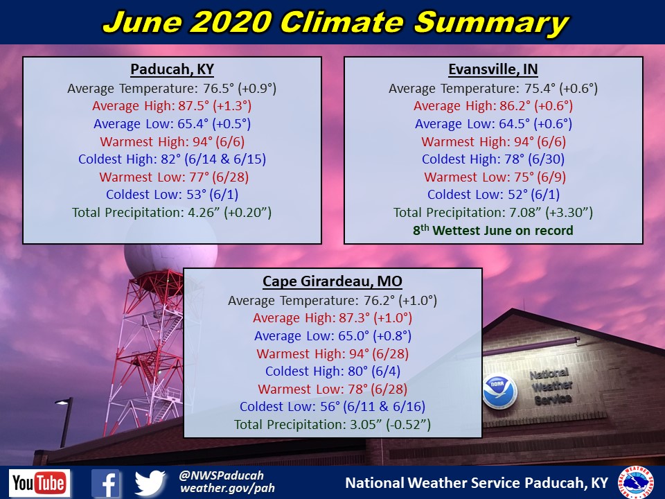
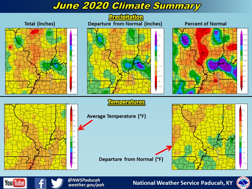
June 2020 Climate Review: Temperatures finished slightly above normal by around 0.5 to 1 degree. Most of the month didn’t stray too far from normal, with no daily average exceeding 8 degrees above or below normal in Paducah. We experienced numerous days through the month with lower than normal humidity levels, before typical summer-time humidity set in during the final 5 days of the month.
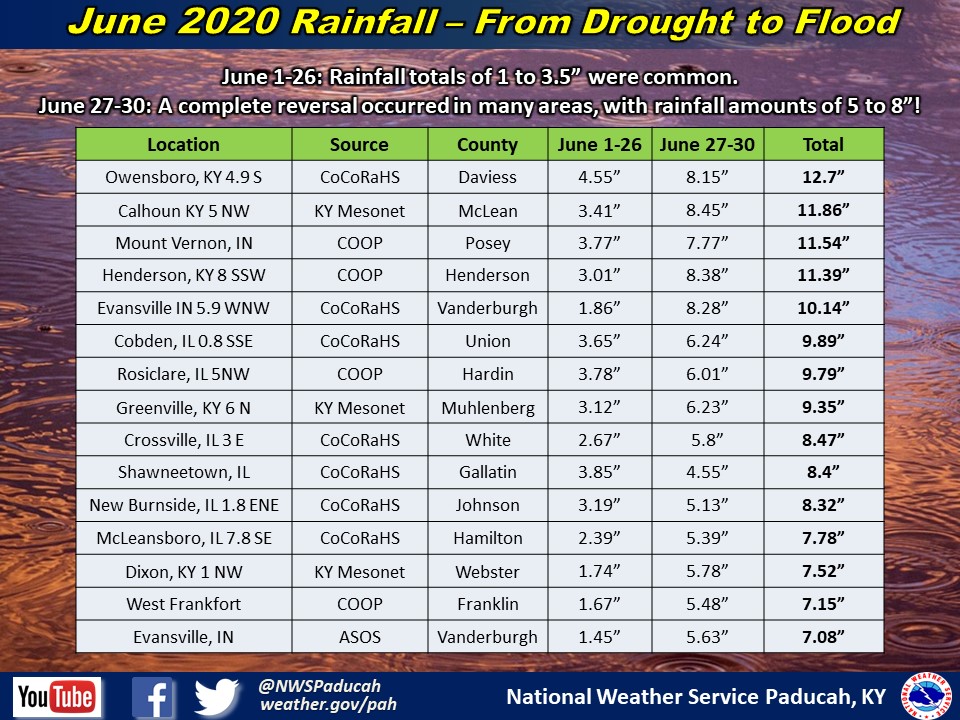
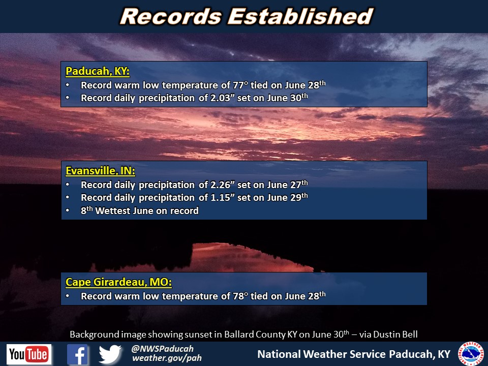
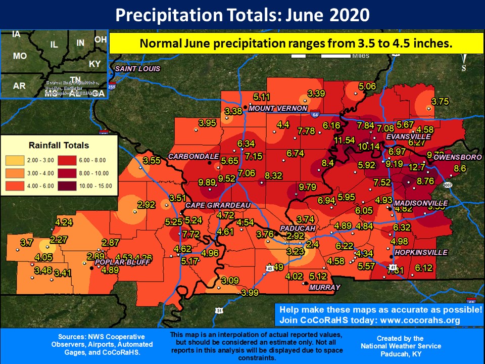
The first 25 days of the month were quite dry across the region, with abnormally dry (D0 on Drought Monitor) conditions developing in many areas east of the Mississippi River by June 23. A complete reversal occurred during the final 4 days of the month, with excessive amounts of rainfall occurring in many areas resulting in flash flooding. The most extreme of these events occurred overnight and into the morning hours on June 28th with rainfall amounts of 4 to nearly 8 inches occurring in portions of Henderson, Daviess, and McLean Counties in Kentucky. Additional rounds of heavy rain occurred mainly along and east of the Mississippi River through June 30th.
The end result was many areas finishing with above normal and even well above normal rainfall for the month. Portions of southern Illinois into southwest Indiana and northwest Kentucky received amounts of 6 to 11 inches, with some locally higher amounts. The highest reported total was 12.70” at a CoCoRaHS station 5 miles south of Owensboro, KY. The Evansville airport picked up 5.63” over the final 4 days of the month, which boosted it to the 8th wettest June on record with 7.08” total. Evansville was on pace to finish as the 13th driest June on record through June 26! There were still some areas that finished near to below normal on monthly rainfall though, including areas of southeast Missouri, north of I-64 in southern Illinois and southwest Indiana, and some parts of the Jackson Purchase area of west Kentucky.
The graphic below is an interpolated rainfall map using actual observations. Please note that there are likely discrepancies in between observations, since the values are estimated based on nearest reports.
| June 2020 Review: Precipitation and Temperature Maps (Click on image to enlarge) |
 |
| Climate Maps are from the Northeast Regional Climate Center |