Overview
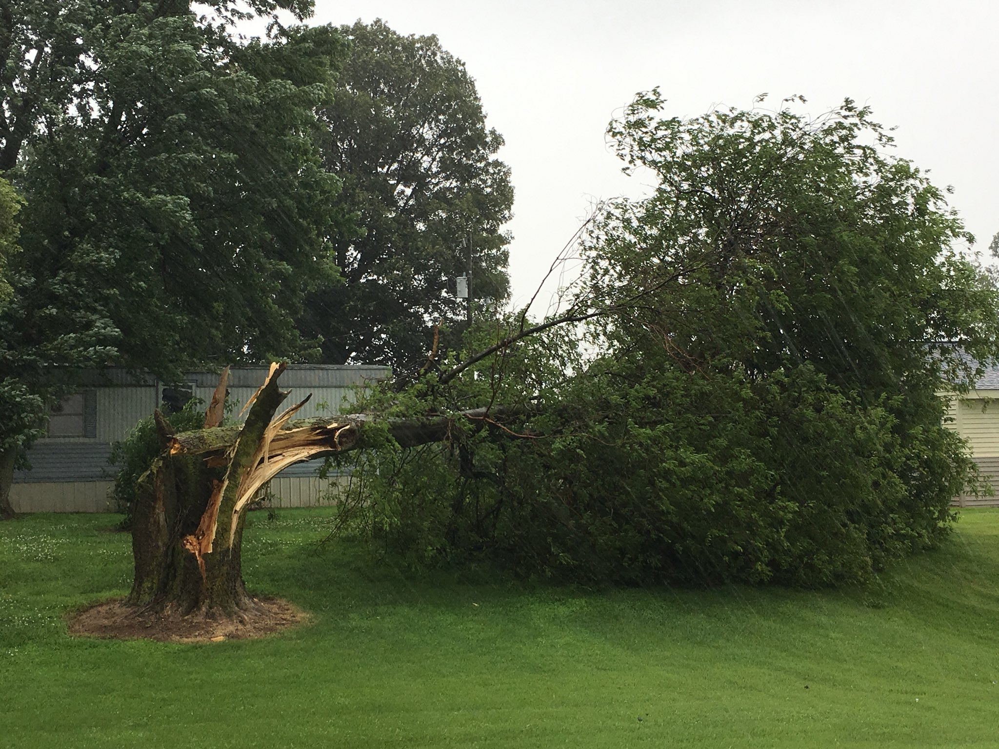
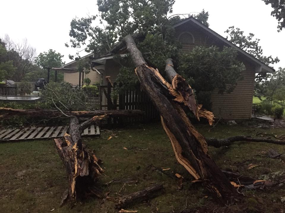
Multiple rounds of thunderstorms moved across the region through the course of the day. The first line of storms produced a weak tornado and a microburst, both with estimated winds of 85 mph, near Norris City, Illinois. Another microburst with peak estimated winds of 90 mph carved a 25 mile long, two mile wide damage path across northwest Posey County through southern Gibson County, Indiana. The worst damage was in and around Fort Branch, Indiana, where several homes were damaged and a semi was blown over. This line of storms also produced numerous reports of wind damage as it moved through portions of southern Illinois, southwest Indiana, and northwest Kentucky during the morning hours.
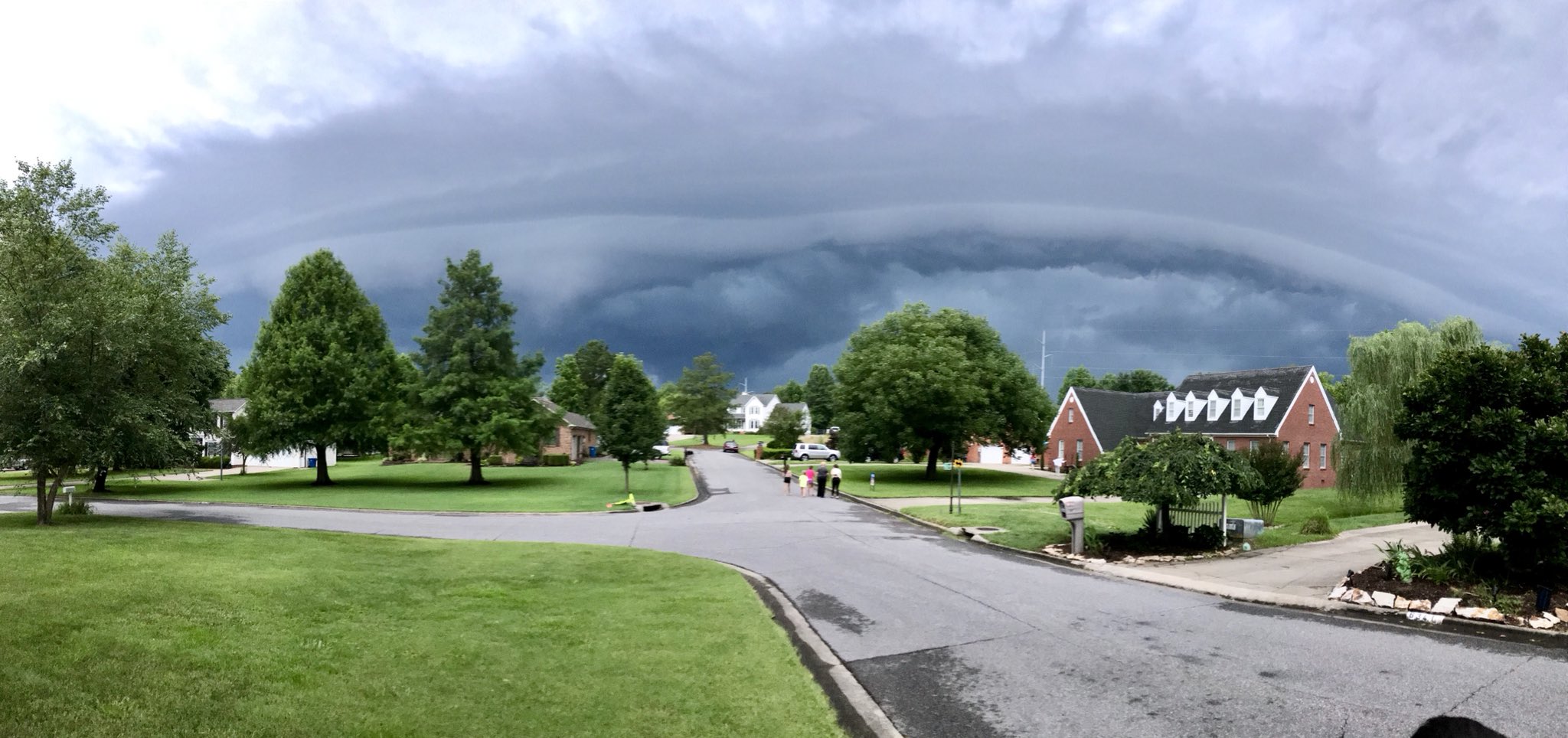
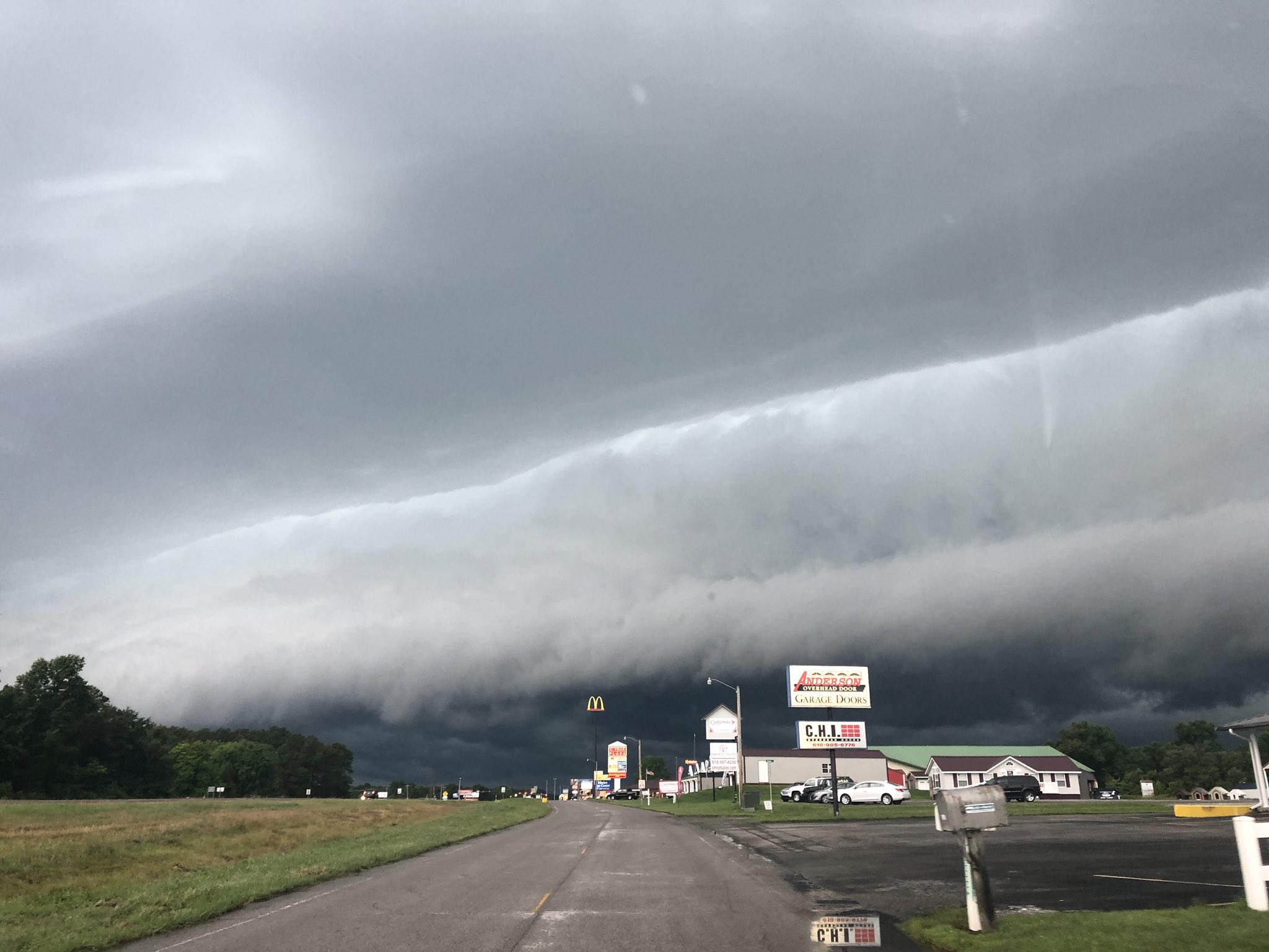
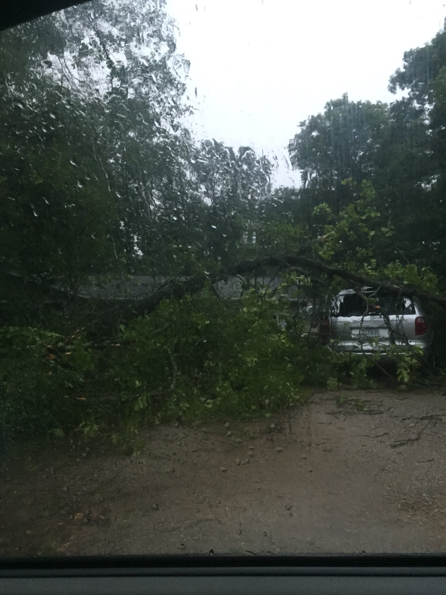
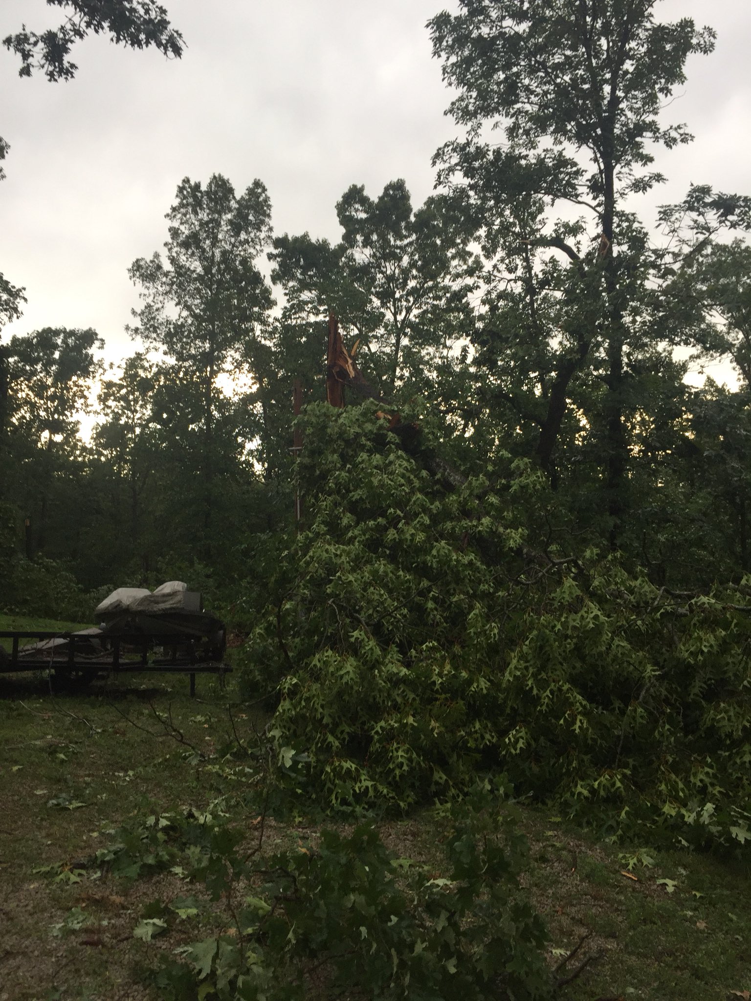
Additional development then occurred over southeast Missouri by mid-afternoon with this cluster spreading eastward through the early evening hours. The second line of storms produced a microburst with estimated winds of 85 mph, which caused extensive tree damage near Breman, Kentucky, in Muhlenberg County. Finally, another line of storms moved in from south-central Missouri around 630 p.m. and progressed rapidly through the area, exiting by around 10 p.m. Damaging winds were the main impact associated with all three rounds of storms, with plenty of great shelf cloud pictures. We had over a dozen observing stations report winds between 45 and 63 mph. Torrential rainfall of 1 to 2+ inches was observed in some areas along with some reports of hail, mostly up to the size of nickels. However, there was a report of ping pong ball sized hail in Van Buren, MO.
Tornado and Microbursts:
|
Tornado - Norris City, Illinois
Track Map .png)  |
||||||||||||||||
|
Microburst #1 - Norris City, Illinois
Track Map |
||||||||||||||||
|
Microburst #2 - Fort Branch, Indiana
Track Map 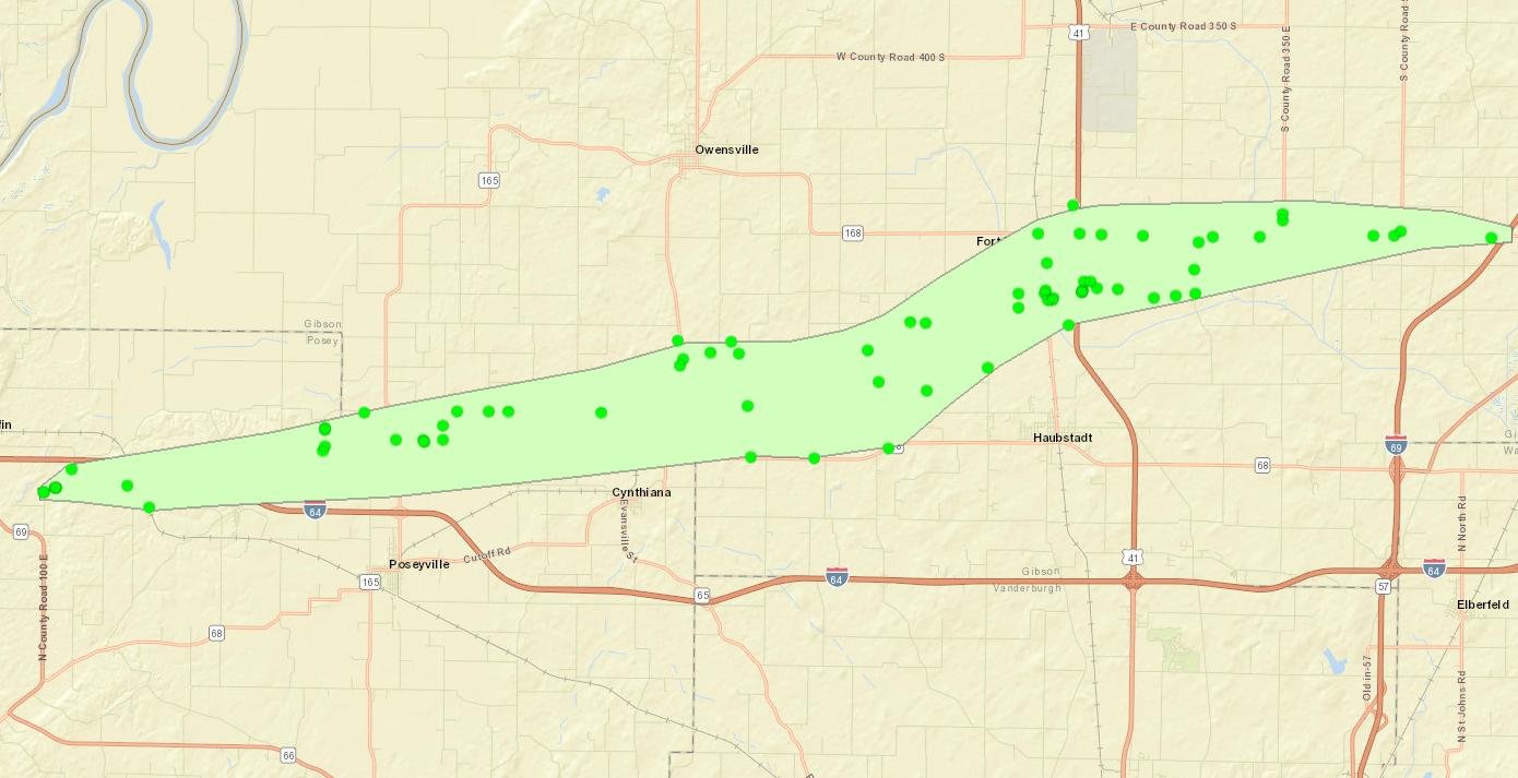 |
||||||||||||||||
|
Microburst #3 - Bremen, Kentucky
Track Map 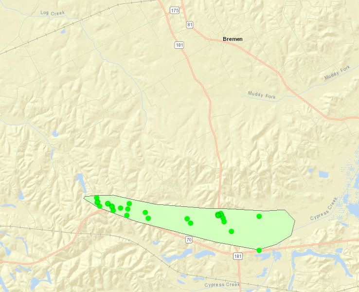 |
||||||||||||||||
The Enhanced Fujita (EF) Scale classifies tornadoes into the following categories:
| EF0 Weak 65-85 mph |
EF1 Moderate 86-110 mph |
EF2 Significant 111-135 mph |
EF3 Severe 136-165 mph |
EF4 Extreme 166-200 mph |
EF5 Catastrophic 200+ mph |
 |
|||||
Photos:
 |
 |
 |
 |
| Shelf cloud in Paducah, KY around 7:30pm via NWS Employee | 3rd shelf cloud of day in Paducah, KY via Jennfier Rukavina | Shelf cloud in Carterville IL around 7:15pm via Dan Hyson | Shelf cloud in Perryville, MO around 6:30pm via Marc Kester |
 |
 |
 |
 |
| Tree damage during morning storms in Stanley, KY via Chris Conley | Tree on house in Poplar Bluff, MO from evening storms via Craig Meador | Tree damage from western Perry County, MO via Darin Deckerd | Tree damage from western Perry County, MO via Darin Deckerd |
Radar:
A morning round of storms was followed by a brief lull before storms redeveloped during the late afternoon and more moved in from the west through the evening hours.
Click here for a radar loop of this event
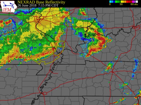 |
| Radar loop from 7 AM through 10:30 PM on June 26th |
Storm Reports
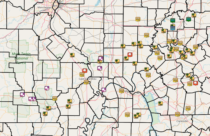 |
PRELIMINARY LOCAL STORM REPORT...SUMMARY
NATIONAL WEATHER SERVICE PADUCAH KY
1047 PM CDT TUE JUN 26 2018

..TIME...   ...EVENT...      ...CITY LOCATION...     ...LAT.LON...
..DATE...   ....MAG....      ..COUNTY LOCATION..ST.. ...SOURCE....
            ..REMARKS..

0825 AM     TSTM WND DMG     WEST END                37.89N 88.71W
06/26/2018                   SALINE             IL   LAW ENFORCEMENT

            TREES DOWN IN THE COMMUNITY.

0901 AM     HAIL             2 N ANNA                37.49N 89.24W
06/26/2018  M0.75 INCH       UNION              IL   TRAINED SPOTTER

            PENNY SIZE HAIL REPORTED.

0925 AM     TSTM WND GST     FAIRFIELD               38.38N 88.37W
06/26/2018  E55.00 MPH       WAYNE              IL   EMERGENCY MNGR

0928 AM     TSTM WND DMG     CREAL SPRINGS           37.62N 88.84W
06/26/2018                   WILLIAMSON         IL   BROADCAST MEDIA

            TREES BLOCKING NORTH LINE STREET IN THE COMMUNITY.

0928 AM     TSTM WND DMG     HARRISBURG              37.74N 88.55W
06/26/2018                   SALINE             IL   LAW ENFORCEMENT

            TREES DOWN IN DIFFERENT AREAS OF THE COMMUNITY.

0935 AM     TSTM WND DMG     OMAHA                   37.89N 88.30W
06/26/2018                   GALLATIN           IL   LAW ENFORCEMENT

            POLE AND LINE DOWN ALONG SECOND STREET.
0940 AM     TSTM WND DMG     4 SW NORRIS CITY        37.94N 88.38W
06/26/2018                   HAMILTON           IL   NWS STORM SURVEY

            A MICROBURST WITH ESTIMATED PEAK WINDS OF 85 MPH BEGAN
            APPROXIMATELY 4.5 MILES SOUTHWEST OF NORRIS CITY. THE
            DAMAGE WAS FOCUSED AROUND AND SOUTH OF SANDY RUN LAKE.
            MANY DOZENS OF TREES WERE UPROOTED OR BROKEN. AT LEAST
            TWO HOMES WERE DAMAGED BY FALLING TREES.
0941 PM     TORNADO          3 SW NORRIS CITY        37.95N 88.37W
06/26/2018                   WHITE              IL   NWS STORM SURVEY

            AN EF-0 TORNADO WITH ESTIMATED PEAK WINDS OF 85 MPH
            OCCURRED APPROXIMATELY 3.8 SOUTHWEST OF NORRIS CITY. THE
            TORNADO DAMAGE OCCURRED MAINLY ON THE NORTH SIDE OF SANDY
            RUN LAKE. DOZENS OF TREES, SOME LARGE, WERE UPROOTED OR
            BROKEN.

0945 AM     TSTM WND DMG     BROUGHTON               37.93N 88.46W
06/26/2018                   HAMILTON           IL   LAW ENFORCEMENT

            TREE DOWN.

0950 AM     TSTM WND DMG     2 S NORRIS CITY         37.95N 88.33W
06/26/2018                   WHITE              IL   LAW ENFORCEMENT

            TREES DOWN ALONG HIGHWAY 1

0954 AM     TSTM WND GST     CARMI                   38.09N 88.17W
06/26/2018  M51.00 MPH       WHITE              IL   AWOS

            REPORTED FROM CARMI ILLINOIS AIRPORT.

0955 AM     TSTM WND DMG     CAVE-IN-ROCK            37.47N 88.17W
06/26/2018                   HARDIN             IL   LAW ENFORCEMENT

            TREES AND POWER LINES DOWN ALONG HIGHWAY 1
1004 AM     TSTM WND DMG     1 SE GRIFFIN            38.19N 87.90W
06/26/2018                   POSEY              IN   NWS STORM SURVEY

            A MICROBURST WITH PEAK ESTIMATED WINDS OF 90 MPH OCCURRED
            ALONG A 25 MILE PATH FROM NW POSEY COUNTY INTO SOUTHERN
            GIBSON COUNTY. THE MICROBURST BEGAN APPROXIMATLY 1.6
            MILES SE OF GRIFFIN AND ENDED 7.5 MILES E OF FORT BRANCH.
            THE DAMAGE SWATH WAS AS MUCH AS TWO MILES WIDE. THE MOST
            INTENSE DAMAGE OCCURRED IN AND NEAR FORT BRANCH. AT LEAST
            10 HOMES SUSTAINED MINOR SHINGLE AND EXTERIOR DAMAGE. TWO
            BARNS WERE HEAVILY DAMAGED NEAR FORT BRANCH. A SEMI WAS
            BLOWN OVER ON THE SOUTH SIDE OF FORT BRANCH.

1010 AM     TSTM WND DMG     POSEYVILLE              38.17N 87.78W
06/26/2018                   POSEY              IN   AMATEUR RADIO

            WIDESPREAD TREE DAMAGE ALONG INTERSTATE 64 NEAR THE BLACK
            RIVER REST AREA.

1010 AM     TSTM WND GST     UNIONTOWN               37.77N 87.93W
06/26/2018  M47.00 MPH       UNION              KY   MESONET

            MEASURED VIA KENTUCKY MESONET.

1010 AM     TSTM WND DMG     6 SW MOUNT VERNON       37.87N 87.98W
06/26/2018                   POSEY              IN   EMERGENCY MNGR

            NUMEROUS TREES AND POWER LINES DOWN. ISOLATED POWER
            OUTAGES REPORTED.

1015 AM     TSTM WND GST     4 NW MARION             37.37N 88.13W
06/26/2018  M63.00 MPH       CRITTENDEN         KY   MESONET

            REPORTED VIA KENTUCKY MESONET

1023 AM     TSTM WND DMG     FORT BRANCH             38.25N 87.57W
06/26/2018                   GIBSON             IN   EMERGENCY MNGR

            HUNDREDS OF TREES AND POWER LINES DOWN THROUGH MUCH OF
            THE CITY. WIDESPREAD POWER OUTAGES. GUTTER AND SHINGLE
            DAMAGE ON TWO HOMES. SEMI ROLLED OVER. DAMAGE OCCURRED ON
            SOUTHEAST SIDE OF TOWN TO 2 MILES EAST.

1023 AM     TSTM WND DMG     FORT BRANCH             38.25N 87.57W
06/26/2018                   GIBSON             IN   TRAINED SPOTTER

            REPORT OF TWO SEMI-TRACTOR TRAILERS BLOWN OVER. ONE TREE
            UPROOTED AND SEVERAL LARGE LIMBS DOWN. LOCATION ON
            HIGHWAY 41 ON SOUTH END OF FORT BRANCH.

1023 AM     TSTM WND DMG     2 S FORT BRANCH         38.22N 87.57W
06/26/2018                   GIBSON             IN   EMERGENCY MNGR

            TREES AND POWER LINES DOWN ALONG COAL MINE ROAD.

1026 AM     TSTM WND GST     4 NW MARION             37.37N 88.13W
06/26/2018  M36.00 MPH       CRITTENDEN         KY   MESONET

            REPORT VIA KENTUCKY MESONET. POWER LINE DOWN ALONG OLD
            PINEY ROAD.

1028 AM     TSTM WND GST     HENDERSON               37.84N 87.58W
06/26/2018  M46.00 MPH       HENDERSON          KY   AWOS

            REPORT FROM HENDERSON KENTUCKY AIRPORT.

1038 AM     TSTM WND GST     EVANSVILLE              37.98N 87.54W
06/26/2018  M60.00 MPH       VANDERBURGH        IN   TRAINED SPOTTER

            TREE LIMBS DOWN AND POWER OUTAGES REPORTED ON THE NNW
            SIDE OF TOWN.

1040 AM     TSTM WND GST     5 E HENDERSON           37.84N 87.49W
06/26/2018  M49.00 MPH       HENDERSON          KY   MESONET

            PEAK GUST FROM KENTUCKY MESONET WEATHER OBSERVATION SITE.


1043 AM     TSTM WND DMG     HENDERSON               37.84N 87.58W
06/26/2018                   HENDERSON          KY   PUBLIC

            WIDESPREAD TREES AND POWER LINES DOWN.

1043 AM     TSTM WND GST     EVANSVILLE              37.98N 87.54W
06/26/2018  E60.00 MPH       VANDERBURGH        IN   TRAINED SPOTTER

            WINDS ESTIMATED 50 TO 60 MPH IN THE SUBDIVISION OF ANGEL
            MOUNDS.

1052 AM     TSTM WND DMG     WINSLOW                 38.38N 87.21W
06/26/2018                   PIKE               IN   TRAINED SPOTTER

            TREES AND POWER AND LINES DOWN.

1058 AM     TSTM WND GST     ST. JOSEPH              37.69N 87.33W
06/26/2018  E55.00 MPH       DAVIESS            KY   PUBLIC

            PEA SIZE HAIL REPORTED WITH THIS STORM.

1100 AM     TSTM WND GST     4 S MADISONVILLE        37.28N 87.51W
06/26/2018  M53.00 MPH       HOPKINS            KY   MESONET

            PEAK GUST REPORTED FROM KENTUCKY MESONET.

1104 AM     TSTM WND DMG     2 SW CADIZ              36.85N 87.85W
06/26/2018                   TRIGG              KY   TRAINED SPOTTER

            NUMEROUS TREES DAMAGED WITH WIND GUSTS ESTIMATED 40 TO 50
            MPH.

1105 AM     TSTM WND DMG     1 E STANLEY             37.82N 87.23W
06/26/2018                   DAVIESS            KY   TRAINED SPOTTER

            LARGE TREE SNAPPED WITH WIDESPREAD TREE LIMBS DOWN. WINDS
            ESTIMATED 50 TO 60 MPH.

1106 AM     TSTM WND GST     OWENSBORO               37.76N 87.12W
06/26/2018  M53.00 MPH       DAVIESS            KY   AWOS

            WIND GUST REPORT FROM OWENSBORO KENTUCKY AIRPORT.

1113 AM     TSTM WND DMG     OWENSBORO               37.76N 87.12W
06/26/2018                   DAVIESS            KY   PUBLIC

            SEMI TRACTOR BLOWN ON WEST SIDE OF COMMUNITY AT THE
            TRACTOR SUPPLY STORE.

1120 AM     TSTM WND GST     GREENVILLE              37.21N 87.18W
06/26/2018  M47.00 MPH       MUHLENBERG         KY   MESONET

            PEAK WIND GUST FROM KENTUCKY MESONET.

1135 AM     FLASH FLOOD      WINSLOW                 38.38N 87.21W
06/26/2018                   PIKE               IN   TRAINED SPOTTER

            FLASH FLOODING REPORTED ALONG HIGHWAY 61 NEAR THE
            INTERSECTION OF HIGHWAY 56. WATER OVER ROADWAYS IN
            DIFFERENT LOCATIONS.

1140 AM     TSTM WND GST     FORT CAMPBELL NORTH     36.65N 87.46W
06/26/2018  M44.00 MPH       CHRISTIAN          KY   AWOS

            REPORT FROM FORT CAMPBELL KENTUCKY WEATHER OBSSERVATION.

1145 AM     TSTM WND DMG     OTWELL                  38.45N 87.09W
06/26/2018                   PIKE               IN   STORM CHASER

            TREES DOWN.

1150 AM     TSTM WND GST     5 SW ELKTON             36.76N 87.22W
06/26/2018  M43.00 MPH       TODD               KY   MESONET

            PEAK WIND GUST AT KENTUCKY MESONET.

1203 PM     FLASH FLOOD      PRINCETON               38.36N 87.57W
06/26/2018                   GIBSON             IN   LAW ENFORCEMENT

            FLASH FLOODING ALONG MCROBERTS ROAD NORTH SIDE OF TOWN.
            WATER OVER ROAD ALONG HIGHWAY 64 EAST OF TOWN.

0355 PM     TSTM WND DMG     PERRYVILLE              37.73N 89.87W
06/26/2018                   PERRY              MO   BROADCAST MEDIA

            MULTIPLE TREES DOWN.

0420 PM     FUNNEL CLOUD     3 E FRUITLAND           37.45N 89.58W
06/26/2018                   CAPE GIRARDEAU     MO   TRAINED SPOTTER

0440 PM     HAIL             JACKSON                 37.38N 89.65W
06/26/2018  E0.88 INCH       CAPE GIRARDEAU     MO   PUBLIC

            RELAYED VIA FACEBOOK.

0445 PM     TSTM WND DMG     3 S CARBONDALE          37.68N 89.22W
06/26/2018                   JACKSON            IL   TRAINED SPOTTER

            EIGHT INCH TREE LIMBS DOWN. CHIMNEY DAMAGE TO A HOUSE.

0445 PM     TSTM WND DMG     MAKANDA                 37.62N 89.24W
06/26/2018                   JACKSON            IL   BROADCAST MEDIA

            TREE BLOCKING OLD US 51 SOUTH NEAR RACCOON VALLEY ROAD.

0449 PM     HAIL             4 S CARBONDALE          37.67N 89.22W
06/26/2018  M0.88 INCH       JACKSON            IL   EMERGENCY MNGR

            NICKLE SIZE HAIL REPORTED AS WELL AS TREE LIMBS DOWN.

0459 PM     HAIL             2 N ANNA                37.49N 89.24W
06/26/2018  M0.50 INCH       UNION              IL   TRAINED SPOTTER

0536 PM     HAIL             VAN BUREN               37.01N 91.01W
06/26/2018  E1.50 INCH       CARTER             MO   EMERGENCY MNGR

            PING PONG BALL SIZE HAIL ON THE NORTH SIDE OF VAN BUREN.


0543 PM     TSTM WND DMG     1 S CARRIER MILLS       37.67N 88.63W
06/26/2018                   SALINE             IL   LAW ENFORCEMENT

            TREES DOWN BLOCKING BOTH LANES OF HIGHWAY 45.

0546 PM     TSTM WND GST     WEST PADUCAH            37.08N 88.74W
06/26/2018  M45.00 MPH       MCCRACKEN          KY   ASOS

            MEASURED AT BARKLEY REGIONAL AIRPORT.

0549 PM     HAIL             VAN BUREN               37.01N 91.01W
06/26/2018  E0.88 INCH       CARTER             MO   BROADCAST MEDIA

0549 PM     HAIL             1 NE MOUND CITY         37.10N 89.15W
06/26/2018  E0.75 INCH       PULASKI            IL   EMERGENCY MNGR

            FALLING NEAR HIGHWAY 37 AND MOUNDS ROAD.

0550 PM     HAIL             VAN BUREN               37.01N 91.01W
06/26/2018  M0.88 INCH       CARTER             MO   BROADCAST MEDIA

0553 PM     FUNNEL CLOUD     HARRISBURG              37.74N 88.55W
06/26/2018                   SALINE             IL   PUBLIC

0553 PM     TSTM WND DMG     HEROD                   37.58N 88.44W
06/26/2018                   POPE               IL   LAW ENFORCEMENT

            POWER LINES DOWN ON HIGHWAY 34.

0605 PM     HAIL             ELLSINORE               36.93N 90.75W
06/26/2018  M0.88 INCH       CARTER             MO   TRAINED SPOTTER

            NICKEL SIZE HAIL REPORTED.

0608 PM     HAIL             4 W ELLSINORE           36.93N 90.82W
06/26/2018  M0.50 INCH       CARTER             MO   EMERGENCY MNGR

0627 PM     HAIL             GREENVILLE              37.13N 90.45W
06/26/2018  M0.50 INCH       WAYNE              MO   EMERGENCY MNGR

0634 PM     TSTM WND GST     BRECKINRIDGE CENTER     37.68N 87.86W
06/26/2018  E55.00 MPH       UNION              KY   TRAINED SPOTTER

            ESTIMATED WINDS OF 50 TO 55 MPH. RELAYED VIA TWITTER.

0648 PM     TSTM WND DMG     3 SSW HENDERSON         37.80N 87.60W
06/26/2018                   HENDERSON          KY   LAW ENFORCEMENT

            6 TO 10 TREES DOWN ALONG US HIGHWAY 41A

0652 PM     TSTM WND GST     WAPPAPELLO              36.94N 90.27W
06/26/2018  M50.00 MPH       WAYNE              MO   EMERGENCY MNGR

            SEVERAL AREAS IN COMMUNITY REPORTING POWER OUTAGES.

0657 PM     TSTM WND GST     POPLAR BLUFF            36.76N 90.41W
06/26/2018  M58.00 MPH       BUTLER             MO   ASOS

            REPORTED AT POPLAR BLUFF AIRPORT

0701 PM     TSTM WND GST     JACKSON                 37.38N 89.65W
06/26/2018  E50.00 MPH       CAPE GIRARDEAU     MO   TRAINED SPOTTER

            NUMEROUS TREES LIMBS DOWN.

0701 PM     TSTM WND GST     6 W EVANSVILLE          37.98N 87.65W
06/26/2018  E50.00 MPH       VANDERBURGH        IN   TRAINED SPOTTER

0704 PM     TSTM WND GST     5 S CAPE GIRARDEAU      37.24N 89.55W
06/26/2018  M53.00 MPH       SCOTT              MO   ASOS

            MEASURED AT CAPE GIRARDEAU AIRPORT.

0710 PM     TSTM WND DMG     WEST LOUISVILLE         37.70N 87.29W
06/26/2018                   DAVIESS            KY   TRAINED SPOTTER

            TREES UPROOTED. RELAYED VIA FACEBOOK.

0712 PM     TSTM WND GST     NEWBURGH                37.95N 87.40W
06/26/2018  M46.00 MPH       WARRICK            IN   BROADCAST MEDIA

0715 PM     TSTM WND DMG     POPLAR BLUFF            36.76N 90.41W
06/26/2018                   BUTLER             MO   BROADCAST MEDIA

            LARGE COTTONWOOD TREE SNAPPED IN POPLAR BLUFF.

0715 PM     TSTM WND DMG     BLOOMFIELD              36.89N 89.93W
06/26/2018                   STODDARD           MO   LAW ENFORCEMENT

            WIDESPREAD TREES AND POWER LINES DOWN ACROSS THE NORTHERN
            PART OF STODDARD COUNTY. TIME ESTIMATED BY RADAR.

0717 PM     FUNNEL CLOUD     BREMEN                  37.36N 87.22W
06/26/2018                   MUHLENBERG         KY   LAW ENFORCEMENT

0718 PM     TSTM WND DMG     EVANSVILLE              37.98N 87.54W
06/26/2018                   VANDERBURGH        IN   FIRE DEPT/RESCUE

            MULTIPLE TREES DOWN IN EVANSVILLE. A TREE FELL ON A HOUSE
            ON THE WEST SIDE OF EVANSVILLE.
0720 PM     TSTM WND DMG     3 SW BREMEN             37.33N 87.26W
06/26/2018                   MUHLENBERG         KY   NWS STORM SURVEY

            A MICROBURST WITH ESTIMATED WINDS OF 85 MPH CAUSED MINOR
            DAMAGE TO AT LEAST SEVEN HOMES. AT LEAST SEVEN BARNS LOST
            ROOFING OR SIDING. DOZENS OF TREES WERE UPROOTED. SEVERAL
            POWER POLES WERE DOWNED. MOST OF THE DAMAGE WAS ALONG AND
            NORTH OF HIGHWAY 70.

0720 PM     TSTM WND DMG     BREMEN                  37.36N 87.22W
06/26/2018                   MUHLENBERG         KY   LAW ENFORCEMENT

            WIDESPREAD TREES AND POWER LINES DOWN, ONE FELL ACROSS A
            MOBILE HOME. TREES DOWN ON MULTIPLE HOMES.

0720 PM     TSTM WND DMG     DEXTER                  36.79N 89.96W
06/26/2018                   STODDARD           MO   BROADCAST MEDIA

            CONCRETE STORAGE SHED HEAVILY DAMAGED ON NORTH PARK LANE.
            DELAYED REPORT. TIME BASED ON RADAR.

0724 PM     TSTM WND DMG     1 W HARVIELL            36.66N 90.49W
06/26/2018                   BUTLER             MO   EMERGENCY MNGR

            MULTIPLE TREES DOWN BLOCKING HIGHWAY 158 TWO MILES EAST
            OF THE JUNCTION OF US 67 AND US 160. DELAYED REPORT.TIME
            ESTIMATED BY RADAR.

0724 PM     TSTM WND DMG     POPLAR BLUFF            36.76N 90.41W
06/26/2018                   BUTLER             MO   EMERGENCY MNGR

            TREES AND A FENCE BLOWN DOWN ON THE NORTH SIDE OF POPLAR
            BLUFF. DELAYED REPORT.

0725 PM     TSTM WND DMG     CENTRAL CITY            37.30N 87.13W
06/26/2018                   MUHLENBERG         KY   LAW ENFORCEMENT

            WIDESPREAD TREES DOWNS THROUGHOUT THE COMMUNITY.

0729 PM     TSTM WND DMG     CAIRO                   37.71N 87.65W
06/26/2018                   HENDERSON          KY   EMERGENCY MNGR

            TREE FELL ON A CAR. INJURIES REPORTED.

0729 PM     TSTM WND DMG     HEBBARDSVILLE           37.78N 87.38W
06/26/2018                   HENDERSON          KY   EMERGENCY MNGR

            LARGE TREE LIMBS DOWN.

0737 PM     TSTM WND GST     ROCKPORT                37.88N 87.05W
06/26/2018  M53.00 MPH       SPENCER            IN   TRAINED SPOTTER

0744 PM     FUNNEL CLOUD     DRAKESBORO              37.22N 87.05W
06/26/2018                   MUHLENBERG         KY   EMERGENCY MNGR

0837 PM     TSTM WND GST     SEDALIA                 36.64N 88.61W
06/26/2018  E50.00 MPH       GRAVES             KY   PUBLIC

0845 PM     TSTM WND DMG     5 W MURRAY              36.61N 88.41W
06/26/2018                   CALLOWAY           KY   EMERGENCY MNGR

            TREE DOWN ACROSS BUTTERWORTH ROAD WEST OF MURRAY. DELAYED
            REPORT.

0917 PM     TSTM WND DMG     3 NW MURRAY             36.64N 88.35W
06/26/2018                   CALLOWAY           KY   LAW ENFORCEMENT

            *** 1 INJ *** TREE FELL ON A MOVING CAR ON AIRPORT ROAD.
            ONE PERSON INJURED.
Additional Information
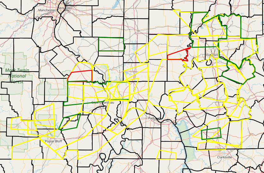
Here is a map showing all of the warnings issued throughout this event.
(Yellow - Severe Thunderstorm Warning; Red - Tornado Warning; Green - Flash Flood Warning or Flood Advisories)
 |
Storm Prediction Center Convective Outlooks:
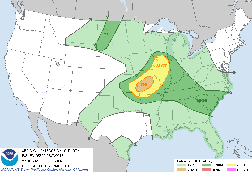 |
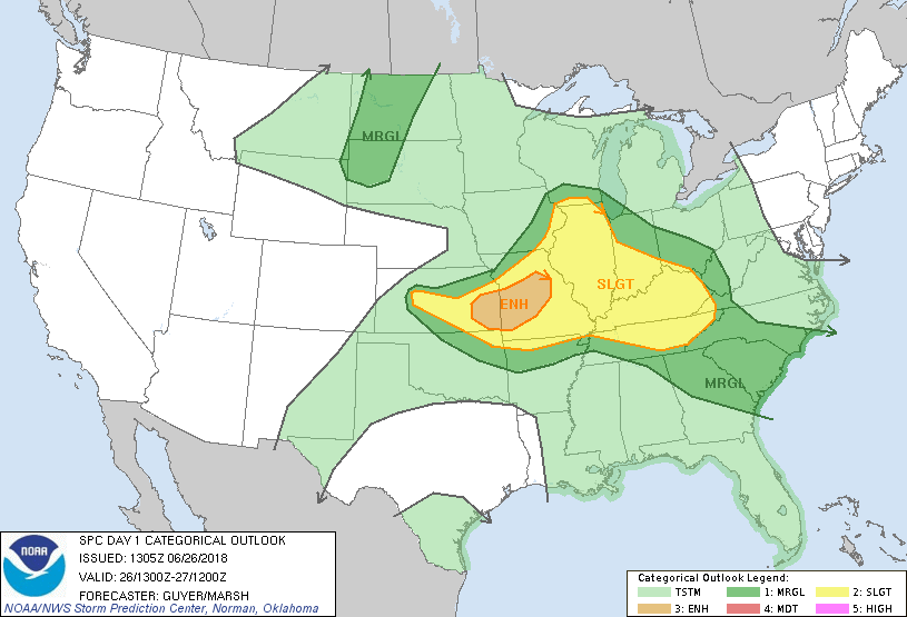 |
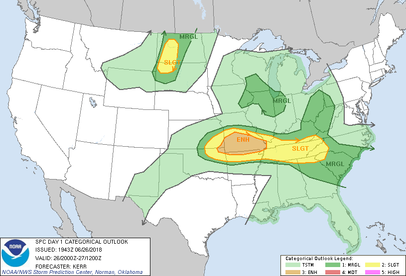 |
| SPC Day 1 Outlook issued at 1 AM | SPC Day 1 Update issued at 8 AM | SPC Day 1 Update issued at 3 PM |
 |
Media use of NWS Web News Stories is encouraged! Please acknowledge the NWS as the source of any news information accessed from this site. |
|

