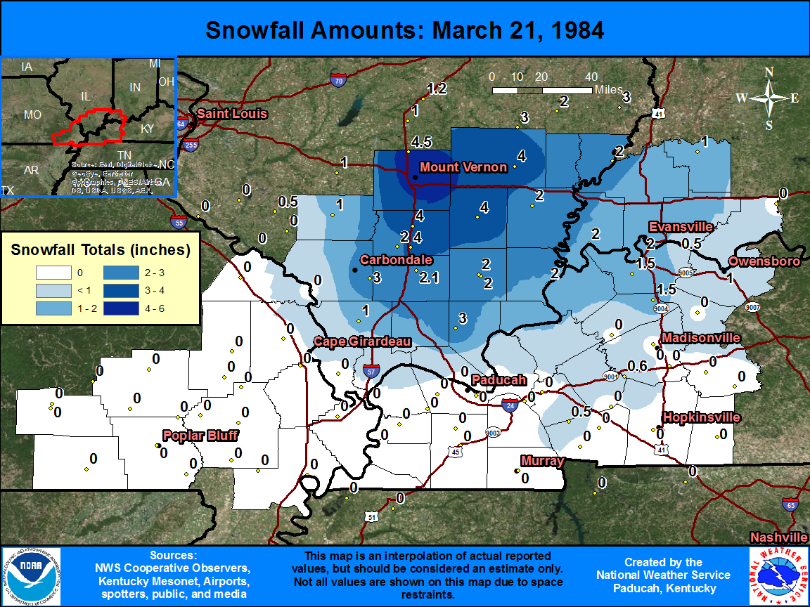
The graphic below shows observed snowfall totals, along with estimated snowfall amounts in-between actual observations. There is a table located below the map, that shows the amount and location of snowfall totals.
| State | Location | Type | County | Snow |
| IL | MT VERNON 3 NE | COOP | Jefferson | 6 |
| IL | DIX | COOP | Jefferson | 4.5 |
| IL | WEST FRANKFORT | COOP | Franklin | 4 |
| IL | BENTON | COOP | Franklin | 4 |
| IL | MCLEANSBORO | COOP | Hamilton | 4 |
| IL | FAIRFIELD RADIO WFIW | COOP | Wayne | 4 |
| IL | DIXON SPRINGS AGR CE | COOP | Pope | 3 |
| IL | CARBONDALE SEWAGE PLT | COOP | Jackson | 3 |
| IL | MARION 4 NNE | COOP | Williamson | 2.1 |
| IL | PLUMFIELD | COOP | Franklin | 2 |
| IL | HARRISBURG | COOP | Saline | 2 |
| IL | SHAWNEETOWN OLD TOWN | COOP | Gallatin | 2 |
| IL | HARRISBURG DISPOSAL | COOP | Saline | 2 |
| IN | MT VERNON | COOP | Posey | 2 |
| IL | CARMI 6 NW | COOP | White | 2 |
| IN | EVANSVILLE MUSEUM | COOP | Vanderburgh | 2 |
| IL | MT CARMEL | COOP | Wabash | 2 |
| IN | EVANSVILLE REGIONAL AP | WBAN | Vanderburgh | 1.9 |
| KY | SEBREE 1 E | COOP | Webster | 1.5 |
| KY | HENDERSON 8 SSW | COOP | Henderson | 1.5 |
| IL | PINCKNEYVILLE 2 N | COOP | Perry | 1 |
| IL | ANNA | COOP | Union | 1 |
| IN | PETERSBURG 61 BRG | COOP | Pike | 1 |
| KY | OWENSBORO | COOP | Daviess | 1 |
| KY | DAWSON SPRINGS | COOP | Hopkins | 0.6 |
| KY | GOLDEN POND 8 N | COOP | Trigg | 0.5 |
| IN | NEWBURGH L&D | COOP | Warrick | 0.5 |

