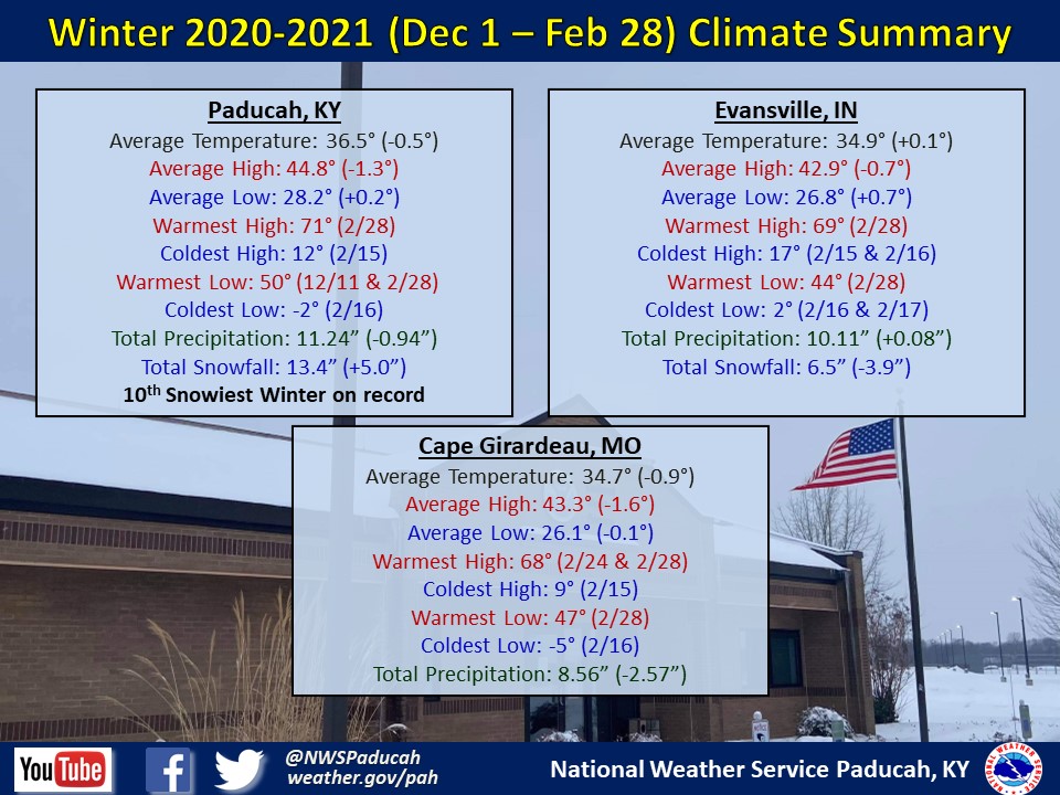
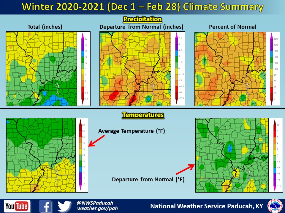
Winter 2020-2021 Climate Summary: Temperatures averaged near to slightly below normal for the season. The region experienced temperatures 2 to 4 degrees warmer than normal in December and January. However, we quickly flipped the switch to significantly colder conditions for February, finishing with temperatures 6 to 10 degrees below normal for the month. So, while much of the winter was warmer than normal, the period from February 7-20 brought down our average temperature for the season drastically.
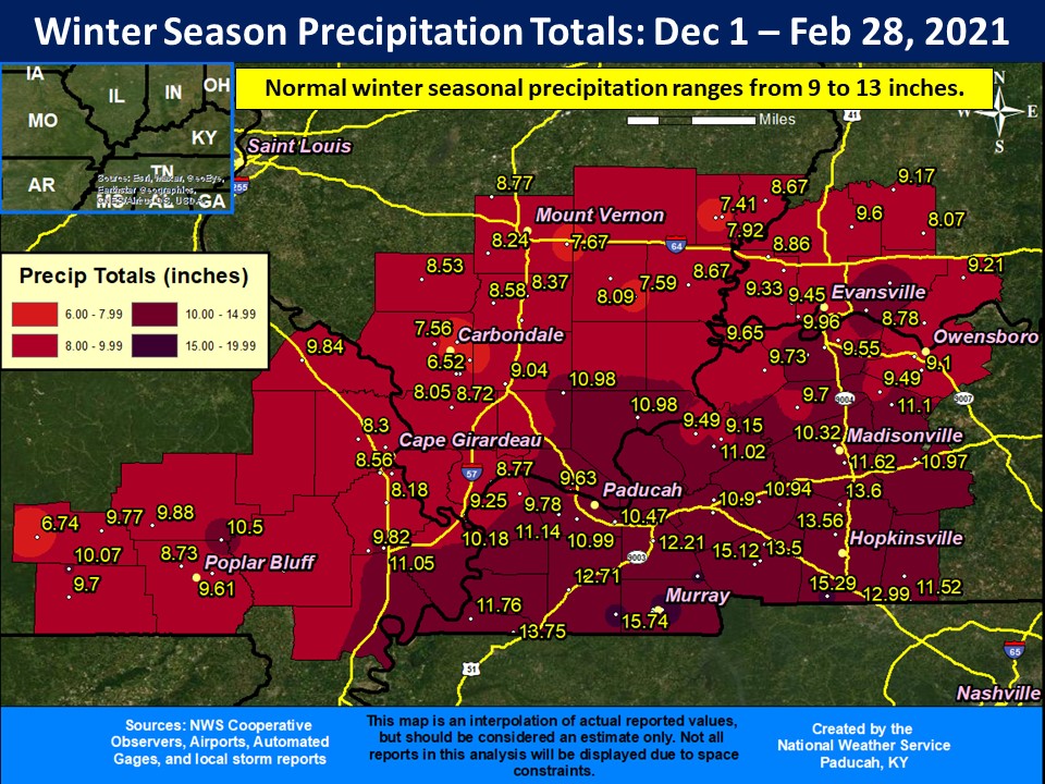
The winter season finished near to slightly drier than normal across a decent portion of the region. Many areas finished with between 8 and 12 inches of precipitation, which generally ranged from right around normal to around 2 inches drier than normal. The exception was across the southern sections of western Kentucky, thanks to a heavy rain event on February 28. Areas from Hickman to Murray and Hopkinsville observed seasonal totals of 12 to 16 inches, which was 1 to 3 inches wetter than normal. The driest month compared to normal was December. For much of the region, the wettest month of the winter was February. However, January was the wettest month for southern portions of southeast Missouri and far west Kentucky. Snowfall was above average thanks to February. Most areas received very little if any measurable snow until February. Back to back snowstorms February 15-18 produced amounts of 4 to 12 inches, with some locally higher amounts. Paducah ended up observing 13.4" which was the 10th snowiest winter on record.
 |
| Winter 2020-2021 Review: Precipitation and Temperature Maps |
 |
| Climate Maps are from the Northeast Regional Climate Center |