Overview
|
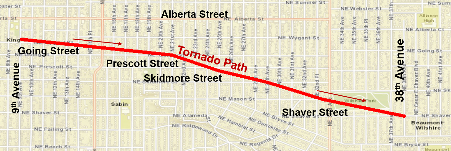
Thunderstorms were developing around the Portland area, producing up to nickel-size hail. As storms spread east into northeast Portland, a stronger storm developed, producing a fast-moving tornado starting around 9th Ave. and Wygant St. and ending around 38th Ave. and Shaver St. The tornado brought down many tree limbs and a few large trees. Minor damage was also done to a few roofs and a chimney. How rare are tornadoes in July in Oregon? There have only been 5 recorded tornadoes in the month of July.
​How many tornadoes have hit Portland? There have been 5 recorded tornadoes within Portland City Limits.
|
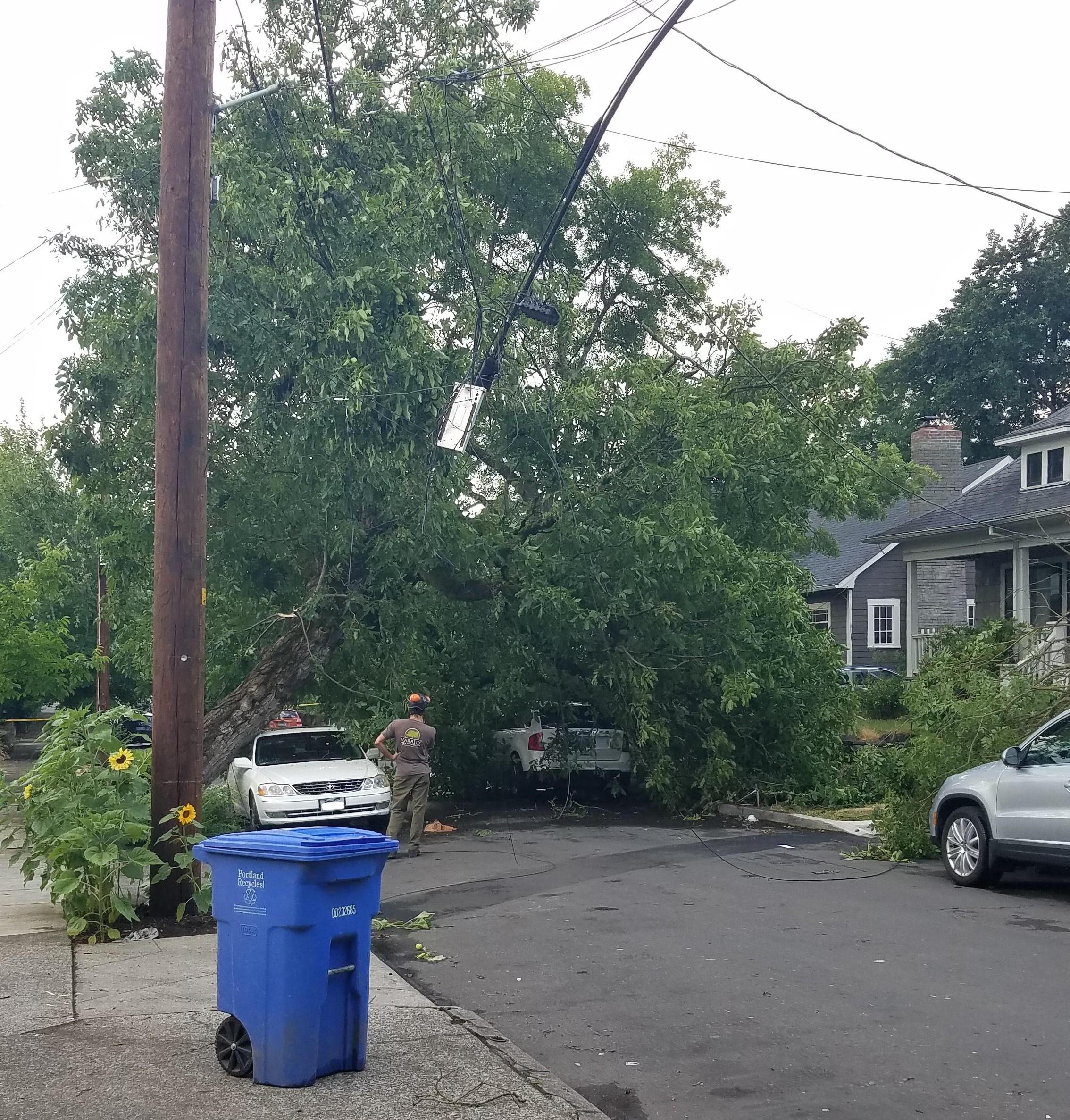
Large tree down on top of cars and power lines. |
|
|
|
 |
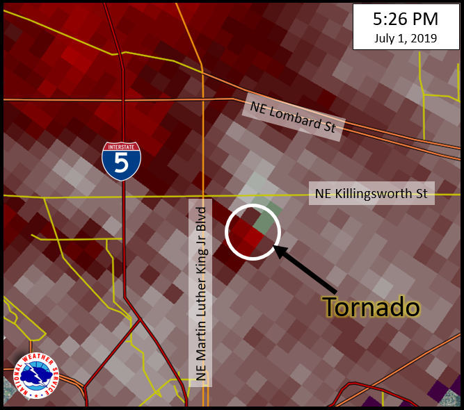
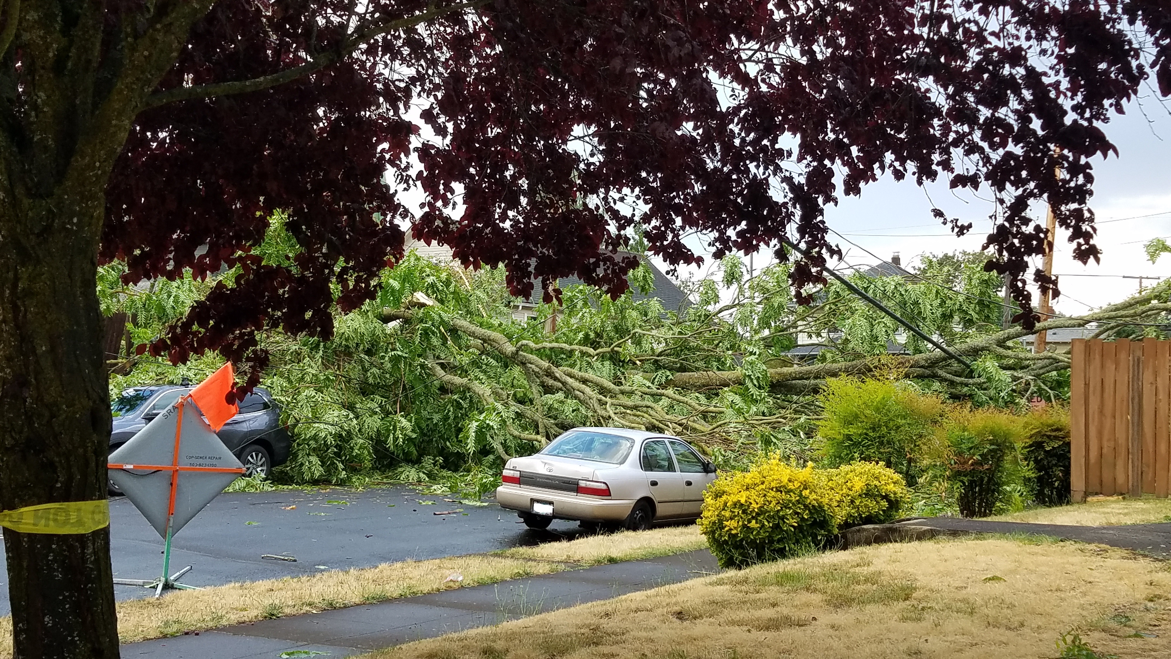
| Radar velocity image showing rotation from the tornado in the area where damage was observed. | Tree blown down onto a car. Photo from storm survey. |
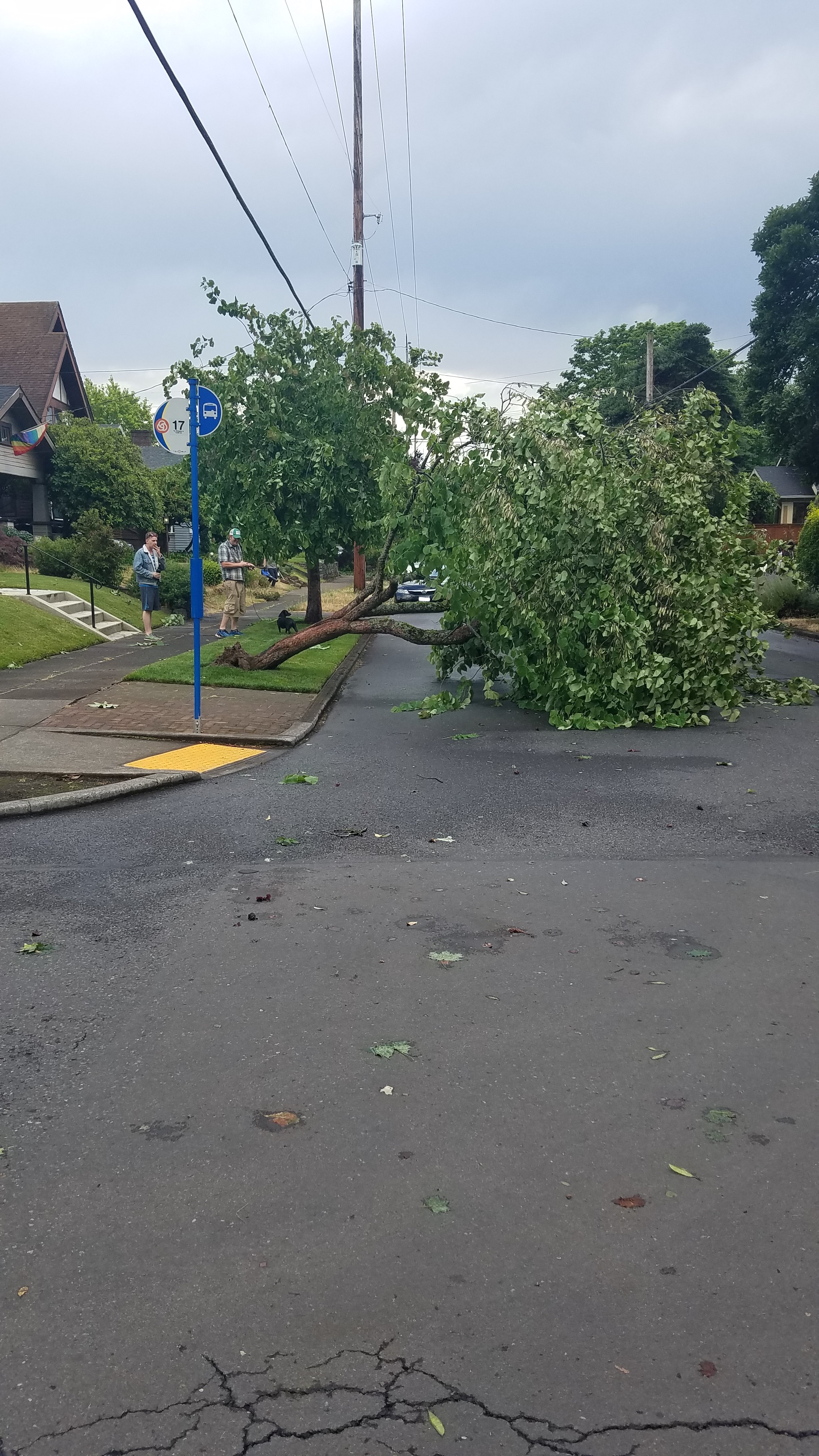
Tree down in the middle of the street. |
Tornadoes:
|
Tornado - Northeast Portland
Track Map
|
||||||||||||||||
The Enhanced Fujita (EF) Scale classifies tornadoes into the following categories:
| EF0 Weak 65-85 mph |
EF1 Moderate 86-110 mph |
EF2 Significant 111-135 mph |
EF3 Severe 136-165 mph |
EF4 Extreme 166-200 mph |
EF5 Catastrophic 200+ mph |
 |
|||||
 |
Media use of NWS Web News Stories is encouraged! Please acknowledge the NWS as the source of any news information accessed from this site. |
|