Overview
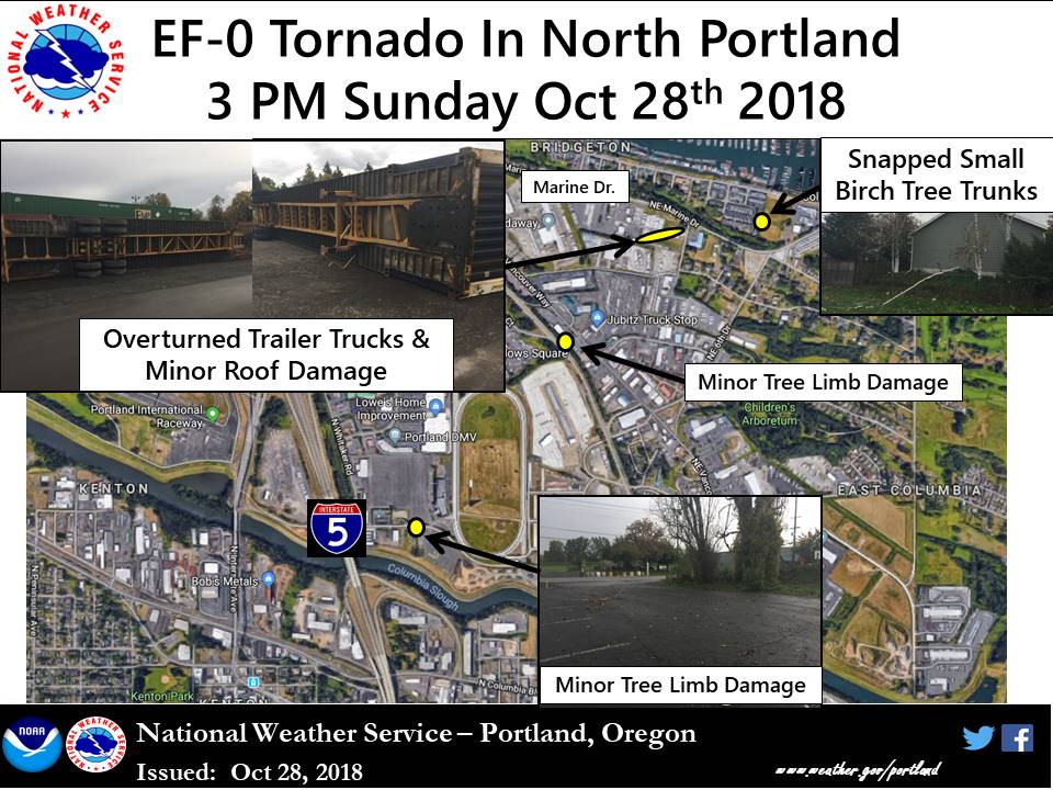
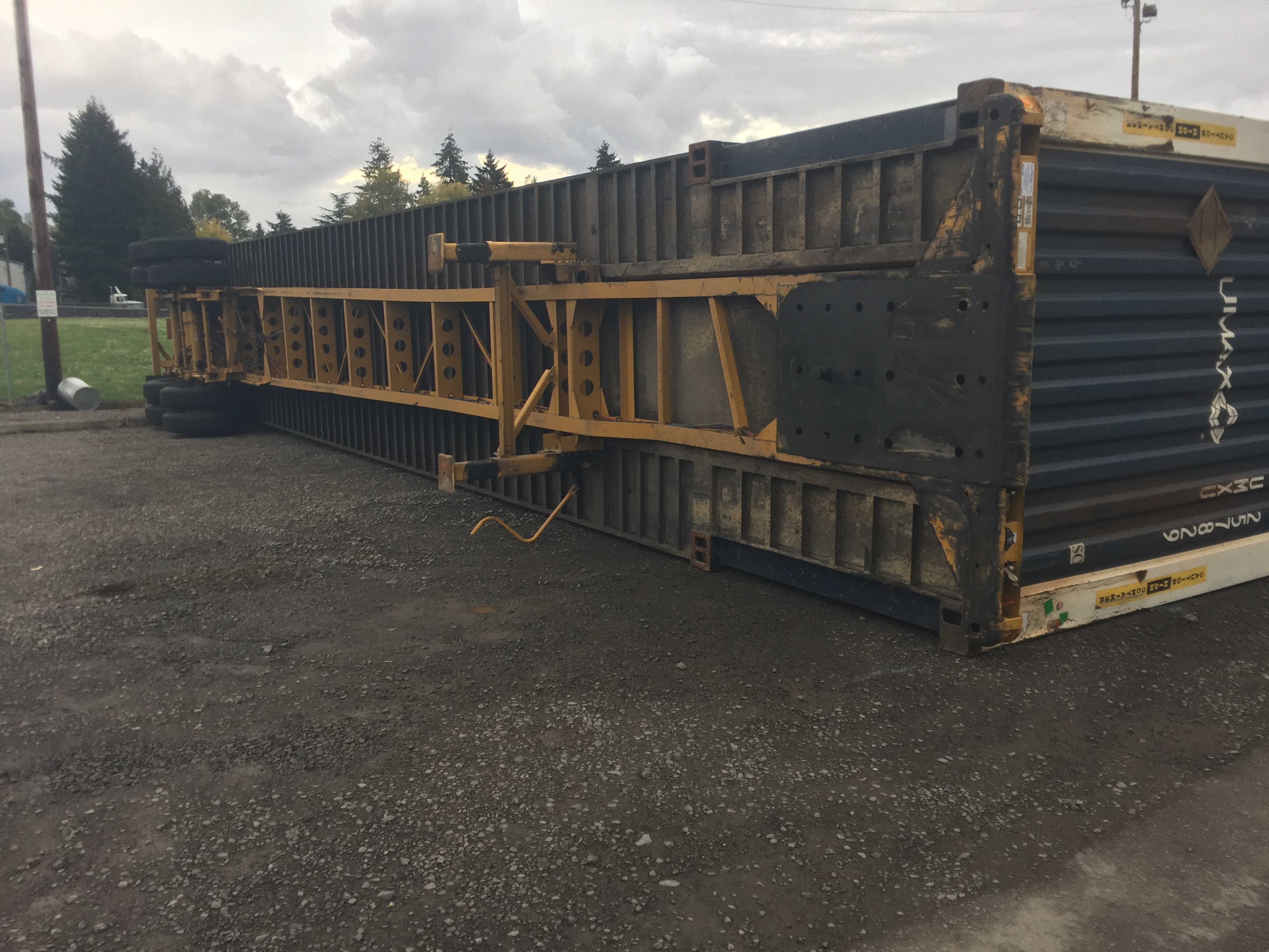
On October 28, 2018, an EF-0 tornado briefly developed in North Portland around 3 PM. The tornado was on the ground for approximately two minutes and caused some minor damage, including snapping some tree limbs and a few small tree trunks. Three semi-truck trailers were overturned in a parking area near Marine Drive, with some minor roof damage observed on a nearby building. A National Weather Service storm survey team rated the tornado an EF-0 with estimated peak wind speeds of 74 mph, based upon this observed damage.
Tornado:
|
Tornado - North Portland
Track Map
|
||||||||||||||||||||
Click on a thumbnail above to view a larger version of the photo. Right-click and select "Save Image As" to download the full resolution photo. |
||||||||||||||||||||
The Enhanced Fujita (EF) Scale classifies tornadoes into the following categories:
| EF0 Weak 65-85 mph |
EF1 Moderate 86-110 mph |
EF2 Significant 111-135 mph |
EF3 Severe 136-165 mph |
EF4 Extreme 166-200 mph |
EF5 Catastrophic 200+ mph |
 |
|||||
 |
Media use of National Weather Service Web News Stories is encouraged! Please credit the National Weather Service as the source of any information accessed from this site. |
|