Overview
|
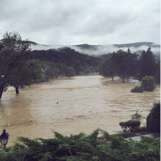
On Thursday, June 23, 2016, several rounds of thunderstorms producing torrential rainfall over nearly the same area moved southeast through portions of the central Appalachians. These storms were associated with a nearly stationary frontal boundary which helped to focus an extremely moist air mass. The diverse topography of the area likely enhanced rainfall intensity - resulting in catastrophic flash flooding, historic river flooding, and 23 fatalities in West Virginia. Thousands of homes and business were damaged or destroyed, and road repair costs alone were expected to exceed 50 million dollars. The fatalities were the highest in the state of West Virginia since November 1985 floods when 47 died. During the flooding, numerous water rescues and evacuations were conducted, and more than 2000 people were temporarily displaced. A State of Emergency was declared by the Governor of West Virginia for 12 counties. |
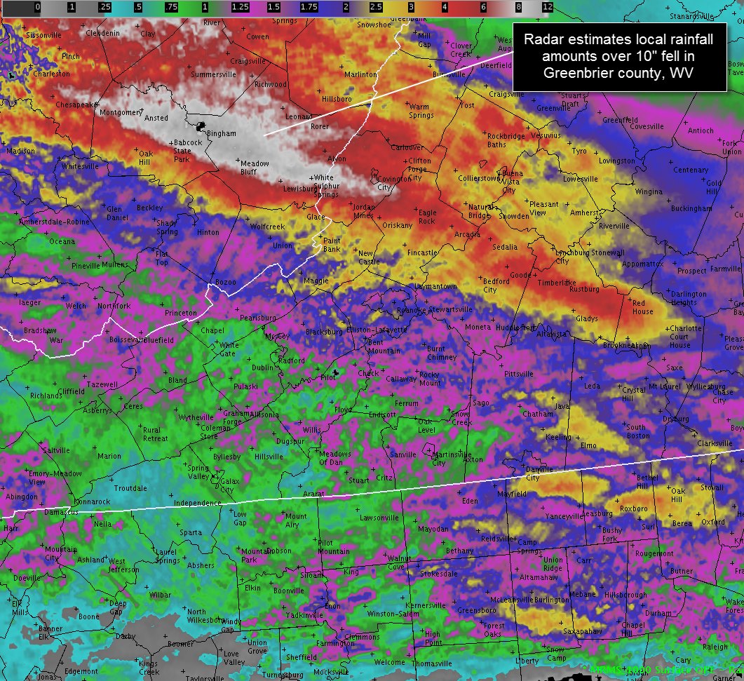
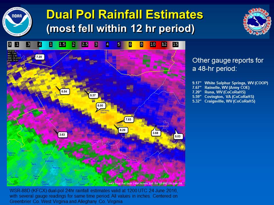 Rainfall Estimates from KFCX Dual Pol Radar |
 |
 |
|
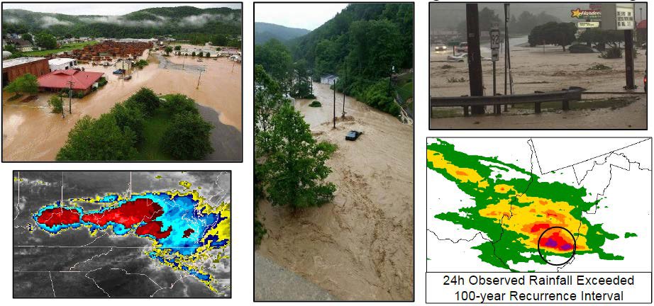
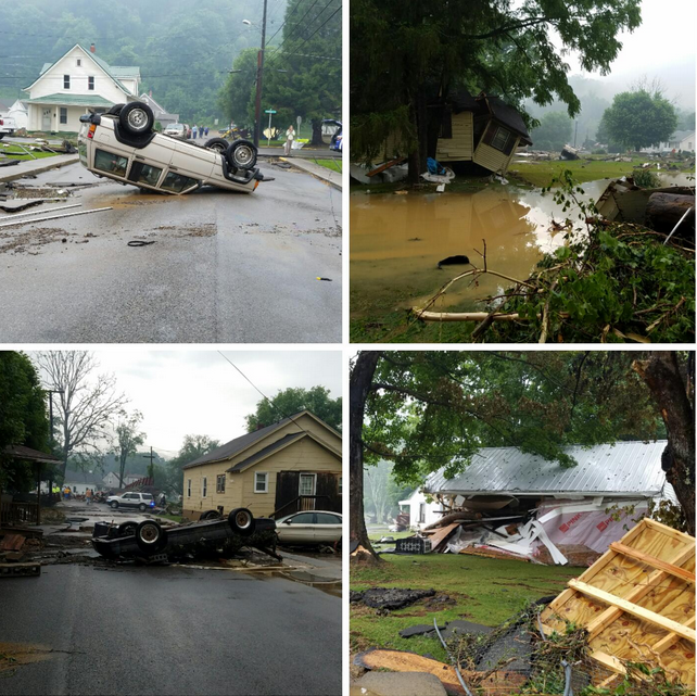
| Collage of flooding photos | Radar Loop |
Flooding
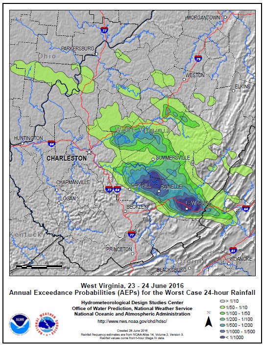
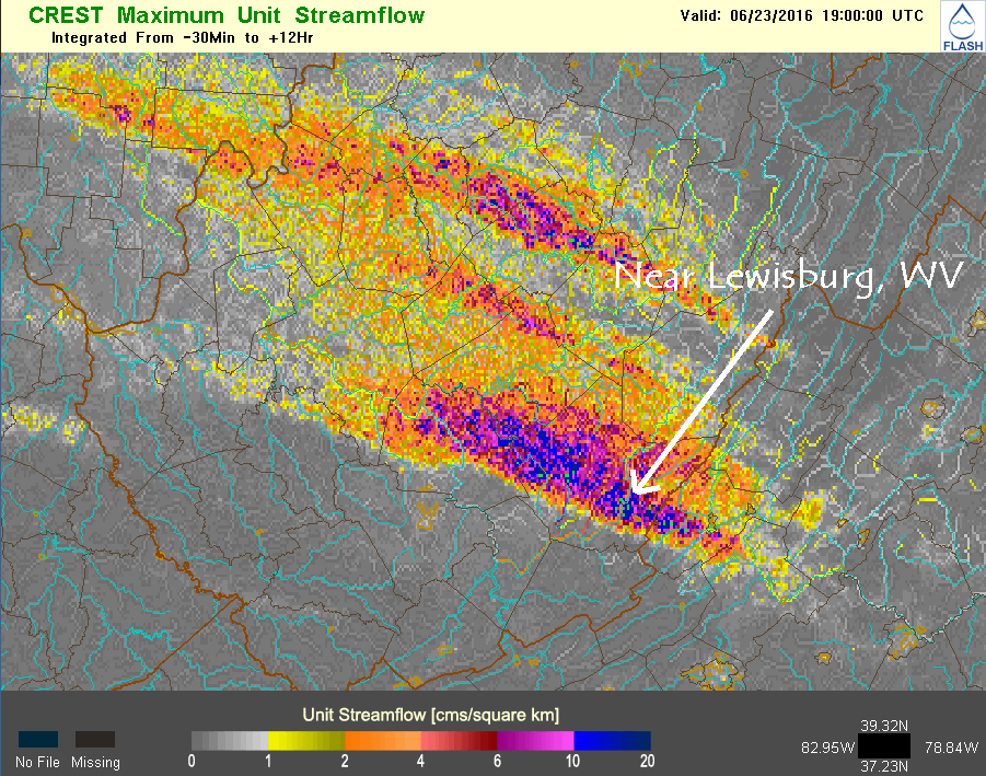
Approximately 8 to 10 inches of rain fell in less than a 12-hour period in the most severely impacted areas of Greenbrier County, WV. The probability of this amount of 24-hr rainfall occurring in any given year of about 1/1000 frequency of occurrence interval as analyzed by the Hydrometeorological Design Studies Center. The greatest weather-related weather impact in the Blacksburg county warning areas was due to flash flooding.
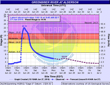
The Greenbrier River at Alderson, WV reached 22 feet, its 3rd highest on record. The last time it was this high was in January 1996 due to rain and snowmelt.
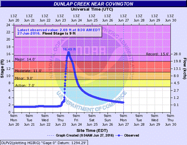
Record flooding at Dunlap Creek near Covington, Virginia (16.49 ft) occurred. The previous record was from Agnes remnants June 1972.
Hydrographs
 |
 |
||
| Greenbrier River at Alderson, WV | Dunlap Creek near Covington, VA |
Supporting Images
 |
 |
||
| Radar Totals Estimated by radar | Hydrometeorological Design Studies Center Annual Exceedance Probabilities (AEPs) for the Worst Case 24-hour Rainfall - WV 23-24 Jun |
Photos
Click on images to enlarge
 |
 |
 |
 |
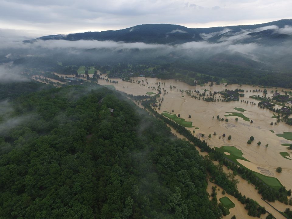
| Greenbrier WV Golf Course (Greenbrier Emergency Management) |
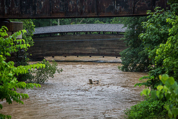
Humpback Bridge near Covington, VA |
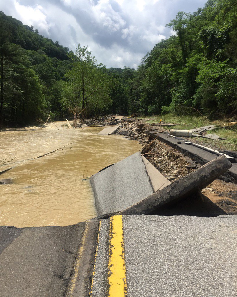
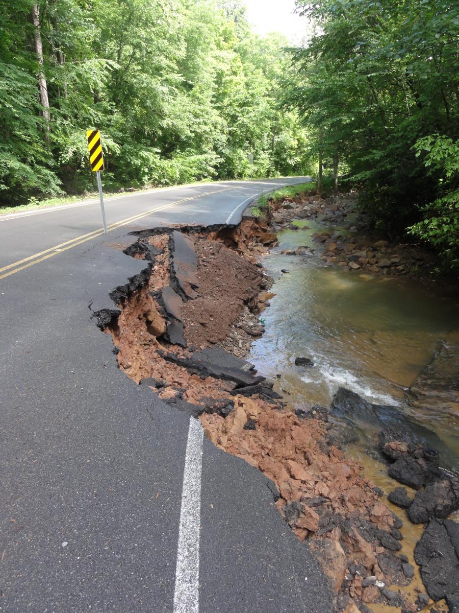
Route 60 Greenbrier County, WV |
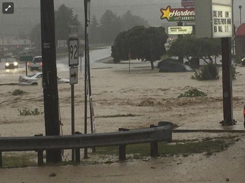
White Sulphur Springs, WV |
 |
 |
 |
 |
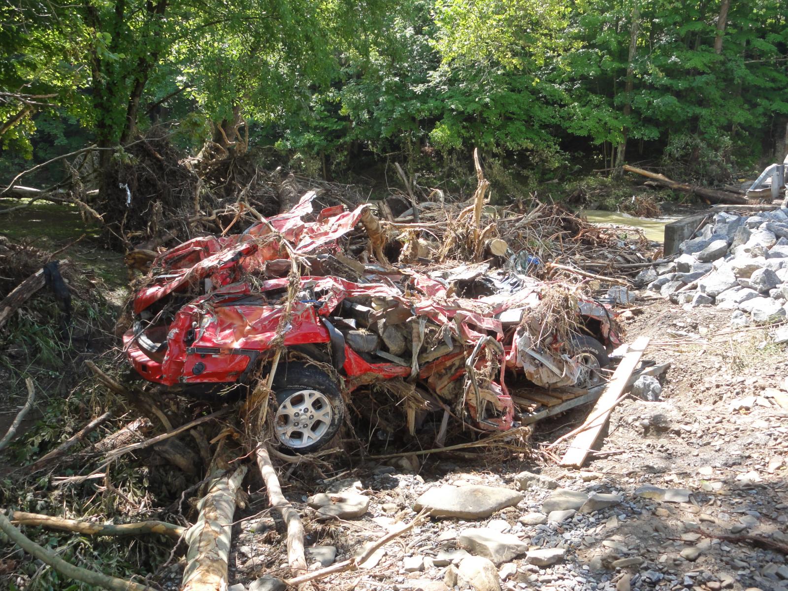
| Car destroyed along Howards Creek in Greenbrier County, WV | Highway 63 at Howard's Creek in Greenbrier County, WV |
flood damage in White Sulphur Springs, WV (via Matt Saffer tweet) |
1st tee at The Greenbrier Golf Course (via Bubba Watson tweet) |
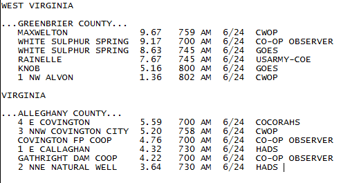
Rain Reports
Environment
 |
 |
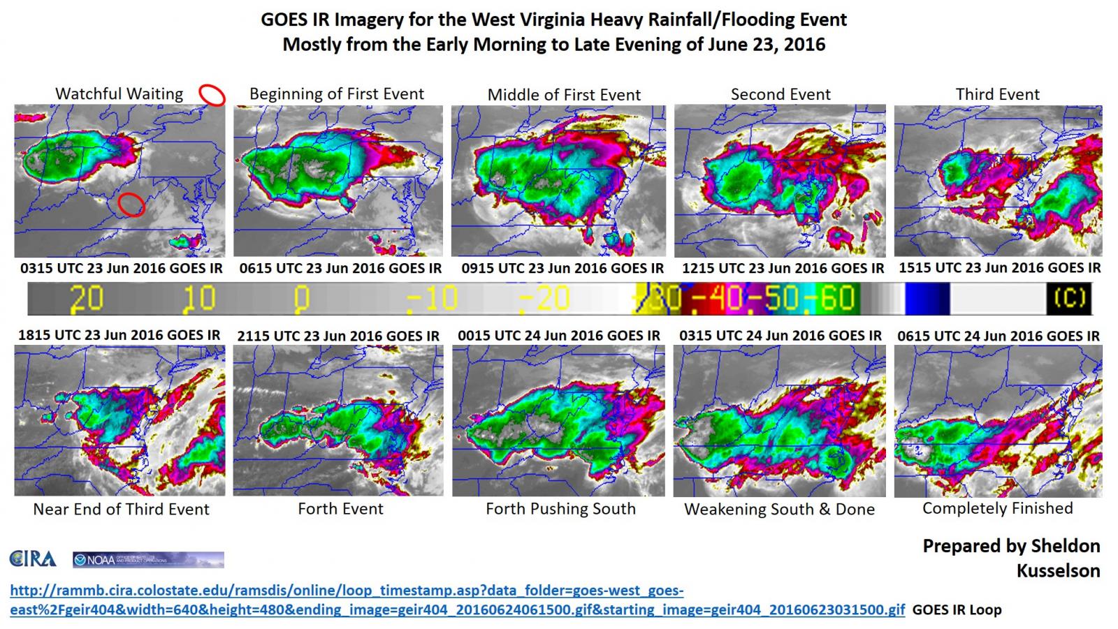 |
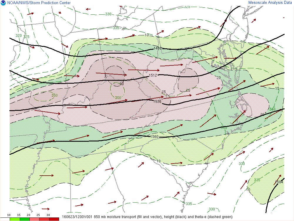
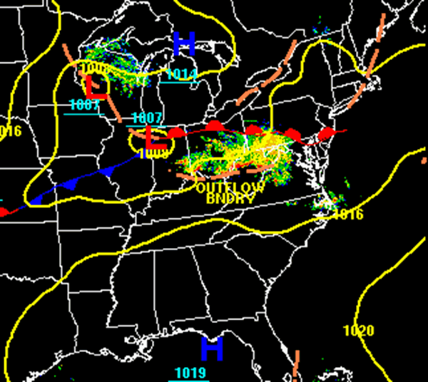
| Figure 1: Low-level transport of moisture was maximized over the Ohio Valley and central Appalachians | Figure 2: Frontal Analysis with radar at 2pm EDT June 23rd, 2017 | Figure 3: Sequence of GOES IR Satellite images from the evening of June 22 to early morning on June 24, showing multiple periods of intense thunderstorm activity moving over WV |
 |
||
| Figure 1: Low-level transport of moisture was maximized over the Ohio Valley and central Appalachians | F |
 |
Media use of NWS Web News Stories is encouraged! Please acknowledge the NWS as the source of any news information accessed from this site. |
|

