Overview
|
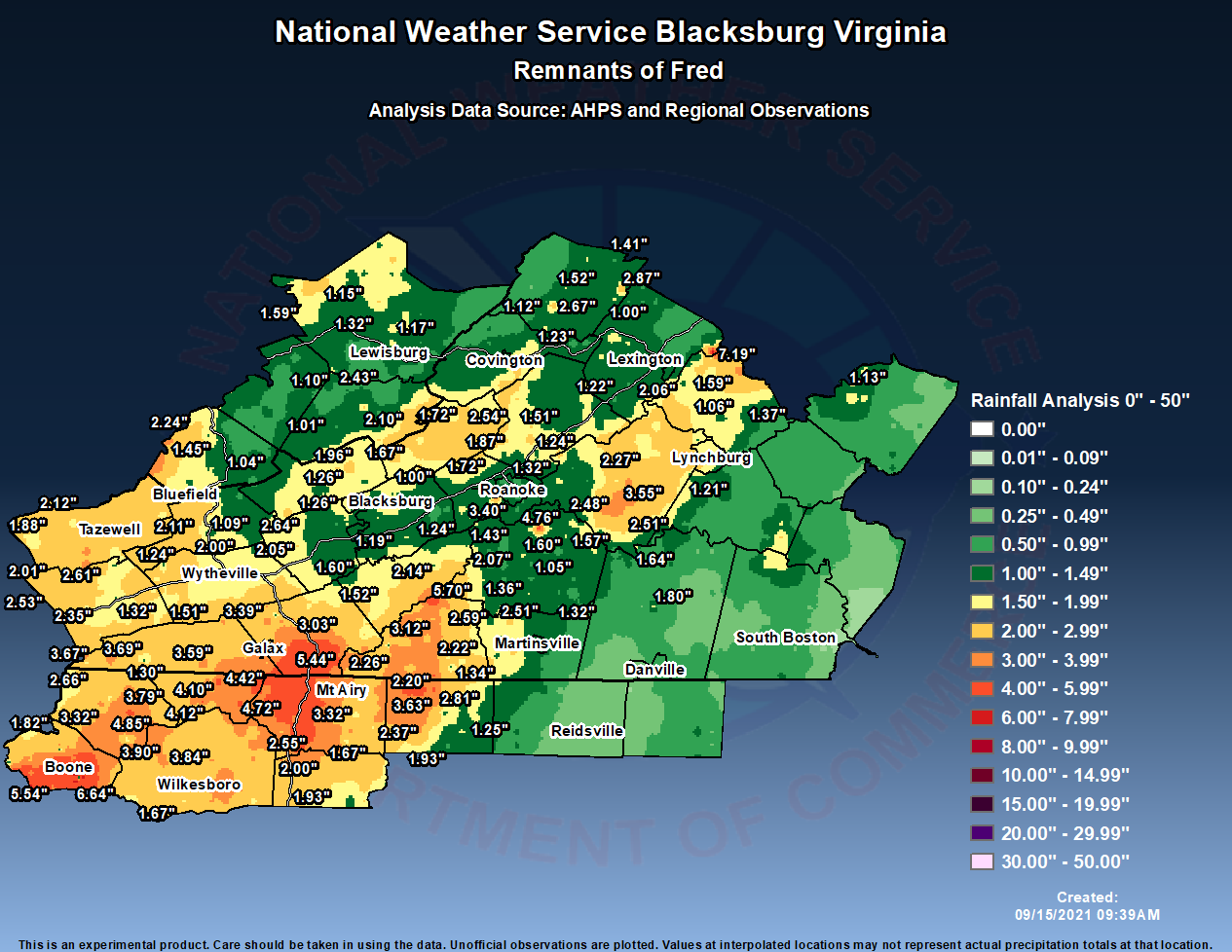
Remnants of Tropical Storm Fred moved north from the Gulf Coast states into the Central Appalachians, Aug 17th-18th. Our area was in a good environment conducive for brief tornadoes, with high shear in place. In addition, a south to southeast flow of high tropical moisture allowed for 2 to 6+ inches of rain to fall over portions of our area, especially in the North Carolina mountains. |
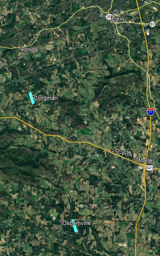 Two Tornado Tracks in Wilkes County, NC Aug 17 2021 |
 |
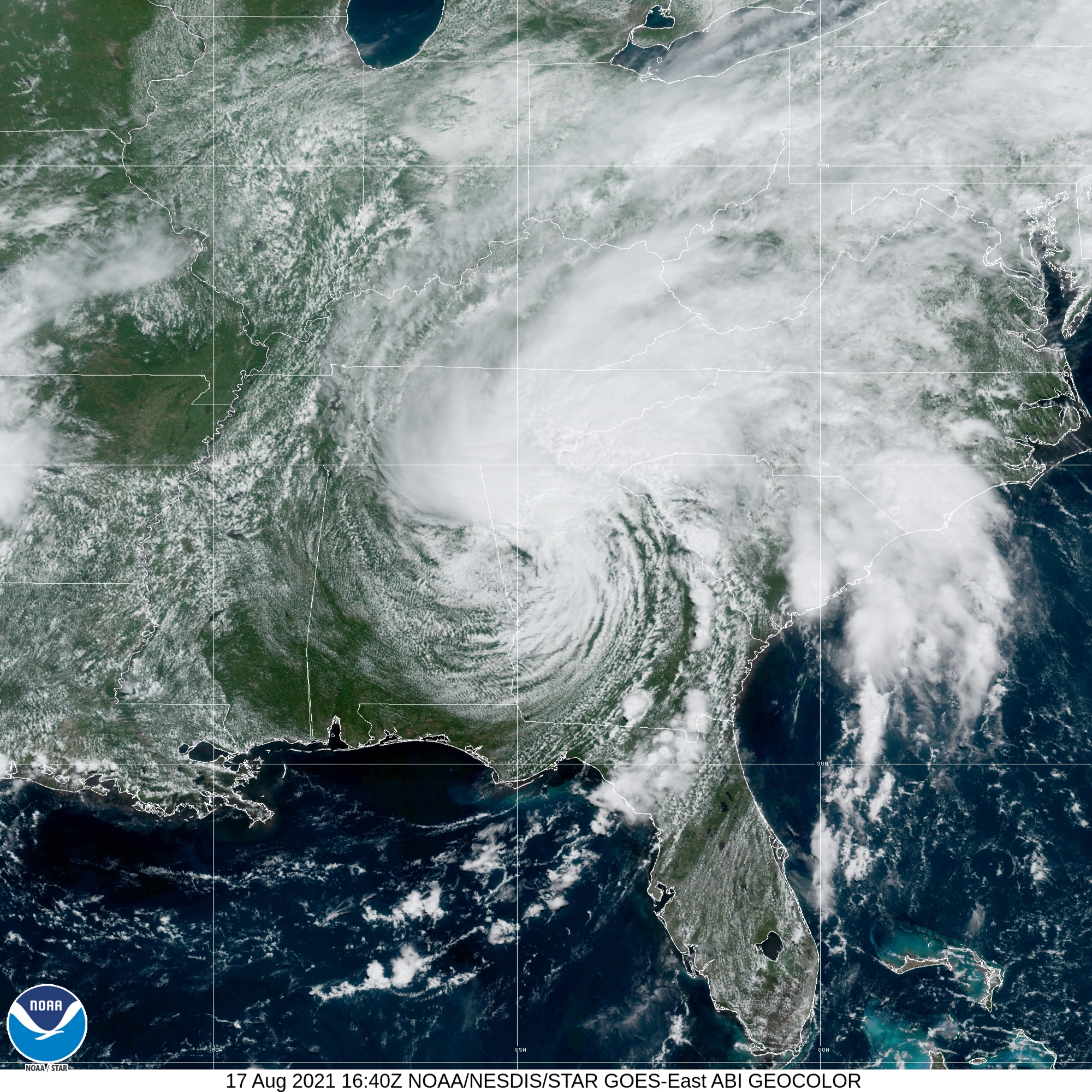 |
| Rainfall Totals From Fred | Satellite image Aug 17th, 2021 around 1pm EDT |
Tornadoes:
|
Tornado - Osbornville, NC
Track Map 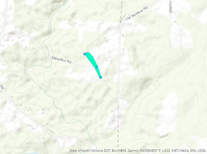 
|
||||||||||||||||
|
Tornado - Clingman, NC
Track Map 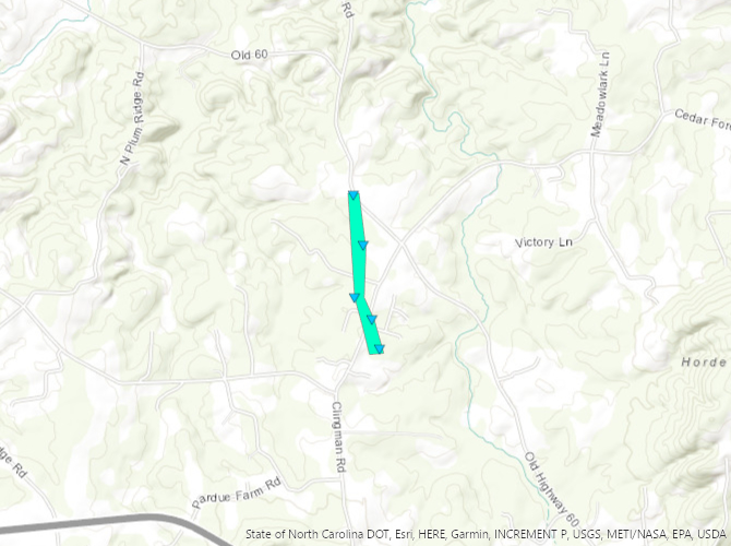
|
||||||||||||||||
The Enhanced Fujita (EF) Scale classifies tornadoes into the following categories:
| EF0 Weak 65-85 mph |
EF1 Moderate 86-110 mph |
EF2 Significant 111-135 mph |
EF3 Severe 136-165 mph |
EF4 Extreme 166-200 mph |
EF5 Catastrophic 200+ mph |
 |
|||||
 |
Media use of NWS Web News Stories is encouraged! Please acknowledge the NWS as the source of any news information accessed from this site. |
|

