This page provides information on significant weather occurring now or in the next couple of days.
If you are an Emergency Manager in need of weather forecast support for an event, please fill out the DSS Request Form.
In addition, our criteria for issuing watches, warnings, and advisories can be found here
The Tropical, Fire Weather and Winter Weather tabs will take you to separate web pages.
Current Conditions | Severe Thunderstorms | Rainfall/Precipitation | Rivers
Tropical | Fire Weather | Winter Weather | Heat/Drought
IMPORTANT: Be sure to check the date/time of the briefing as some or all of the briefing information may be old.
Graphical Hazardous Weather Outlook)Experimental graphical outlook for potential advisories, watches, and warnings in the next 7 days across our area |
 |
Current WatchesCurrent Severe Thunderstorm and Tornado Watches (issued by the Storm Prediction Center) |
 |
Current DiscussionsCurrent Mesoscale Discussions (issued by the Storm Prediction Center) |
|
|
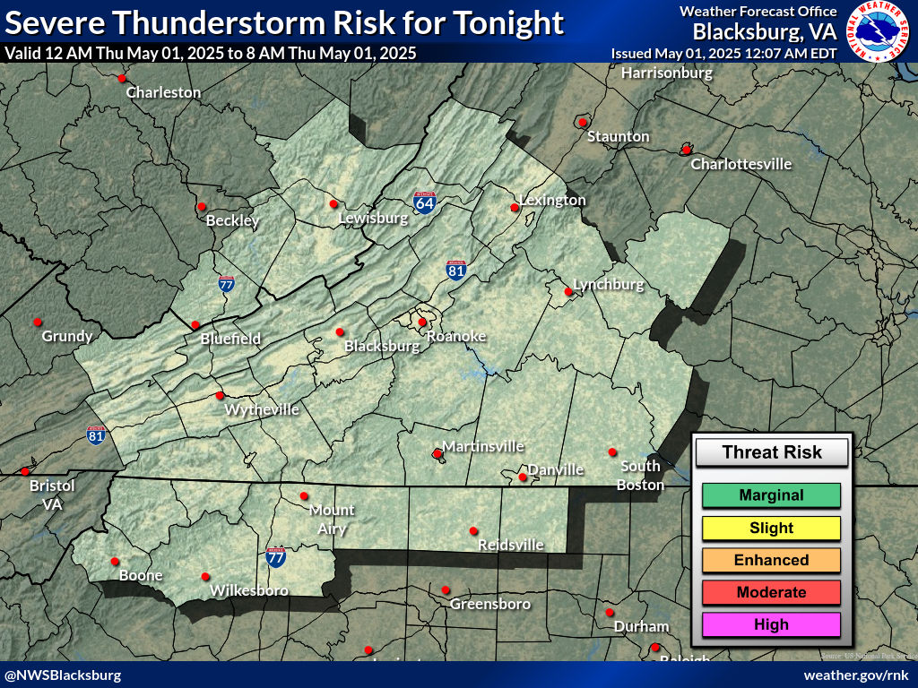
Severe Thunderstorm OutlooksOutlooks indicating the probability for severe thunderstorms (issued by the NWS Storm Prediction Center) Day 1 | Day 1 Tornado | Day 1 Hail | Day 1 Wind |
 |
Mesoscale AnalysisMesoscale analysis of current (and past) weather conditions (from the Storm Prediction Center) |
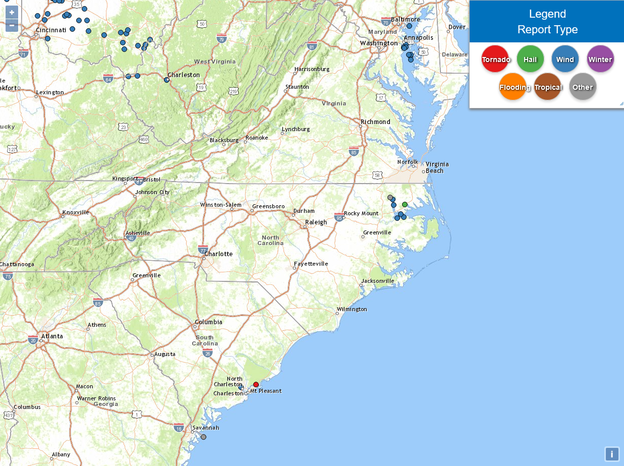 |
Storm ReportsPreliminary reports of tornadoes, hail and strong winds |
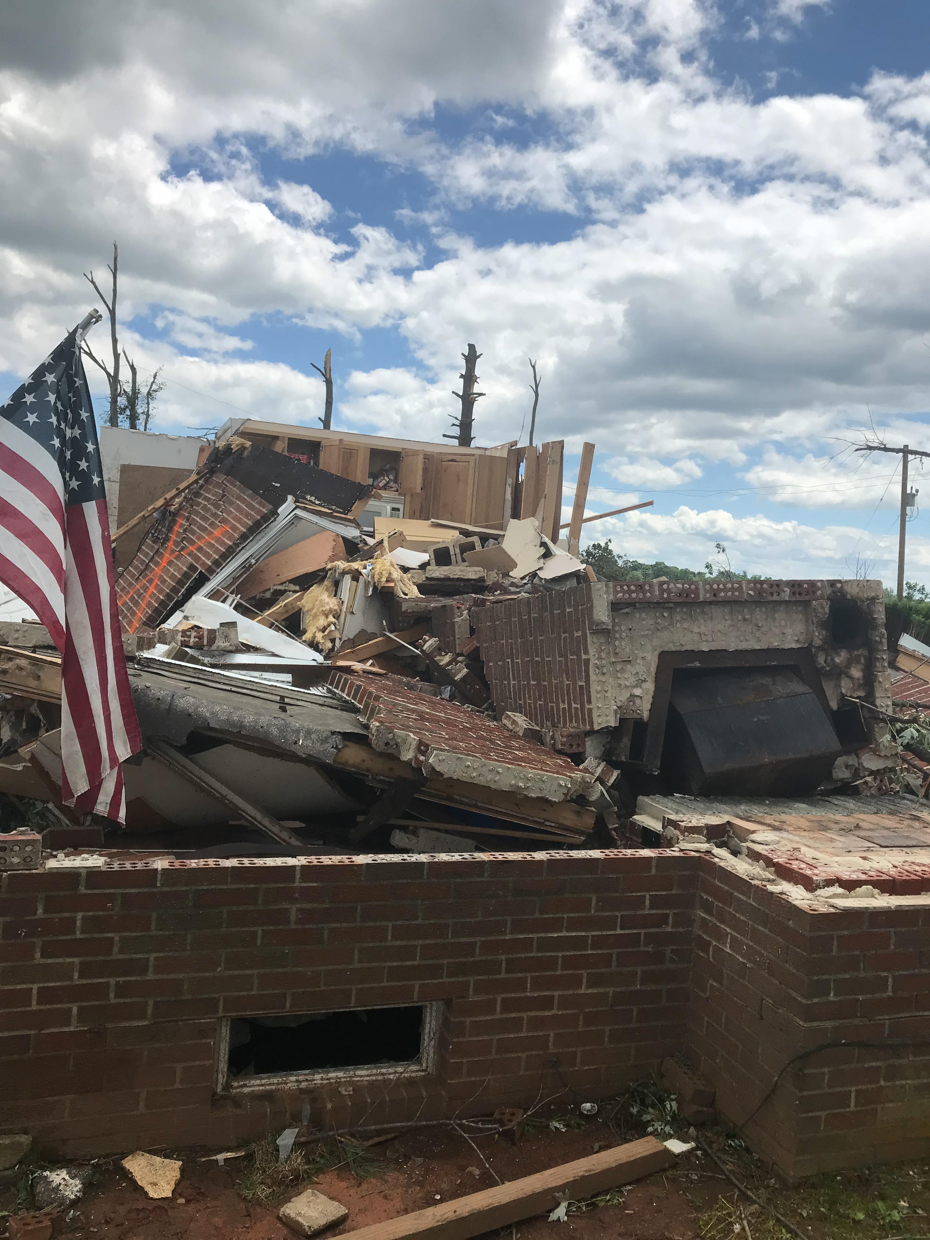 |
Report Severe Weather/Damage To Us
|
Special Weather Statement Issued: 07/22/2026 10:48:00 PM UTC
|
Days 1-4
|
||
|
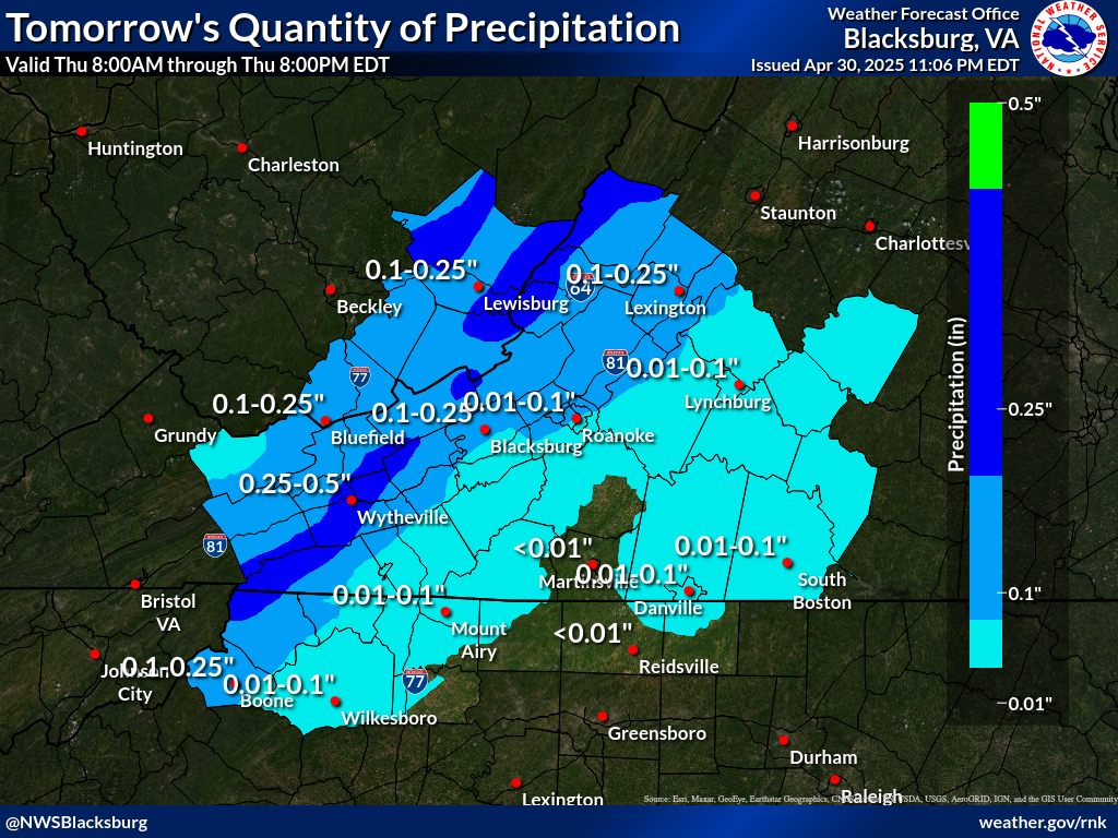
Today
 |
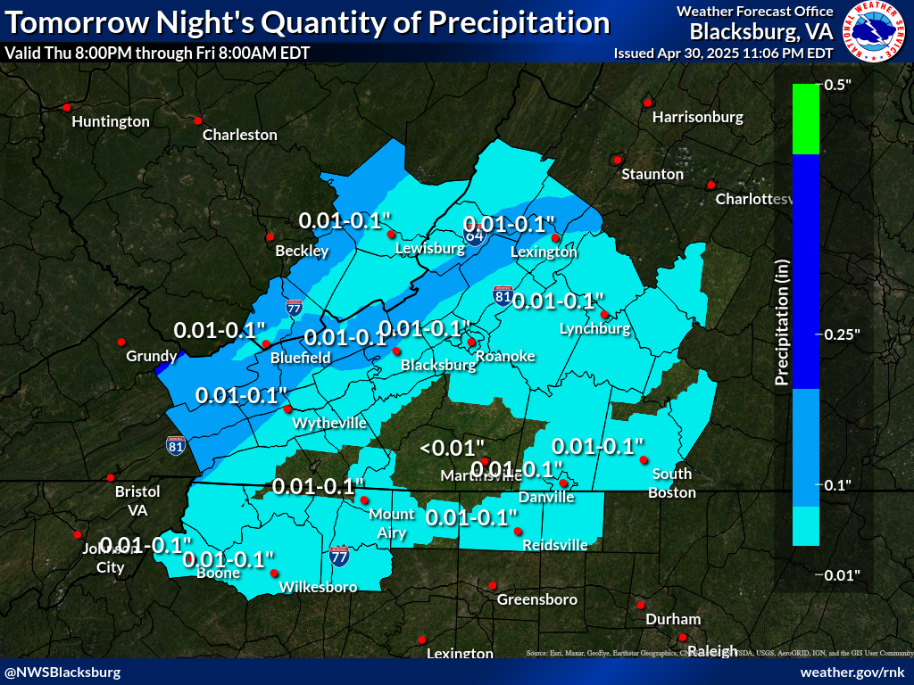
Tonight
 |
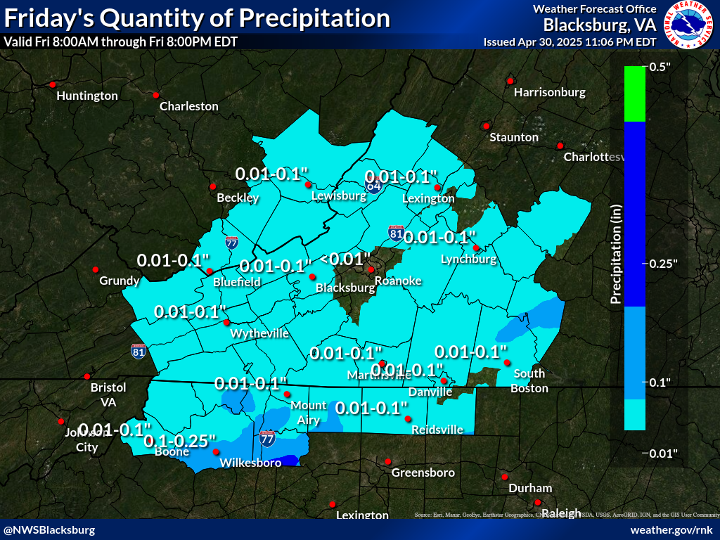
Day 2
 |
|
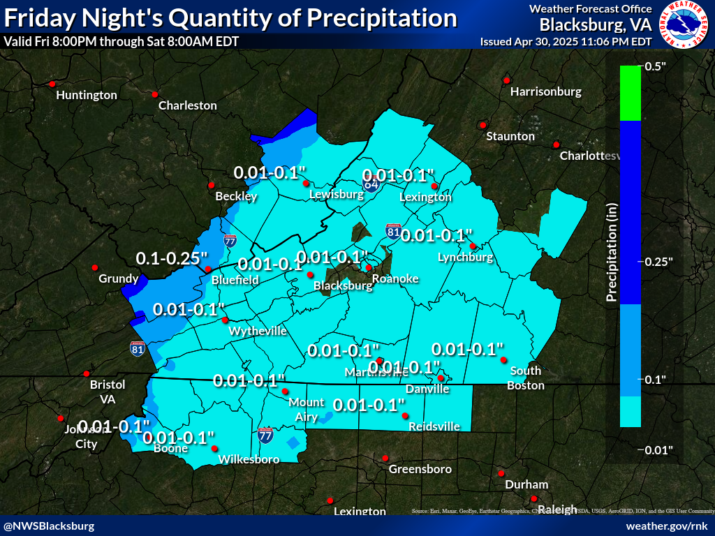
Days 2 Night
 |
Day 3
 |
Day 4
 |
|
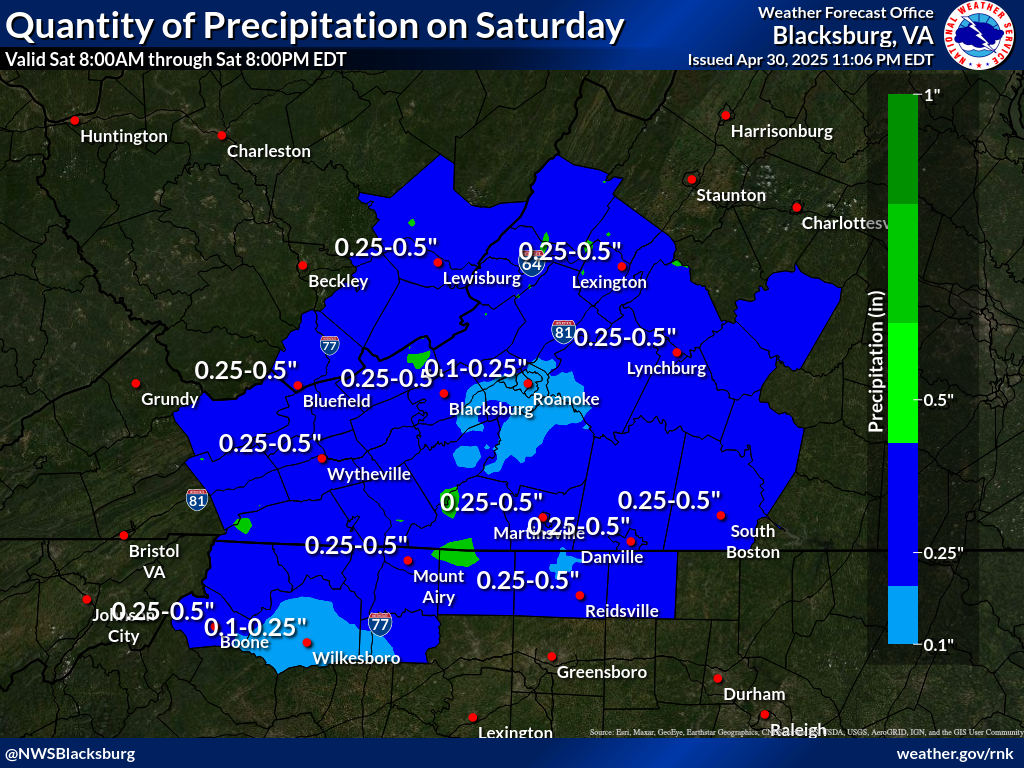
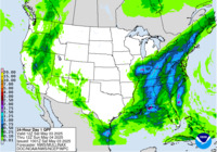
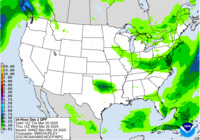
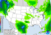
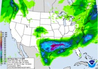
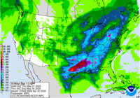
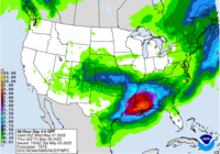
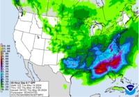
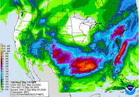
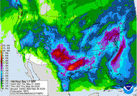
Quantitative Precipitation Forecasts from the Weather Prediction Center |
||
|
Day 1
 |
Day 2
 |
Day 3
 |
|
Days 1-2
 |
Days 1-3
 |
Days 4-5
 |
|
Days 6-7
 |
5-Day Total
 |
7-Day Total
 |
|
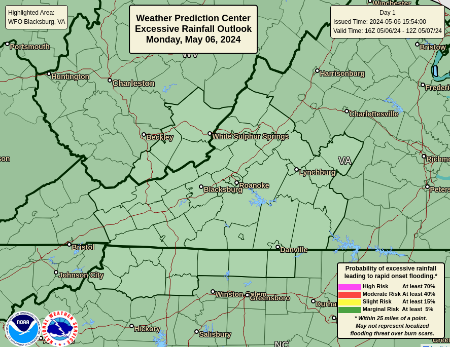
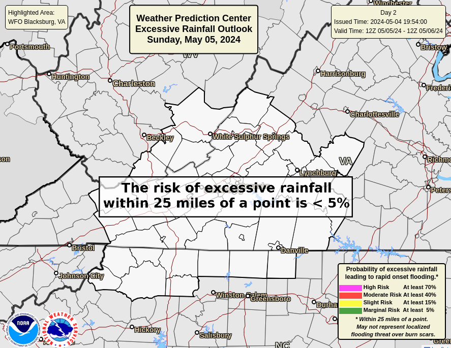
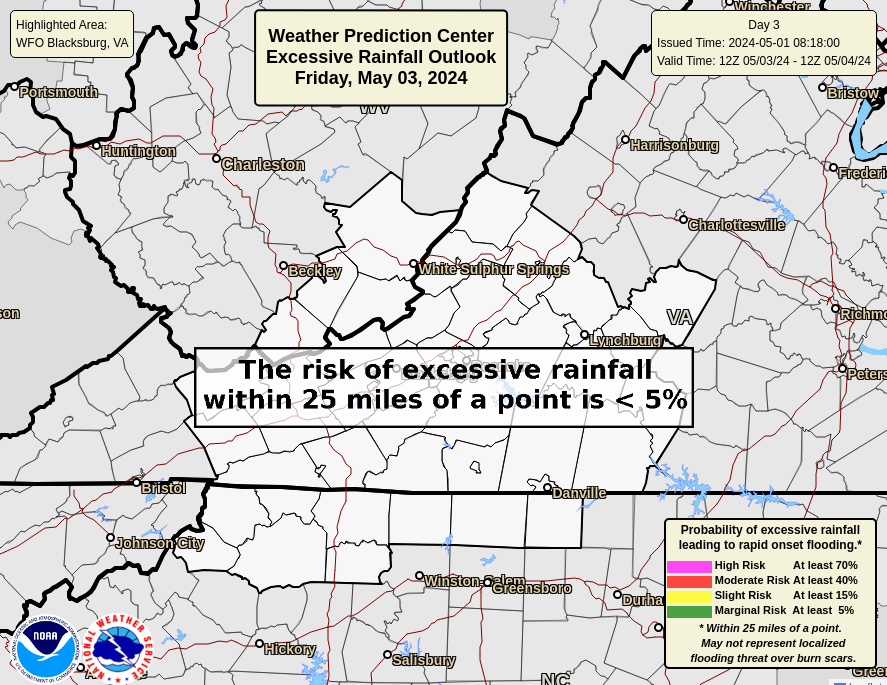
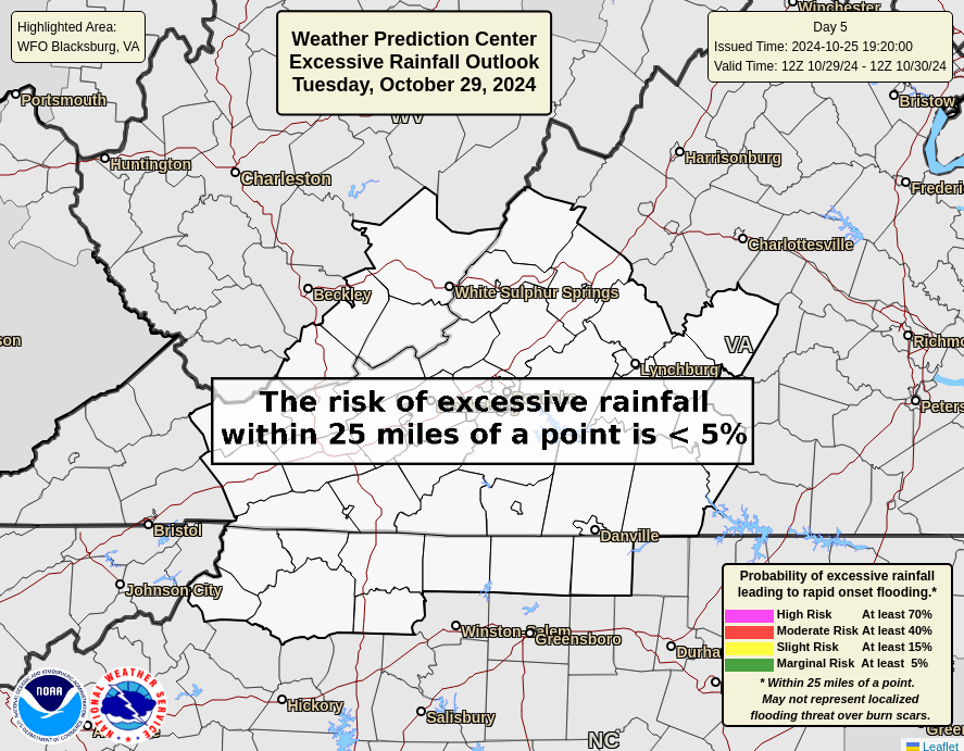
Excessive Rainfall Forecasts and Flooding Outlook from the Weather Prediction Center
|
||
|
Excessive Rainfall Day 1
 |
Excessive Rainfall Day 2
 |
Excessive Rainfall Day 3
 |
|
Excessive Rainfall Day 4
 |
Excessive Rainfall Day 5
 |
|
|
Flood Hazard Outlook
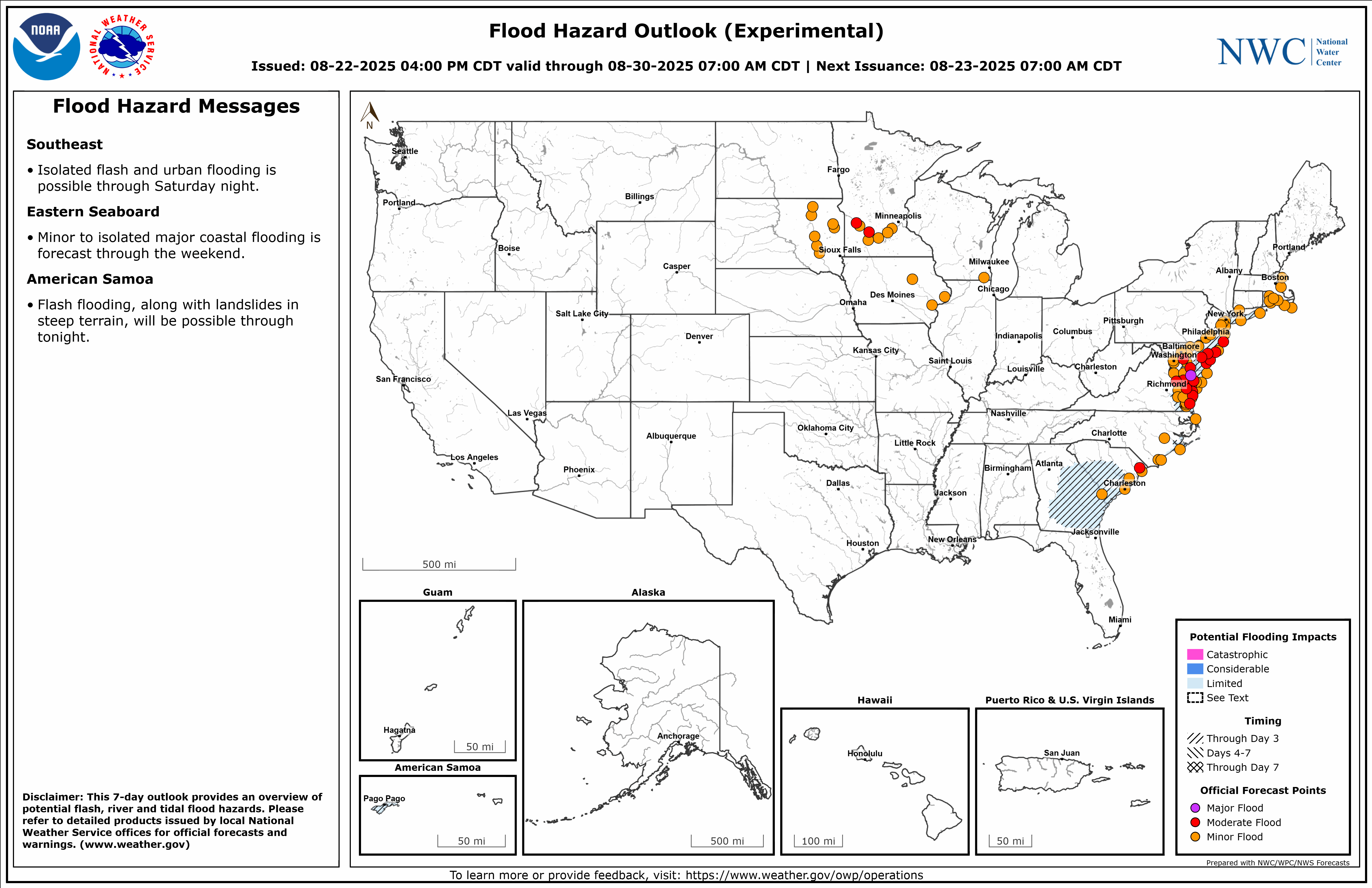 |
Flood Hazard Outlook
 |
 |
 |
Latest forecast text messages from WFO Blacksburg, VA:
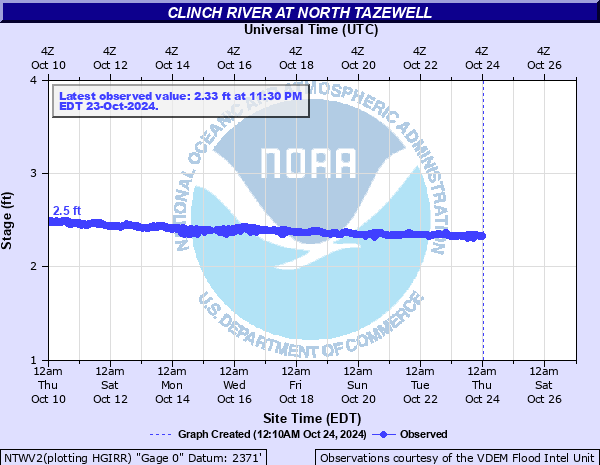
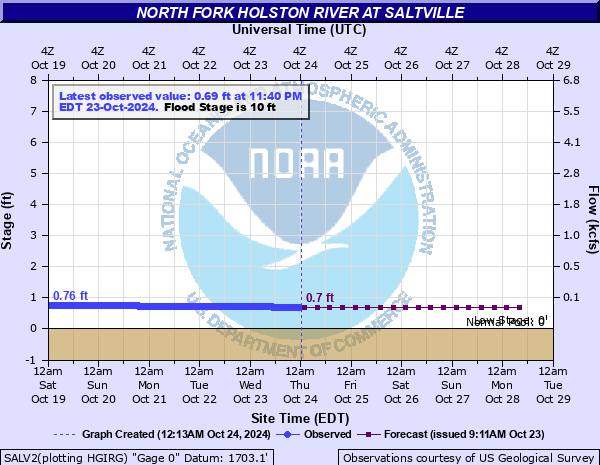
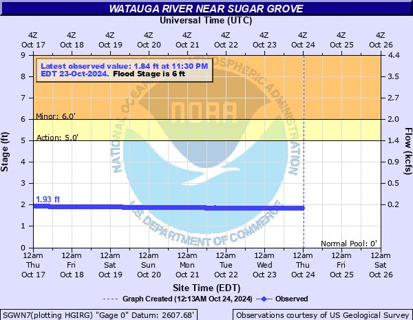
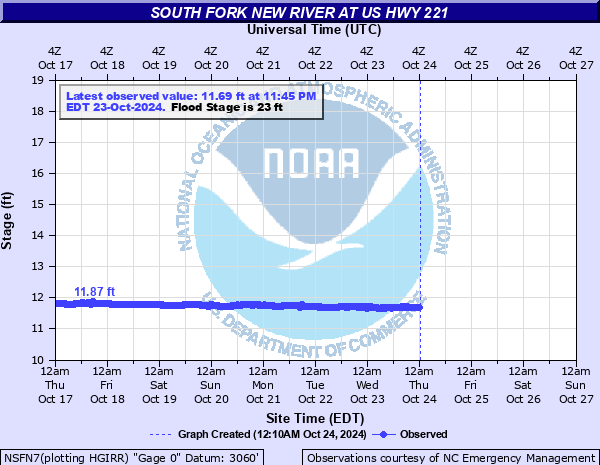
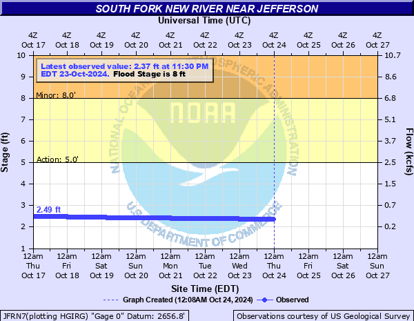
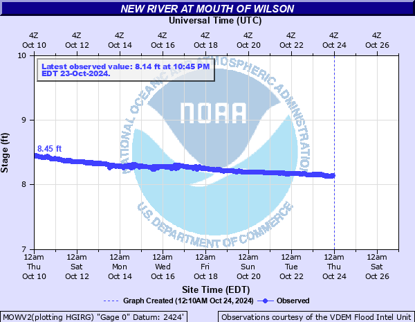
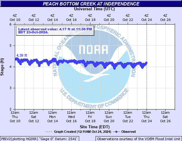
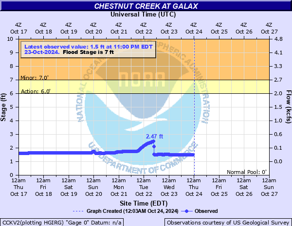
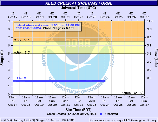
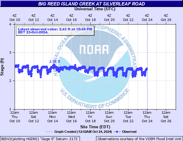
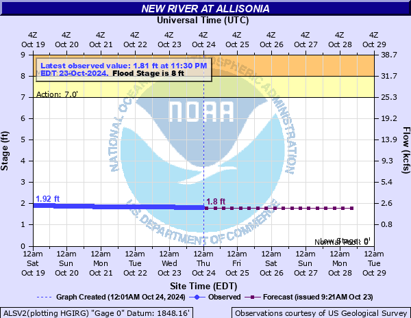
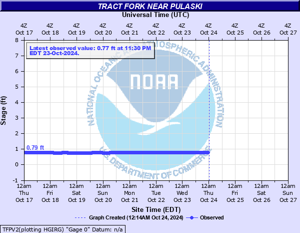
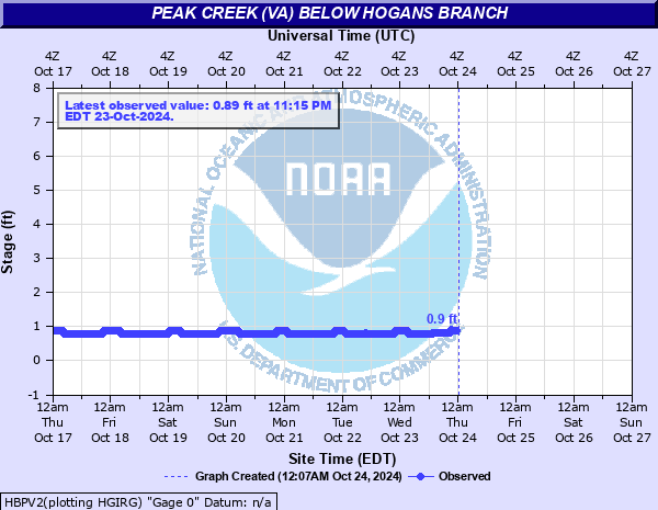
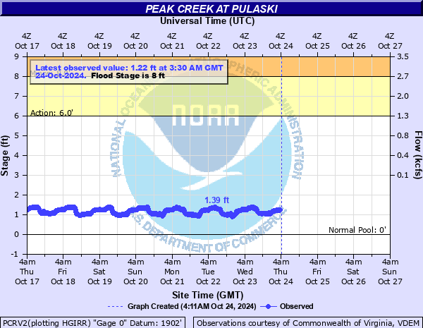
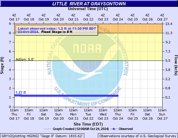
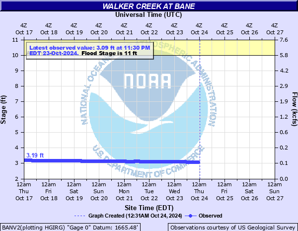
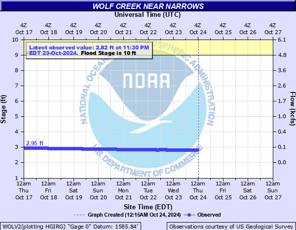
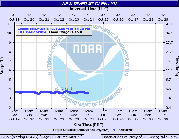
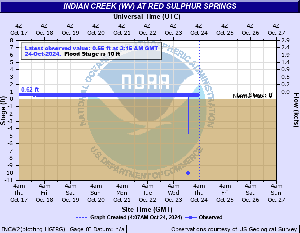
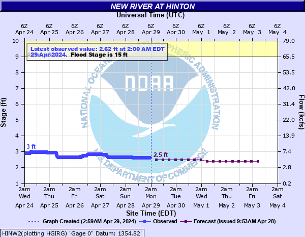
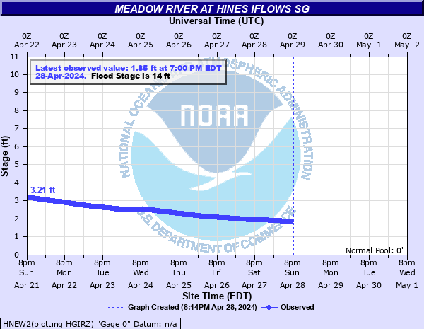
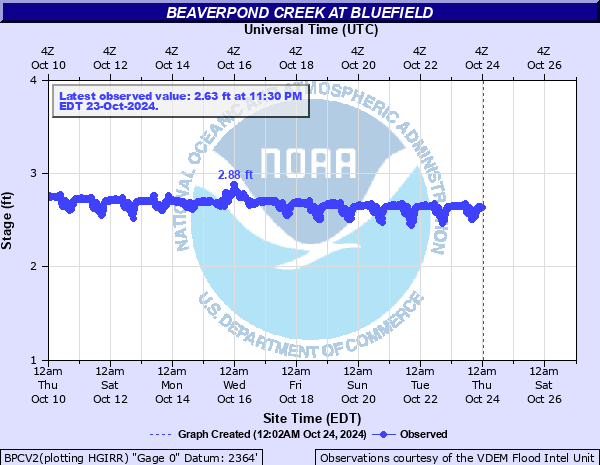
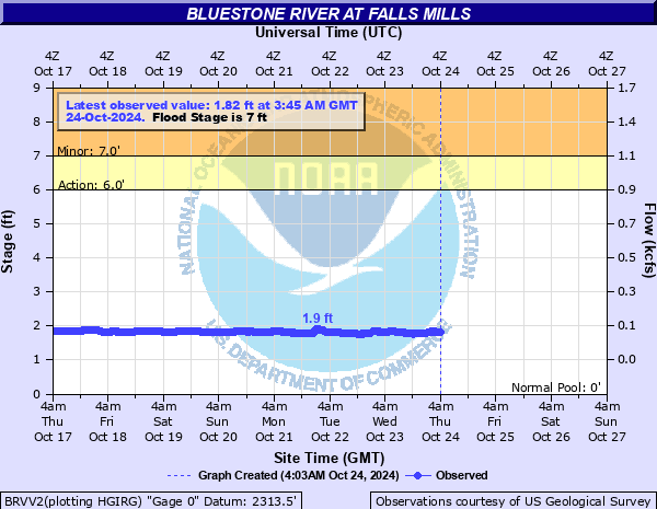
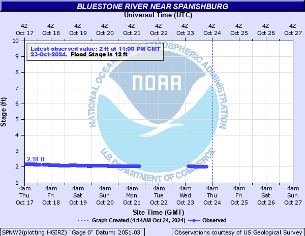
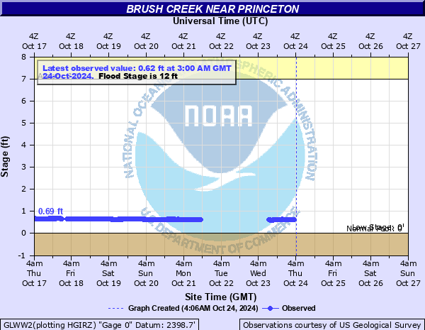
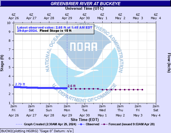
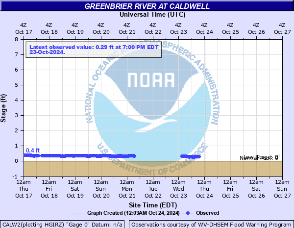
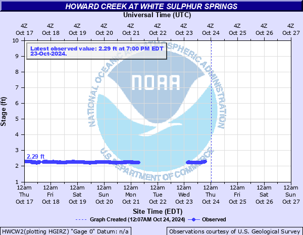
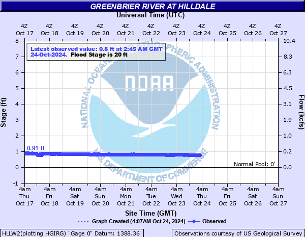
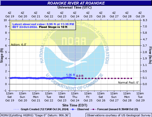
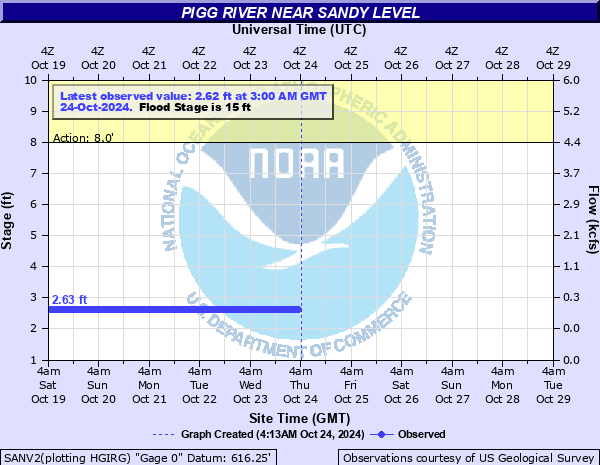
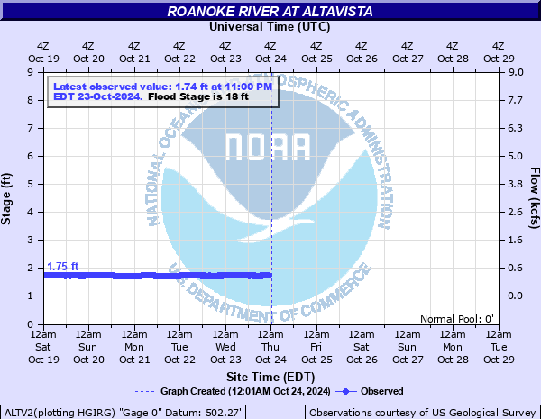
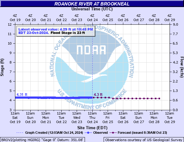
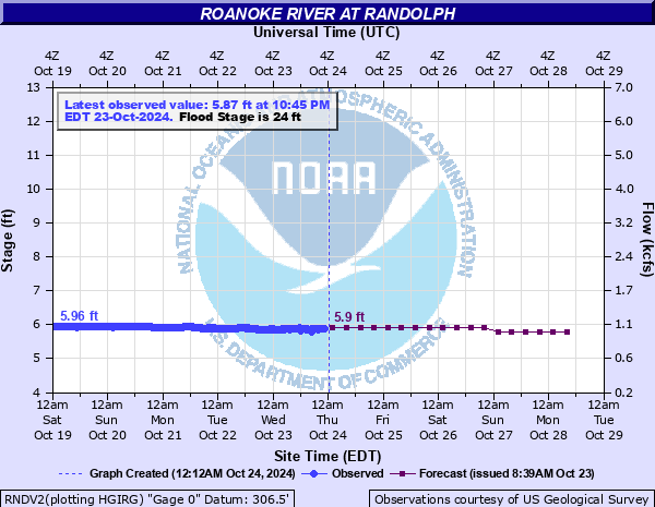
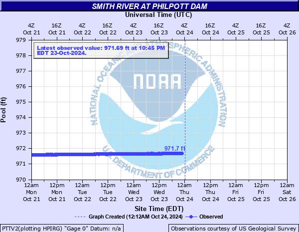
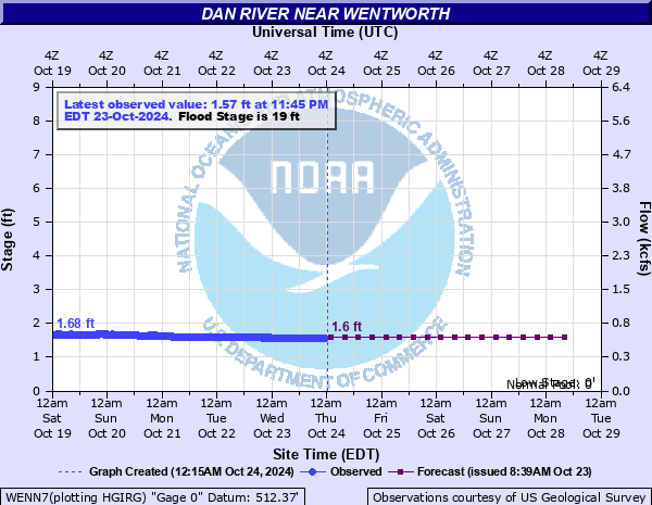
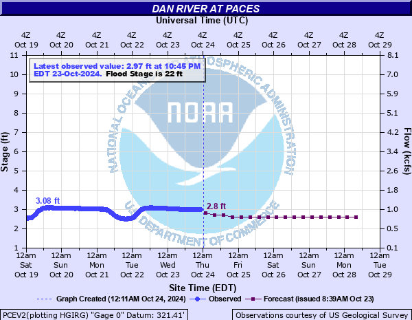
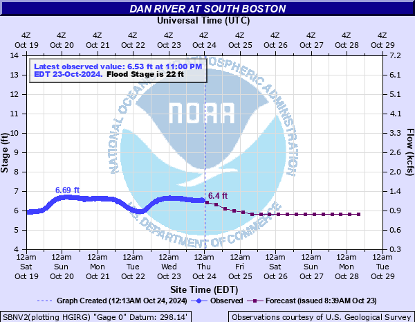
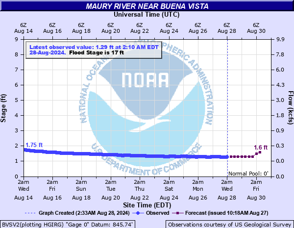
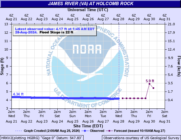
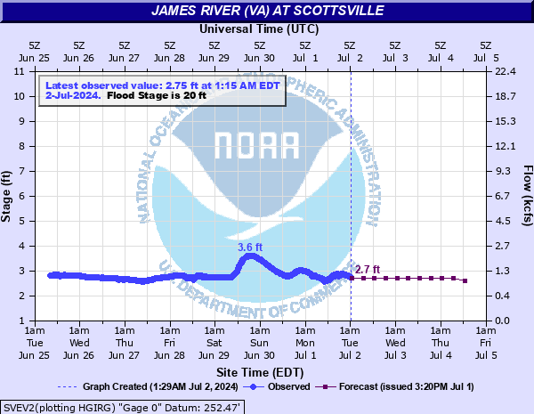
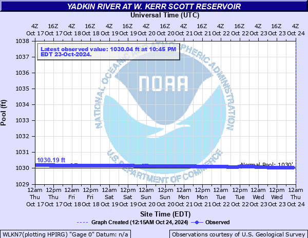
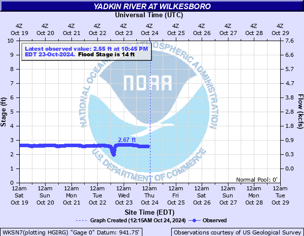
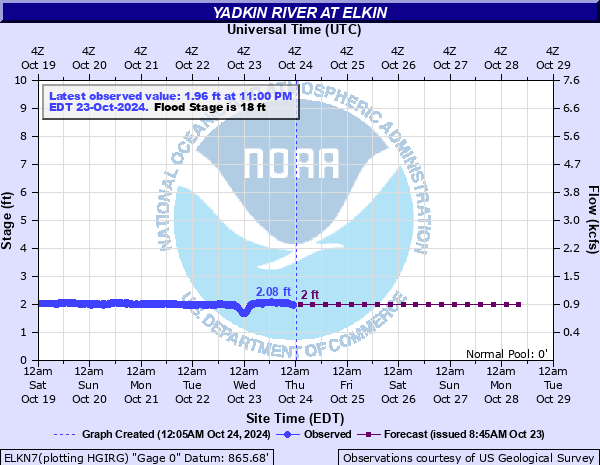
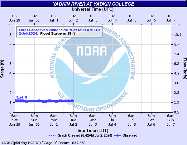
Hydrographs (showing stages and flows over time) are available through the National Water Prediction Service (NWPS) by clicking site names.
| River Conditions at: 9:00 PM EDT 07/23/2026 | |||||||||
Location |
Flood Stage (ft.) |
Observed (ft.) |
24-Hr Change |
Crest (ft.) | Forecast for 8.0 AM | ||||
| Fri. | Sat. | Sun. | Mon. | ||||||
| Tennessee River Basin | |||||||||
| - | 2.7 | -0.3 | - | - | - | - | - | ||
| 10.0 | 2.61 | -1.9 | 2.4 | 2.1 | 1.9 | 1.8 | 1.7 | ||
| 10.0 | 2.87 | -0.1 | 2.8 | 1.7 | 1.6 | 1.4 | 1.3 | ||
| - | - | - | - | - | - | - | - | ||
| 7.0 | 2.37 | -0.4 | - | - | - | - | - | ||
| 6.0 | - | - | - | - | - | - | - | ||
| New River Basin | |||||||||
| 23.0 | 7.12 | 0.0 | - | - | - | - | - | ||
| 8.0 | 2.21 | +0.2 | - | - | - | - | - | ||
| 18.0 | 4.67 | -0.6 | - | - | - | - | - | ||
| - | 8.15 | - | - | - | - | - | - | ||
| - | 4.12 | -0.5 | - | - | - | - | - | ||
| - | 4.17 | -0.3 | - | - | - | - | - | ||
| 9.0 | 1.82 | +0.4 | 1.3 | 1.2 | 1.1 | 1.1 | 1.0 | ||
| 7.0 | 1.53 | -0.5 | - | - | - | - | - | ||
| 16.0 | 3.24 | -0.4 | - | - | - | - | - | ||
| 6.5 | 2.19 | +0.1 | - | - | - | - | - | ||
| 7.0 | 2.82 | - | - | - | - | - | - | ||
| 8.0 | 2.16 | +0.4 | 2.0 | 1.7 | 1.6 | 1.5 | 1.4 | ||
| - | 0.84 | -0.3 | - | - | - | - | - | ||
| - | - | - | - | - | - | - | - | ||
| 8.0 | 1.29 | -0.2 | - | - | - | - | - | ||
| 8.0 | 1.64 | -0.3 | - | - | - | - | - | ||
| 14.0 | 2.91 | +0.4 | 3.0 | 2.6 | 2.5 | 2.4 | 2.3 | ||
| 11.0 | 4.05 | +0.8 | - | - | - | - | - | ||
| 10.0 | 3.46 | +0.4 | - | - | - | - | - | ||
| - | 6.03 | -0.2 | - | - | - | - | - | ||
| 9.0 | 3.4 | -0.5 | - | - | - | - | - | ||
| 15.0 | 4.79 | +1.5 | - | - | - | - | - | ||
| 10.0 | 0.7 | -0.2 | - | - | - | - | - | ||
| 15.0 | 2.44 | -0.1 | 2.5 | 2.2 | 2.0 | 2.0 | 2.1 | ||
| 14.0 | 5.9 | -2.6 | - | - | - | - | - | ||
| 14.0 | 4.18 | -1.8 | - | - | - | - | - | ||
| Bluestone River Basin | |||||||||
| - | 2.62 | -0.1 | - | - | - | - | - | ||
| 7.0 | 2.02 | -0.1 | - | - | - | - | - | ||
| 12.0 | 2.93 | -0.3 | - | - | - | - | - | ||
| - | 2.17 | -0.5 | - | - | - | - | - | ||
| 12.0 | 1.18 | -0.3 | - | - | - | - | - | ||
| 12.0 | 4.24 | -1.1 | - | - | - | - | - | ||
| Greenbrier River Basin | |||||||||
| - | 3.2 | -1.5 | 2.7 | 2.7 | 2.5 | 2.4 | 2.3 | ||
| 17.0 | 2.37 | +2.0 | - | - | - | - | - | ||
| 14.0 | 7.17 | -0.5 | - | - | - | - | - | ||
| - | 2.36 | +0.6 | - | - | - | - | - | ||
| - | 2.48 | -0.2 | - | - | - | - | - | ||
| 15.0 | 1.48 | +0.4 | - | - | - | - | - | ||
| 14.0 | 3.28 | - | 3.0 | 2.7 | 2.6 | 2.6 | 2.5 | ||
| 20.0 | 2.59 | +0.8 | - | - | - | - | - | ||
| Roanoke River Basin | |||||||||
| 10.0 | 1.37 | +0.3 | 1.2 | 0.9 | 0.9 | 0.8 | 0.8 | ||
| 15.0 | 3.25 | +0.2 | 3.2 | 2.7 | 2.7 | 2.6 | 2.6 | ||
| 18.0 | 1.72 | -0.2 | - | - | - | - | - | ||
| 23.0 | 4.39 | -0.2 | 4.3 | 4.0 | 4.1 | 4.0 | 4.0 | ||
| 24.0 | 6.15 | +1.0 | 6.1 | 5.6 | 5.3 | 5.2 | 5.2 | ||
| Dan River Basin | |||||||||
| - | 172.0 | - | - | - | - | - | - | ||
| 19.0 | 3.33 | +2.2 | 1.8 | 1.3 | 1.2 | 1.1 | 1.1 | ||
| 21.0 | 7.4 | +1.5 | 6.7 | 5.2 | 4.8 | 4.5 | 4.4 | ||
| 22.0 | 7.0 | +4.5 | 8.1 | 4.4 | 3.3 | 3.0 | 2.7 | ||
| 22.0 | 10.09 | +4.3 | 9.9 | 9.0 | 7.4 | 6.7 | 6.1 | ||
| James River Basin | |||||||||
| 17.0 | 5.07 | -0.1 | 4.9 | 4.9 | 4.9 | ||||
| 16.0 | 2.33 | -0.5 | 2.2 | 1.9 | 1.9 | ||||
| 17.0 | 2.76 | -0.3 | 2.8 | 2.3 | 2.3 | ||||
| 17.0 | 1.33 | -0.1 | 1.4 | 1.3 | 1.3 | ||||
| 22.0 | 4.73 | +0.2 | 4.7 | 4.3 | 4.3 | ||||
| 16.0 | 3.39 | -0.1 | 3.3 | 3.2 | 2.9 | ||||
| 20.0 | 3.63 | +0.1 | 3.5 | 3.5 | 3.2 | ||||
| Yadkin River Basin | |||||||||
| - | 416.0 | - | - | - | - | - | - | ||
| 14.0 | 2.19 | -0.2 | 2.2 | 2.1 | 2.1 | 2.1 | 2.1 | ||
| 18.0 | 1.63 | -0.3 | 1.5 | 1.1 | 1.2 | 1.2 | 1.1 | ||
| 18.0 | 5.73 | +4.9 | 8.1 | 2.7 | 1.4 | 1.3 | 1.2 | ||
| Drought Information From the Climate Prediction Center | ||
|
National Drought Impacts
 |
Monthly Outlook
 |
Seasonal Outlook
 |
|
Palmer Drought Index
 |
Crop Moisture Index
 |
Calculated Soil Moisture
 |


