
A Moderate Risk of severe thunderstorms (level 4 of 5) is in the outlook across portions of the Midwest today. Damaging winds, a few tornadoes and frequent lightning with heavy rainfall are in the forecast. Meanwhile, dangerous heat across the southern Plains into the Great Lakes, mid-Atlantic and Northeast will expand into Friday. Risk for wildfires for the central Rockies and Sacramento Valley. Read More >
Southeast RFC
River Forecast Center
SERFC River Flood Summary: Minor: 0 (0%)
Moderate: 0 (0%)
Major: 0 (0%)
Use the map below to view forecast locations experiencing flooding and link to detailed forecast information.
US Dept of Commerce
National Oceanic and Atmospheric Administration
National Weather Service
Southeast RFC
4 Falcon Drive
Peachtree City, GA 30269
770-486-0028
Comments? Questions? Please Contact Us.


 Precipitation for past 24 hours
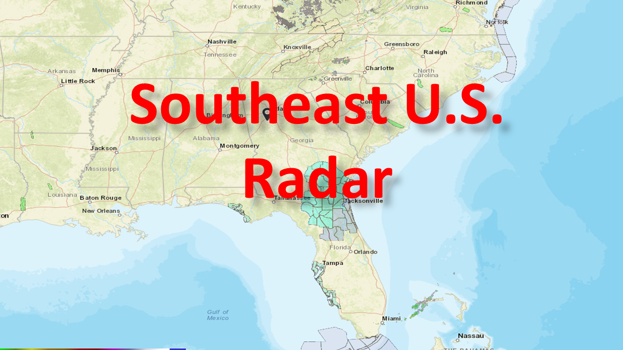 Current Southeast U.S. Radar
 Forecast precipitation for next 48 hours
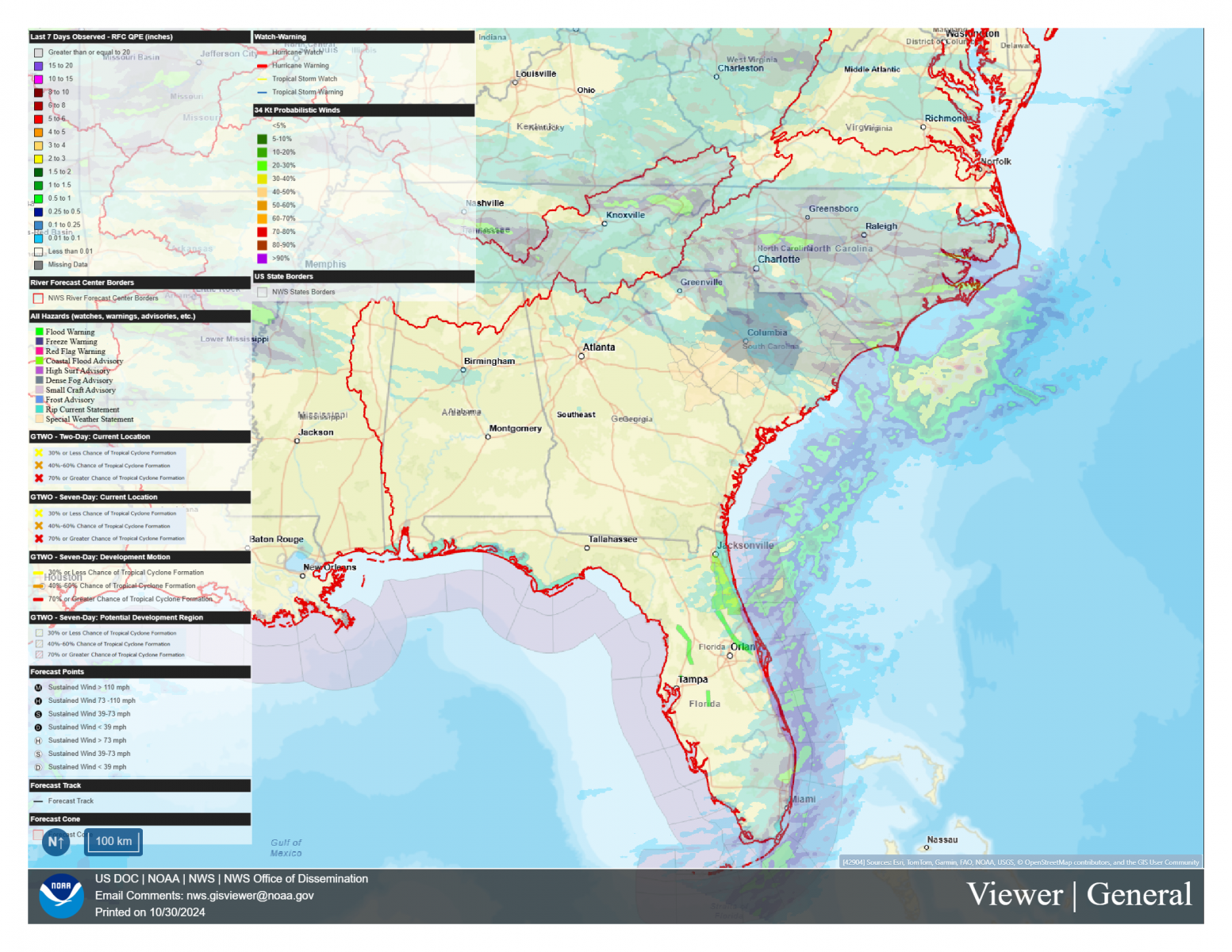 NWS GIS Viewer
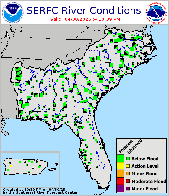 Legacy SERFC status map
 Southeast U.S. Drought Monitor