National Weather Service United States Department of Commerce

Severe Thunderstorms in the Northern Plains; Heavy Rainfall in the Mississippi and Tennessee Valleys; Critical Fire Weather in the Southwest

Severe thunderstorms, with a significant wind threat, will continue through tonight across the northern Plains. Wind gusts of 60 to 100 mph are possible. Heavy rainfall will continue through tonight from Oklahoma into Missouri, and in the Tennessee Valley through Monday. Critical fire weather conditions continue in the Southwest through Tuesday. Read More >

NWS Seattle

Weather Briefing & Outlook

Decision Support Services for Western Washington

Register for Email Briefings

Situation Briefing

These briefings are updated when significant weather is expected.
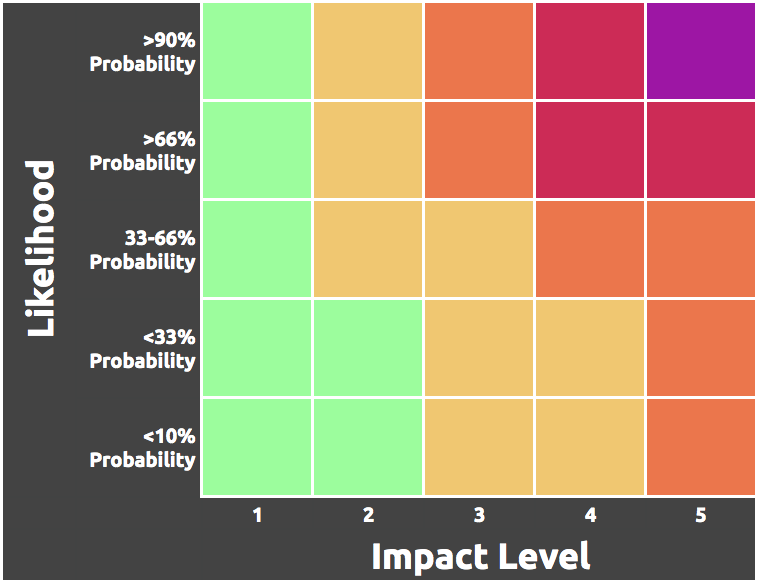
 

Weather Risk Matrix


Special Events Briefings

Access active briefings and view live status updates below. This page will be operational from June 5 - July 19, 2026. Please note that not all briefings are updated daily. Briefings for Fan Zones and other local events are issued daily for the 3 days leading up to an activation date. These briefings and more information may also be accessed via the NWS Washington Special Events Dashboard.

Briefing Focus Last Updated Status

How We Determine Risk

Weather Risk Outlook colors are determined by examining both the impact level and the associated probability of potential scenarios.
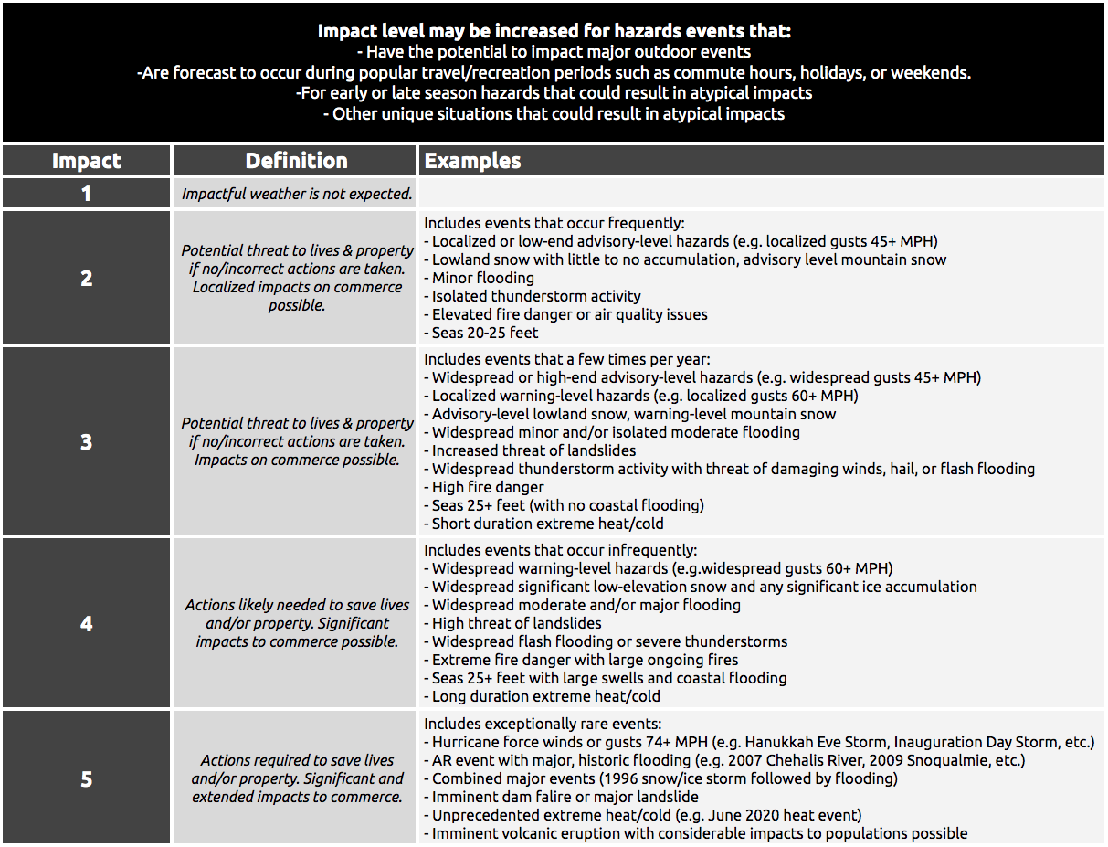
1 Impact Assessment

WRO Impact Matrix

2 Risk Level Calculation

WRO Color Matrix

Warning, Watch & Advisory Criteria

Definitions and thresholds for Western Washington.

Download Criteria (PDF)

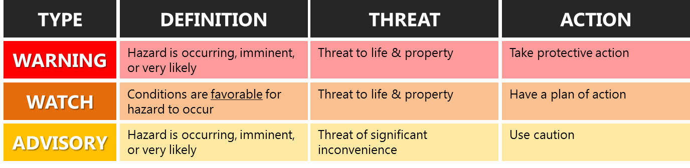
Hazard Classification

Weather Hazards