
A frontal boundary extending from the western High Plains to the Southeast will focus additional showers and thunderstorms this weekend. Some of these storms may become severe, alongside frequent lightning, and isolated instances of flash flooding. Meanwhile dry conditions will continue for the Great Basin where fire weather concerns linger. For the mid-Atlantic and Northeast, seasonable weather. Read More >
Seattle/Tacoma, WA
Weather Forecast Office
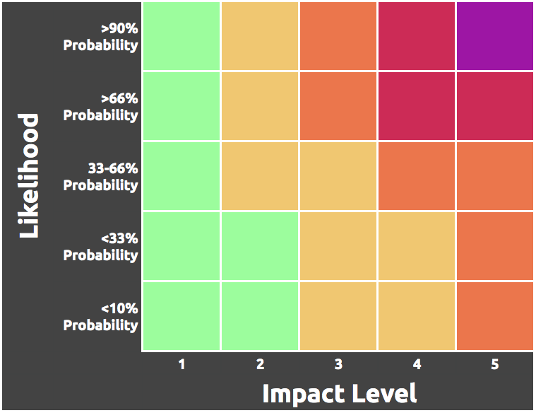
The Weather Risk Outlook colors are determined after NWS Seattle meteorologists examine both the impact level of potential weather scenarios AND the associated probability of those scenarios. The resulting outlook displays the highest risk for each day.
NWS Seattle meteorologists first use the impact table to determine the level of impact expected with a forecast weather event.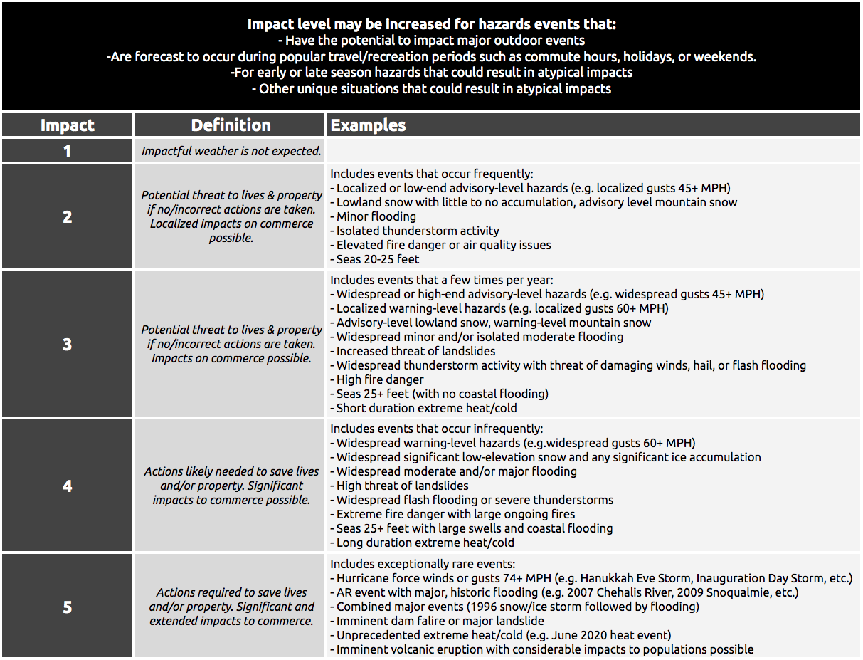
NWS Seattle meteorologists then determine the color by determining the probability of occurrence using all the available information and then reference the matrix to determine the risk level associated with the forecast weather event.
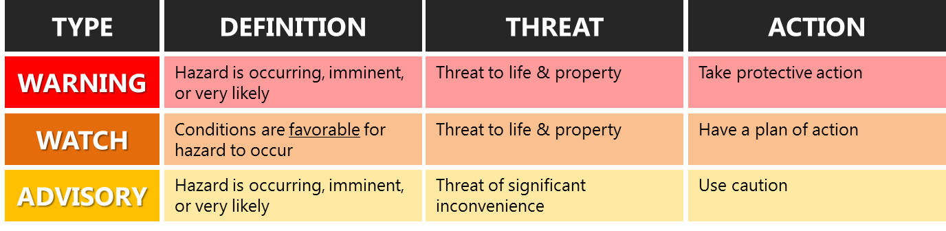
NWS Seattle Warning, Watch, Advisory Criteria (not all links in this download will work)
US Dept of Commerce
National Oceanic and Atmospheric Administration
National Weather Service
Seattle/Tacoma, WA
7600 Sand Point Way NE
Seattle, WA 98115-6349
(206) 526-6087
Comments? Questions? Please Contact Us.

