
Dangerous and extreme heat will remain across portions of the southern U.S. through the weekend. A heat wave over the Southwest U.S. will intensify this week, peaking and expanding into the Intermountain West and northern High Plains this weekend. Multiple rounds of thunderstorms will produce heavy to excessive rainfall with significant flash flooding across portions of southern New England. Read More >
| Local Discussions, Zones, and other Forecast Products | ||||||||||||||||||||||||||||||||||||||||||||||||||||||
|
||||||||||||||||||||||||||||||||||||||||||||||||||||||
| NWS Glossary of Terms and Contractions | ||||||||||||||||||||||||||||||||||||||||||||||||||||||
| Digital Weather Grids, Local and Regional Scales (for states/locations not listed, select national view) |
||||||||||||||||||||||||||||||||||||||||||||||||||||||
|
||||||||||||||||||||||||||||||||||||||||||||||||||||||
Other Unique Forecast Discussions
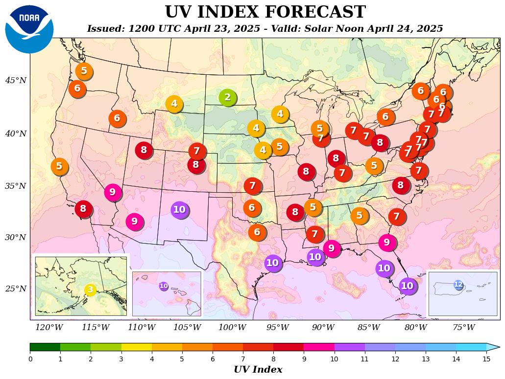
UV Index Forecasts: graphic map. |
||||||||||||||||||||||||||||||||||||||||||||||||||||||

