National Weather Service United States Department of Commerce

Severe Thunderstorms, Heavy Rainfall and Dangerous Heat

Severe thunderstorms are expected today and Friday from the upper Midwest, central Great Lakes into the Ohio and mid-Mississippi Valley's. In addition, heavy rainfall threat increases on Friday across the Ohio Valley. Meanwhile, early summer-like heat wave across portions of southern Texas with new daily records are forecast today and through the weekend; The heat spreads across the Gulf States. Read More >

Click a location below for detailed forecast.

Last Map Update: Fri, May 16, 2025 at 2:18:39 am AST

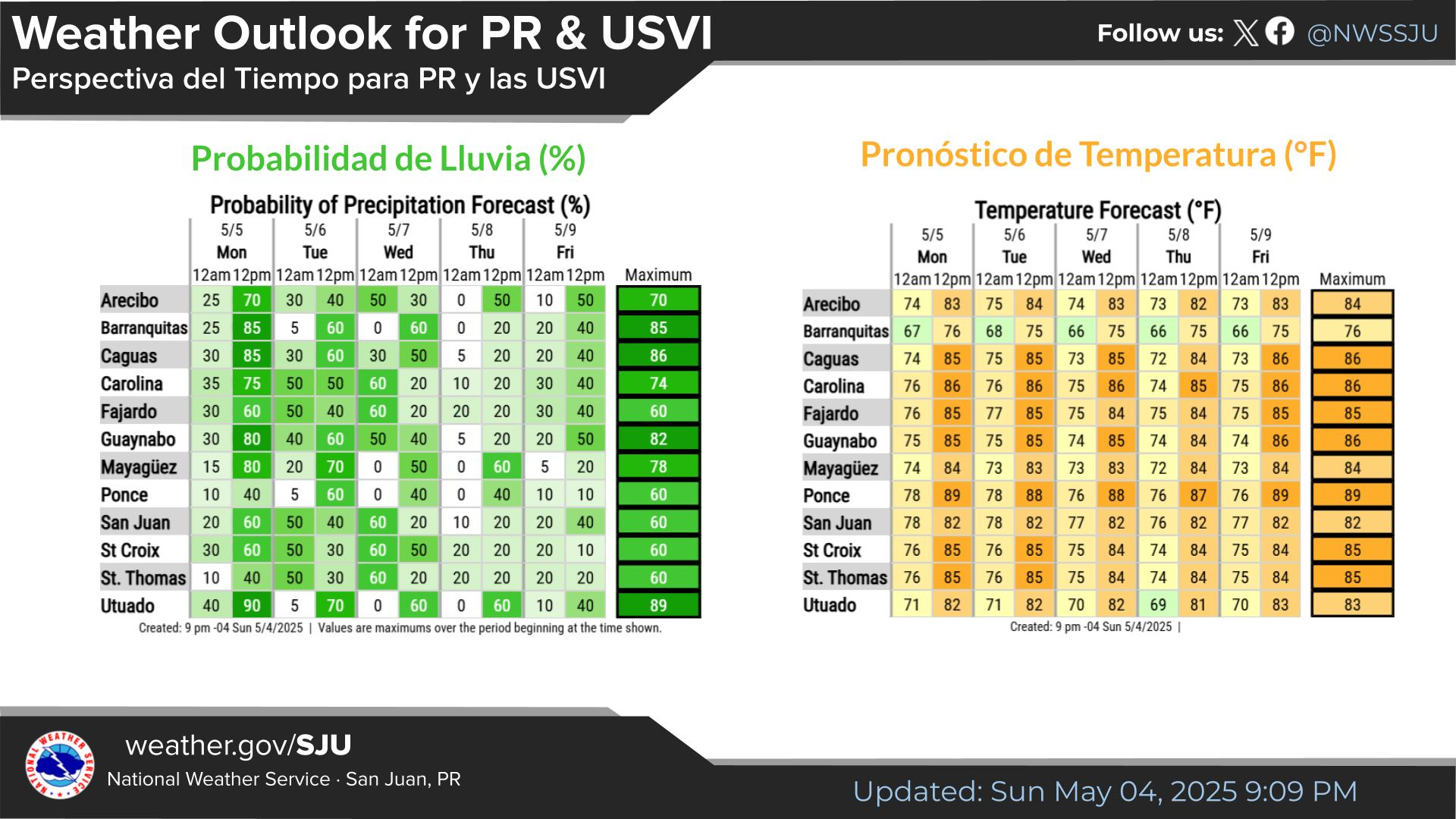
A wet weather pattern has begun across the region due to abundant moisture and favorable conditions generated by an approaching upper-level trough. As a result, there is a limited to elevated flooding risk, particularly in low-lying or poorly drained areas. Periods of excessive rainfall may also lead to ponding on roads. Residents and visitors alike are urged to stay alert and monitor official updates. Never drive through flooded roads—turn around, don’t drown. Whether you're a resident or a visitor, your safety is our priority. Please remain weather-aware as conditions may change quickly.
Ha comenzado un patrón de tiempo lluvioso en la región debido a la abundante humedad y las condiciones favorables generadas por una vaguada en los niveles altos de la atmósfera. Como resultado, existe un riesgo limitado a elevado de inundaciones, especialmente en áreas bajas o con mal drenaje. Los periodos de lluvia excesiva también podrían causar acumulación de agua en las carreteras. Se exhorta a residentes y visitantes a mantenerse atentos y a seguir las actualizaciones oficiales. Nunca conduzcas por caminos inundados: da la vuelta, no te ahogues. Seas residente o visitante, tu seguridad es nuestra prioridad. Mantente informado(a), ya que las condiciones podrían cambiar rápidamente.
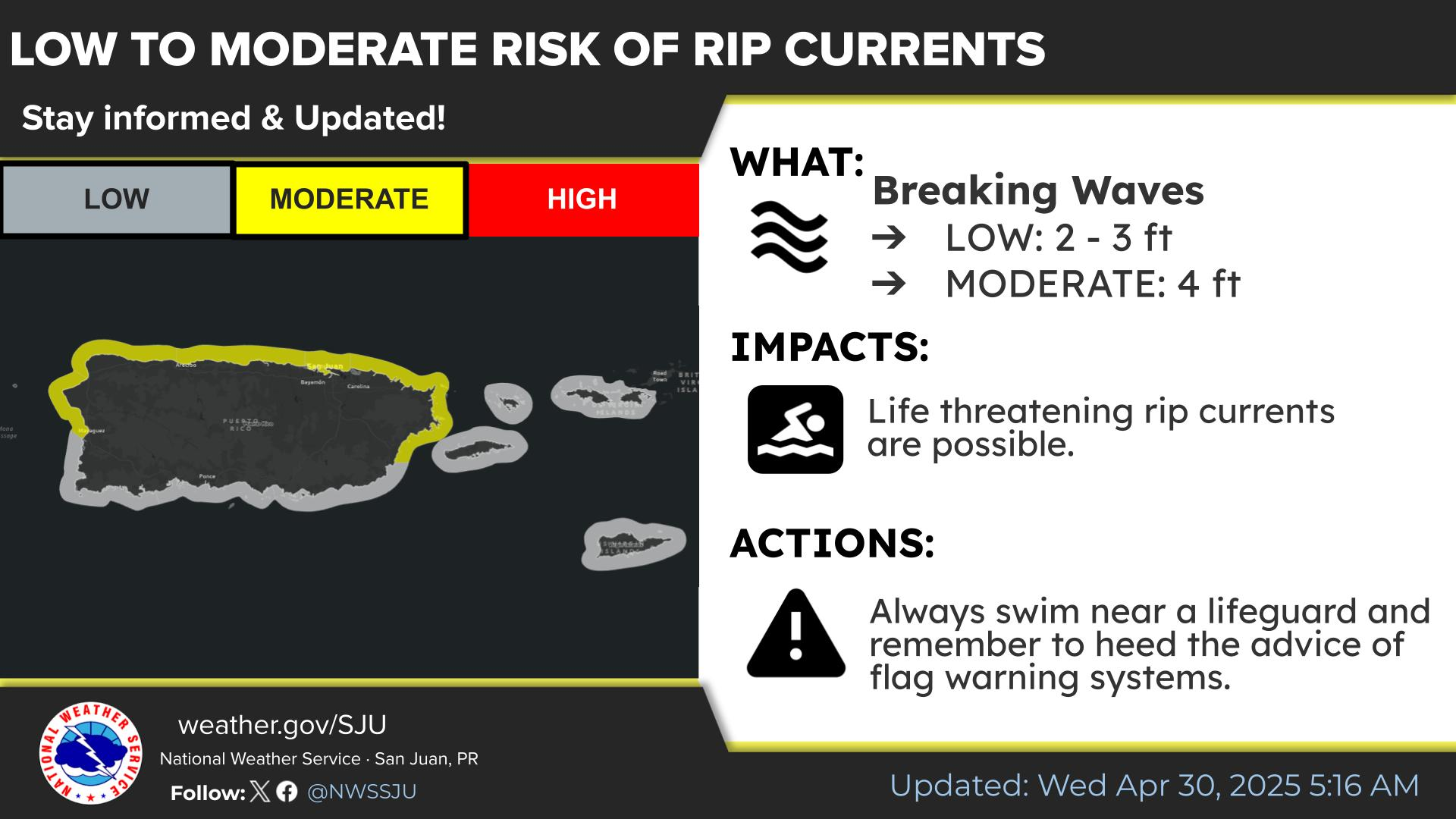
May 15th: There is a moderate risk of life-threatening rip currents across most local beaches today. These strong currents can quickly pull swimmers away from shore, creating dangerous conditions. Please exercise caution while swimming, always follow local safety advisories, and avoid entering the water if you are inexperienced or unsure. Your safety is the top priority.
15 de mayo: Existe un riesgo moderado de corrientes marinas peligrosas en la mayoría de las playas locales hoy. Estas corrientes fuertes pueden arrastrar rápidamente a los nadadores mar adentro, generando condiciones peligrosas. Por favor, nade con precaución, siga siempre las recomendaciones locales de seguridad y evite entrar al agua si no tiene experiencia o no está seguro. Su seguridad es la máxima prioridad.
TJUA Radar - Cayey, P.R.