
Wildfires and poor air quality continue for the Pacific Northwest, Rockies and extended into the Plains. Severe thunderstorms possible for the northern Plains and upper Midwest on Monday along a frontal boundary. Another boundary will focus showers and thunderstorms for the eastern seaboard with localized heavy rainfall possible. For Alaska, a strong Bering Sea storm will bring winds and rainfall. Read More >
Spaceflight Meteorology Group
National Center
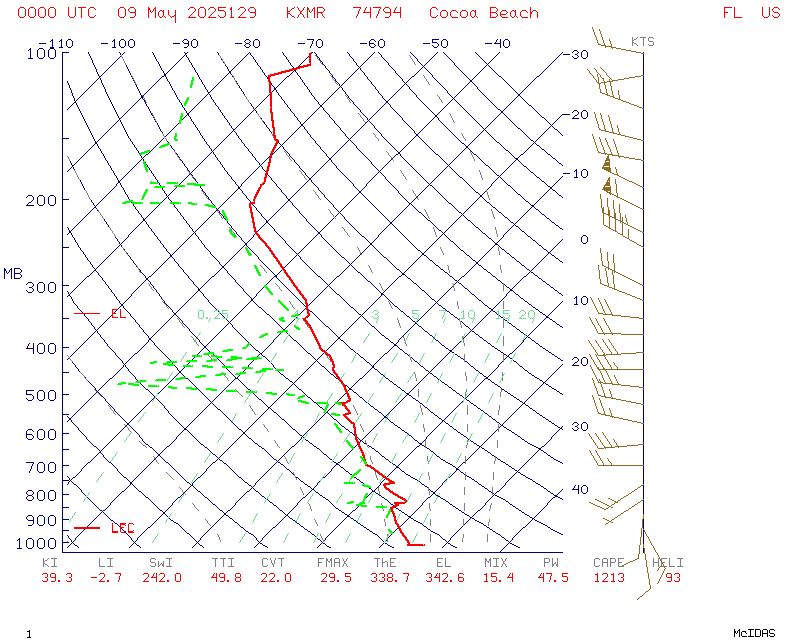
Y-axis is pressure in millibars. Wind barbs are located to the left hand side of the diagram with speed in knots. Temperature is solid red line in Celcius. Dashed green line is dew point in Celcius.
US Dept of Commerce
National Oceanic and Atmospheric Administration
National Weather Service
Spaceflight Meteorology Group
Johnson Space Center / WS8
Houston, TX 77058
Comments? Questions? Please Contact Us.

