
Dangerous and extreme heat will remain across portions of the southern U.S. through the weekend. A heat wave over the Southwest U.S. will intensify this week, peaking and expanding into the Intermountain West and northern High Plains this weekend. Multiple rounds of thunderstorms will produce heavy to excessive rainfall with significant flash flooding across portions of southern New England. Read More >
Spaceflight Meteorology Group
National Center
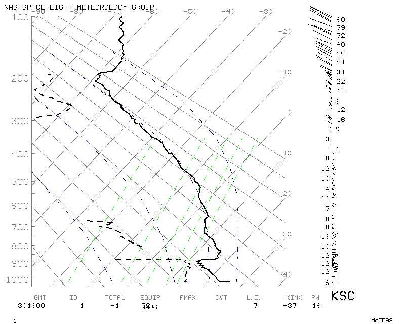
Latest mission support Skew-T Log P diagram from the Cape Canaveral. The most recent daily synoptic rawinsonde plots for KXMR may be found at these highlighted links for early morning and late afternoon.
Y-axis is pressure in millibars. Wind staffs are located to the right hand side of the diagram with speed in knots.
US Dept of Commerce
National Oceanic and Atmospheric Administration
National Weather Service
Spaceflight Meteorology Group
Johnson Space Center / WS8
Houston, TX 77058
Comments? Questions? Please Contact Us.

