
Dangerous and extreme heat will remain across portions of the southern U.S. this week. Heavy rainfall may bring significant flash flooding across portions of the Mid-Atlantic and Northeast through the night, and additional flash flooding concerns across New England on Wednesday. Monsoonal thunderstorms will bring a flash flood risk to the Four Corners region, especially in burn scar areas Read More >
Spaceflight Meteorology Group
National Center
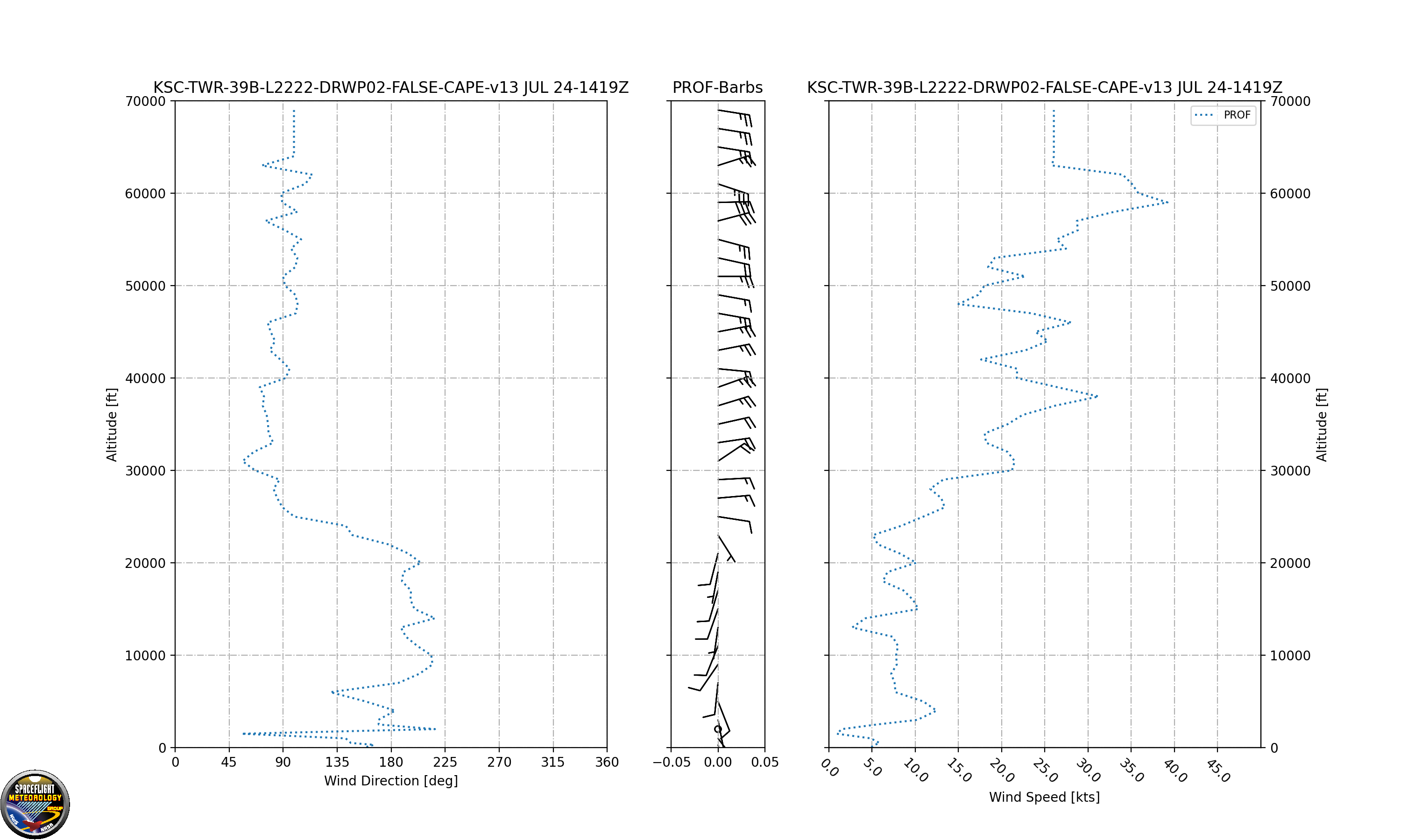
Click image to enlarge
The Simple Unified KSC / USSF Eastern Range Wind Profile combines launch pad or nearby tall tower anemometers with a nearby 915 MHz boundary layer profiler and the KSC 48 MHz Tropospheric Doppler Radar Wind Profiler (TDRWP) to display the distribution of winds with height around the Kennedy Space Center. Depending upon mission profile winds are selected near the ground by the anemometers nearest the launch pad (or in some cases wind tower 313 which is 492 feet tall). Next the closest working boundary layer 915 MHz profiler winds are displayed. Lastly the TDRWP winds are used. This data is considered experimental and may not always be available. Display is not monitored routinely for timeliness or accuracy. Data is provided as a courtesy and not recommended for protection of life or property. Use at your own risk.
US Dept of Commerce
National Oceanic and Atmospheric Administration
National Weather Service
Spaceflight Meteorology Group
Johnson Space Center / WS8
Houston, TX 77058
Comments? Questions? Please Contact Us.

