
Dangerous heat will expand from the Gulf Coast into the Southern Plains and Desert Southwest through week's end. Additional extreme heat impacting the Pacific Northwest will shift to the northern Plains by the weekend. Tropical Storm Bertha is expected to continue to impact portions of the northern Gulf Coast from the western Florida Panhandle to southeastern Louisiana through tonight. Read More >
Spaceflight Meteorology Group
National Center
KSC / Eastern Range Experimental Mesonet Plot
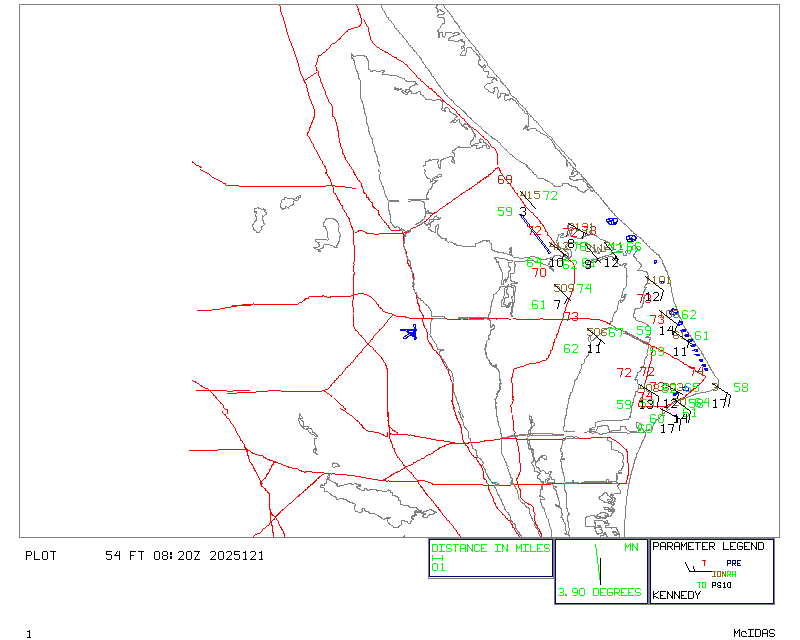
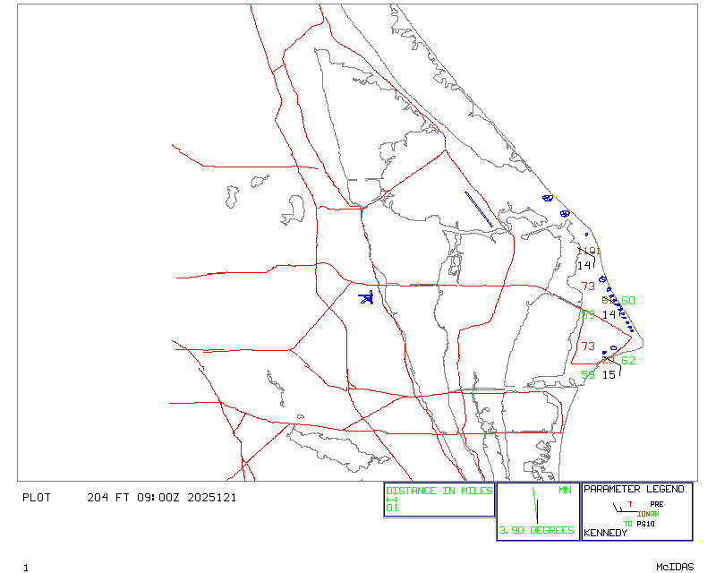
This mesonet data from the KSC / USAF Eastern Range area is considered experimental and provisional. This product is not for the protection of life and property. Quality control procedures of the data appearing on this page are minimal. The top image depicts observations recorded at 54 feet AGL and the bottom image shows data at 204 feet AGL.
Additional plots and data listings may be available at the NWS Western Region Weather and Hazards Data Viewer and at the Utah MesoWest (you may need to choose all networks in the drop down box and zoom in). Data listings of all wind tower levels are available at the Utah MesoWest site. The NWS Weather and Hazards Viewer typically shows only one level, usually the lowest one available at that particular tower so the elevation may not be indicative of where the sensor is located.
US Dept of Commerce
National Oceanic and Atmospheric Administration
National Weather Service
Spaceflight Meteorology Group
Johnson Space Center / WS8
Houston, TX 77058
Comments? Questions? Please Contact Us.

