Widespread life-threatening flash and urban flooding will continue to pose a significant threat to life and property in south-central Texas. Catastrophic fiver flooding, with rapid rises on small streams, arroyos, and typically dry washes, is expected. Monsoonal showers persist across the Great Basin and Southwest with greatest flash flooding in southern Arizona. Read More >
Overview
|
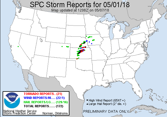
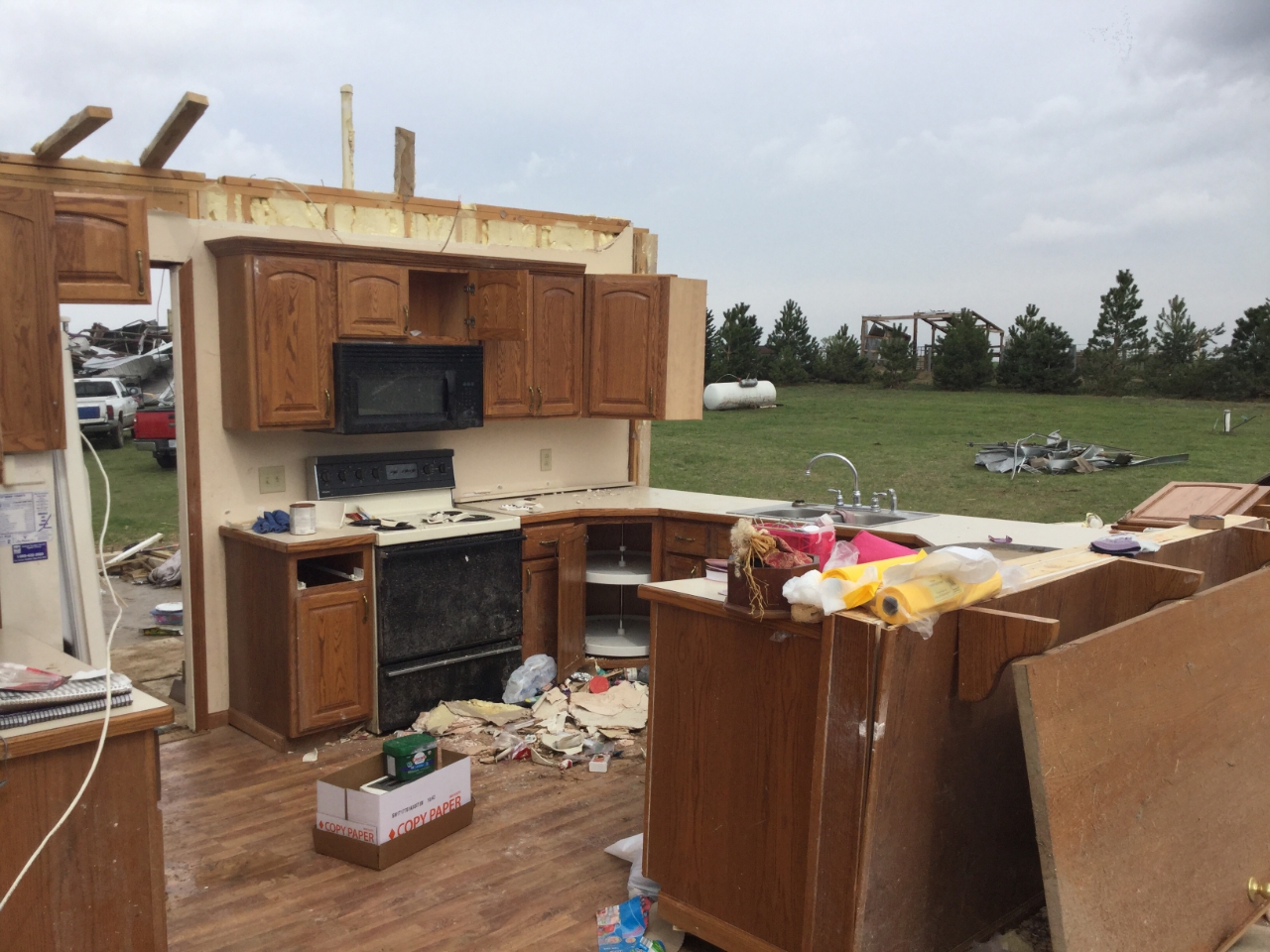
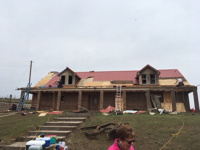
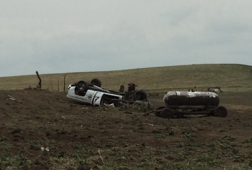
A volatile weather event unfolded across north central Kansas on the afternoon and evening of May 1, 2018. Multiple supercells spawned nearly a dozen tornadoes, including a longer-tracked EF-3, across the state of Kansas. Thankfully, no injuries or fatalities were reported. In addition, very large hail up to the size of softballs were reported. |
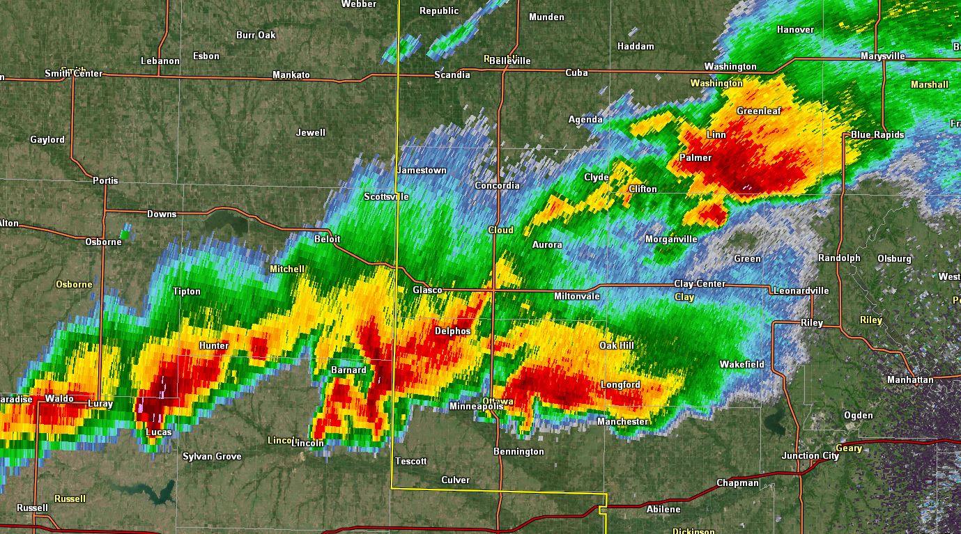 Five supercells progressing across north central Kansas |
Tornadoes:
|
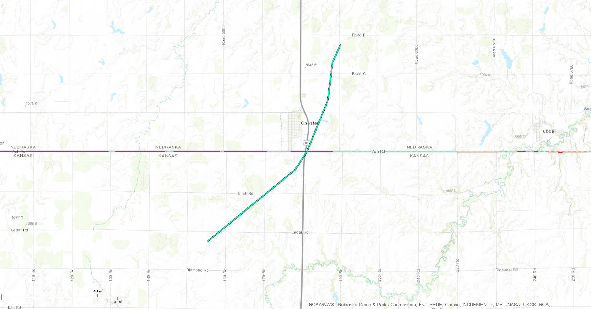
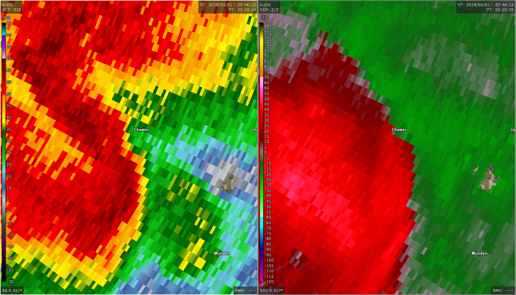
Tornado #1 - Chester, NE
|
||||||||||||||||
|
Tornado #2 - 6 mi NE of Glasco, KS
|
||||||||||||||||
|
Tornado #3 - 8.5 mi SE of Concordia, KS
|
||||||||||||||||
|
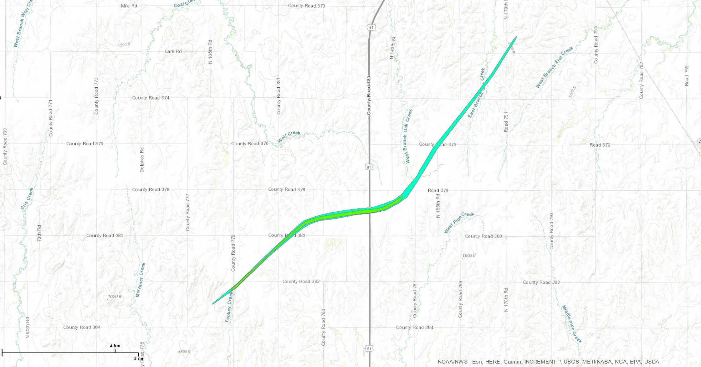
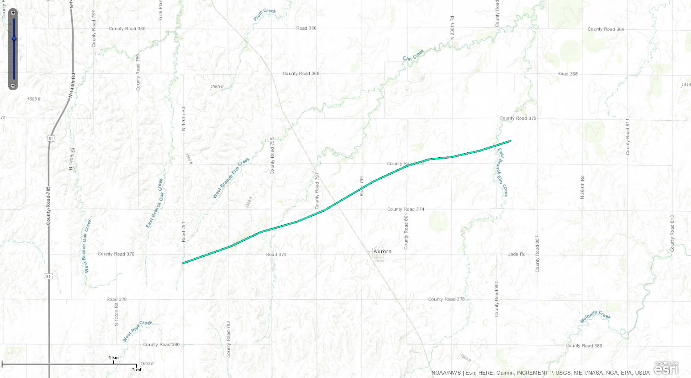
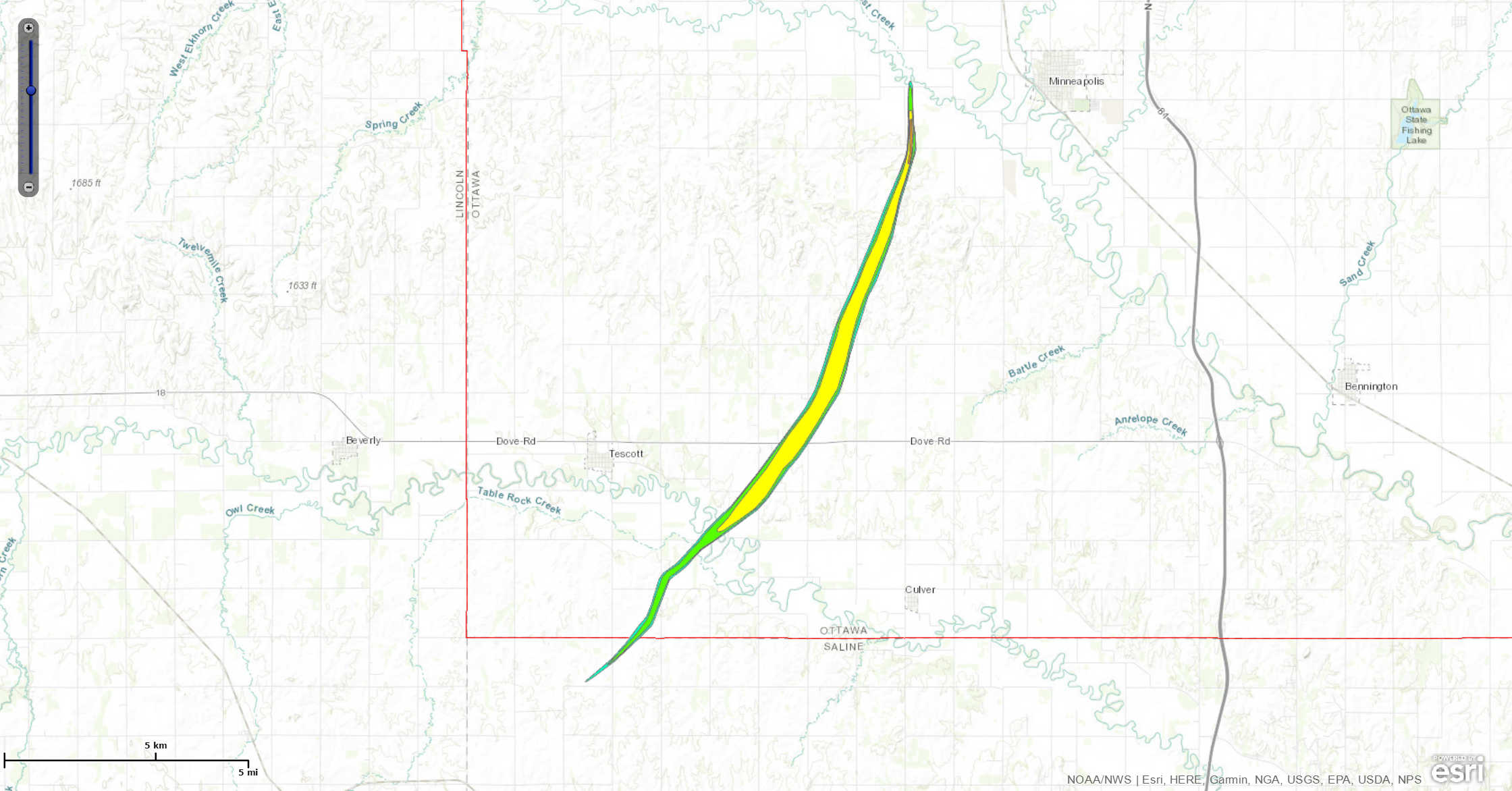
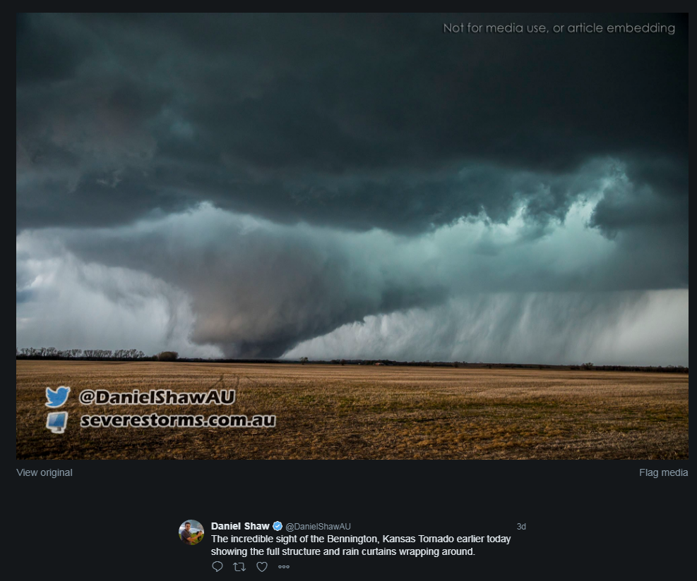
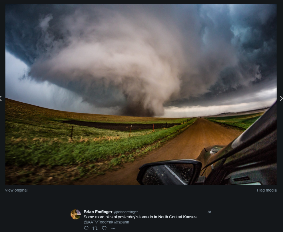
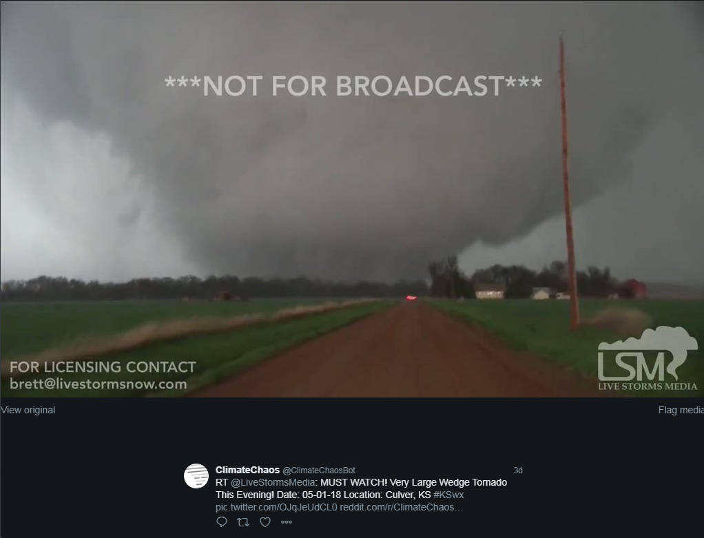
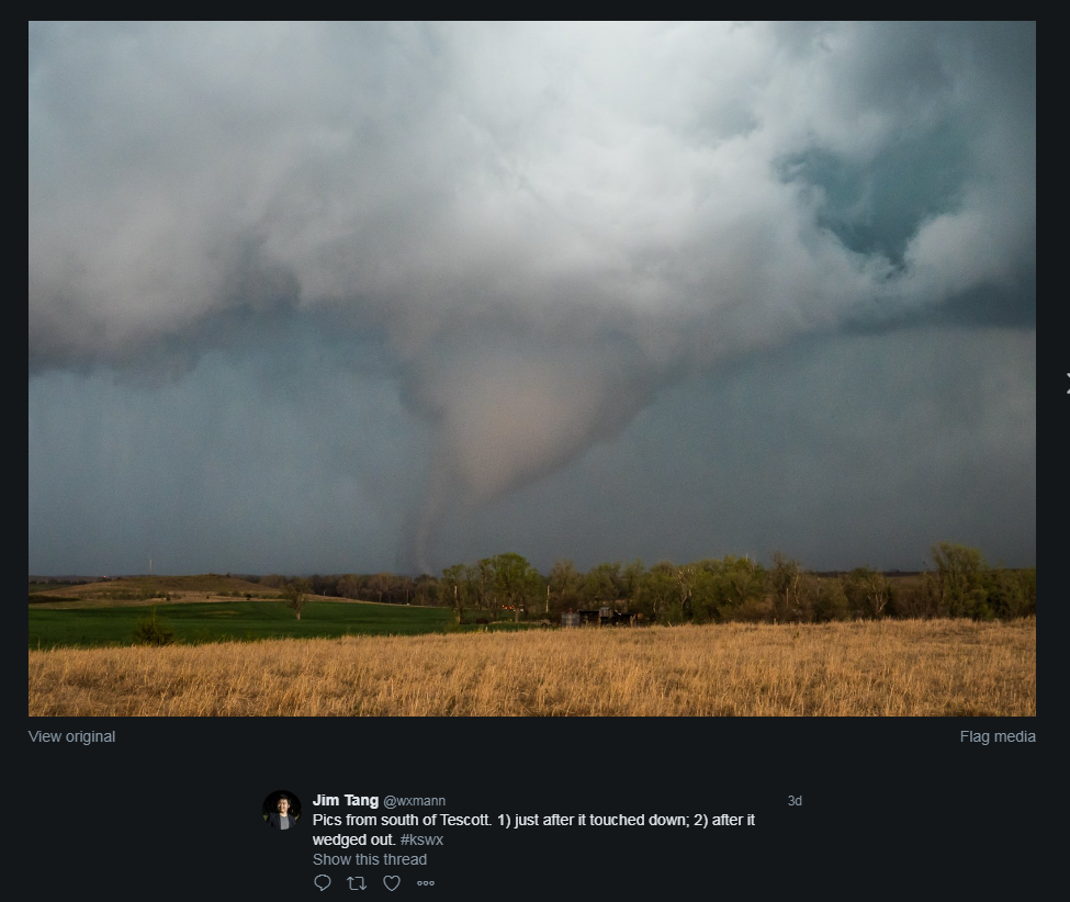
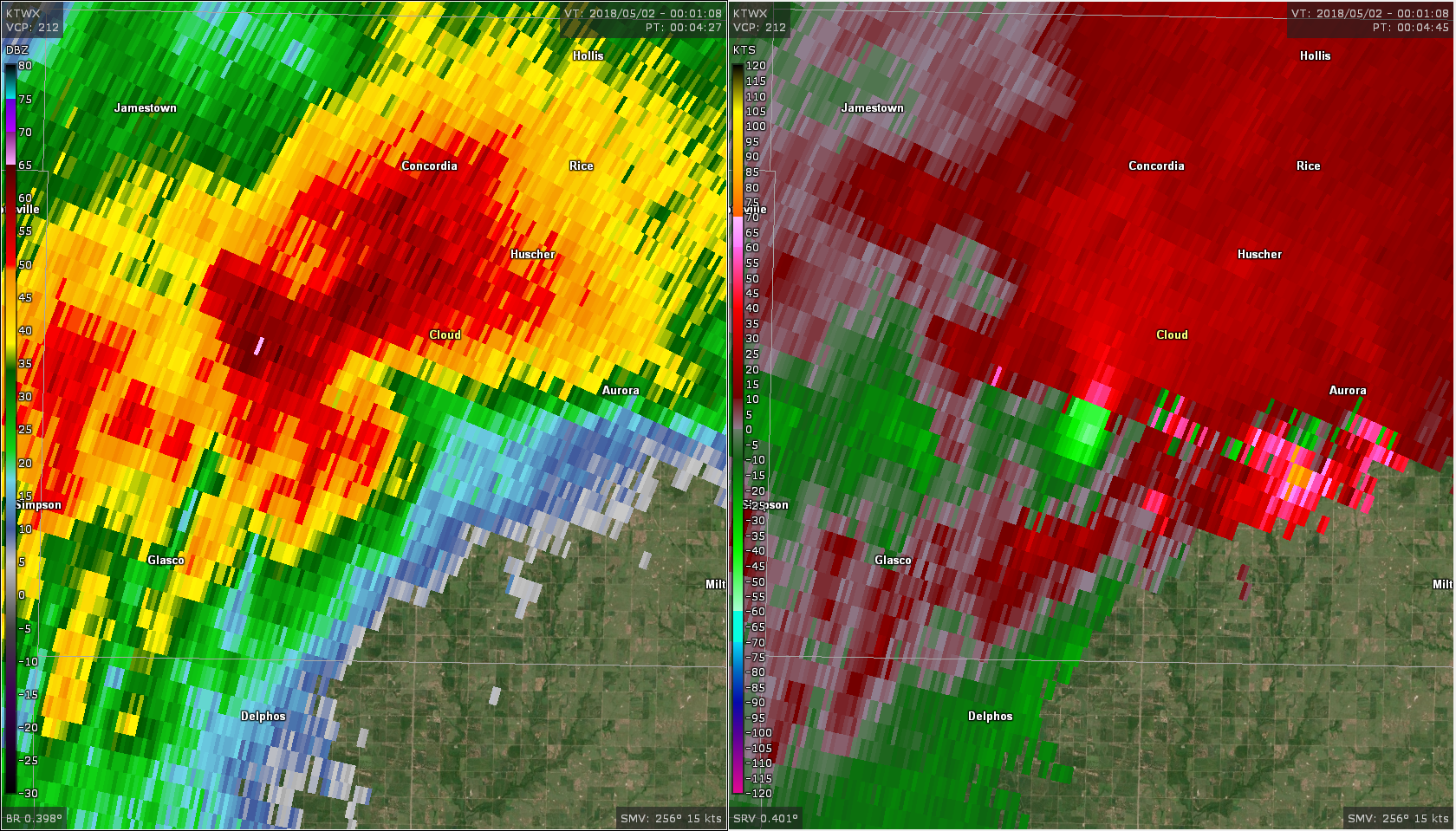
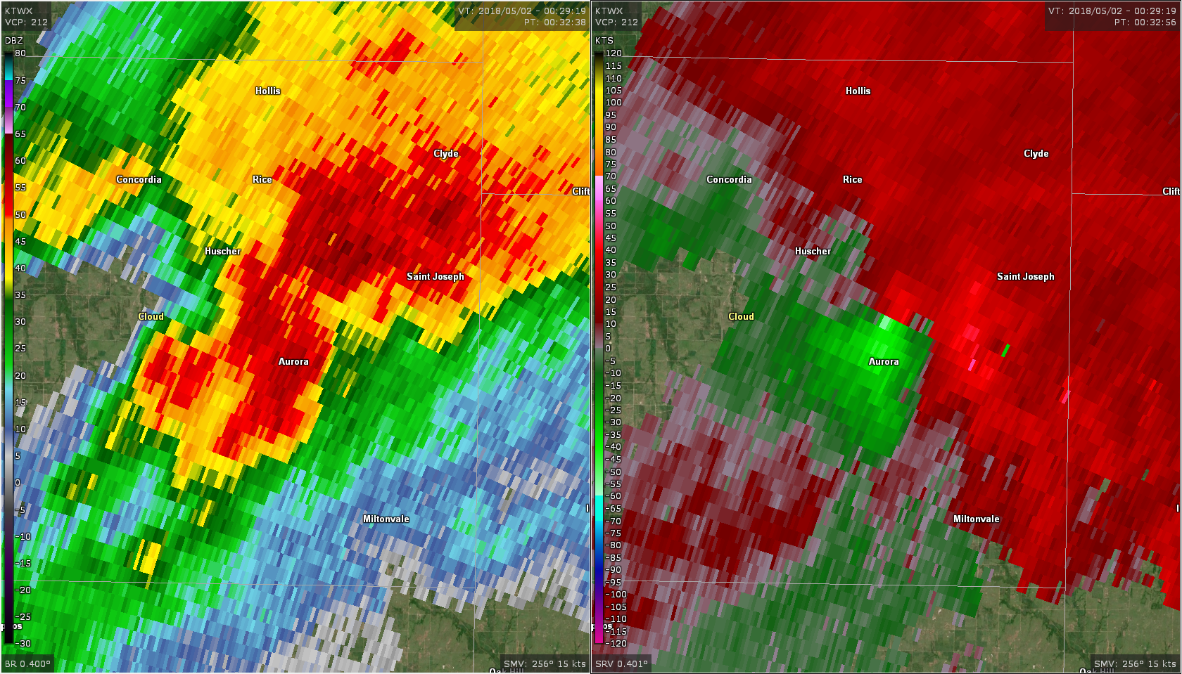
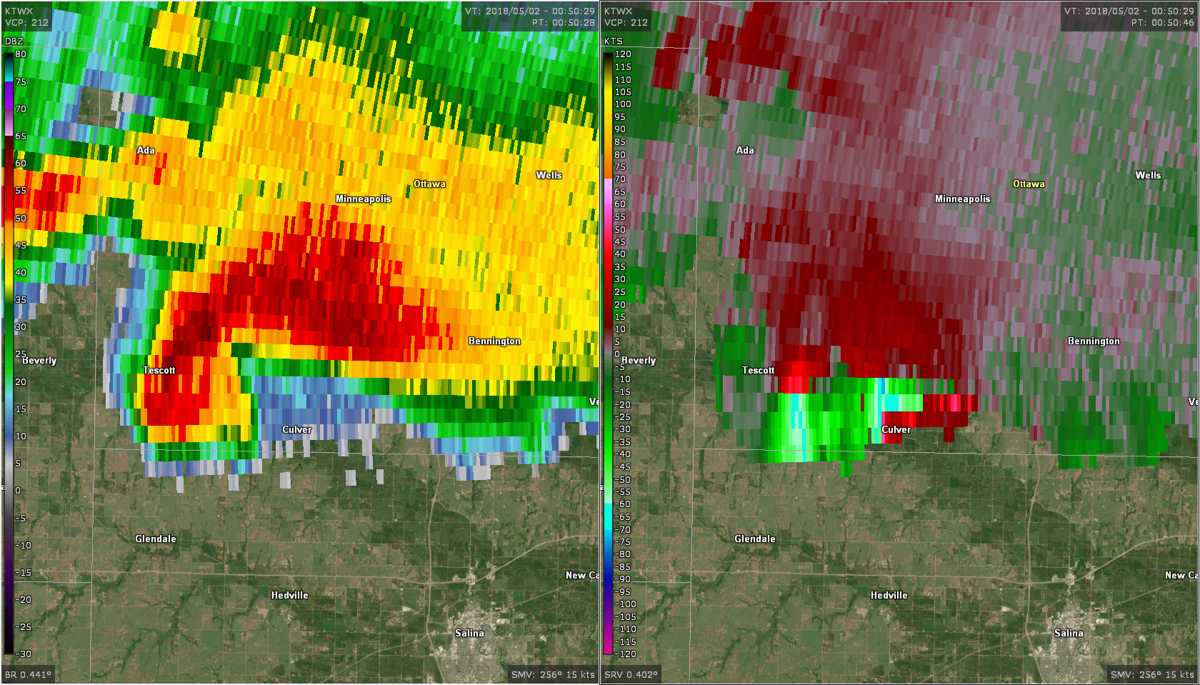
Tornado #4 - 4.5 mi S of Tescott, KS
|
||||||||||||||||
|
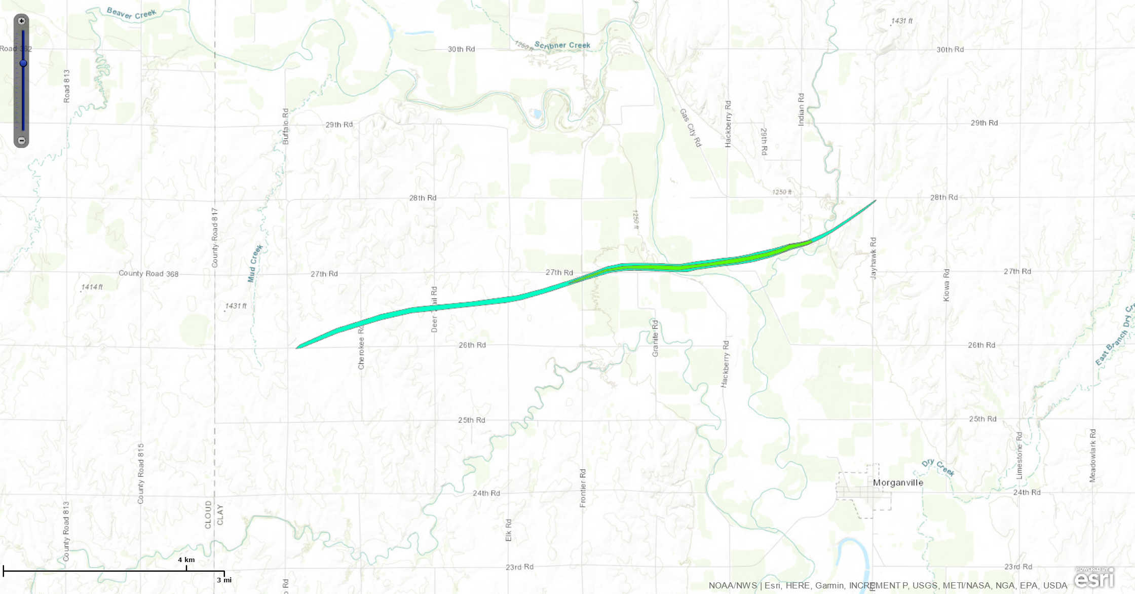
Tornado #5 - 6.1 mi SW of Clifton, KS
|
||||||||||||||||
|
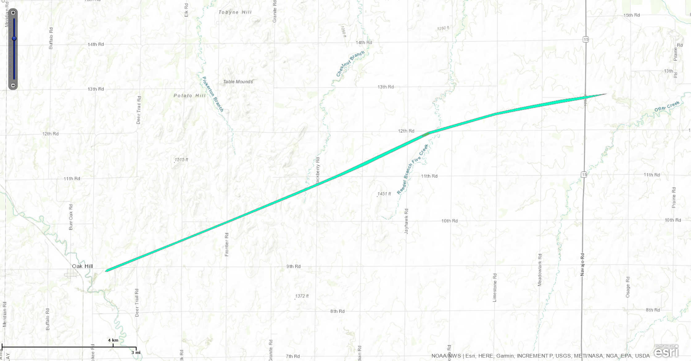
Tornado #6 - 1 mi E of Oak Hill, KS
|
||||||||||||||||
The Enhanced Fujita (EF) Scale classifies tornadoes into the following categories:
| EF0 Weak 65-85 mph |
EF1 Moderate 86-110 mph |
EF2 Significant 111-135 mph |
EF3 Severe 136-165 mph |
EF4 Extreme 166-200 mph |
EF5 Catastrophic 200+ mph |
 |
|||||
Photos & Video:
Tornado #1: Chester, NE
 |
 |
 |
| Moving towards Chester (5:48pm) (courtesy of Willard Sharp) |
Moving closer (5:50pm) (courtesy of Willard Sharp) |
Moving across the Highway (5:52pm) (courtesy of Willard Sharp) |
Tornado #2: 6 mi NE of Glasco
Tornado #3: 8.5 mi SE of Concordia
No photos or video known to exist
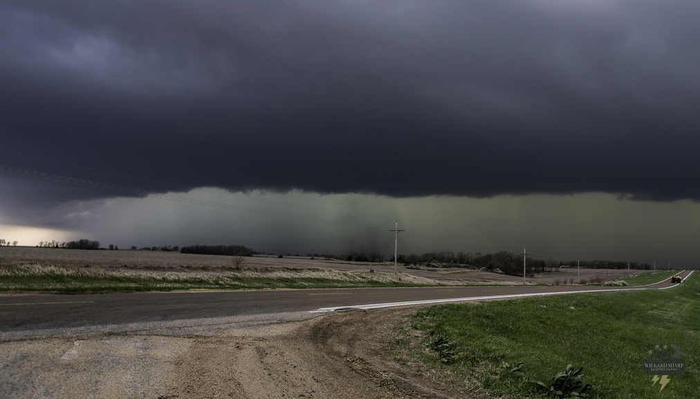
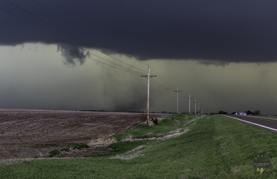
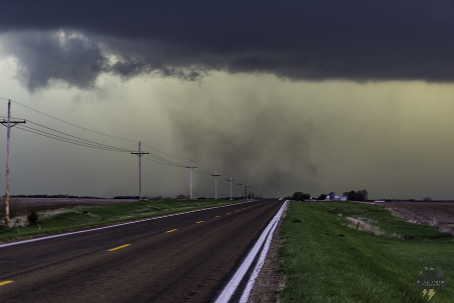
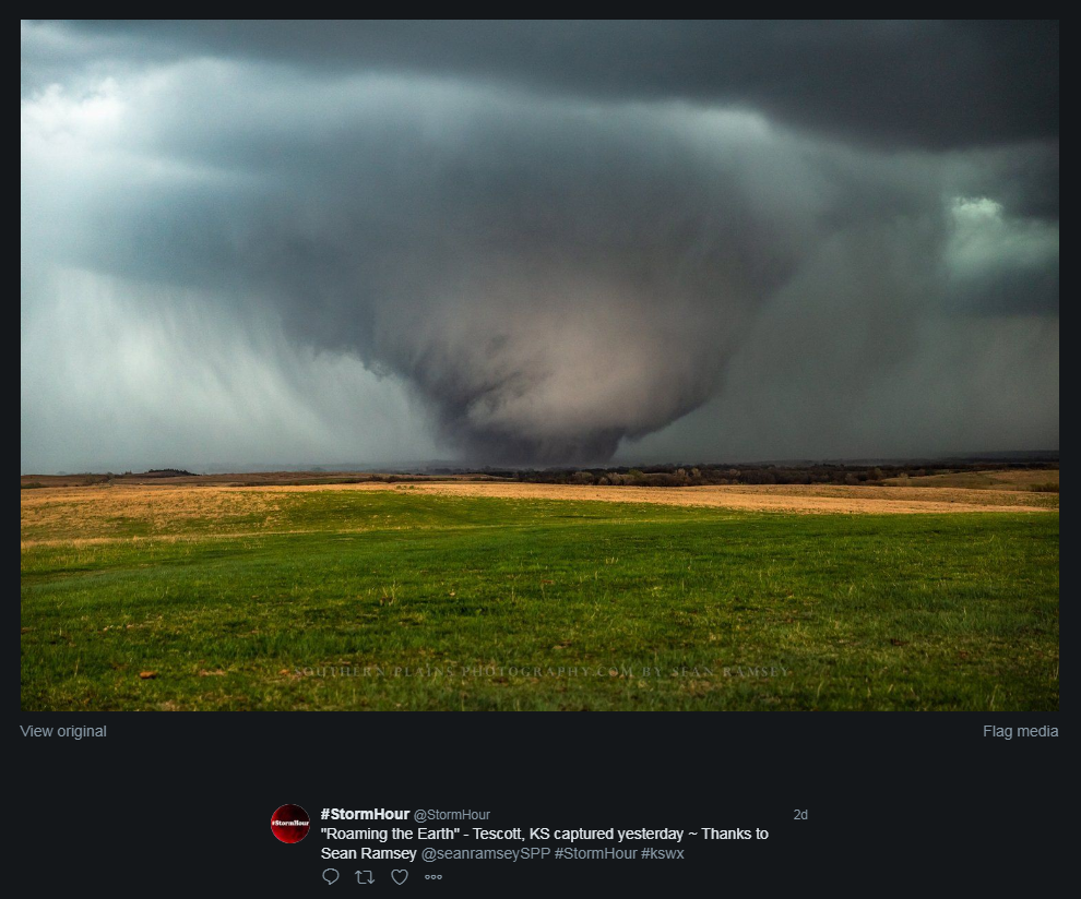
Tornado #4: 4.5 mi SE of Tescott
 |
 |
 |
 |
| Ottawa County Tornado (courtesy of StormHour) |
Ottawa County Tornado (courtesy of Daniel Shaw) |
Ottawa County Tornado (courtesy of Brian Emfinger) |
Ottawa County Tornado (courtesy of ClimateChaos) |
 |
 |
 |
 |
| Ottawa County Tornado (Courtesy of Jim Tang) |
EF3 Tornado damage near Minneapolis | EF2 Tornado damage near Culver | EF2 Tornado damage near Culver |
Tornado #5: 6.1 mi SW of Clifton
No photos or video known to exist
Tornado #6: 1 mi E of Oak Hill
Radar Data:
Radar Loop
 |
| Radar Loop of the Tornadic Supercells |
 |
 |
 |
 |
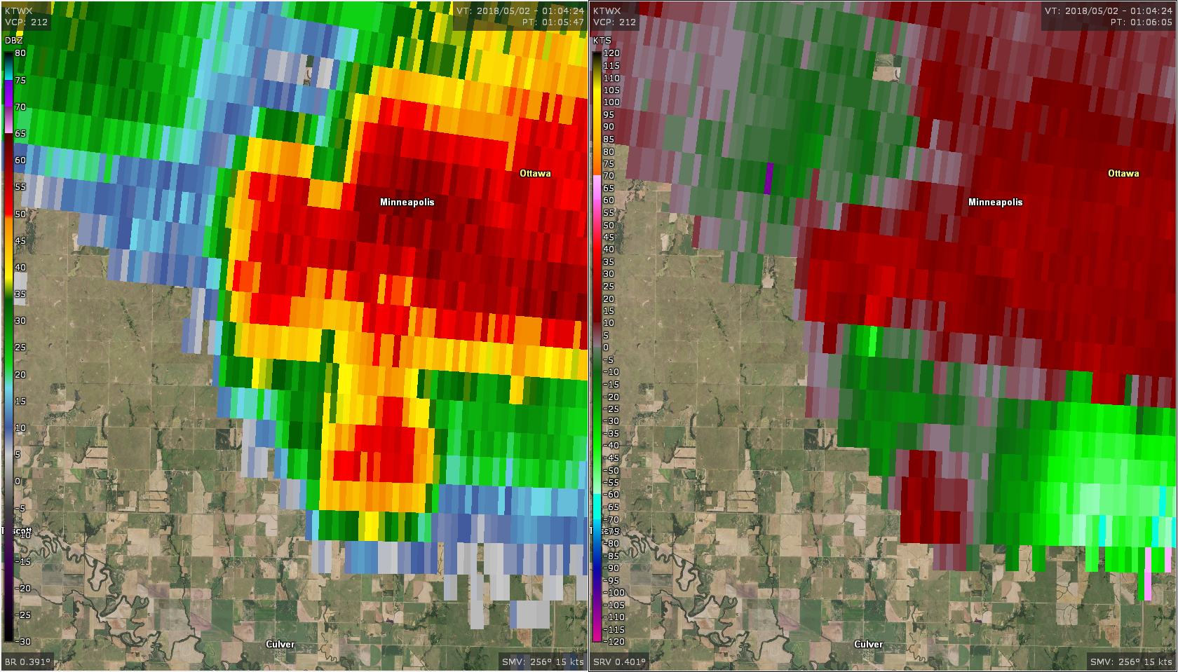
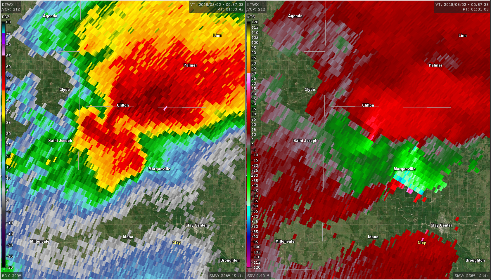
| Reflectivity/SRM image of Tornado #1 (center of the image) from the UEX radar at 5:50pm CDT. | Reflectivity/SRM image of Tornado #2 (center of the image) from the TWX radar at 7:04pm CDT. | Reflectivity/SRM image of Tornado #3 (center of the image) from the TWX radar at 7:32pm CDT. | Reflectivity/SRM image of Tornado #4 (center of the image) from the TWX radar at 7:50pm CDT. |
 |
 |
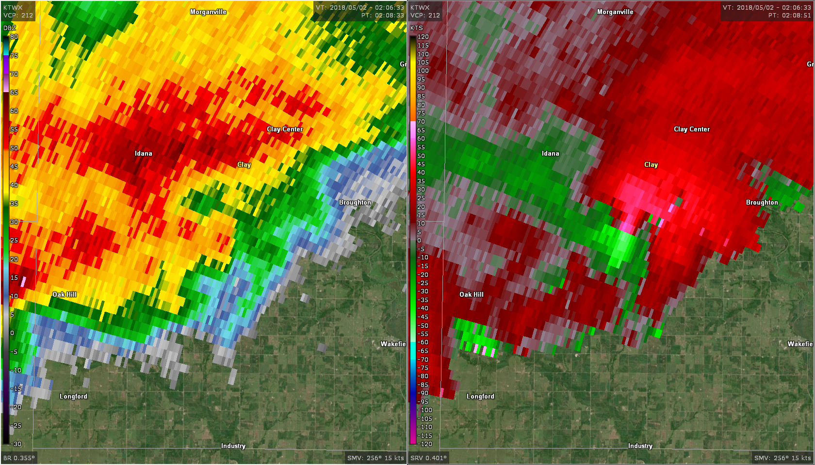 |
| Reflectivity/SRM image of Tornado #4 as it was occluding and producing EF3 damage (center of the image) from the TWX radar at 8:06pm CDT. | Reflectivity/SRM image of Tornado #5 (center of the image) from the TWX radar at 8:01pm CDT. | Reflectivity/SRM image of Tornado #6 (center of the image) from the TWX radar at 9:08pm CDT. |
Environment
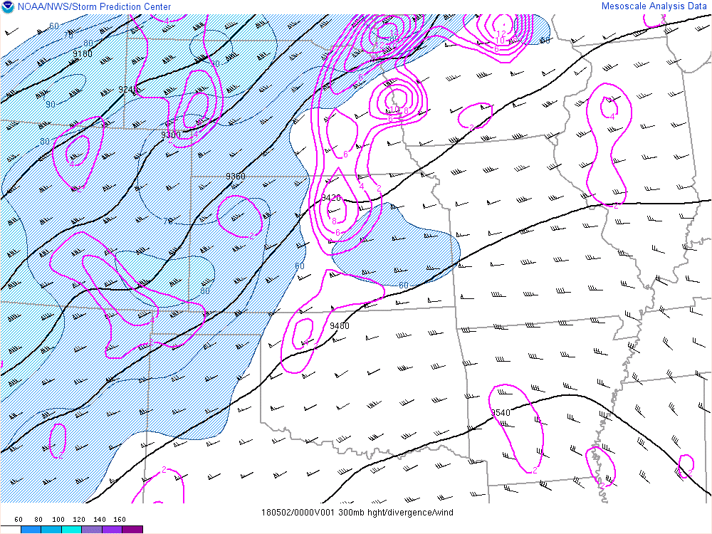
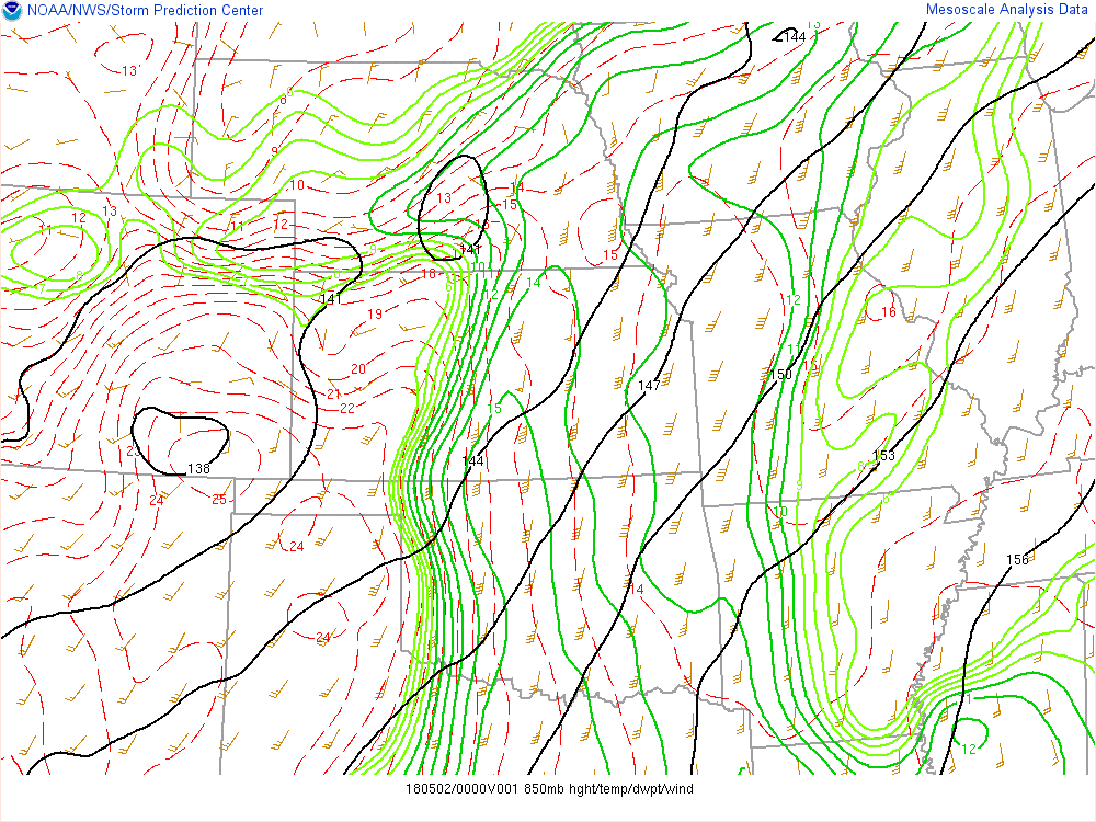
The synoptic environment leading up to this event featured a large upper level trough of low pressure situated across the western United States with a 100 kt jet streak ejecting northeastward ahead of the trough. Closer to the surface, strong low to mid-level flow pumped Gulf moisture northward into the region. A quasi-stationary area of low pressure was centered over north central Kansas/south central Nebraska with an attendant dryline protruding southward across central Kansas. This dryline served as the focus for thunderstorm development during the mid to late afternoon hours.
 |
 |
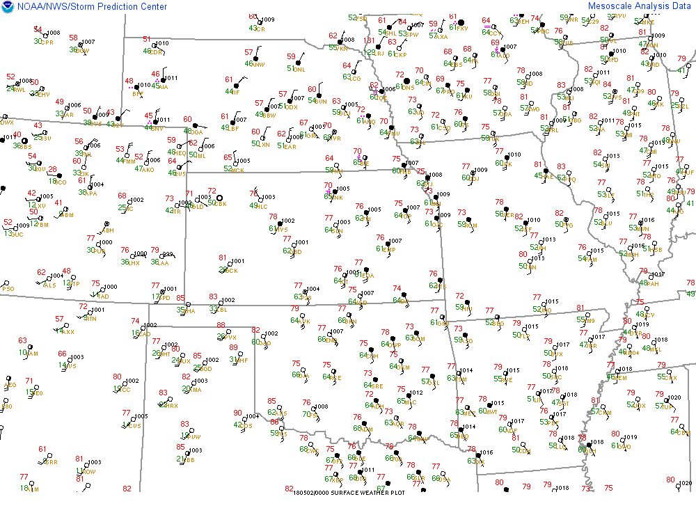 |
| Figure 1: Upper level plot over the Central Plains, showing a trough in the west and a jet streak lifting NE and providing upper level diffluence. | Figure 2: An 850mb plot showing strong moisture advection northward into central and eastern Kansas. | Figure 3: Surface map at 7pm May 1, showing the low over north central KS and a dryline extending southward across the state. |
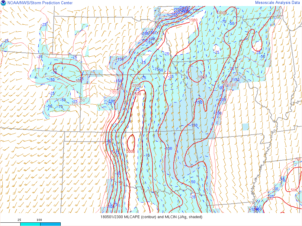
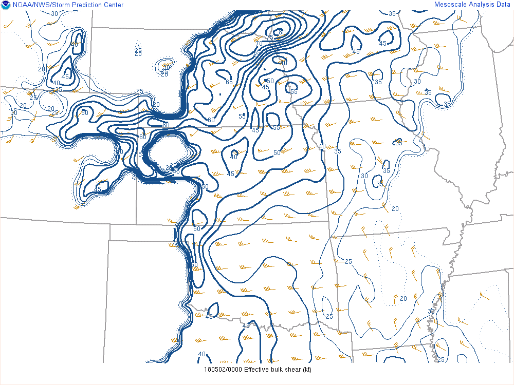
The thermodynamic environment ahead of the dryline featured ample instability with MLCAPE values of 2000-2500 J/kg in the warm sector. Deep shear values in the warm sector were in the neighborhood of 40-50 kts and oriented orthogonal to the orientation of the dryline. The effective storm-relative helicity was around 300 to 400 m2/s2, well within the favorable zone for significant tornadoes.
 |
 |
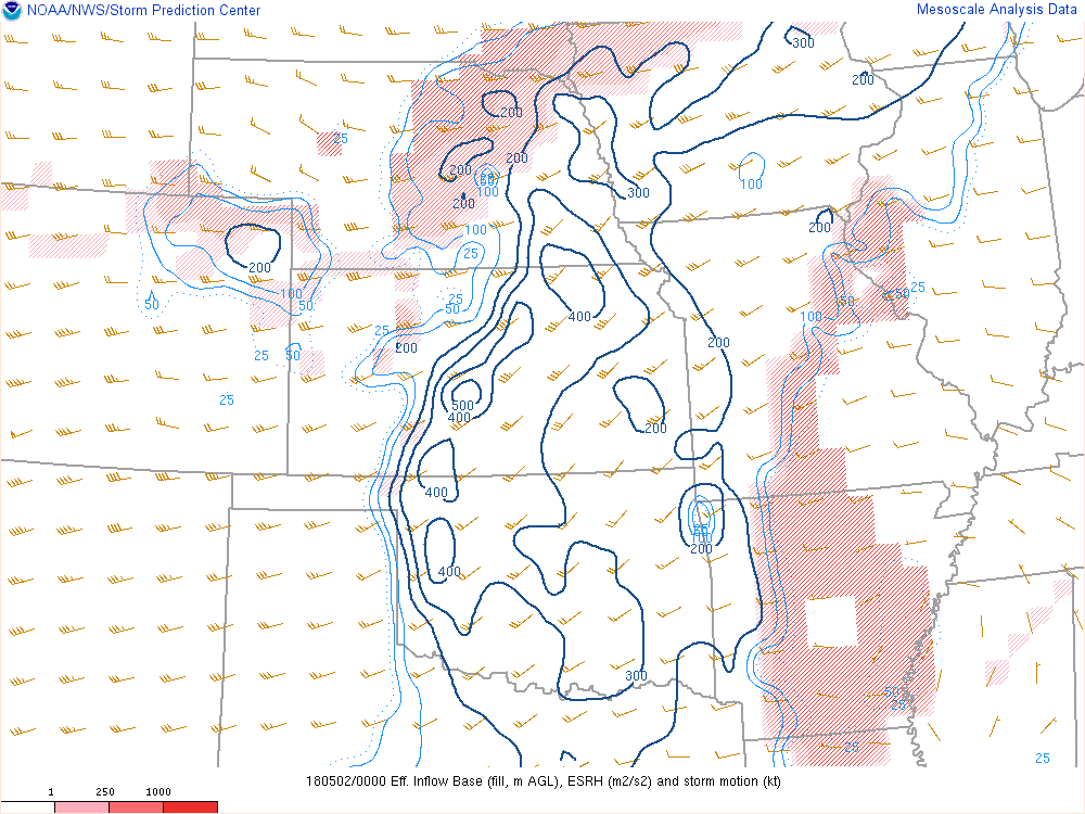 |
| Figure 4: MLCAPE values at 23Z May 1 show a narrow ribbon of instability ahead of the dryline | Figure 5: Effective shear over the region at 00Z May 2 | Figure 6: Effective storm-relative helicity at 00Z May 2. |
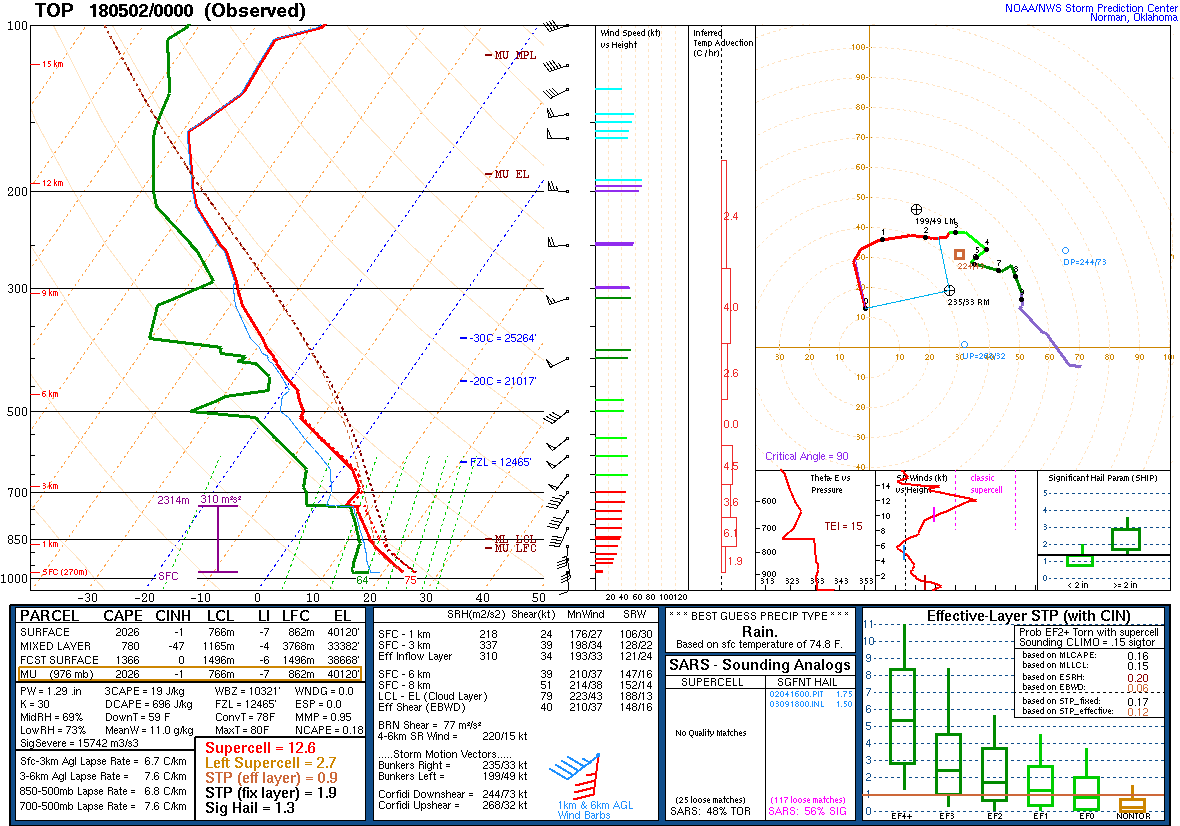 |
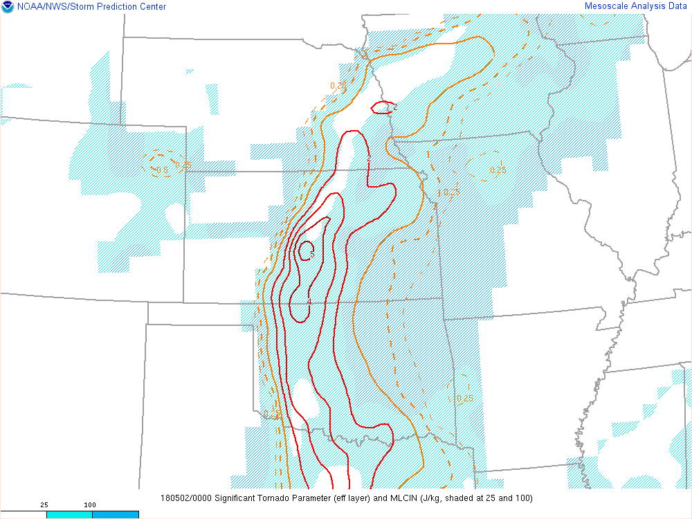 |
| Figure 7: The 00Z sounding at Topeka shows an uncapped atmosphere with ample curvature in the 0-3 km hodograph. | Figure 8: The Significant Tornado Parameter shows a narrow ribbon of elevated values along the region where the tornadoes were observed. |
Additional Information
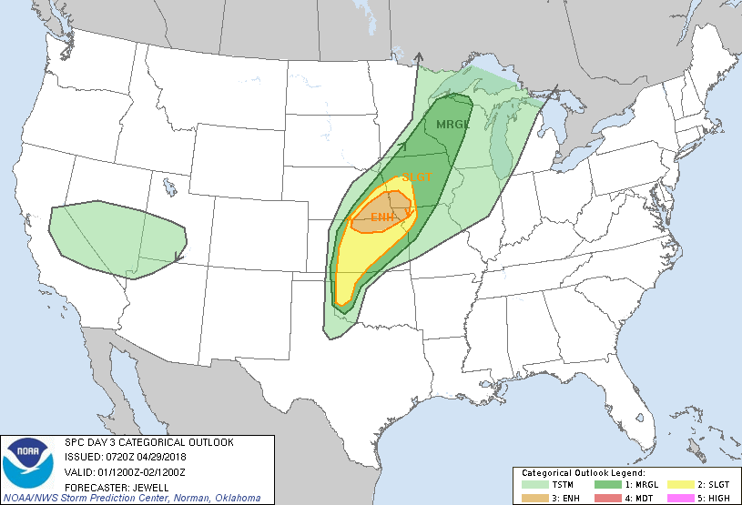
The Forecast
 |
 |
 |
 |
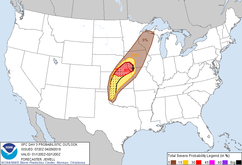
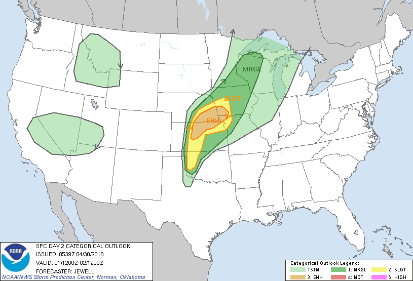
| SPC Day 3 Categorical Outlook | SPC Day 3 Probabilistic Outlook | SPC Day 2 Categorical Outlook | SPC Day 2 Probabilistic Outlook |
 |
 |
 |
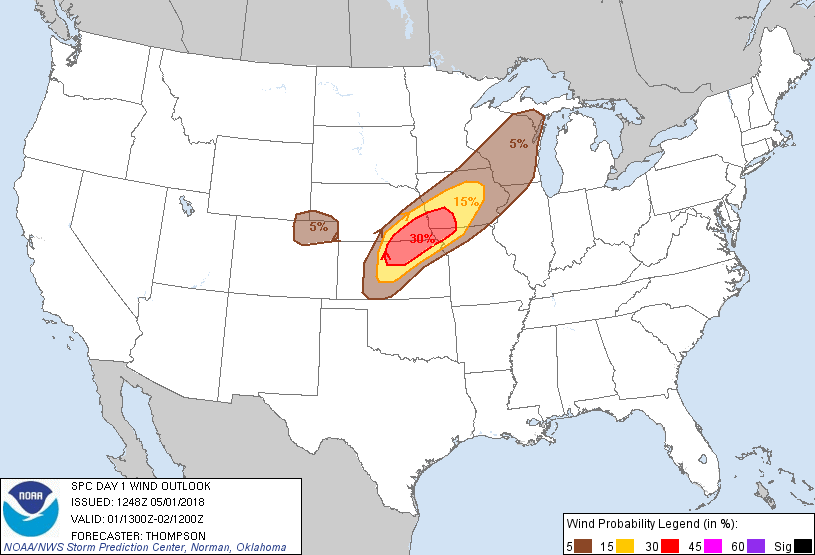 |
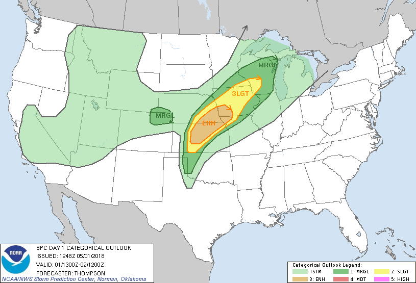
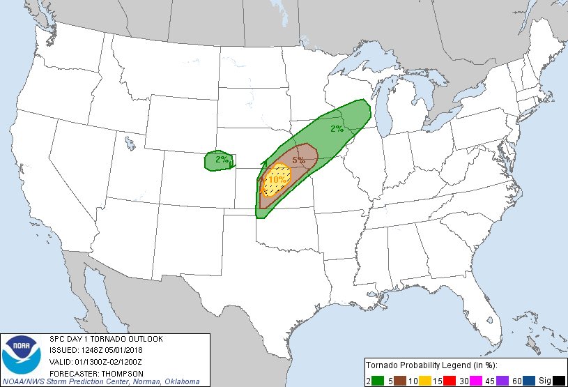
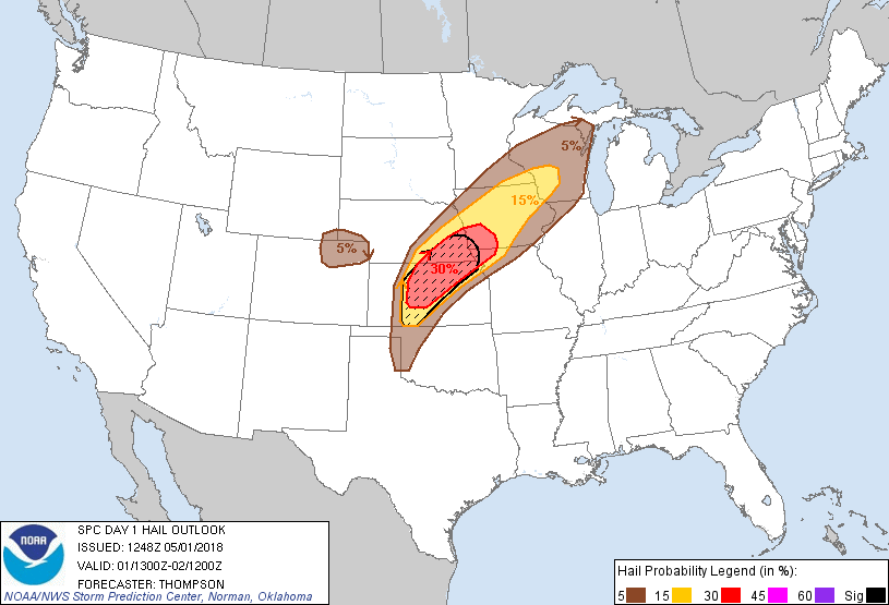
| SPC Day 1 Categorical Outlook | SPC Day 1 Tornado Outlook | SPC Day 1 Hail Outlook | SPC Day 1 Wind Outlook |
Tornado Warning Lead Time
| Counties & Valid Time | Lead Time |
| Ottawa/Cloud Counties - 6:10pm to 7:00pm | 49+ Minutes |
| Cloud County - 6:53pm to 7:30pm* | 6+ Minutes |
| Washington, Republic, Clay & Cloud Counties - 7:24pm to 8:00pm* | Tornado Ongoing |
| Ottawa County - 7:26pm to 8:00pm | 17+ Minutes |
| Ottawa County - 7:54pm to 8:30pm* | Tornado Ongoing |
| Clay, Dickinson & Ottawa - 8:26pm to 9:00pm* | 30+ Minutes |
* Replaces Earlier Warning
Summaries from other NWS Offices
 |
Media use of NWS Web News Stories is encouraged! Please acknowledge the NWS as the source of any news information accessed from this site. |
|