Overview
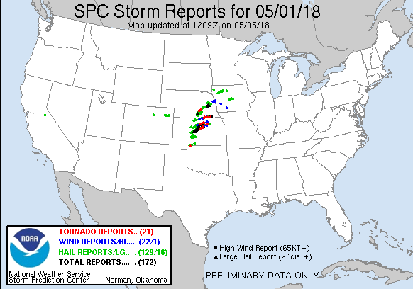
After a very slow start to severe weather season across the Plains, the weather finally started to get active for the start of May. Severe storms impacted central and eastern Kansas on both May 1st and 2nd. Most notable was a large tornado that started in extreme northern Saline county on May 1st and tracked across southern Ottawa county. This tornado was eventually rated an EF-3.
May 2nd
 |
 |
 |
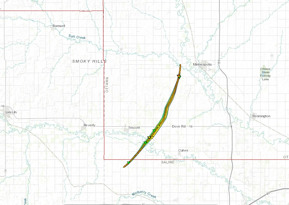 |
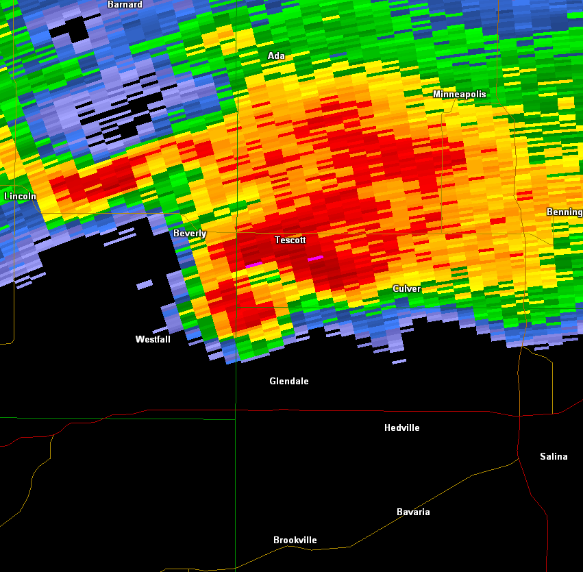
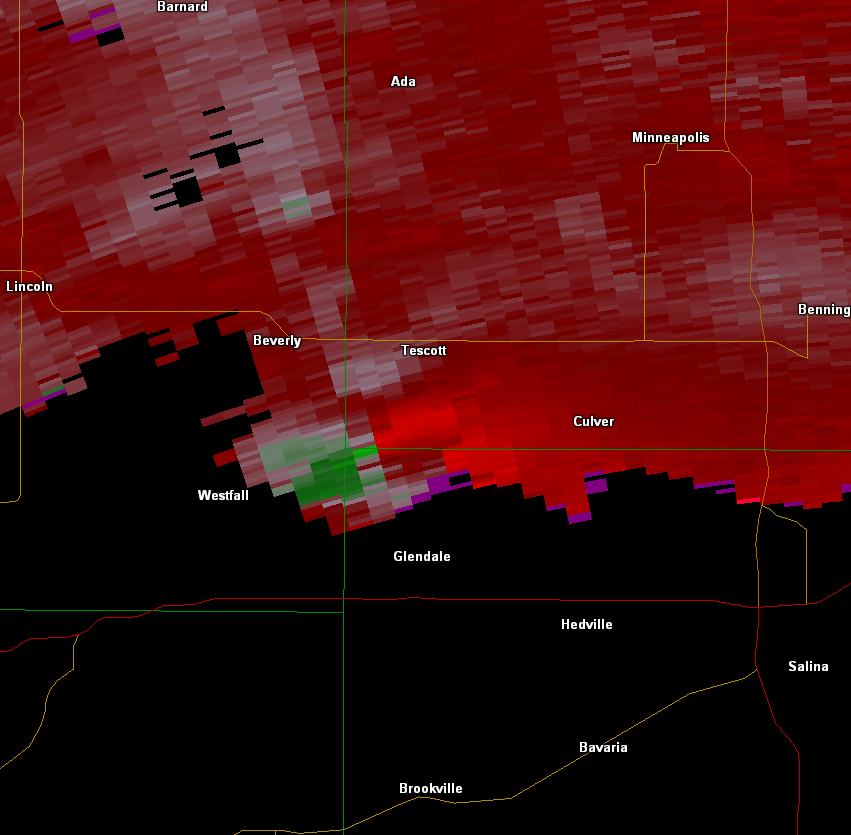
| Storm reports from May 1st 2018 | Supercell thunderstorm over extreme northern Saline county that produced an EF-3 tornado after it crossed into Ottawa county. | Storm relative velocity image of the same supercell that eventually produced an EF-3 tornado | Tornado track |
|
|
|
|
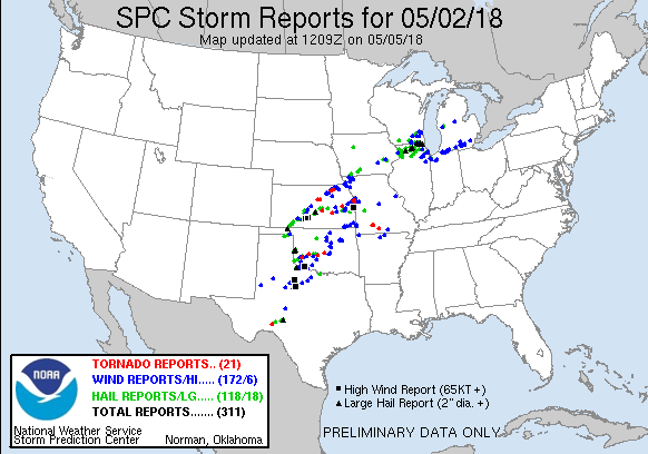
May 2nd
 |
 |
|
|
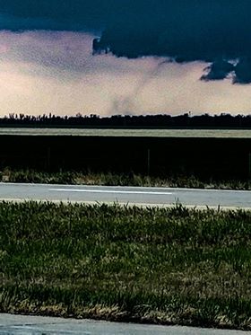
| Storm report for May 2nd 2018 | Brief tornado just north of Moundridge. Picture by Kyle Wirtel | Video showing approaching shelf cloud over northern Butler County and a brief tornado about 2 min into the video | Screen grab of the brief tornado north of Cassoday. |
|
|
| Shelf cloud approaching Wichita | Shelf cloud approaching Wichita |
 |
Media use of NWS Web News Stories is encouraged! Please acknowledge the NWS as the source of any news information accessed from this site. |
|

