
Dangerous and extreme heat will remain across portions of the southern U.S. this week. Heavy rainfall may bring significant flash flooding across portions of the Mid-Atlantic and Northeast through the night, and additional flash flooding concerns across New England on Wednesday. Monsoonal thunderstorms will bring a flash flood risk to the Four Corners region, especially in burn scar areas Read More >
Trained storm spotters and storm chasers reported funnel clouds and tornadoes across portions of east central Kansas during the evening hours of June 20th. Two tornadoes were confirmed in the NWS-Topeka county warning area--the sixth and seventh tornado events in 2009.
Tornado 1
Date: June 20, 2009 County: Coffey
Beginning Time: 6:10pm CDT
Ending Time: 6:10pm CDT
Beginning Location: 4 WSW Waverly
Ending Location: 4 WSW Waverly
Duration: < 1 Minute
Path Length: < 1 Mile
Maximum Width: 25 Yards
Deaths: 0
Injuries: 0
EF-Scale Rating: EF-0
A brief tornado occurred over an open field four miles west-southwest of Waverly...near the intersection of 24th and Planter Roads. Emergency management conducted a storm survey of the area and found no damage. The tornado was witnessed by the general public, a former deputy, and a storm chaser.
 |
Photo taken by Darin Brunin from the intersection of Hwy 31 and 26th Road looking south/southwest. Image used with permission.
Tornado 2
Date: June 20, 2009 County: Franklin
Beginning Time: 7:10pm CDT
Ending Time: 7:12pm CDT
Beginning Location: 1 SW Princeton
Ending Location: 0.5 W Princeton
Duration: 2 Minutes
Path Length: 1 Mile
Maximum Width: 25 Yards
Deaths: 0
Injuries: 0
EF-Scale Rating: EF-0
The condensation funnel associated with the tornado first lowered one mile southwest of Princeton...near the intersection of Ellis and Eisenhower Roads. The updraft of the thunderstorm was in the process of occluding, resulting in the vortex's motion in a south to north direction. A weak ground circulation was present with the tornado which occured over open fields. The tornado dissipated half a mile west of Princeton, approximately one mile west of Highway 59. The tornado was witnessed by the general public, trained storm spotters, and storm chasers.
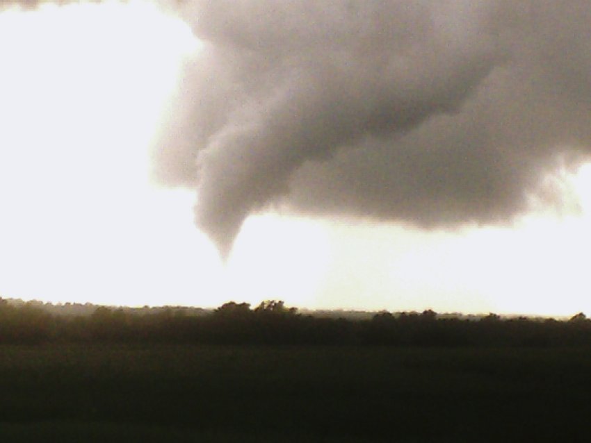 |
Photo above taken by Wayne Adams from south of Princeton on Hwy 59 looking northwest. Image used with permission.
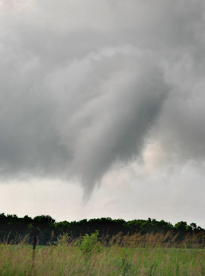 |
Photo above taken by Rick Schmidt near Princeton. Image used with permission.

