Dangerous heat will expand from the Gulf Coast into the Southern Plains and Desert Southwest through week's end. Additional extreme heat impacting the Pacific Northwest will shift to the northern Plains by the weekend. Tropical Storm Bertha is expected to continue to impact portions of the northwestern Gulf Coast from south central Louisiana to the upper Texas coast today. Read More >
Overview
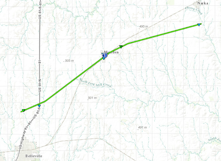
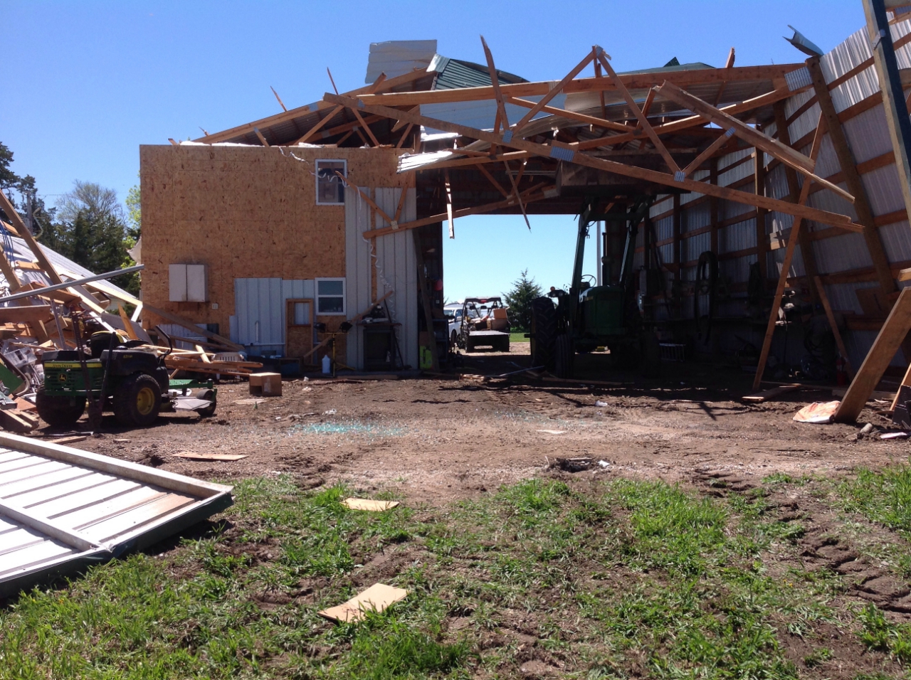
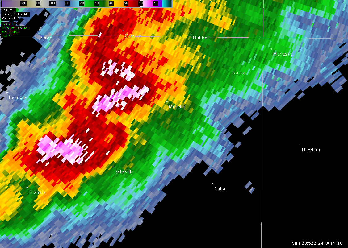
Severe thunderstorms moved through northern Kansas on April 24, 2016 producing numerous giant hail, severe winds, heavy rain and an EF1 tornado in Republic County, Kansas. The tornado produced EF1 damage with estimated winds of 110 mph. Two non-life threatening injuries were reported.
Tornadoes:
|
Tornado - LOCATION
|
||||||||||||||||
The Enhanced Fujita (EF) Scale classifies tornadoes into the following categories:
| EF0 Weak 65-85 mph |
EF1 Moderate 86-110 mph |
EF2 Significant 111-135 mph |
EF3 Severe 136-165 mph |
EF4 Extreme 166-200 mph |
EF5 Catastrophic 200+ mph |
 |
|||||
Photos & Video:
 |
 |
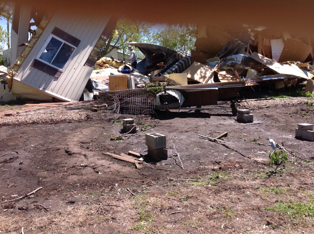 |
| Car in Munden | Out building 1 mile northeast of Munden | Mobile home destroyed in Munden |
Radar:
 |
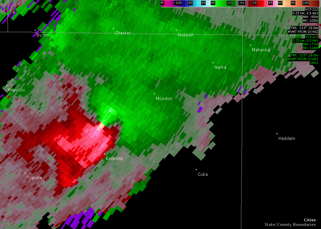 |
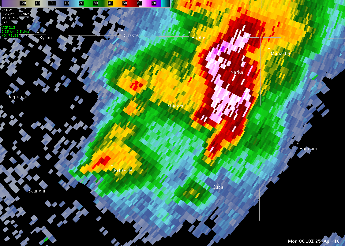 |
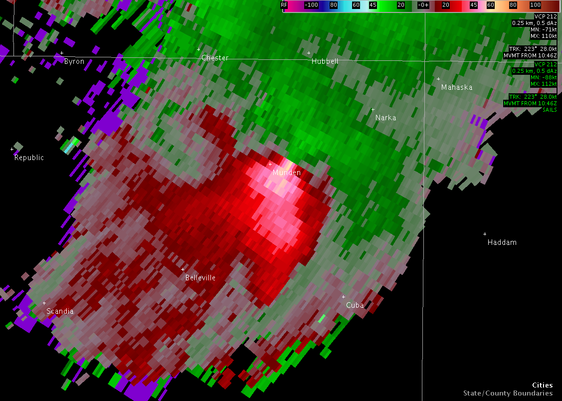 |
| Base Reflectivity 6:52 PM CDT | Storm Relative Velocity 652 PM CDT | Base Reflectivity 710 PM CDT | Storm Relative Velocity 710 PM CDT |
 |
Media use of NWS Web News Stories is encouraged! Please acknowledge the NWS as the source of any news information accessed from this site. |
|