Dangerous and extreme heat will remain across portions of the central U.S. this week, persisting across the mid to lower Mississippi Valley, Gulf Coast, southern Plains and portions of Texas. A heat wave over the Southwest U.S. will peak this weekend. Heavy to excessive rainfall may produce flash flooding from the Delmarva Peninsula north into the Hudson Valley today and tonight. Read More >
Overview
Severe thunderstorms developed across central Kansas during the early evening hours and moved northeast into the area. Five EF-0 or EF-1 tornadoes were confirmed, with many other reports of large hail and damaging winds:
For more information on the tornadoes in south-central Kansas, including the EF-3 tornado that moved through Andover, see this page from NWS Wichita:
Tornadoes:
|
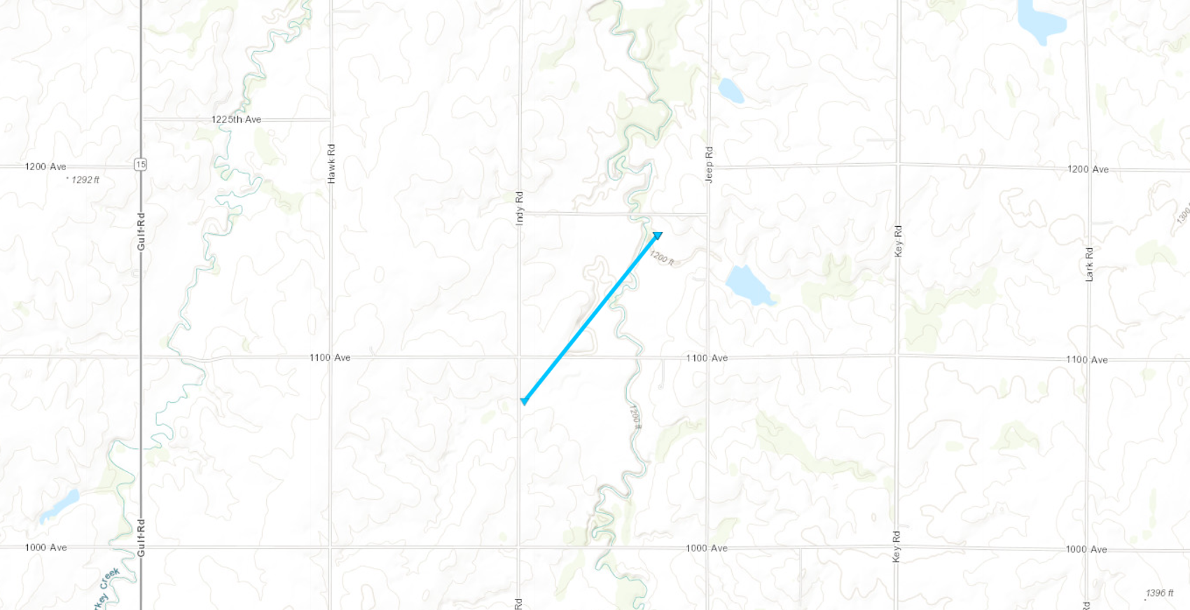
Tornado - 7 Miles NW of Hope
|
||||||||||||||||
|
Tornado - 5 Miles SE of Carlton
|
||||||||||||||||
|
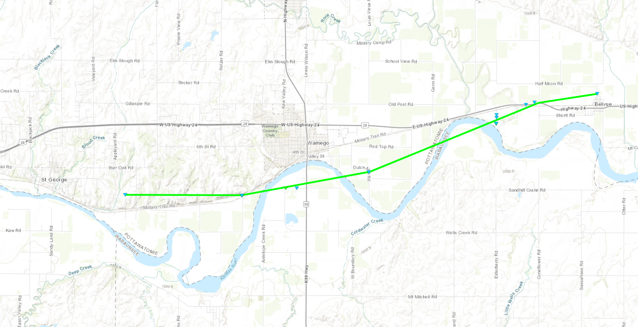
Tornado - Wamego/Belvue
|
||||||||||||||||
|
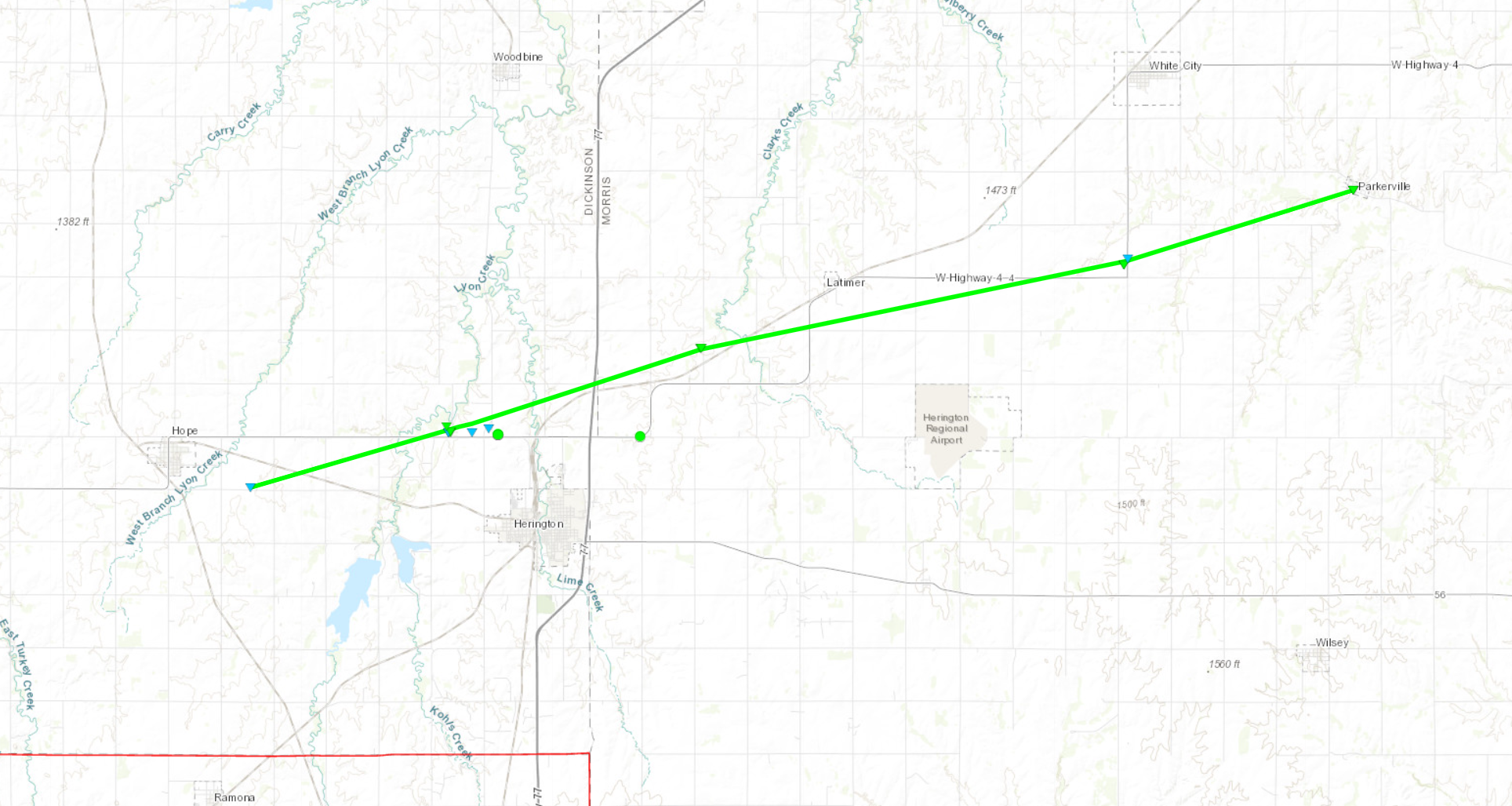
Tornado - Herington/Parkerville
|
||||||||||||||||
|
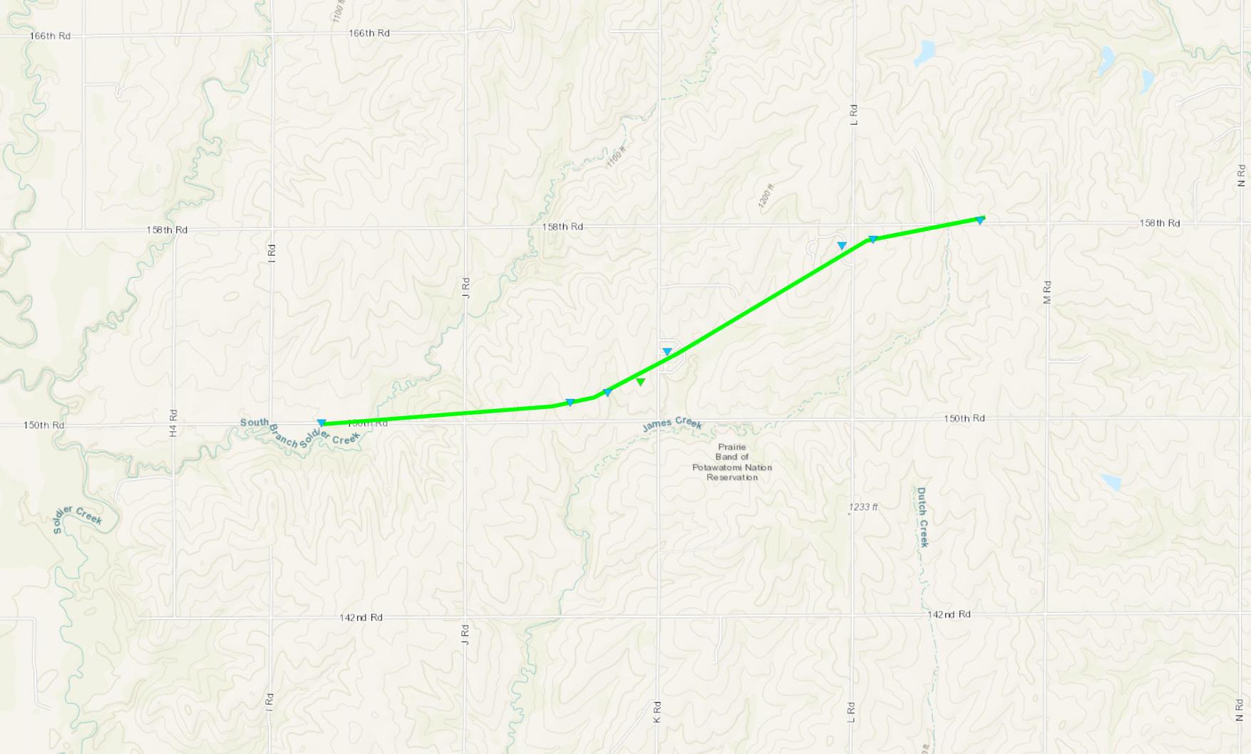
Tornado - 6 Miles W of Mayetta
|
||||||||||||||||
The Enhanced Fujita (EF) Scale classifies tornadoes into the following categories:
| EF0 Weak 65-85 mph |
EF1 Moderate 86-110 mph |
EF2 Significant 111-135 mph |
EF3 Severe 136-165 mph |
EF4 Extreme 166-200 mph |
EF5 Catastrophic 200+ mph |
 |
|||||
Photos
Header
 |
 |
 |
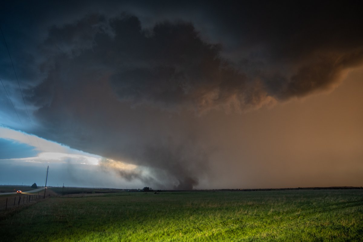
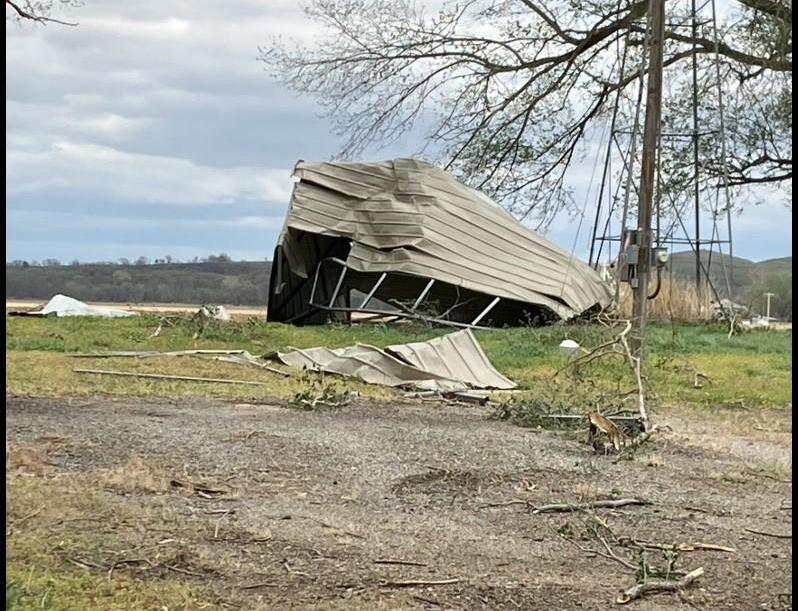
| Beginning of the Herington tornado. (Jim Ladue) |
EF-1 Damage Northwest of Herington. (NWS Damage Survey) |
EF-1 Damage Northeast of Herington. (NWS Damage Survey) |
 |
 |
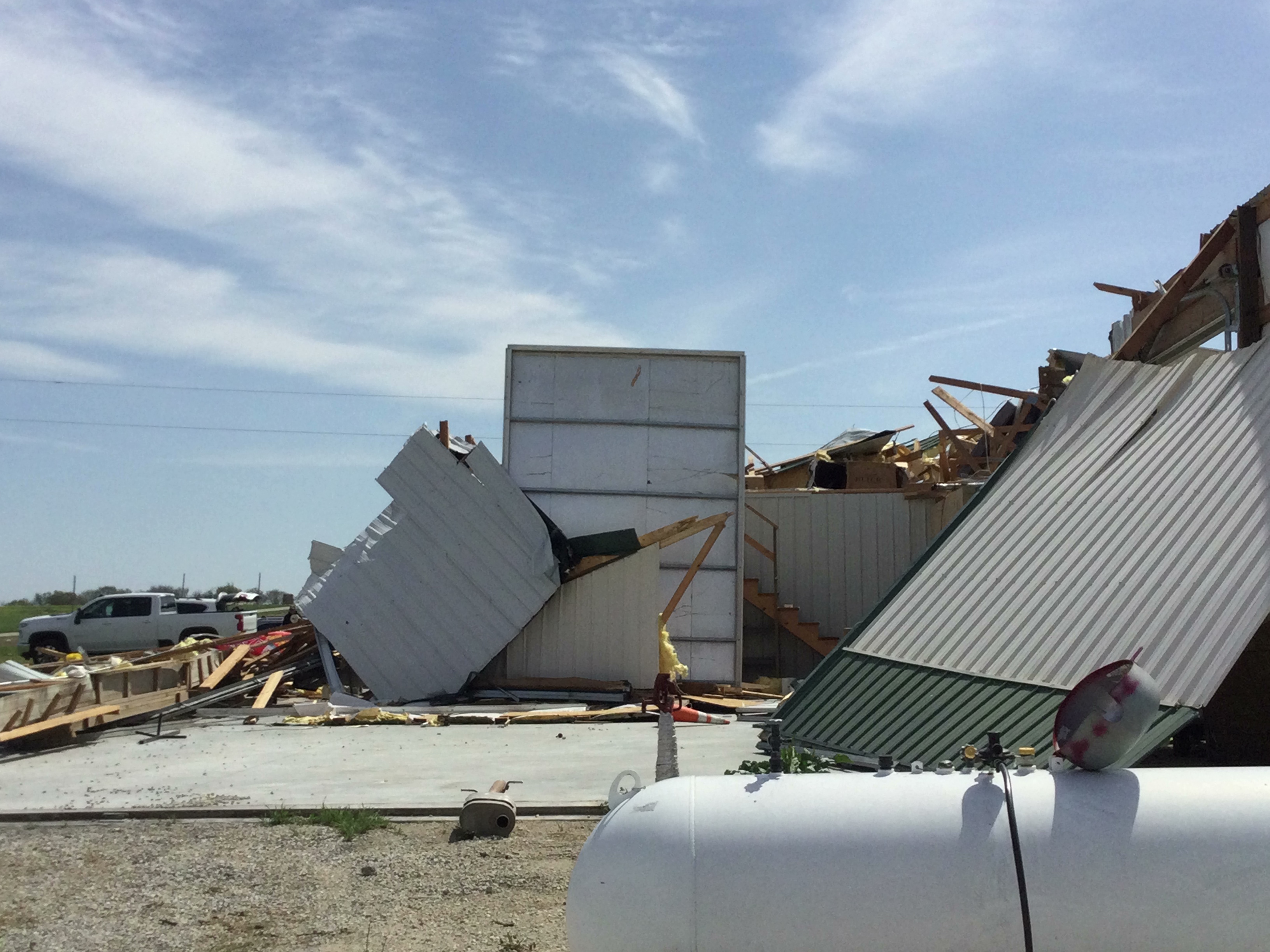 |
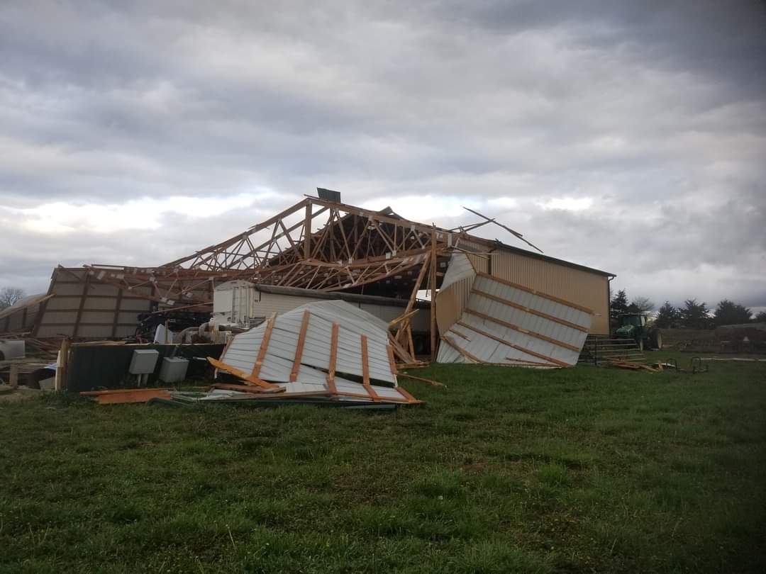
| EF-0 southeast of Wamego. Carport tossed into field. (NWS Damage Survey) |
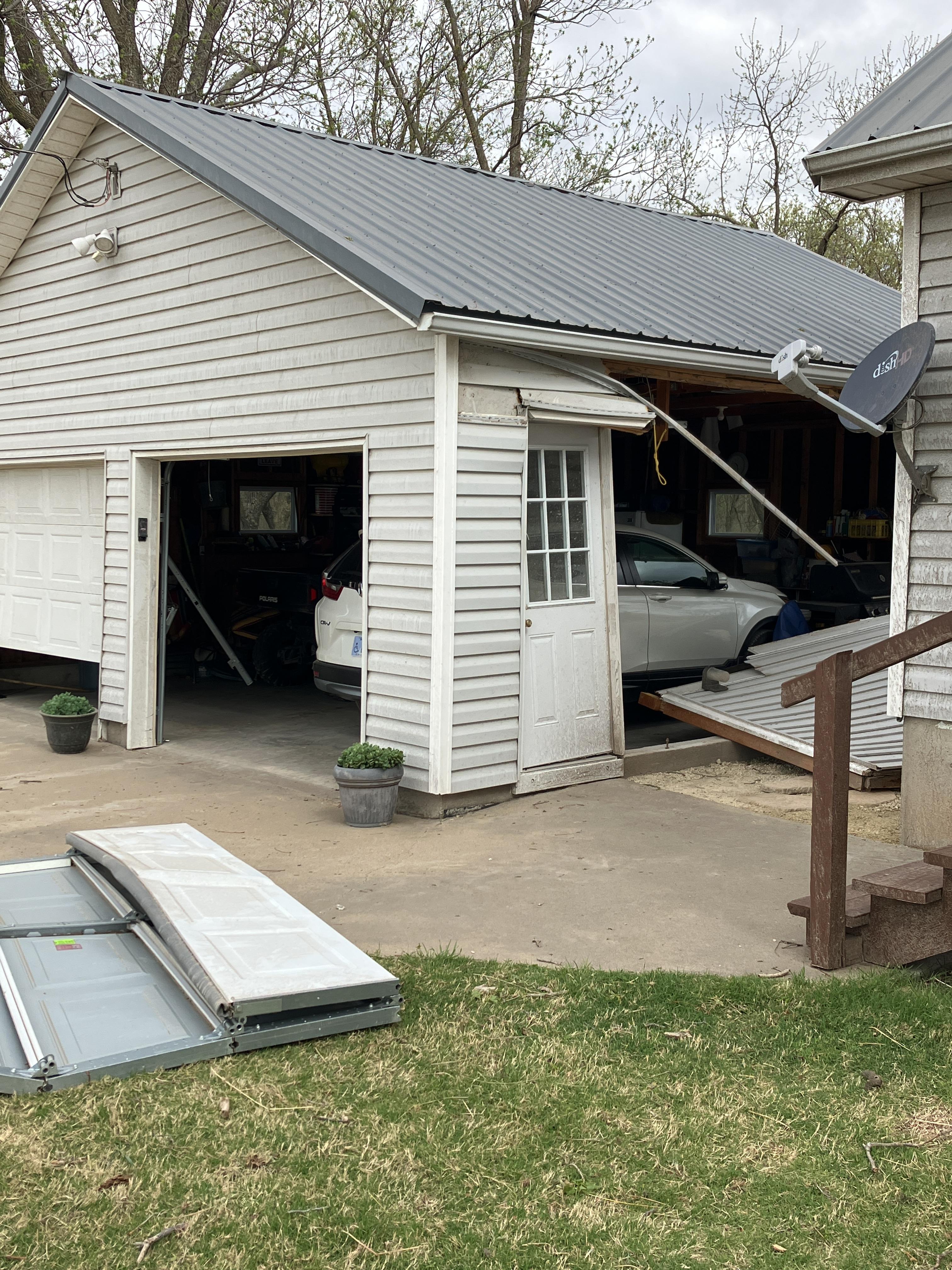
Outbuilding destroyed in Jackson County. EF-1 damage. (NWS Damage Survey) |
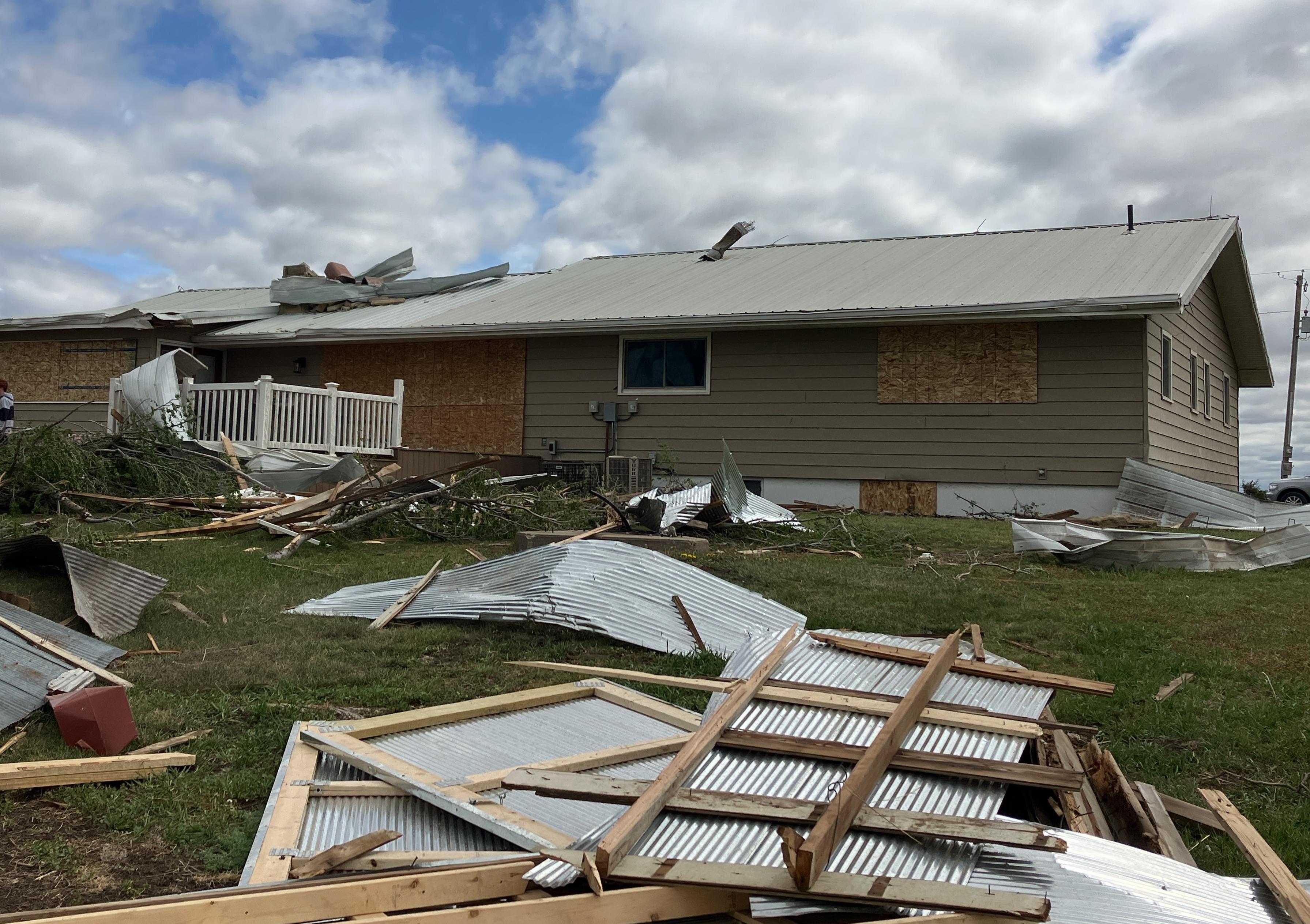
Large outbuilding destroyed east of Eskridge, with winds estimated up to 110 mph. Damage in the area was spread in a divergent pattern, indicating straight-line winds. (NWS Damage Survey) |
Radar
Header
.5.png) |
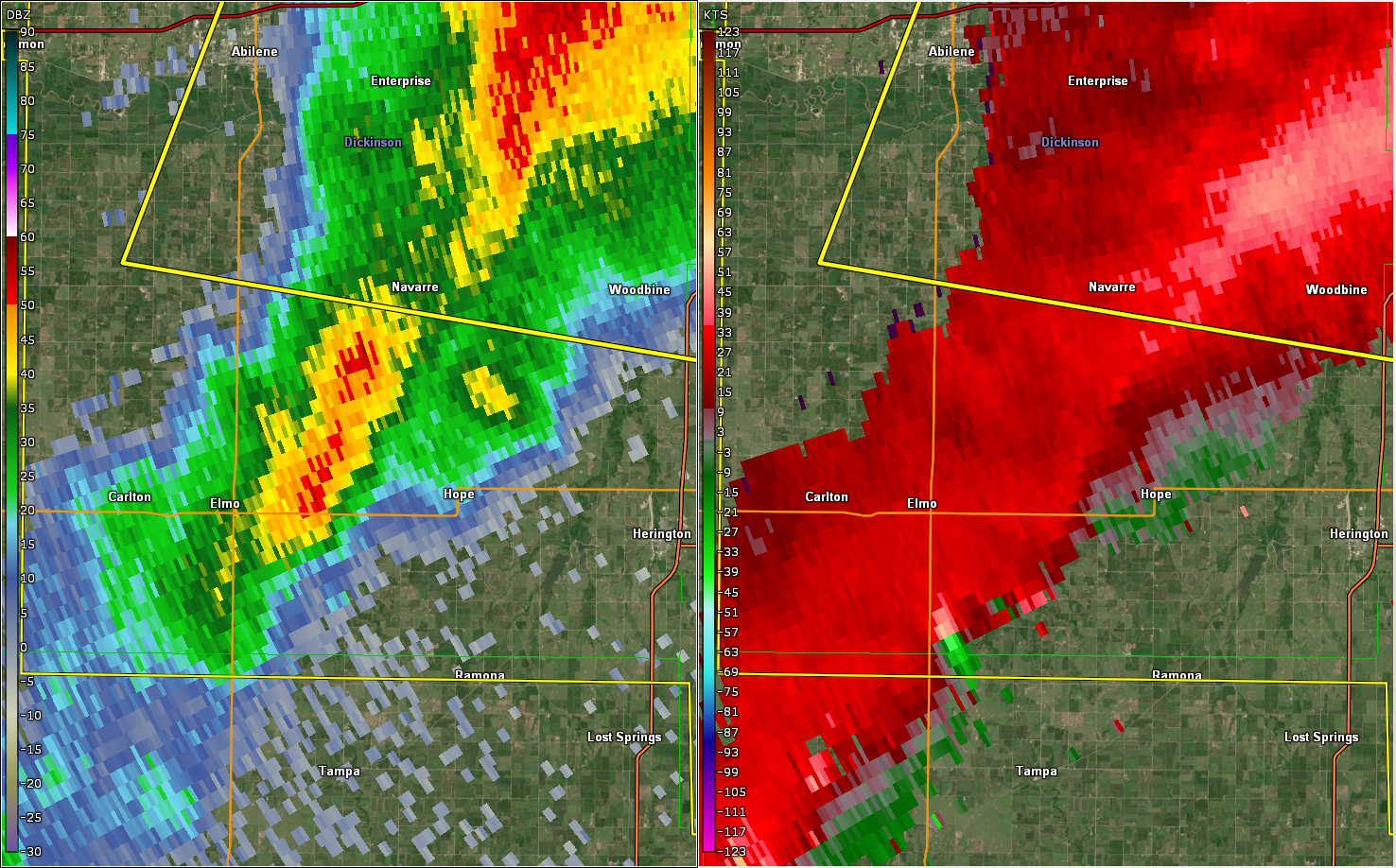 |
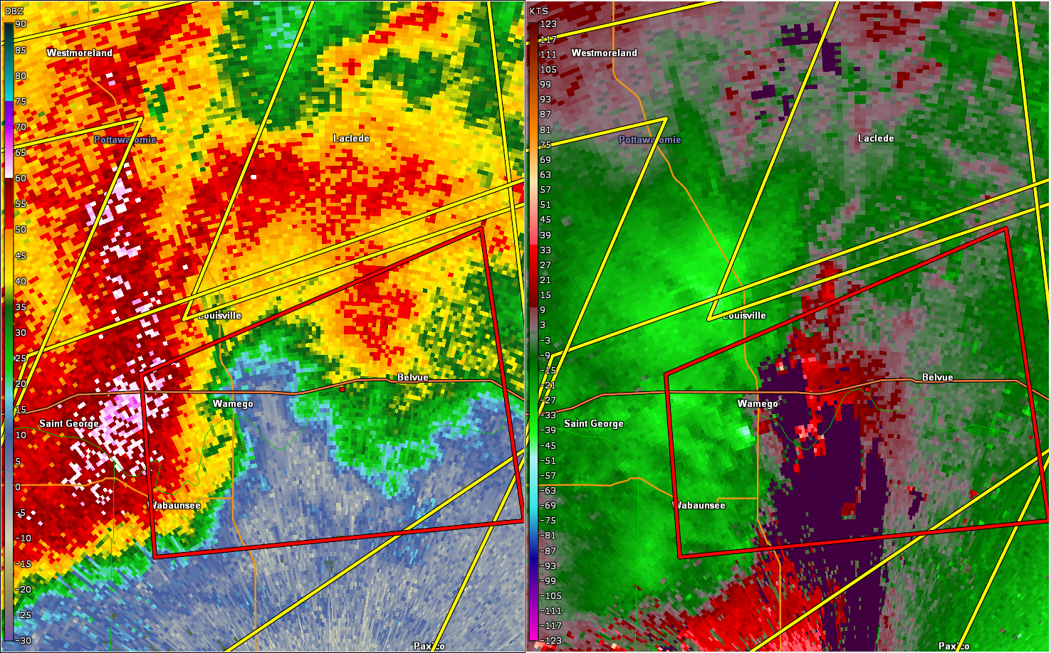 |
| Radar at 6:32pm, at the time of tornado #1 northeast of Carlton. | Radar at 7:53pm, near the beginning of tornado #2 southeast of Carlton. | Radar at 8:09pm, as tornado #3 passed just south of Wamego. |
 |
 |
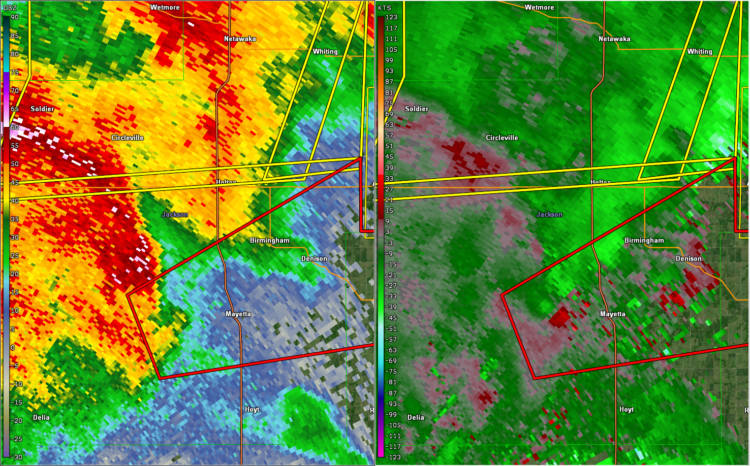 |
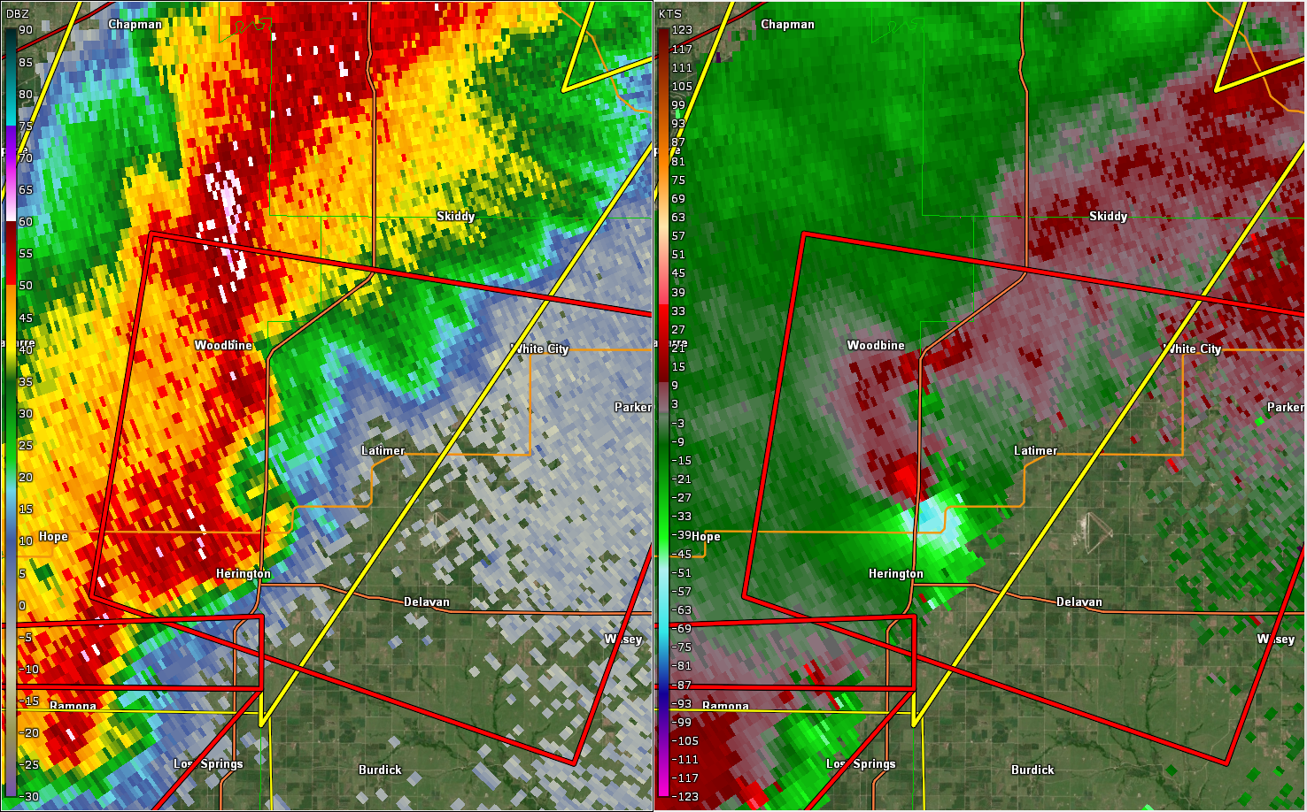
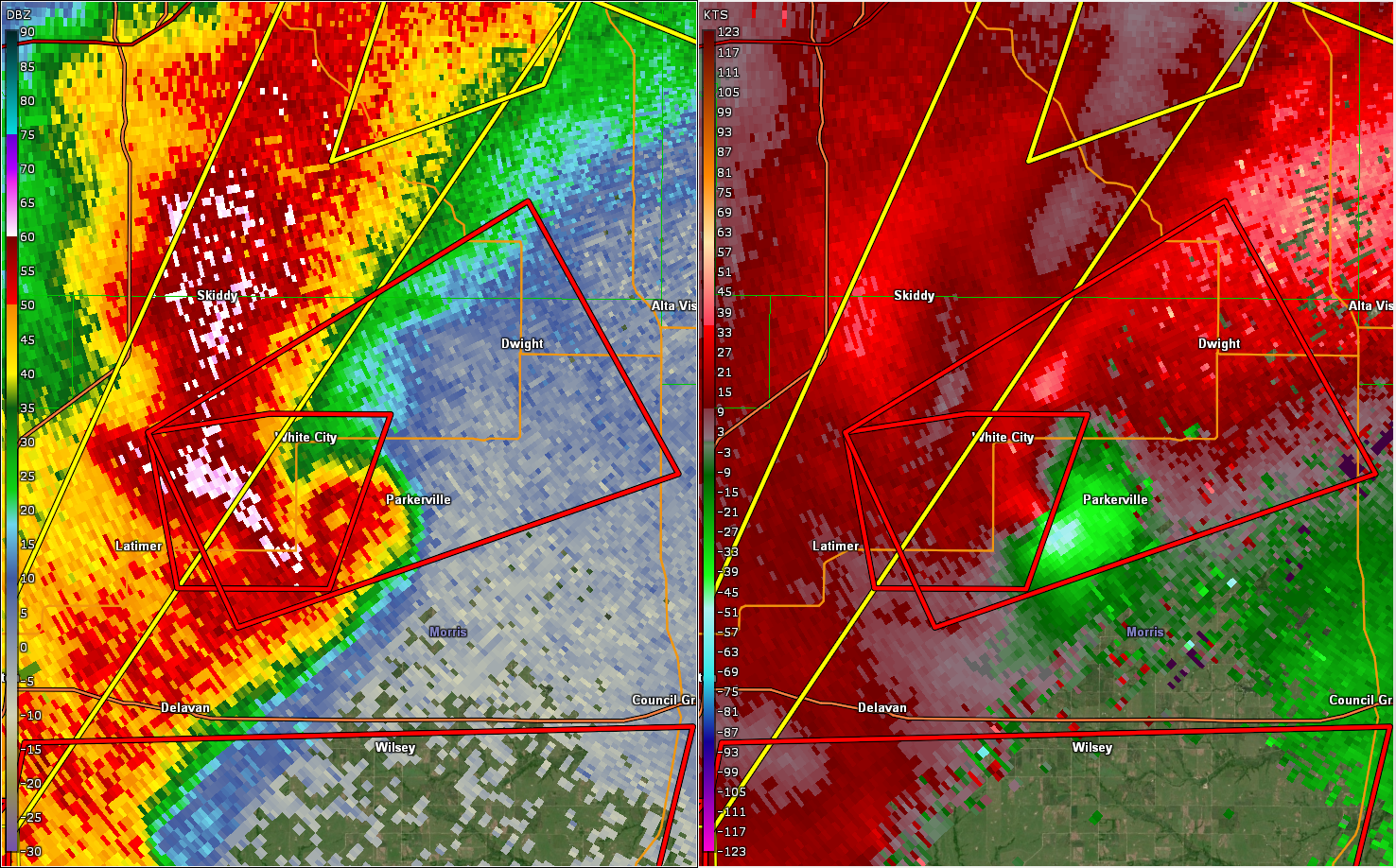
| Radar at 8:09pm, near the beginning of tornado #4 north of Herington. | Radar at 8:25pm, near the end of tornado #4 just southwest of Parkerville. | Radar at 8:43pm, near the end of tornado #5 west of Mayetta. |
Environment
Soundings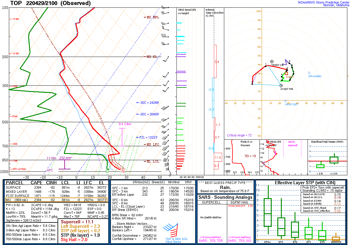 |
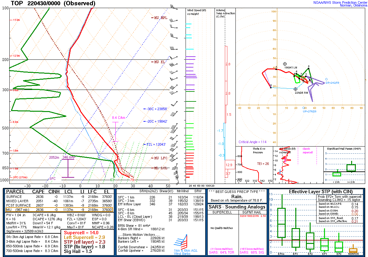 |
| 21z (4pm CDT) Topeka sounding | 0z (7pm CDT) Topeka sounding |
 |
 |
 |
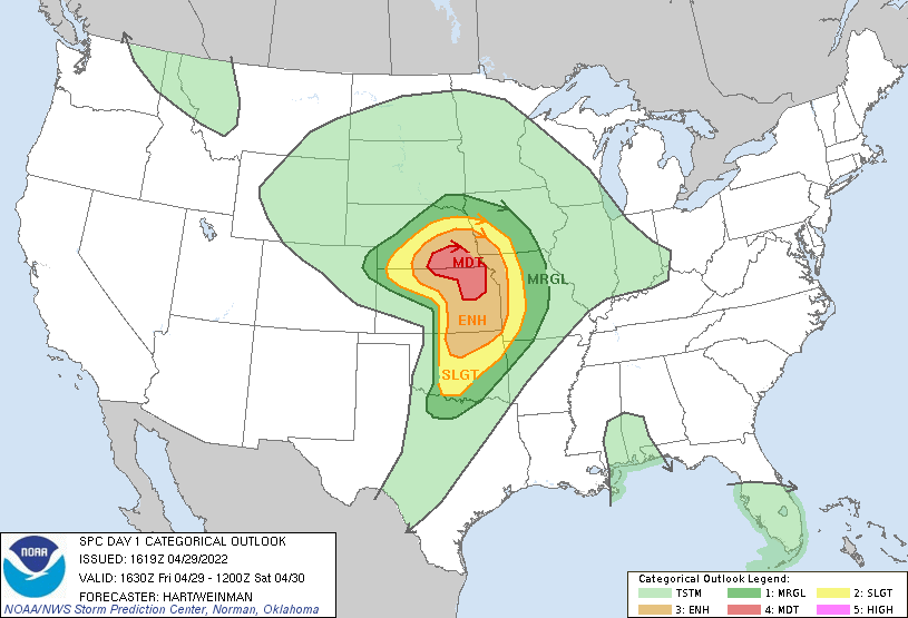
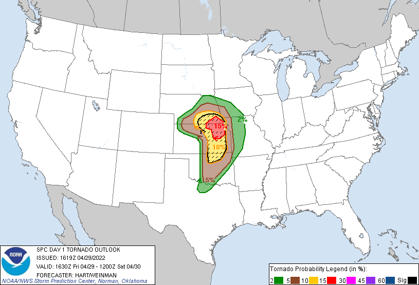
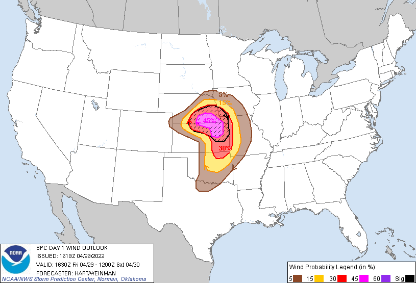 |
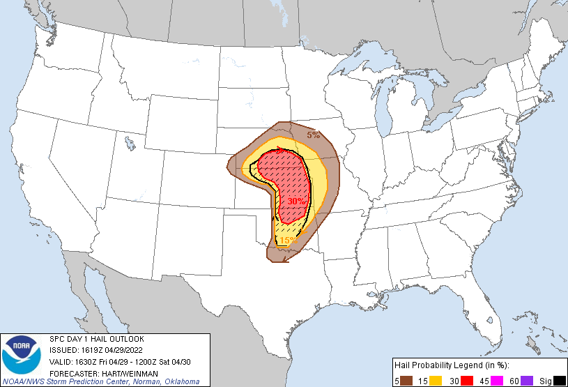
| SPC Outlook - Overall Categories | SPC Outlook - Tornado | SPC Outlook - Hail | SPC Outlook - Wind |
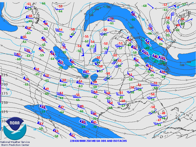
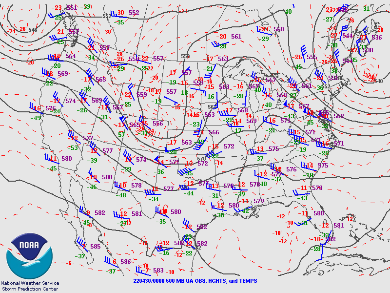
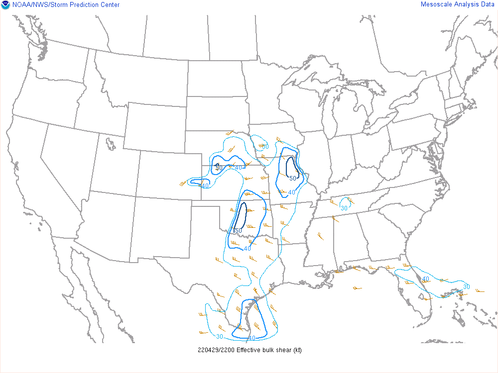
Additional environmental data.
 |
 |
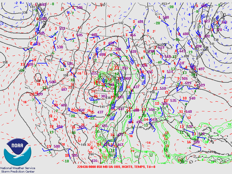 |
| 250 mb pattern valid at 7pm. | 500 mb pattern valid at 7pm. | 850 mb pattern valid at 7pm. |
 |
 |
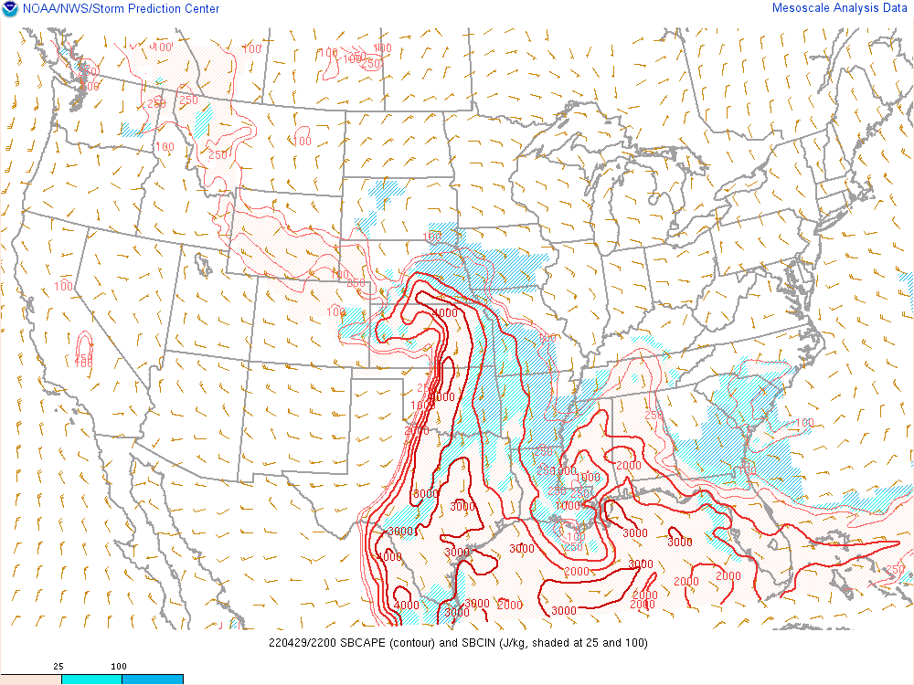 |
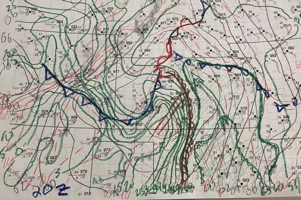
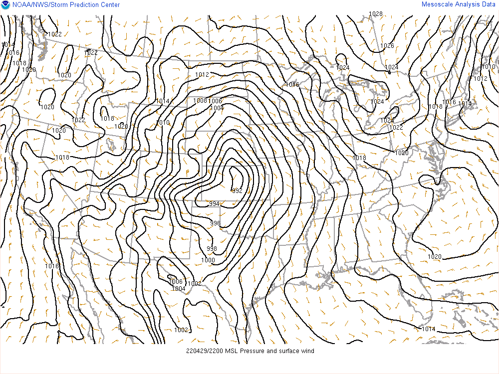
| Hand-drawn surface analysis valid at 3pm. | Figure 8: Sea level pressure and surface winds valid at 5pm. | Surface based CAPE and CIN valid at 5pm. |
|
|
 |
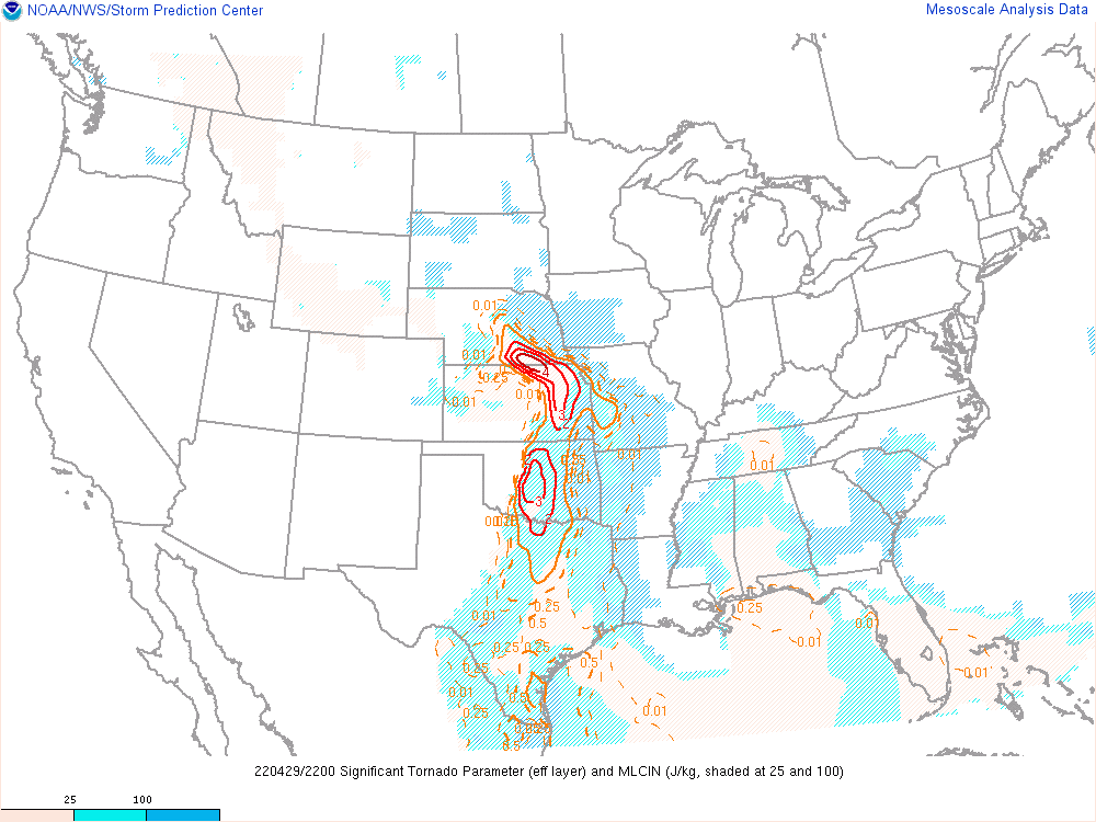 |
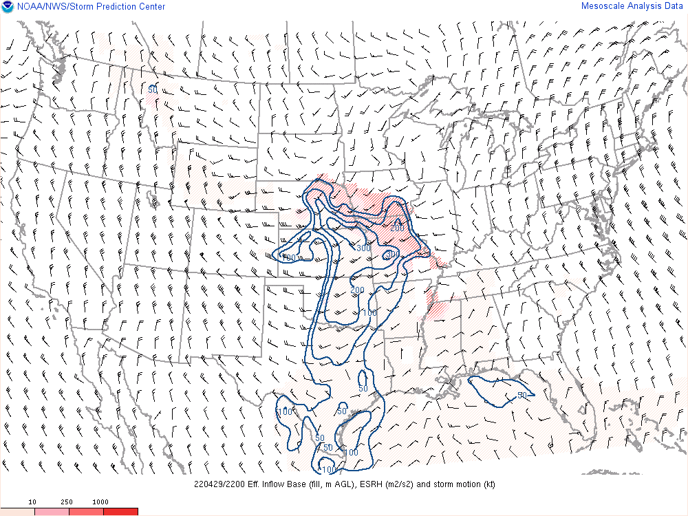
| Effective Storm Relative Helicity valid at 5pm. | Effective Bulk Shear valid at 5pm. | Significant Tornado Parameter valid at 5pm. |
 |
Media use of NWS Web News Stories is encouraged! Please acknowledge the NWS as the source of any news information accessed from this site. |
|