Dangerous heat will expand from the Gulf Coast into the Southern Plains and Desert Southwest through week's end. Additional extreme heat impacting the Pacific Northwest will shift to the northern Plains by the weekend. Tropical Storm Bertha is expected to continue to impact portions of the northern Gulf Coast from the western Florida Panhandle to southeastern Louisiana through tonight. Read More >
Overview
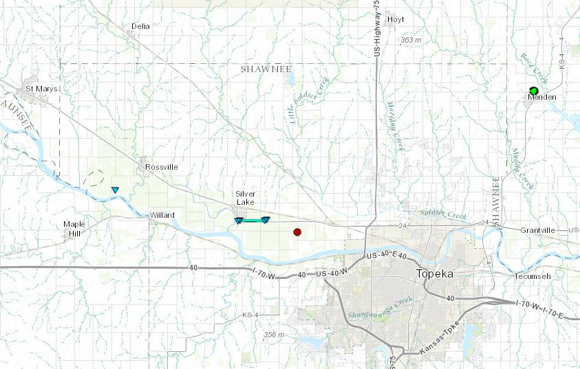
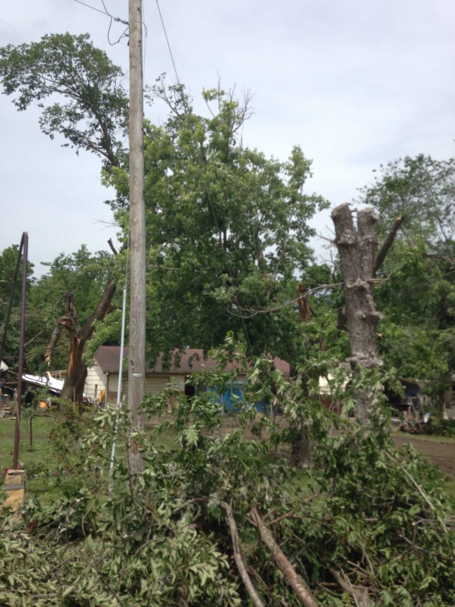
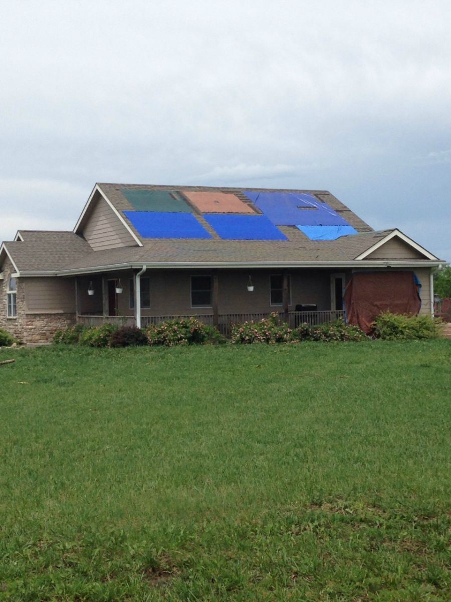
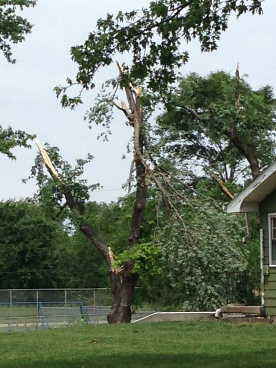
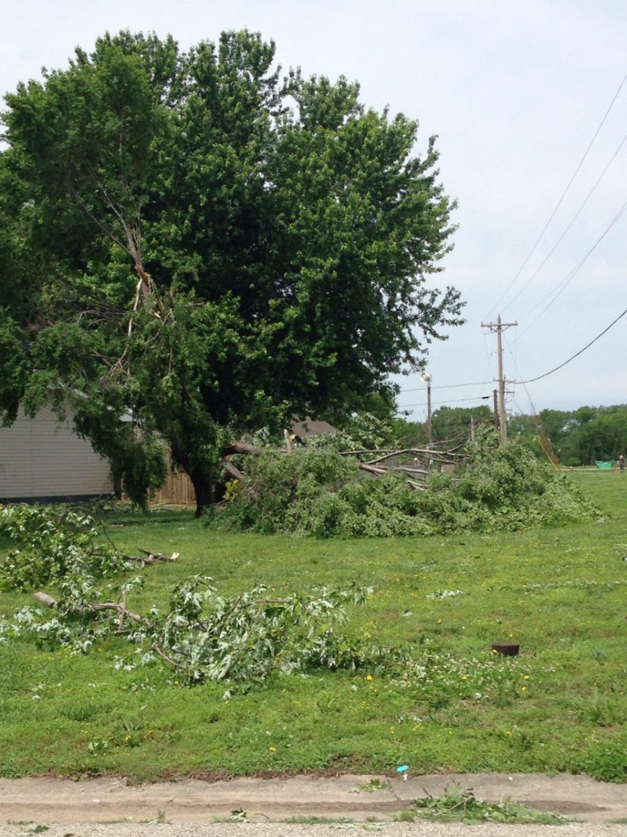
Three tornadoes occurred in northeast Kansas on the afternoon of Thursday, May 26th. One tornado developed near the Kansas River in the south part of Wamego and traveled north through Wamego, damaging trees and producing some minor roof damage to homes. The tornado intensified and produced more intense damage north of Wamego, then traveled through Louisville before ending. A second very brief tornado was spotted by a storm spotter just a couple of miles southwest of Rossville, but was only on the ground for approximately 20 seconds. A third small tornado occurred in Silver Lake and moved quickly within an area of damaging straight line winds associated with a bow echo. The apparent tornado path appeared to be around 50 yards wide. The straight line wind damage swath was much larger and was responsible for overturning irrigation pivots and other damage south of Highway 24.
Tornadoes:
|
Tornado - Wamego
Track Map 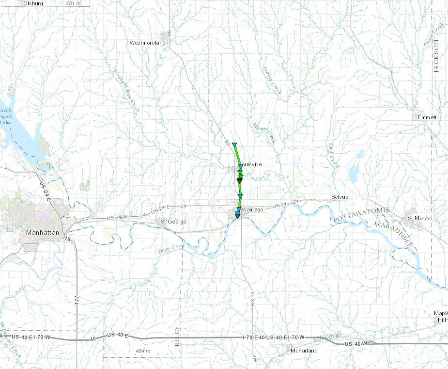 
|
|||||||||||||||||||||||||||||||||
The Enhanced Fujita (EF) Scale classifies tornadoes into the following categories:
| EF0 Weak 65-85 mph |
EF1 Moderate 86-110 mph |
EF2 Significant 111-135 mph |
EF3 Severe 136-165 mph |
EF4 Extreme 166-200 mph |
EF5 Catastrophic 200+ mph |
 |
|||||
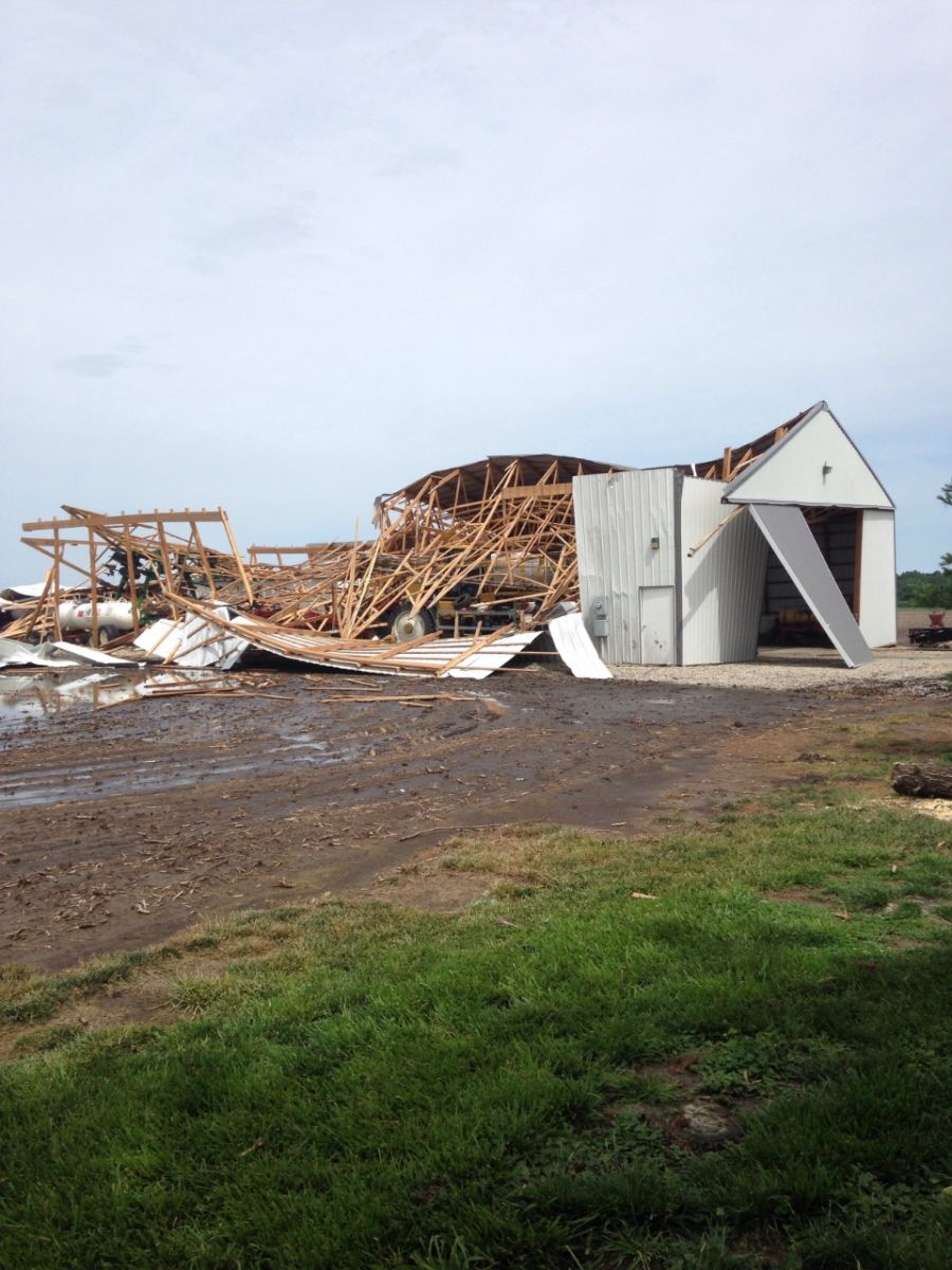
Photos & Video:
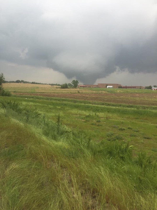
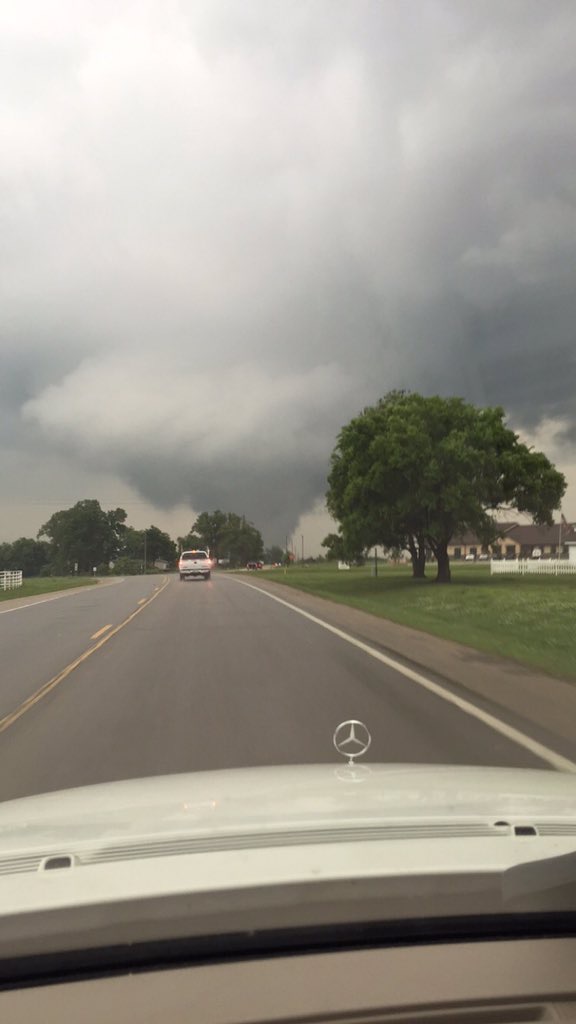
Wamego Tornado
 |
 |
 |
 |
| Tornado near Wamego Photo Courtesy of Chris Schmidt |
Tornado near Wamego Photo Courtesy of Chris Schmidt |
Tree Damage near Wamego |
Roof Damage to a Home north of Wamego |
Silver Lake Tornado
 |
 |
 |
|
| Tree Damage near Silver Lake | Tree Damage near Silver Lake | Damage to an outbuilding near Silver Lake |
|
Storm Reports
Click on this link to view an interactive version of this map and to view detailed information regarding each storm report received.
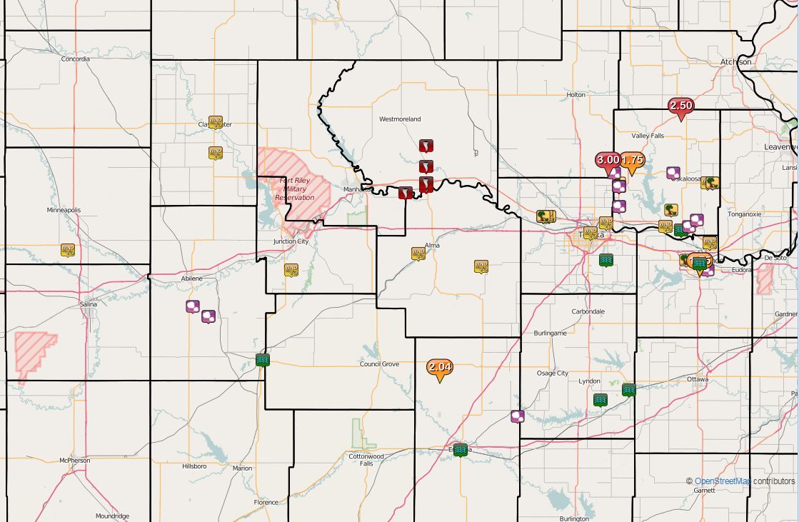 |
| Storm Reports from Thursday, May 26th, 2016 |
 |
Media use of NWS Web News Stories is encouraged! Please acknowledge the NWS as the source of any news information accessed from this site. |
|