Dangerous and extreme heat will remain across portions of the central U.S. this week, persisting across the mid to lower Mississippi Valley, Gulf Coast, southern Plains and portions of Texas. A heat wave over the Southwest U.S. will peak this weekend. Heavy to excessive rainfall may produce flash flooding from the Delmarva Peninsula north into the Hudson Valley today and tonight. Read More >
Overview
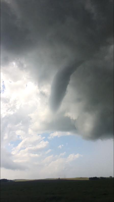
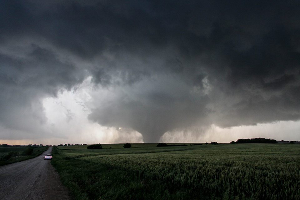
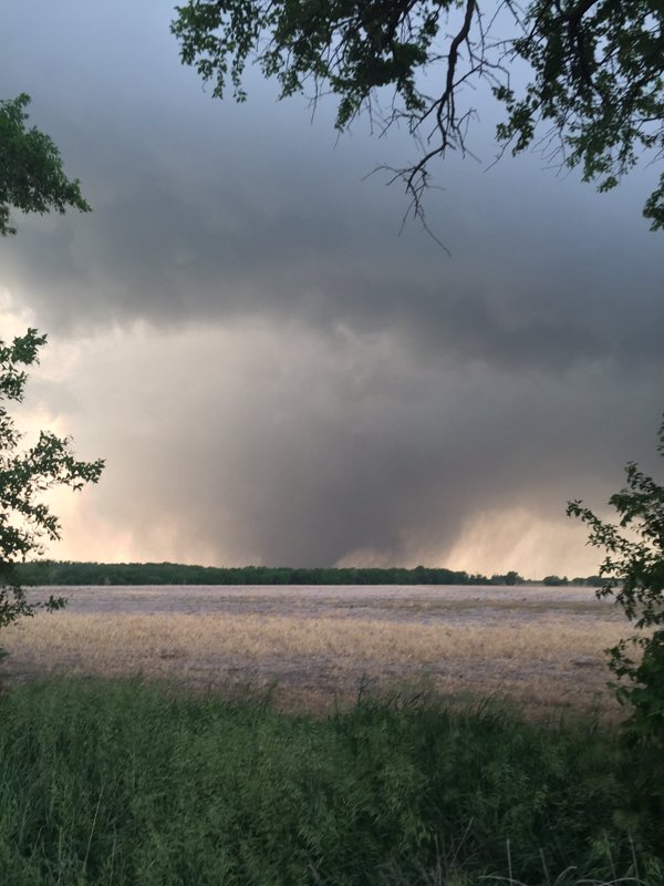
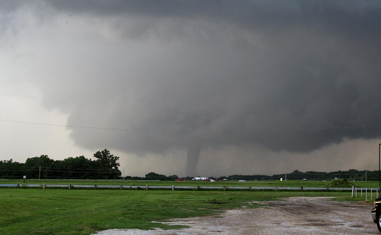
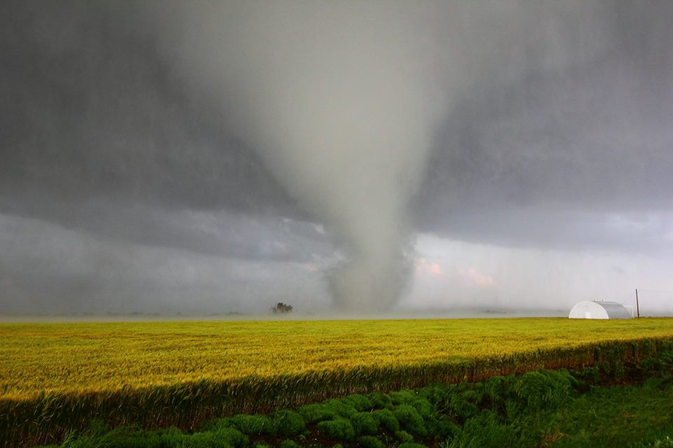
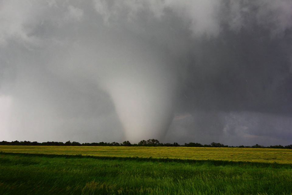
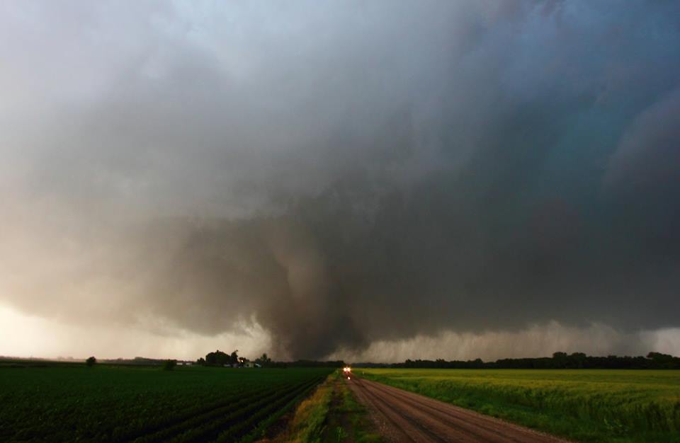
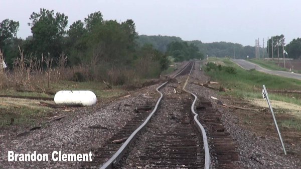
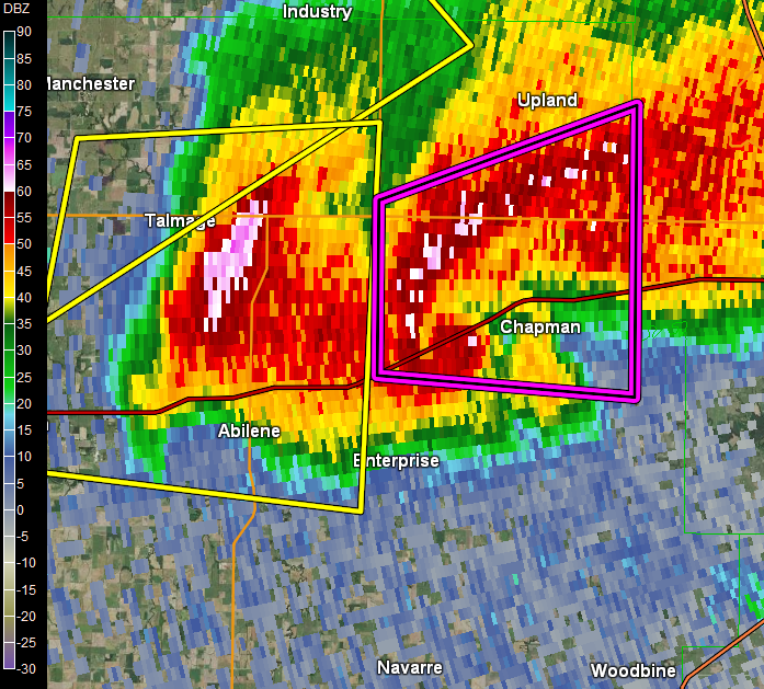
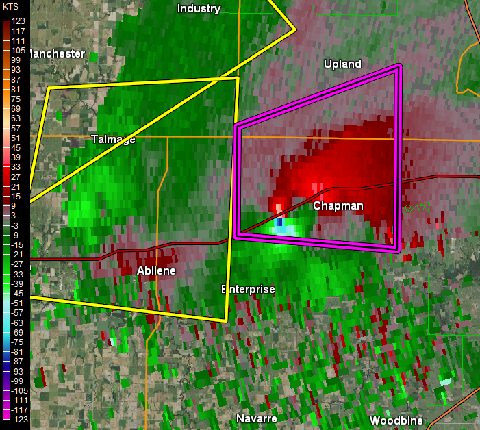
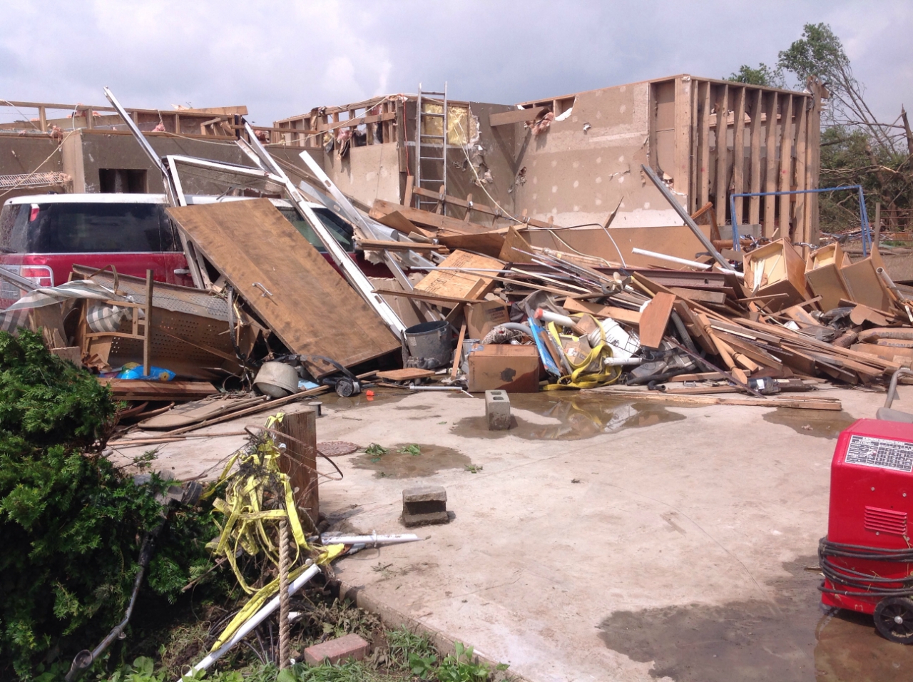
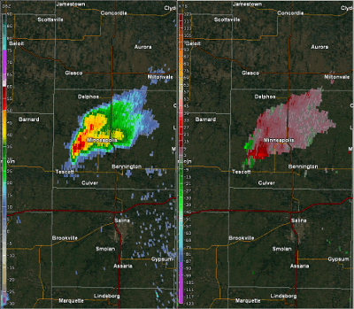
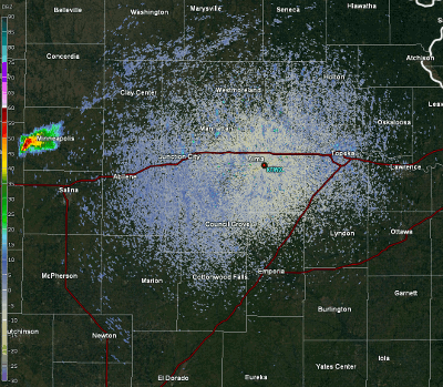
An isolated supercell thunderstorm formed over Ottawa County in north central KS on Wednesday, May 25, 2016, and this storm went on to produce 4 tornadoes. The first tornado touched down at around 6:08 PM 3 miles south of Minneapolis and was on the ground for approximately 1 minute. The second tornado that occurred was a long-track violent EF4 tornado that was on the ground for over an hour and up to a 1/2 mile wide at times. The tornado developed just north of Niles Kansas around 707pm and moved ESE damaging and destroying everything in its path as it passed 2-3 miles north of the city of Abilene. The tornado then appeared to weaken for a time as it moved to the northeast of Abilene however it re-intensified and took a southeast turn as it approached interstate 70 and then went on to produce the most severe damage after crossing interstate 70 just a mile or two southwest of the city of Chapman. The tornado then moved east passing 1 mile south of Chapman and finally dissipated between 835 and 840pm just west of the Dickinson and Geary County line.
Based on spotter reports, there were 2 additional tornadoes that developed from this same storm. The third tornado occurred approximately 3 miles south of Alta Vista in Morris County, and there were reports of structural damage to at least one barn and 4 power-line poles that were snapped. The fourth tornado occurred approximately 6 miles south of Eskridge in Wabaunsee County.
Following is a summary of the damage survey conducted by the National Weather Service.
Tornadoes:
|
Tornado - Near Niles, north of Abilene, to just south of Chapman, KS
|
||||||||||||||||||||||||||||||||
|
||||||||||||||||||||||||||||||||
Radar loops of the long-lived tornadic supercell
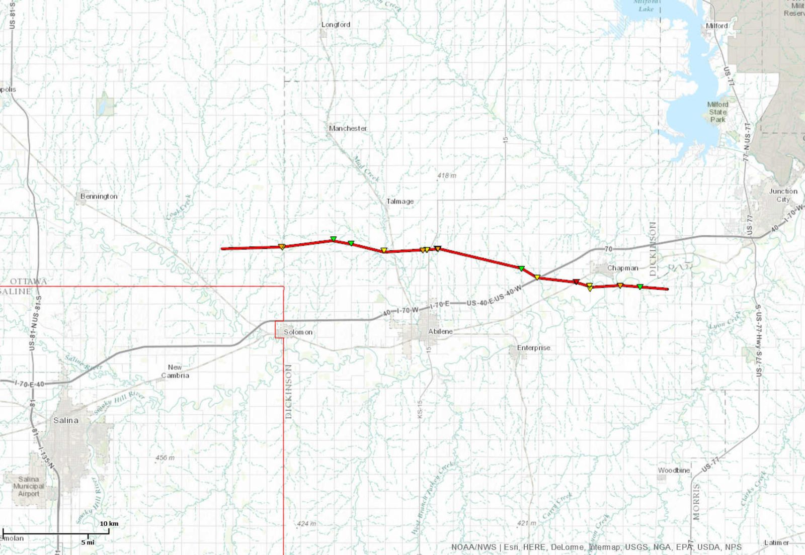
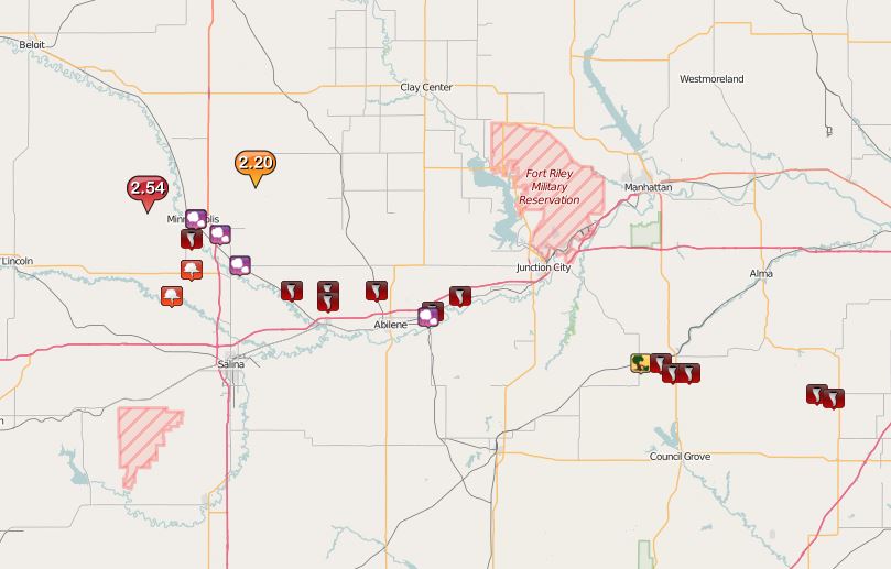
Storm Reports
Click on this link for an interactive version of this map and to view detailed information regarding each storm report received.
 |
|
Storm Reports from Wednesday, May 25th, 2016 |
 |
Media use of NWS Web News Stories is encouraged! Please acknowledge the NWS as the source of any news information accessed from this site. |
|