
Heavy rain and widely scattered severe storms capable of large hail, damaging winds, and possibly a tornado are expected over portions of the central and southern Plains into the Lower Missouri Valley. Unseasonable warmth will continue for a few more days across the Midwest and Southeast where several daily record highs could fall. Read More >
| Frost and Freeze Climatology |
| Arkansas | ||
| (Courtesy of the Southern Regional Climate Center) | ||
| Average Date of: | First 32°F | Last 32°F |
| Average Date of: | First 28°F | Last 28°F |
| Probability of First Freezing Temperatures by Date for Select Cities | ||
| Average Date of First Autumn Freeze (32°F) |
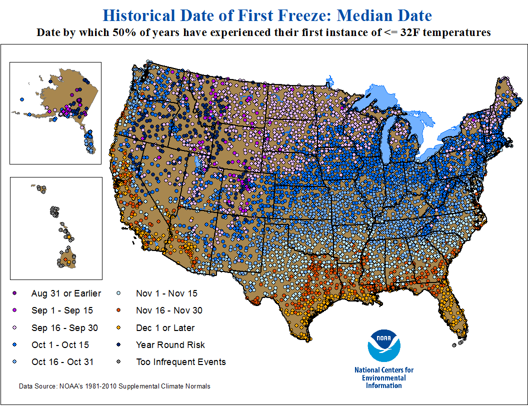 |
| Average Date of Last Spring Freeze (32°F) |
 |
|
Record Earliest Occurrence of the First Frost/Light Freeze (32°F)
|
 |
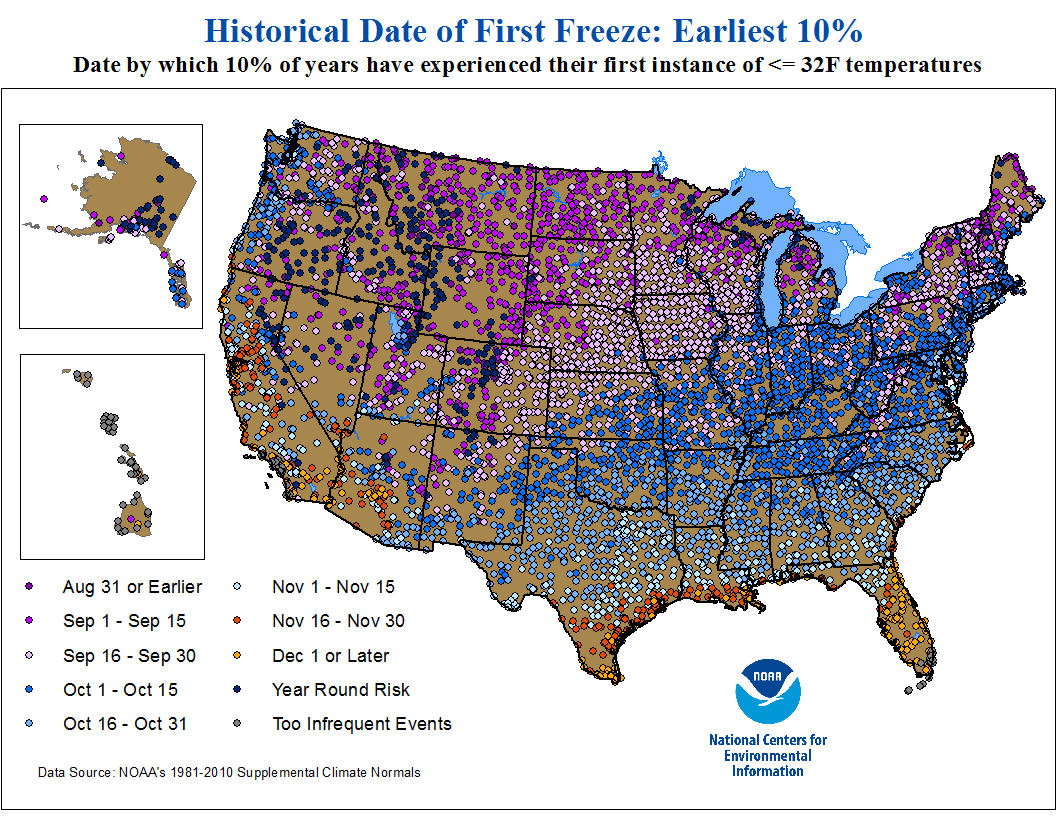 |
|
Record Latest Occurrence of the First Frost/Light Freeze (32°F)
|
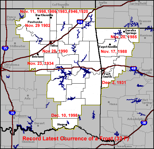 |
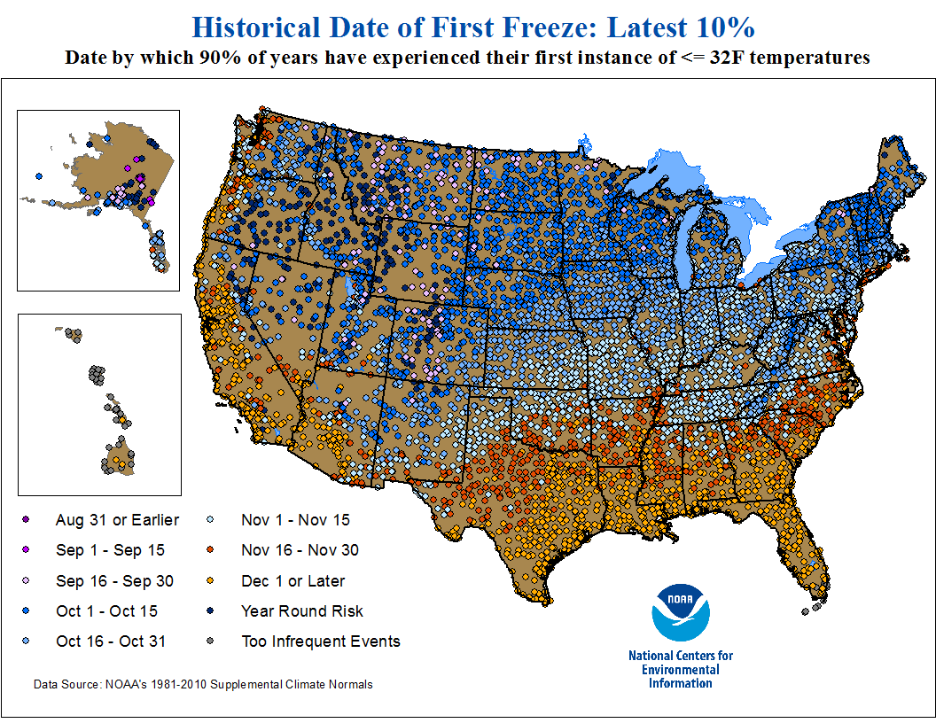 |




 Follow us on X
 Follow us on Facebook
 Follow us on YouTube
 TSA RSS Feed