
Widespread life-threatening flash and urban flooding continues in south-central Texas, with considerable flooding impacts possible across central Texas. Wildfire smoke is impacting air quality across much of the Great Lakes region into southern New England and the Mid-Atlantic. Monsoonal thunderstorms may produce isolated to scattered flash flooding across the Southwest into the Great Basin. Read More >
March 25, 2015 Severe Weather Event
Information on this webpage is considered preliminary.
Anyone with information that could enhance the record of these storms should contact the National Weather Service Office in Tulsa at 918-838-7838 during business hours or send us an email at: sr-tsa.stormreport@noaa.gov. Information can also be posted on our Facebook page.
| Jump to: | Event Summary | Clifty Tornadoes | Other Event Images |
| Sand Springs/West Tulsa Co. Tornado | Northeast Tulsa Tornado | Return to all Weather Events webpage |
Event Summary – March 25, 2015
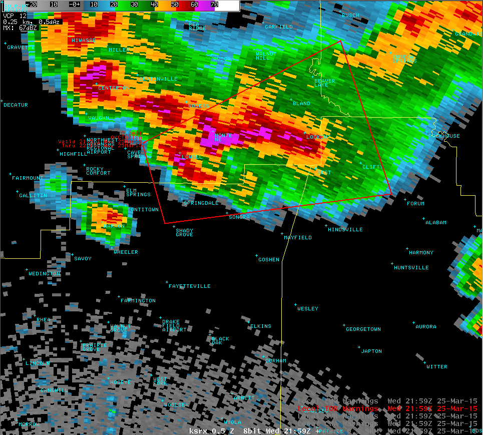
Severe thunderstorms developed late in the afternoon on March 25, 2015 near a warm front that had surged north into northeast Oklahoma and northwest Arkansas. With a highly sheared and unstable air mass in place across the area, discrete supercells were able to develop near the warm front late in the afternoon and into the early evening hours. Several tornadoes were spawned from the supercells from west of Tulsa into northwest Arkansas. As the evening wore on, a cold front surged into the area from the northwest and thunderstorms congealed into a line along the cold front marching to the south and east during the evening and overnight hours. Many of the storms became severe producing large hail and damaging winds before exiting southeast Oklahoma and west-central Arkansas.
In addition to the severe weather, heavy rains caused flooding across northeast Oklahoma and northwest Arkansas.
Preliminary Tornado Information (last updated 11am 04/01/15):
Information from this event is still considered preliminary. Anyone with information that could enhance the record of this event should contact the National Weather Service Office in Tulsa at 918-838-7838 during business hours, or send us an email at sr-tsa.stormreport@noaa.gov.
Images related to each tornado can be enlarged by clicking. Hover your mouse over the image for a caption.
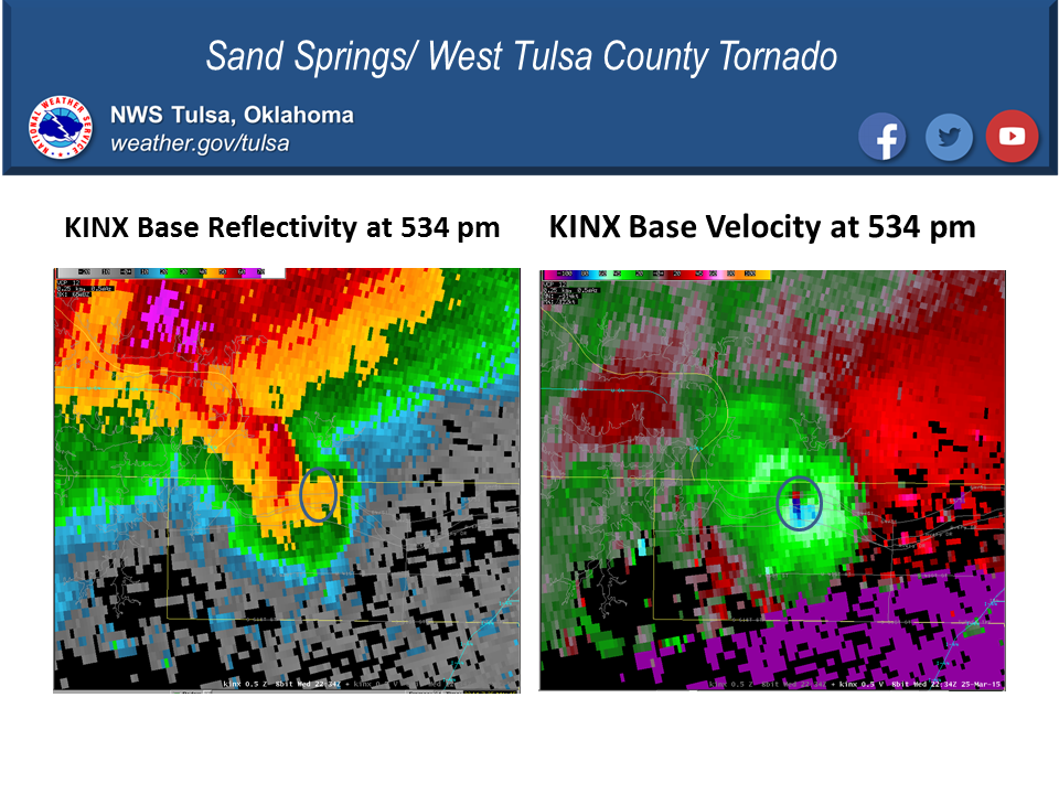
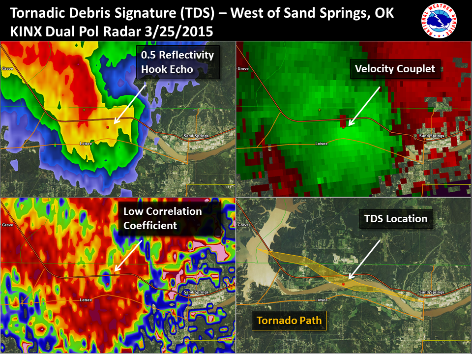
| Sand Springs/West Tulsa County Tornado (Pawneed/Osage/Tulsa Counties OK) | ||
| EF-Scale | EF-2 |
Damage:
|
| Maximum Estimated Wind Speed | 125 - 135 mph |
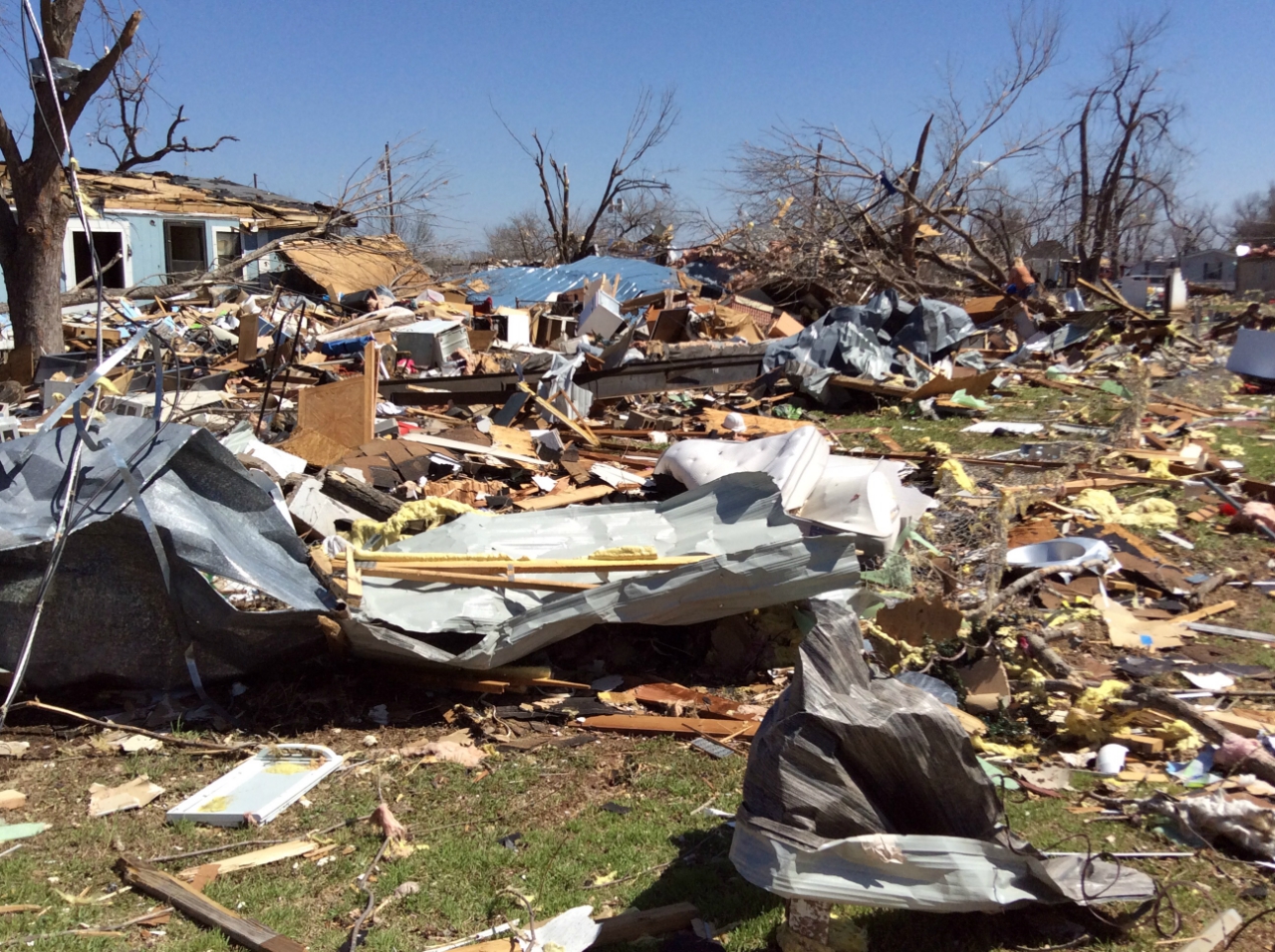
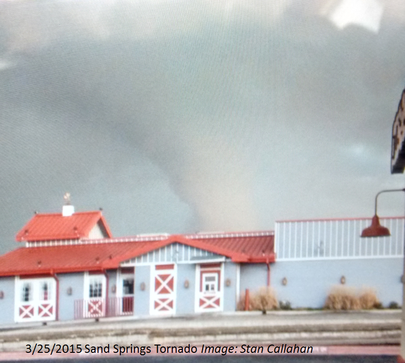
The tornado developed over Keystone Lake in Pawnee County, and moved ESE across Highway 412 near the bridge at the Pawnee/Osage County line. It damaged ranch style homes, barns, and a church on 209th West Ave. The tornado traveled SE damaging several more homes on 193rd West Ave and crossed Highway 412 where it blew over a semi tractor trailer. Large utility poles were snapped south of Highway 412, and a doughnut business was destroyed at 177th West Ave. The tornado continued SE across the Arkansas River, then moved eastward across River Oaks Estates mobile home park where numerous homes were destroyed, resulting in one fatality and 30 injuries. The tornado then crossed the river again, as it headed toward Sand Springs where it dissipated just before reaching Highway 97. Numerous trees were snapped and uprooted along the path, and many power poles were also snapped. Extensive wind damage was also found further east on Charles Page Blvd. A broad area of wind damage, generally from the north to south, caused shingle damage and minor structural damage to many homes, uprooted numerous trees, and damaged businesses. The north facing wall of a gymnastics facility collapsed inward, resulting in the roof collapsing over that portion of the building. 75 children were in the facility at the time and were taken to underground shelter before the wind struck the building. These winds were estimated to be around 100mph. |
| Path Length | 11.1 miles | |
| Maximum Path Width | 800 yards | |
| Start Location and Time | 4 miles southeast of Westport, OK at 5:21pm CDT on March 25, 2015 | |
| End Location and Time | 0.6 miles southwest of Sand Springs, OK at 5:38pm CDT on March 25, 2015 | |
  |
  |
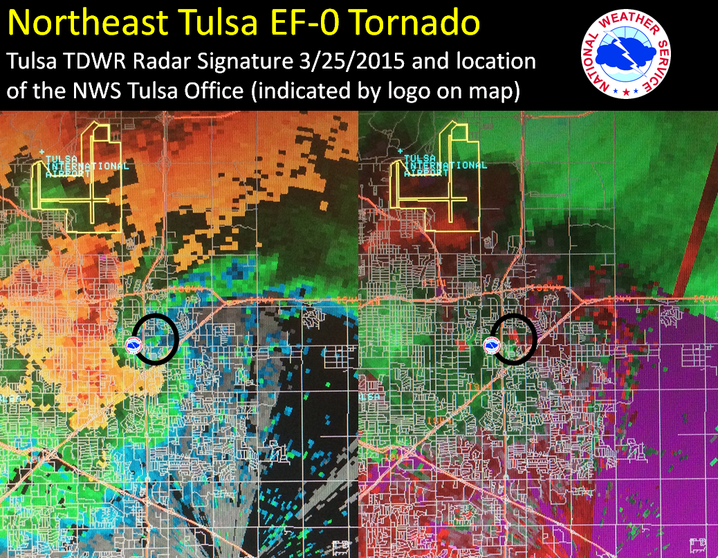
| Northeast Tulsa Tornado (Tulsa County OK) | ||
| EF-Scale | EF-0 |
Damage:
|
| Maximum Estimated Wind Speed | 70 to 80 mph | A tornado developed in an undeveloped area south of the Tulsa International Airport and moved southeast toward Admiral Blvd. The tornado damaged several mobile homes, a number of permanent homes, and snapped large tree limbs north of I-244. Numerous homes, a number of mobile homes, a strip mall, an apartment complex, and businesses were damaged south of I-244 and west of Highway 169. The tornado continued southeastward as it crossed Highway 169 at and south of Admiral Blvd., damaging the roofs of numerous homes and snapping many large tree limbs. A carport was destroyed and a garage was partially pushed inward as the tornado turned more southerly before dissipating near E. 11th St. S., just west of Garnett Road and 900 yards east of the NWS Office in Tulsa. |
| Path Length | 2.3 miles | |
| Maximum Path Width | 600 yards | |
| Start Location and Time | 1.8 miles south of Tulsa International Airport, OK at 6:01pm CDT on March 25, 2015 | |
| End Location and Time | 3.7 miles southeast of Tulsa International Airport, OK at 6:05pm CDT on March 25, 2015 | |
  |
| Clifty Tornado #1 (Madison County AR) | ||
| EF-Scale | EF-1 |
Damage:
|
| Maximum Estimated Wind Speed | 95 - 105 mph | A tornado developed northwest of Clifty, where it severely damaged three chicken houses and damaged a home. It moved east-northeast, damaging an additional chicken house, several homes, and snapped trees along Highway 127. The tornado then damaged a mobile home, another chicken house, and trees as it crossed Highway 23. |
| Path Length | 3.9 miles | |
| Maximum Path Width | 650 yards | |
| Start Location and Time | 2.6 miles northwest of Clifty, AR at 526 pm CDT on March 25, 2015 | |
| End Location and Time | 3.5 miles northeast of Clifty, AR at 533 pm CDT on March 25, 2015 | |
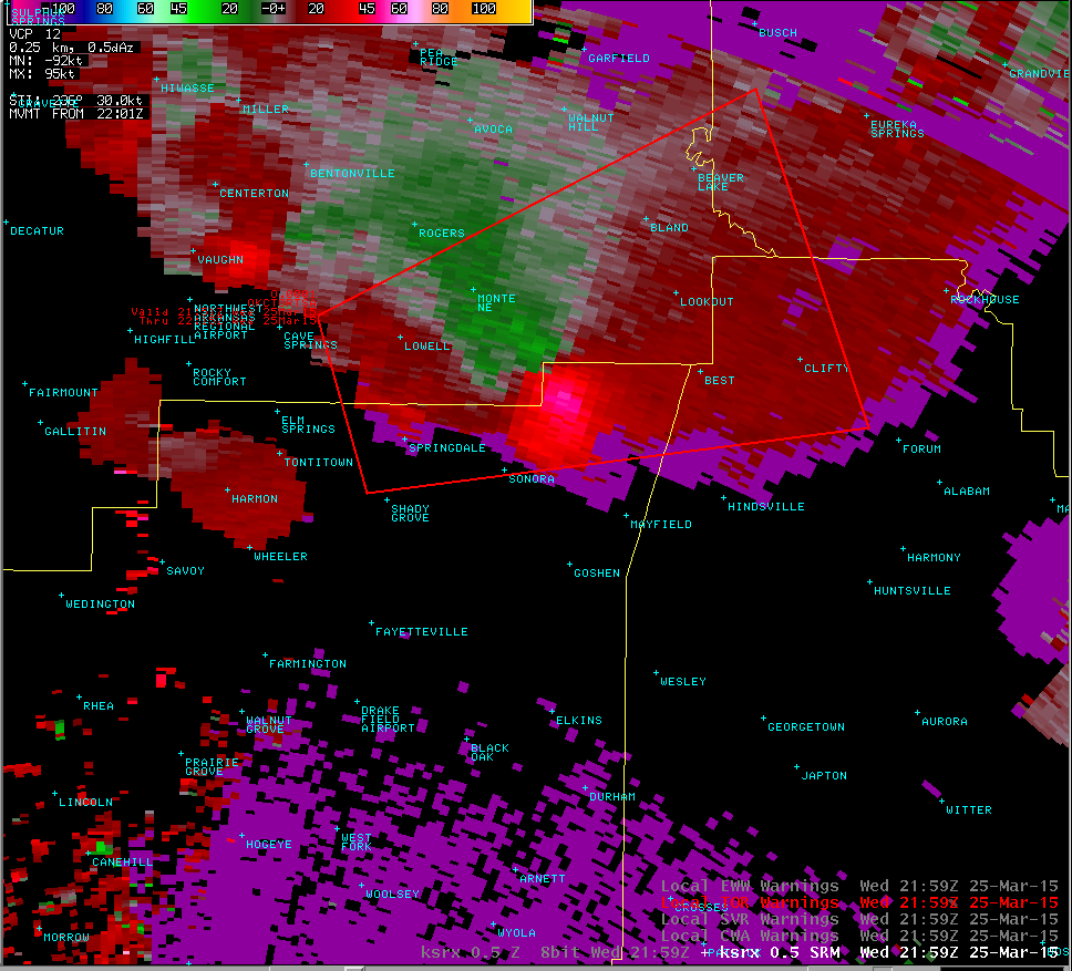
| Clifty Tornado #2 (Madison County AR) | ||
| EF-Scale | EF-0 |
Damage:
|
| Maximum Estimated Wind Speed | 75 - 85 mph | Based on radar data and the ground survey, it appears that another tornado developed to the south of the dissipating tornado west of Highway 23 northeast of Clifty. It crossed Highway 23 damaging the roof of a house, snapping large tree limbs, and destroying a barn. It dissipated before reaching County Road 1050. |
| Path Length | 1.0 miles | |
| Maximum Path Width | 200 yards | |
| Start Location and Time | 2.7 miles northeast of Clifty, AR at 532 pm CDT on March 25, 2015 | |
| End Location and Time | 3.7 miles northeast of Clifty, AR at 534 pm CDT on March 25, 2015 | |
  |
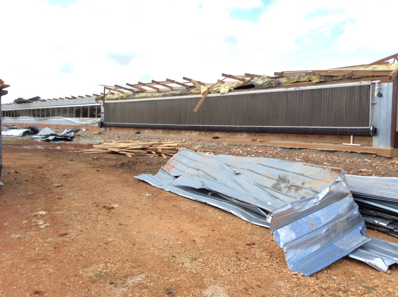  |
Image captions below the image. Click on image to open a larger version in a new window.
 |
 |
 |
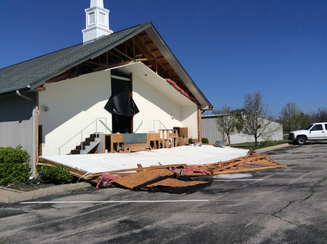
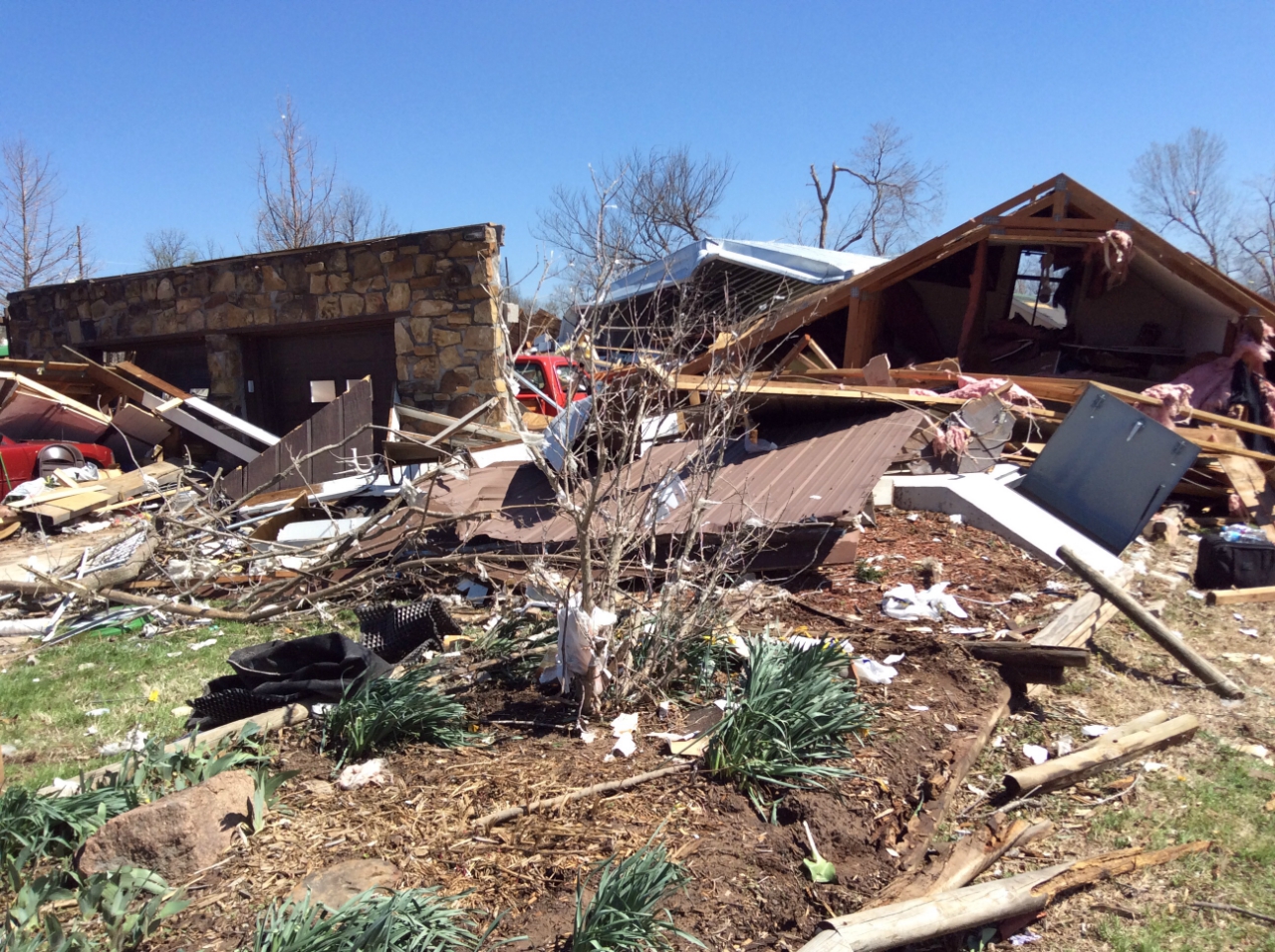
| Damage to a church from the Sand Springs tornado. Image: NWS Tulsa | Damage to farm buildings from the Sand Springs tornado. Image: NWS Tulsa | Destroyed metal building from the Sand Springs tornado. Image: NWS Tulsa |
 |
 |
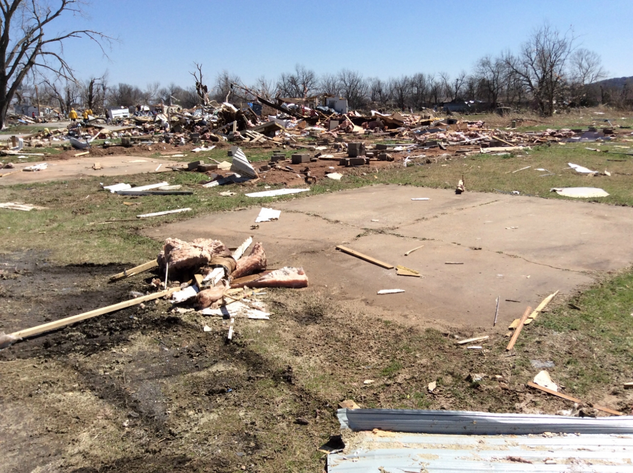 |
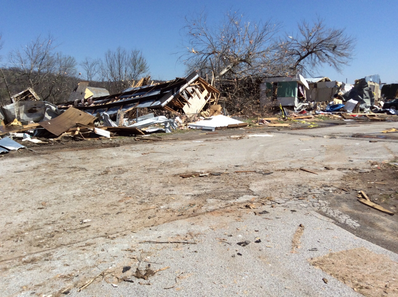
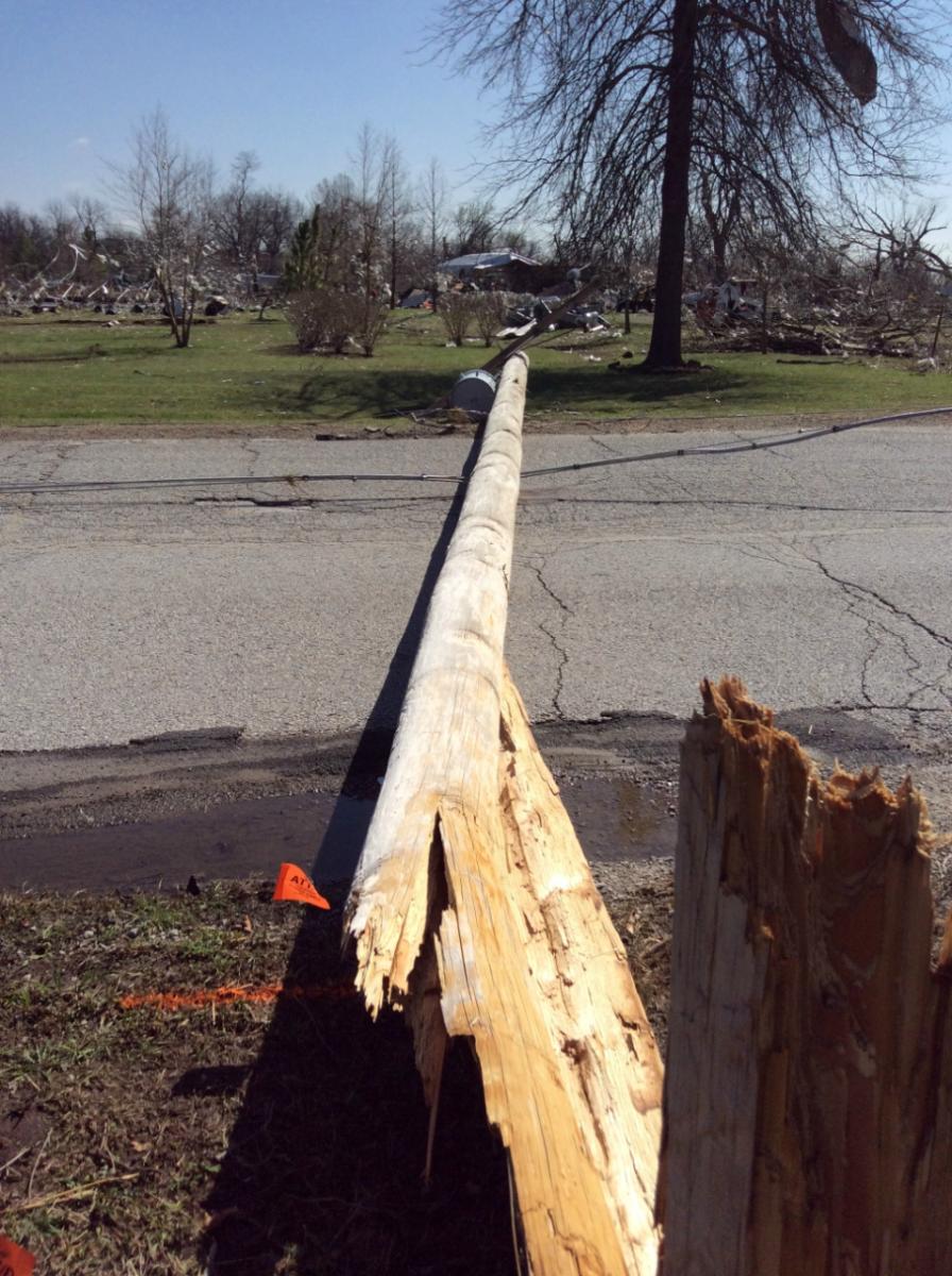
| Mobile home damage from the Sand Springs tornado. Image: NWS Tulsa | Utility pole damage from the Sand Springs tornado. Image: NWS Tulsa | Mobile home destroyed from the Sand Springs tornado. Image: NWS Tulsa |
 |
 |
 |
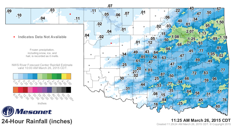
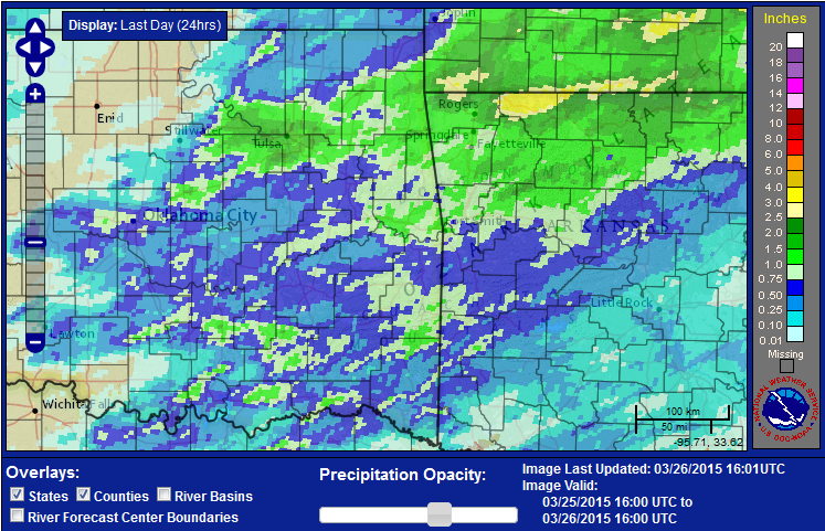
| 24-hour rainfall measurements from the Oklahoma Mesonet ending at 11:25am CDT March 26, 2015 | 24-hour rainfall from the Arkansas-Red River Basin River Forecast Center ending at 11am CDT March 26, 2015 | Extensive wind damage was found on Charles Page Blvd. on the west side of Tulsa. A broad area of wind damage, generally from the north to south, caused shingle damage and minor structural damage to many homes, uprooted numerous trees, and damaged businesses. The north facing wall of a gymnastics facility collapsed inward, resulting in the roof collapsing over that portion of the building. 75 children were in the facility at the time and were taken to underground shelter before the wind struck the building. These winds were estimated to be around 100mph. Image: NWS Tulsa |

