
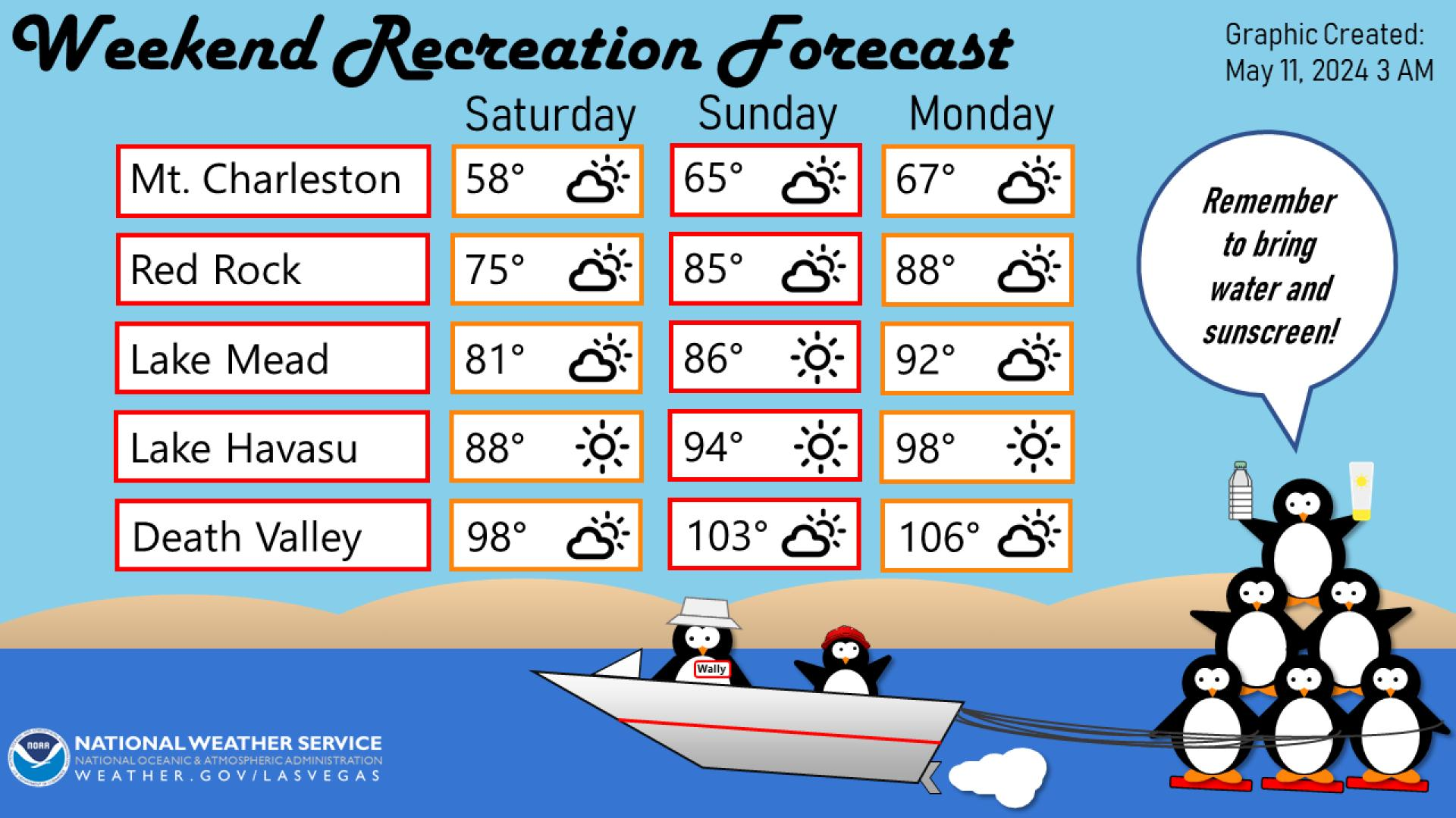
A strong Pacific storm continues to track across the Great Basin. Heavy snow is expected across the higher elevations and heavy rain across lower terrain. Strong gusty winds will make for additional hazards for travelers. These winds will bring increasing fire weather concerns for the southern High Plains. Then we will closely watch for severe thunderstorms across the central Plains on Monday. Read More >
Last Map Update: Sun, May. 5, 2024 at 2:13:57 pm PDT


 nowCOAST Real-Time Observations & Forecasts
 Graphical Forecast
 Satellite
 Las Vegas Radar
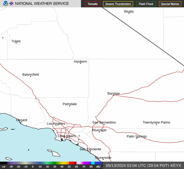 Edwards Radar
 Surface Weather Map
 Social Media
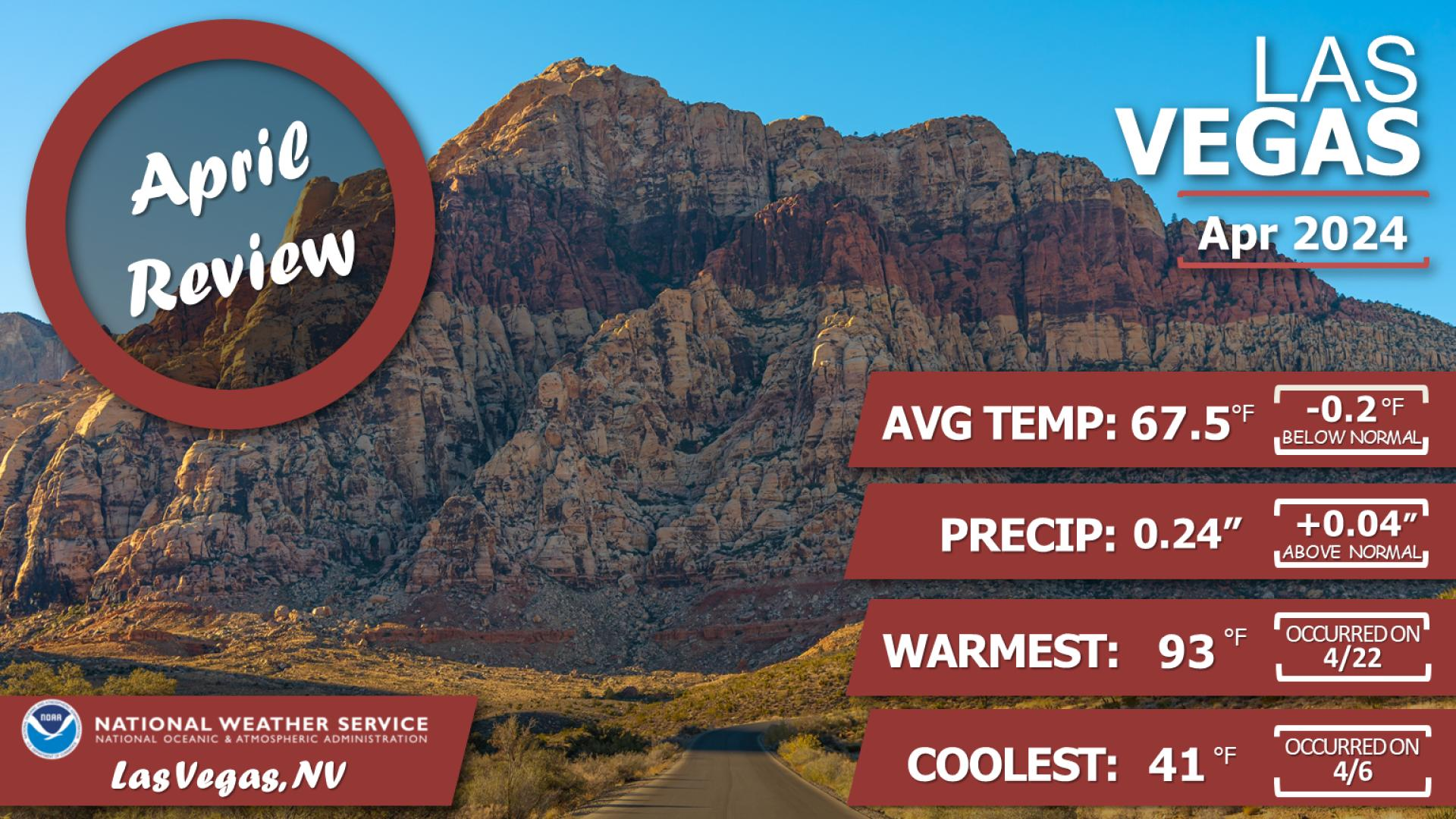
 Las Vegas Daily Climate
 Follow us on YouTube