Please help the NWS spread these important safety messages and posts about historic tsunamis on social media! Everyone is welcome to use the text and images provided below to help the NWS build a Weather-Ready Nation.
Facebook
A tsunami can strike any ocean coast at any time throughout the year. While they don’t happen very often, they pose a major threat to coastal communities. Check out this video for things you can do to prepare. https://youtu.be/x0GX_kc7JZo #TsunamiPrep
Twitter
A #tsunami can strike any ocean coast, any time. If you live, work or play on the coast, you should prepare for a tsunami. https://youtu.be/x0GX_kc7JZo #TsunamiPrep
Facebook
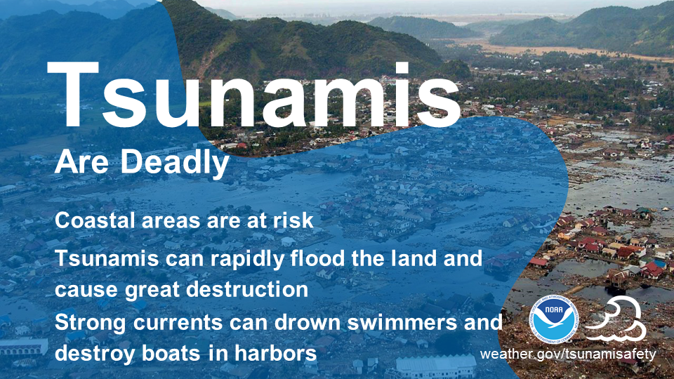
A tsunami can be very dangerous to life and property on the coast. It can produce strong and dangerous currents, rapidly flood the land, and cause great destruction. Even small tsunamis can be dangerous. Strong currents can injure and drown swimmers and damage and destroy boats in harbors. weather.gov/tsunamisafety #TsunamiPrep
Twitter
A #tsunami, which may resemble a fast-rising flood, can be very dangerous to life & property. weather.gov/tsunamisafety #TsunamiPrep
|
Facebook
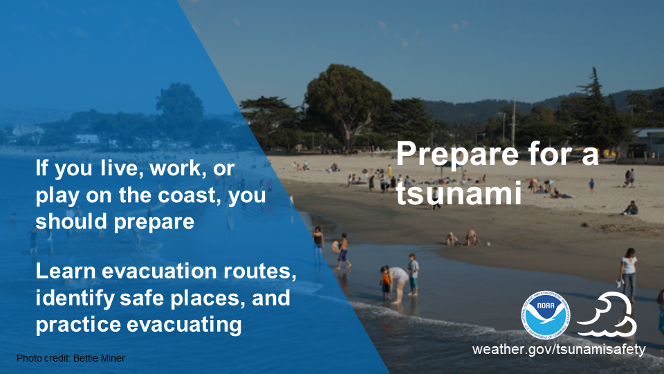
If tsunamis are a threat in your community, you should include tsunami-specific preparations in your emergency plan. Learn the evacuation routes, identify safe places, and practice evacuating. weather.gov/safety/tsunami-before #TsunamiPrep
Twitter
At risk from #tsunamis? Plan for and practice evacuation. weather.gov/safety/tsunami-before #TsunamiPrep
|
Facebook
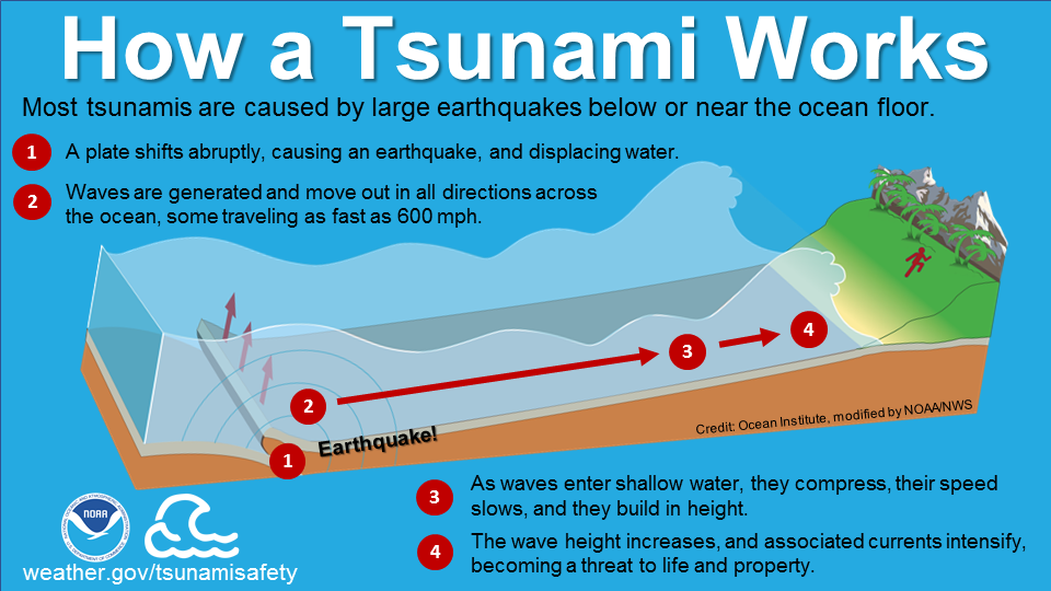
What is a tsunami? A tsunami is not just one wave, but a series of waves caused by a large and sudden displacement of the ocean. Most tsunamis are caused by undersea earthquakes. There is no season for tsunamis. A tsunami can strike at any time along any coast and can be very dangerous to life and property. Learn more at weather.gov/safety/tsunami-about. #TsunamiPrep
Twitter
What is a #tsunami? A series of waves that can strike anywhere on a coast, any time. weather.gov/safety/tsunami-about #TsunamiPrep
|
Facebook
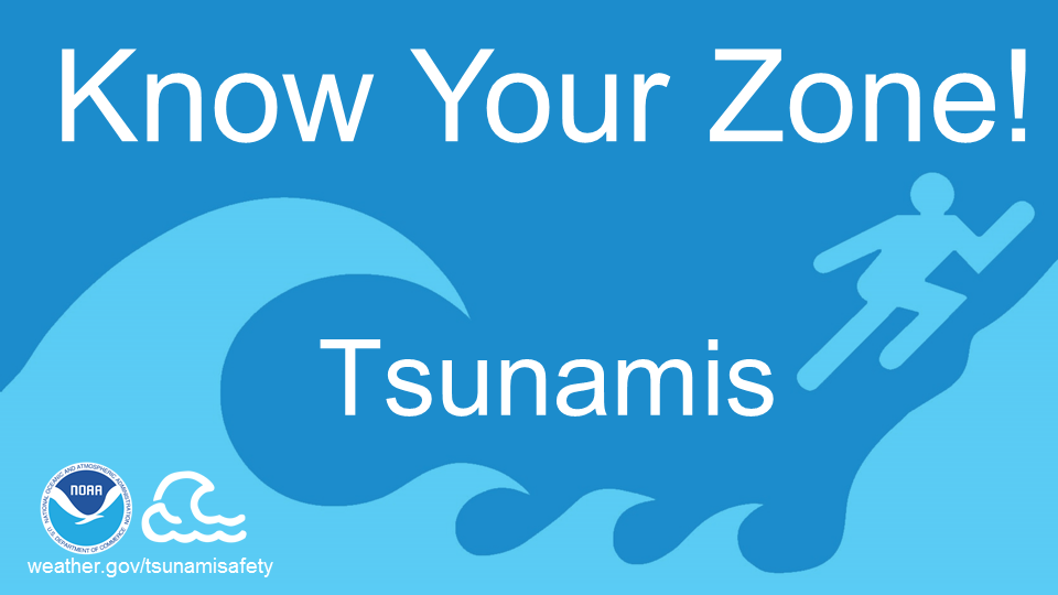
Do you live, work or play on the coast? Do you know your community’s tsunami risk? Your community may have identified and mapped tsunami hazard and evacuation zones. Find links to tsunami maps at https://nws.weather.gov/nthmp/maps.html or ask your local/state emergency management office or your local NWS forecast office for more info. #TsunamiPrep
Twitter
Live, work or play on the coast? Know your #tsunami risk & evacuation zones. https://nws.weather.gov/nthmp/maps.html #TsunamiPrep
|
Facebook
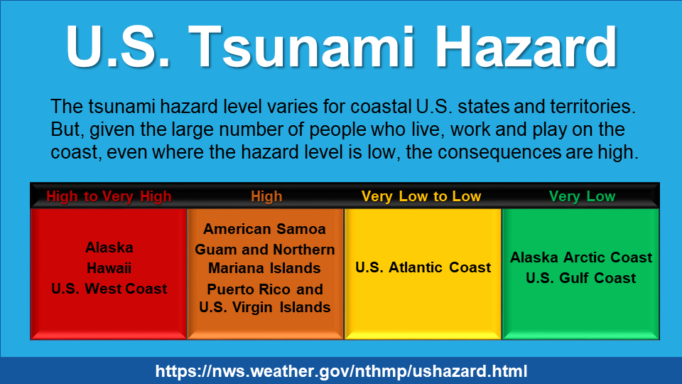
Did you know the tsunami hazard exists for all coastal U.S. states and territories? The hazard level varies, but given the large number of people who live, work and play on the coast, even where the hazard level is low, the consequences are high. Learn more about the hazard where you spend time: https://nws.weather.gov/nthmp/ushazard.html. #TsunamiPrep
Twitter
Could a #tsunami strike where you live, work or play? Find out: https://nws.weather.gov/nthmp/ushazard.html #TsunamiPrep
|
Facebook
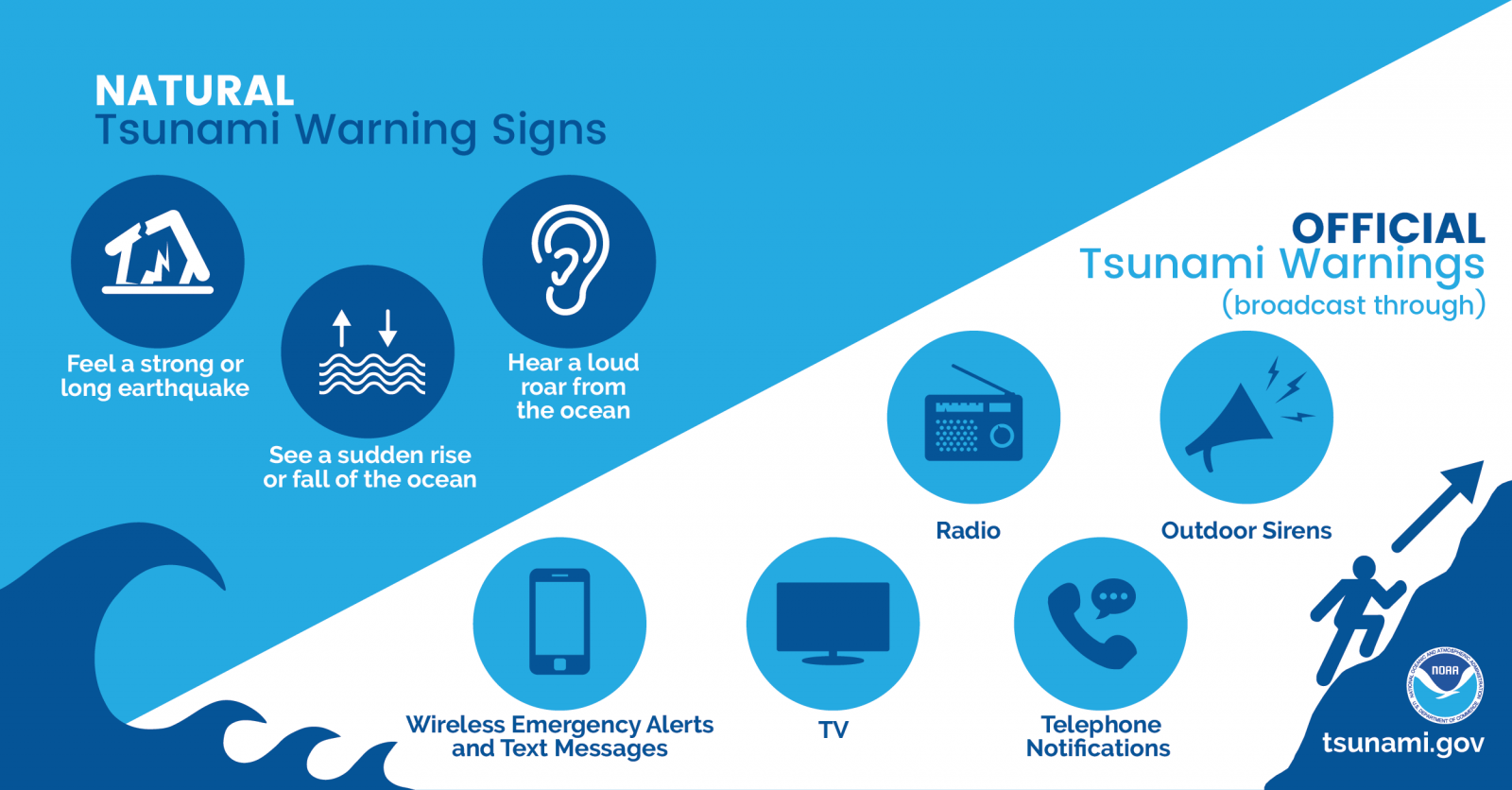
Official tsunami warnings are broadcast through local radio and tv, marine radio, wireless emergency alerts, NOAA Weather Radio and NOAA websites. They may also come through outdoor sirens, local officials, text message alerts and telephone notifications. Learn about the four levels of tsunami alerts for the U.S.: weather.gov/safety/tsunami-alerts. #TsunamiPrep
Twitter
#Tsunami warnings come from many sources: local radio & tv, NOAA Weather Radio, @NOAA websites & social media, etc. Learn about tsunami alerts: weather.gov/safety/tsunami-alerts #TsunamiPrep

|
Facebook
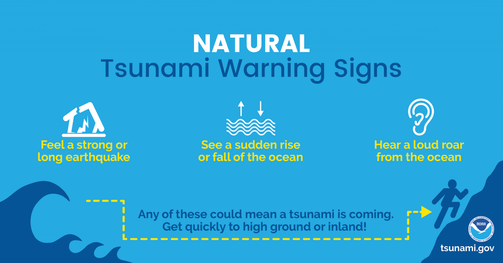
If a tsunami strikes, there may not be enough time for an official warning, so it is important to understand natural warnings. If you are at the coast and feel a strong or long earthquake, see a sudden rise or fall of the ocean, or hear a loud roar from the ocean, a tsunami may follow. Move quickly to high ground or inland, away from the water. weather.gov/safety/tsunami-before #TsunamiPrep
Twitter
Know nature's #tsunami warnings: strong or long quake, sudden ocean rise or fall, ocean roar. weather.gov/safety/tsunami-before #TsunamiPrep
|
Facebook
In the event of a tsunami, some tsunami warnings will be official, others will be natural. Both are equally important. Official tsunami warnings will tell you what to do. Get updates from local radio/tv or your mobile phone. Follow instructions from local officials. weather.gov/safety/tsunami-during #TsunamiPrep
Twitter
Both official & natural #tsunami warnings are important. Learn how to respond: weather.gov/safety/tsunami-during #TsunamiPrep
|
Facebook
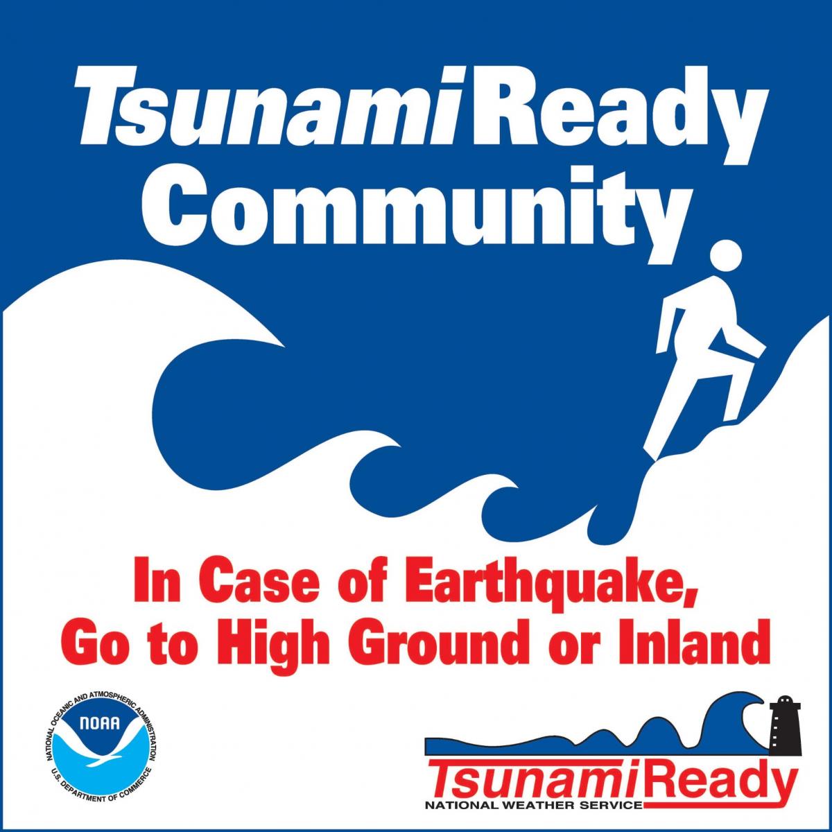
Communication and education are important parts of the tsunami warning system. Through NOAA’s TsunamiReady program, a voluntary community recognition program, the National Weather Service works with communities to help them minimize the risk posed by tsunamis. Areas of emphasis include risk assessment, planning, education, and warning communications. Becoming #TsunamiReady can improve public safety and reduce tsunami losses. Learn more: https://www.weather.gov/tsunamiready/ #TsunamiPrep
Twitter
Becoming #TsunamiReady can improve public safety & reduce #tsunami losses: https://www.weather.gov/tsunamiready/ #TsunamiPrep
|
Facebook
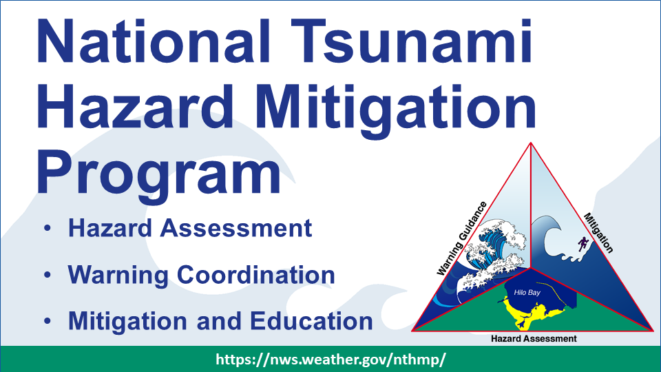
Led by NOAA, the National Tsunami Hazard Mitigation Program (NTHMP) works to protect lives and reduce economic losses from tsunamis at the community level. The #NTHMP includes NOAA, FEMA, the USGS, and 28 U.S. states/territories. Through collaboration, coordination, and support to partner states/territories, the NTHMP focuses on three key functions: hazard assessment, warning guidance, and mitigation. Learn more: https://nws.weather.gov/nthmp/index.html. #TsunamiPrep
Twitter
National Tsunami Hazard Mitigation Program aims to protect lives, reduce economic losses. https://nws.weather.gov/nthmp/index.html #TsunamiPrep #NTHMP
|
Facebook
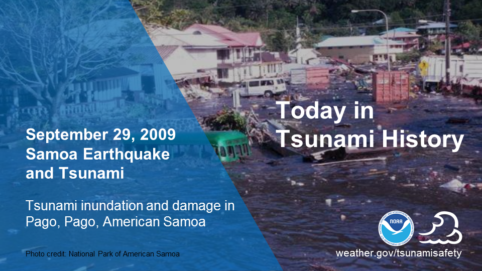
Preparedness saves lives! On September 29, 2009, a magnitude 8.1 earthquake generated a tsunami that took 192 lives and caused great destruction in Samoa, American Samoa and Tonga. While these losses were significant, the disaster could have been much worse. Due to American Samoa's ongoing tsunami preparedness outreach efforts, many lives were saved in the U.S. territory. If you live, work or play on the coast, learn what you can do to prepare for a tsunami from the National Weather Service’s Tsunami Program at weather.gov/tsunamisafety. #TsunamiPrep
Twitter
9/29/2009: #Tsunami killed 192, brought destruction to Samoa, American Samoa & Tonga. Knowledge saved lives! weather.gov/tsunamisafety
|
Facebook
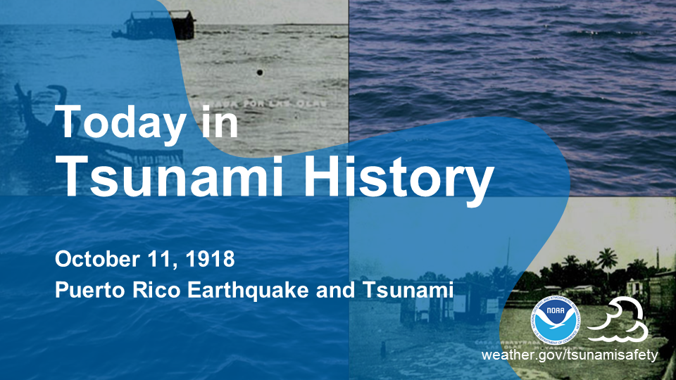
100 years ago today, on October 11, 1918, a tsunami set in motion by an earthquake-generated submarine landslide struck the western and northern coasts of Puerto Rico. Damage from the earthquake and tsunami approximated $62 million (2017 dollars), and at least 140 lives were lost. Today, the National Weather Service works with Puerto Rico's at-risk communities to help them prepare for future tsunamis. weather.gov/tsunamiready #TsunamiPrep
Twitter
100 yrs ago today, 10/11/1918, the Puerto Rico earthquake & #tsunami caused 140+ deaths & ~$62 million in damage. @NWS is helping Puerto Rico prepare for future tsunamis: weather.gov/tsunamiready
|
Facebook
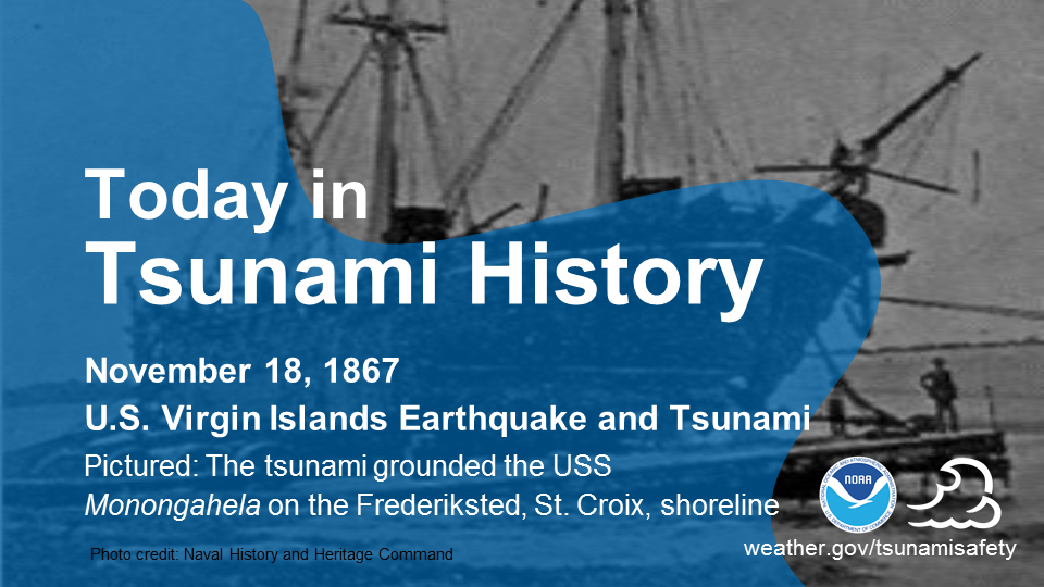
On November 18, 1867, less than a month after a deadly hurricane struck the region, a magnitude 7.5 earthquake generated the most destructive and deadly tsunami in U.S. Virgin Islands recorded history. The first waves reached the shore within about 15 minutes. Since warning time may be limited, like in this event, it’s important to understand natural warnings and how to respond to them: www.weather.gov/safety/tsunami-before #TsunamiPrep
Twitter
November 18, 1867, US Virgin Islands' worst #tsunami. Waves arrived within ~15 minutes. Understand natural warnings & how to respond: www.weather.gov/safety/tsunami-before
|

