
A heat wave over the Southwest will intensify this week, peaking and expanding into the Intermountain West and northern High Plains this weekend. Critical to extremely critical fire weather conditions are forecast from the Northwest and the northern Great Basin this weekend. Particularly Dangerous Situation Red Flag Warnings have been issued. Read More >
Memphis
Center Weather Service Unit
 |
AREA 1 |
AREA 2 |
AREA 3 |
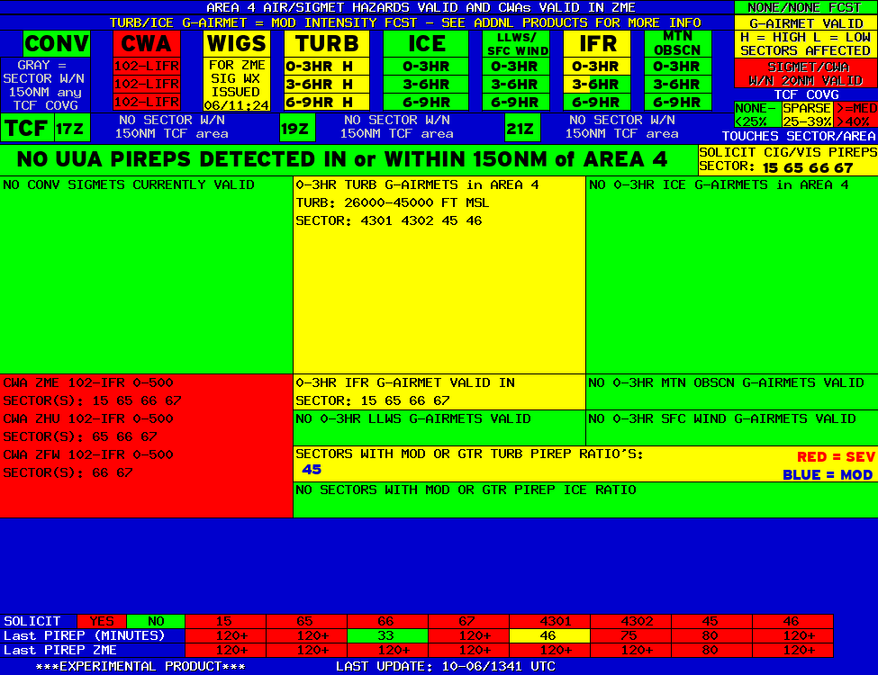
AREA 4 |
AREA 5 |
AREA 6 |
|
|
|
|
|
 |
 |
 |

|
|
|
|
|
|
 |
 |
 |

|
|
Lo Sectors Hi Sectors UH Sectors TRACONs Icing: Lo Sectors Hi Sectors UH Sectors TRACONs CIG/VIS: METARs By Sector TRACONs PIREPs: |
|
Plotted Pireps are updated every 5 minutes, for all flight levels and include Pireps from 2 hours previous.
Click on the PIREP icons to get more information.
The map is displaying PIREPs using the following icons:
|
|
|
|
|
US Dept of Commerce
National Oceanic and Atmospheric Administration
National Weather Service
Memphis
3229 Democrat Road
Memphis, TN 38118
Comments? Questions? Please Contact Us.


