National Weather Service United States Department of Commerce

McCrary Creek EF-1 Magby Creek EF-1 Luxapallila Creek EF-1 Barron Creek EF-1 Boley Springs EF-0 Spunky Hollow Road EF-1 Beauregard EF-0

Severe Weather on March 31, 2016

Event Summary for Central Alabama

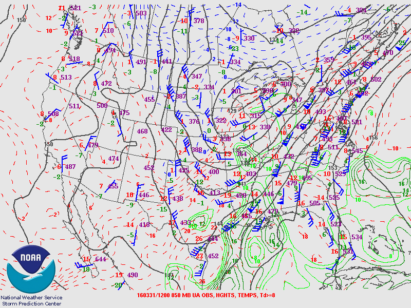
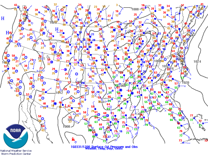
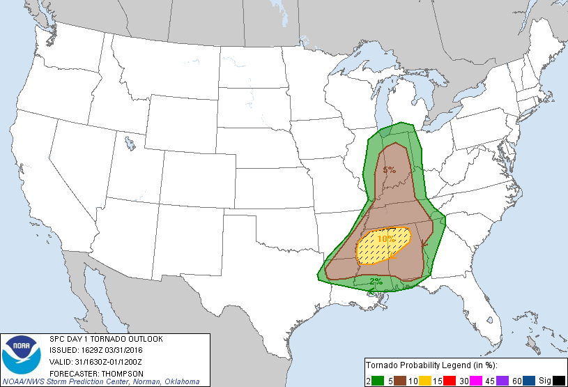
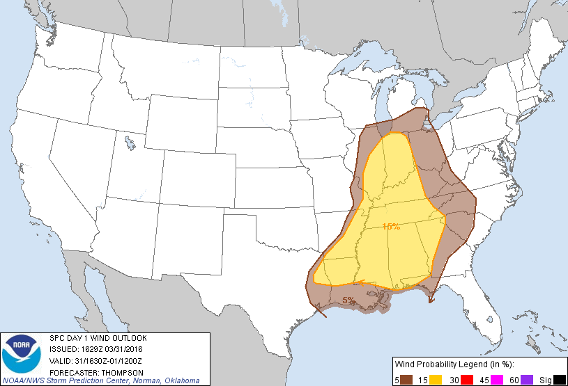
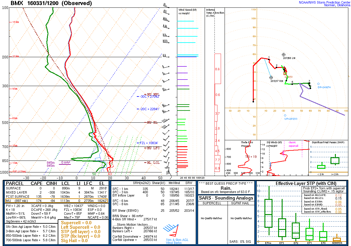
Widespread rain moved through Alabama during the morning hours on March 31st, 2016. In its wake, rain-free conditions were in place through late afternoon. Southerly flow and cloud breaks allowed for surface temperatures to rise into the mid-to-upper 70Fs. With dew points in the mid-to-upper 60Fs, surface-based CAPE values just over 1,000 J/kg were realized.

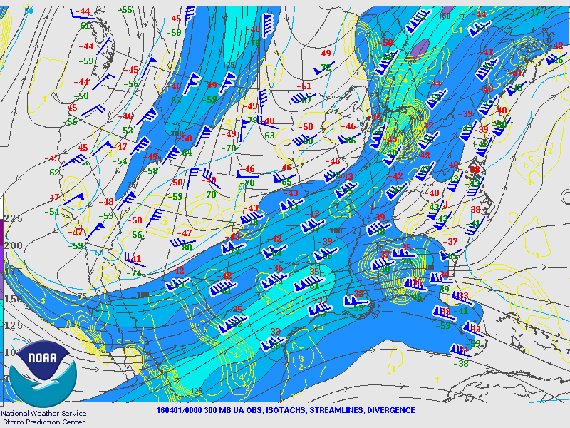
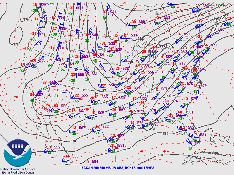
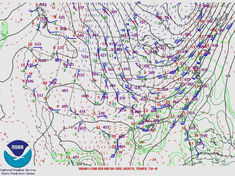
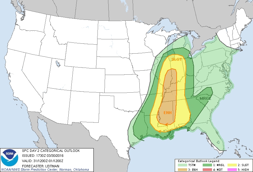
Upper-level winds became stronger as an upstream maximum moved in during the afternoon, increasing bulk shear values to around 50 knots. With improving shear profiles, combined with climbing instability values, the atmosphere became conducive for severe thunderstorms. Shear vectors were also favorable for supercell storms.

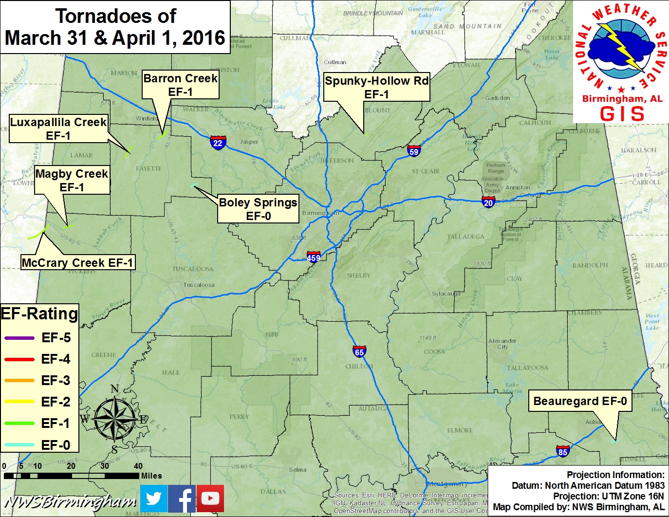
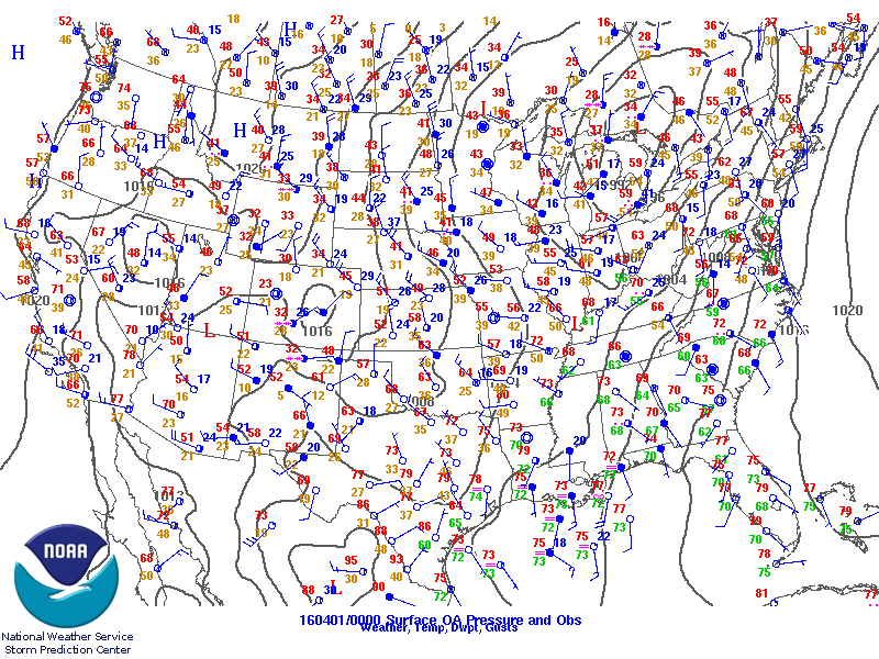
Thunderstorms began forming across Mississippi by mid-afternoon, spreading east into western Alabama by early-evening. A mix of supercells, storm clusters, and bowing segments were observed through the duration of the event. A total of 7 tornadoes touched down, of which included 4 EF-1s and 3 EF-0s.


The information contained below is the individual tornado events that occurred. The data is PRELIMINARY and may be subject to change.


Location/Clickable Detailed Summary Link
Damage Rating/Estimated Maximum Wind Speeds
Injuries/Fatalities
Damage Path Length/Width
Starting Point/Time
Ending Point/Time
McCrary Creek Tornado
(Pickens County)
EF-1
100 mph
None
2.08 miles
500 yards

2.4 NW Stafford
33.4601/-88.2836
632 pm

2.8 NNW Stafford
33.4843/-88.2628
637 pm
Magby Creek Tornado
(Pickens County)
EF-1
95 mph
None
2.88 miles
425 yards

3.9 NNE Ethelsville
33.4674/-88.1877
643 pm

6.1 NE Ethelsville
33.4775/-88.1395
648 pm
Luxapallila Creek Tornado
(Fayette County)
EF-1
105 mph
None
3.72 miles
650 yards

3.7 SE Bluff
33.7762/-87.8708
703 pm

3.8 E Bluff
33.8233/-87.8403
713 pm
Barron Creek Tornado
(Fayette County)
EF-1
88 mph
None
3.70 miles
500 yards

2.9 NE Hubbertville
33.8558/-87.7001
727 pm

3 SW Eldridge
33.8924/-87.6545
735 pm
Boley Springs Tornado
(Fayette County)
EF-0
70 mph
None
1.88 miles
400 yards

1.2 NW Boley Springs
33.6510/-87.5288
805 pm

1.6 NNE Boley Springs
33.6644/-87.5004
809 pm
Spunky Hollow Rd Tornado
(Blount County)
EF-1
90 mph
None
0.32 miles
275 yards

2.1 S Locust Fork
33.8767/-86.6247
942 pm

1.8 S Locust Fork
33.8801/-86.6210
944 pm
Beauregard Tornado
(Lee County)
EF-0
70 mph
None
2.09 miles
50 yards

0.7 S Beauregard
32.5338/-85.3794
1219 am Apr 1

1.8 E Beauregard
32.5444/-85.3416
1223 am Apr 1
          

Pertinent Geographic Information Systems (GIS) Data from this Event


Severe Weather Episode Data 

300 mb
300 mb Analysis
March 31 at 7 am

300 mb
300 mb Analysis
March 31 at 7 pm

300 mb
300 mb Analysis
  April 1at 7 am

500 mb
500 mb Analysis
March 31 at 7 am

500 mb
500 mb Analysis
March 31 at 7 pm

500 mb
500 mb Analysis
  April 1at 7 am

850 mb
850 mb Analysis
March 31 at 7 am

850 mb
850 mb Analysis
March 31 at 7 pm

850 mb
850 mb Analysis
April 1 at 7 am

sfc
Surface Analysis
March 31 at 7 am

sfc
Surface Analysis
March 31 at 7 pm

sfc
Surface Analysis
April 1 at 7 am

Day 1
Day 1 Outlook
Issued March 31 at 1130 am

sfc
Day 2 Outlook
Issued March 30 at 1230 am

sfc
Day 3 Outlook
Issued March 29 at 230 am


Day 1 Tornado Probabilities
Issued March 31 at 1130 am

sfc
Day 1 Wind Damage Probabilities
Issued March 31 at 1130 am

sfc
Day 1 Hail Probabilities
Issued March 31 at 1130 am

Sounding
KBMX Sounding
  7 am March 31

Sounding
KBMX Sounding
  2 pm March 31

Sounding
KBMX Sounding
7 pm March 31


Storm Reports
March 31

Storm Reports
Rainfall Plot
March 31

Storm Reports
Rainfall Plot
  April 1