
A strong atmospheric river will bring prolonged heavy rainfall along with gusty winds to the Pacific Northwest through much of this week. The heavy rainfall may lead to widespread urban and river flooding. Accumulating snow is expected over parts of the central Appalachians and Mid-Atlantic today as well as the Upper Midwest and the Upper Great Lakes this evening into Tuesday. Read More >
Overview
|
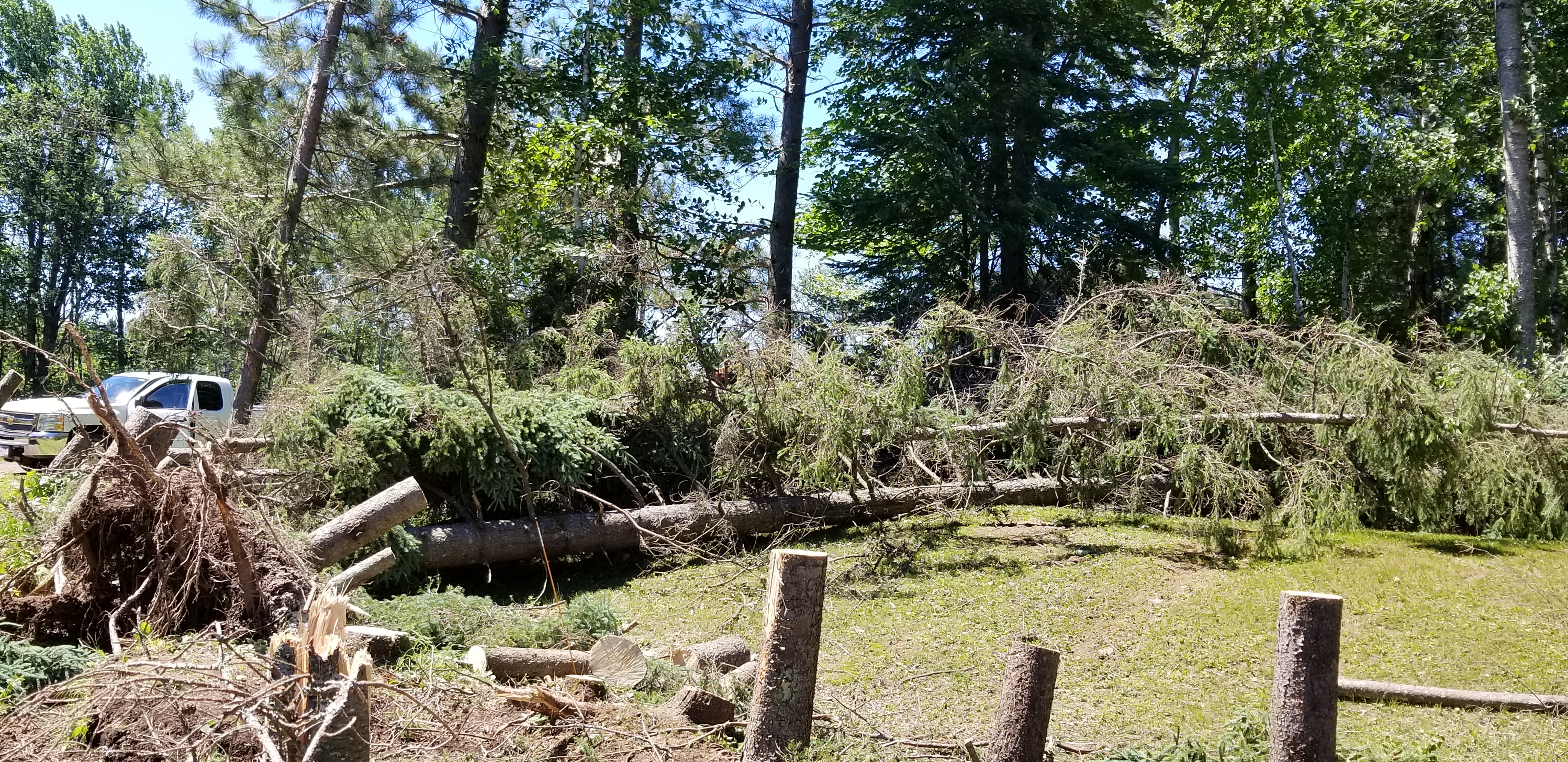
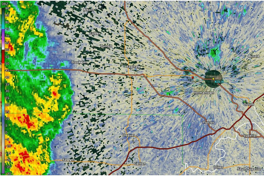
To say it was a bit windy the morning of July 4th is an understatement for a Hermantown, Minnesota, family. A very small area of intense winds, called a microburst, took down numerous trees at the family's home at about 9:30 am July 4th. The National Weather Service estimates that the winds were in the 80 to 90 mile an hour range. There was very little damage outside of the property, which is estimated to be about 50 yards wide and 100 yards deep. The family home's roof was damaged by falling trees and the wind. The family and their dogs were in the home when the storm hit. They sheltered in the basement. The homeowner said there was very little rain and no thunder before, during and after the winds hit. The wind damage area is only 3 miles west-southwest of the National Weather Service office and the airport. The wind sensor at the Duluth airport reported a peak wind of 34 mph. |
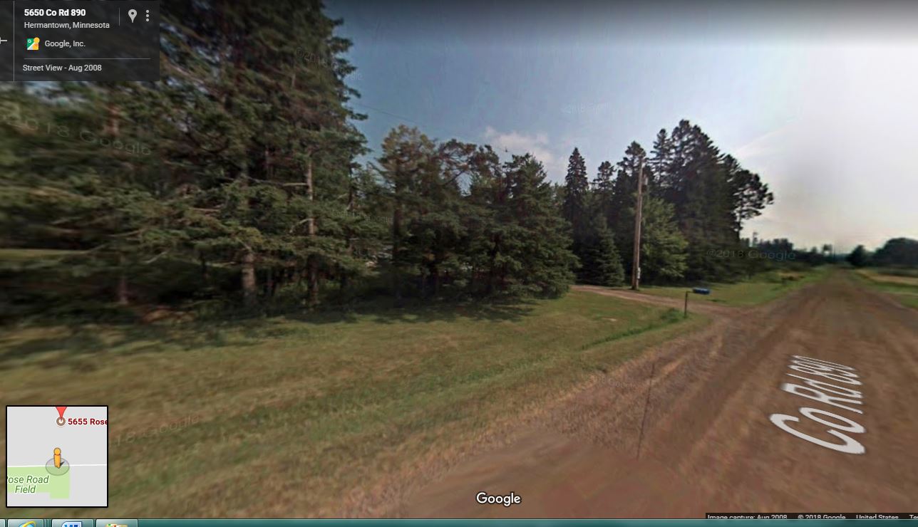 Many of the trees that lined this road in Hermantown are gone after a morning Forth of July storm blew through. Photo via Google Maps |
Wind Damage
 |
 |
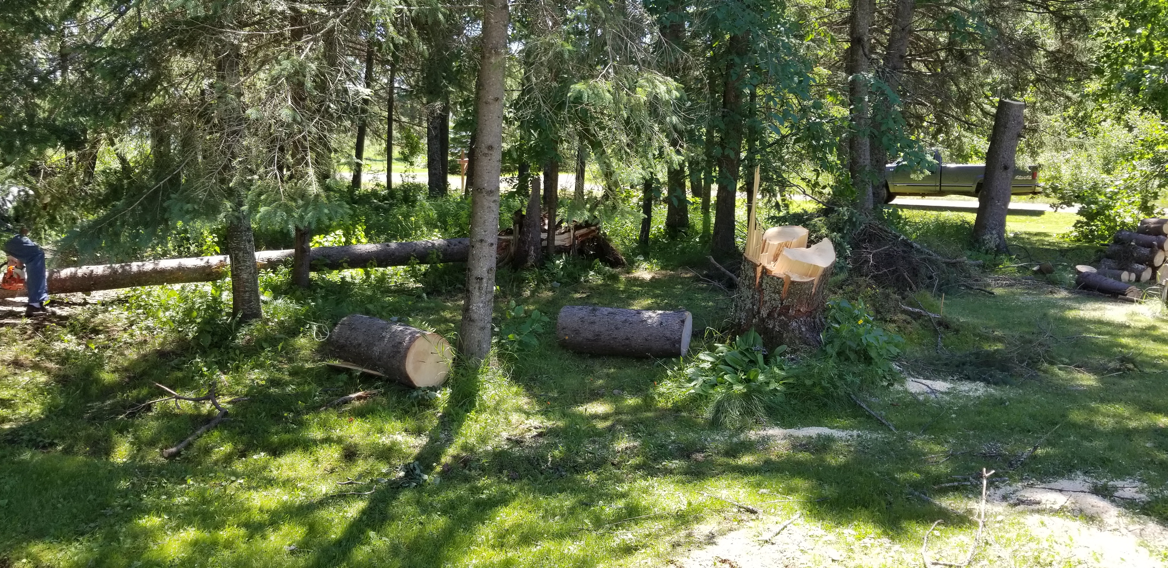 |
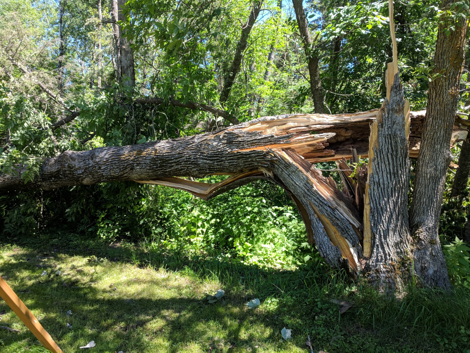
| Large spruce were snapped and uprooted. | Large tree snapped near the base. | Clean up was well under way when the NWS arrived. |
Radar
 |
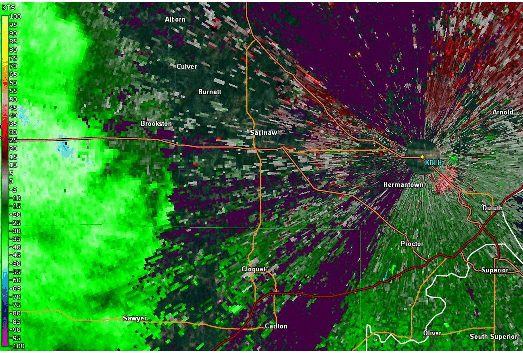 |
| Animated RADAR reflectivity from about 9:05 am to 940 am July 4th, 2018. The small red square near the radar is the damage location. | Animated RADAR base velocity from 9:05 am to 940 am July 4th, 2018. Green colors correspond to winds blowing toward the radar (KDLH) and red are winds blowing away from the radar. The legend to the left is in knots. |
 |
Media use of NWS Web News Stories is encouraged! Please acknowledge the NWS as the source of any news information accessed from this site. |
|

