
A strong atmospheric river moving into northern California later Tuesday will bring a threat for moderate to heavy rainfall and flooding, gusty to high winds, and mountain snows for parts of the Northwest U.S. through at least Wednesday. Gusty winds and isolated rain and snow showers will continue in the Northeast U.S. Tuesday behind a cold front. Read More >
Overview
|
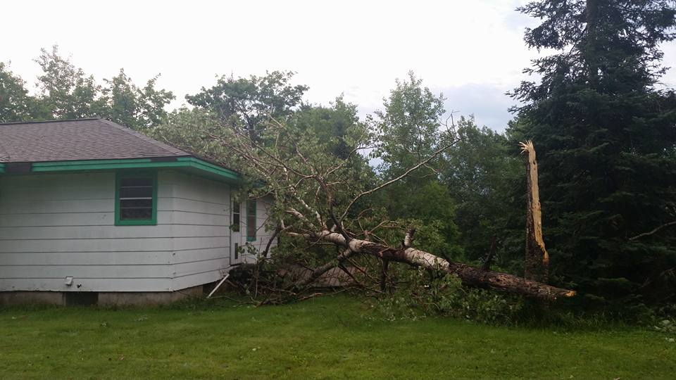
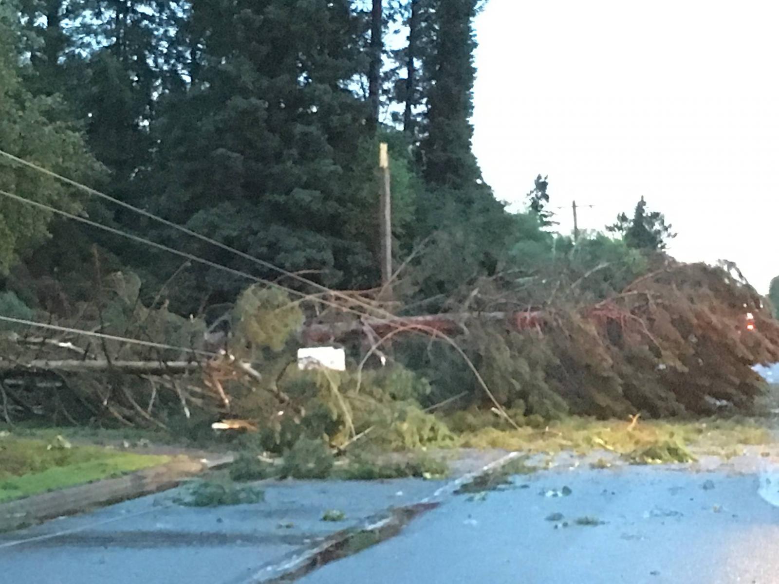
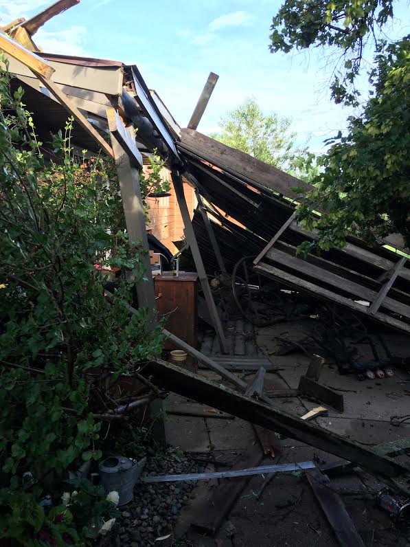
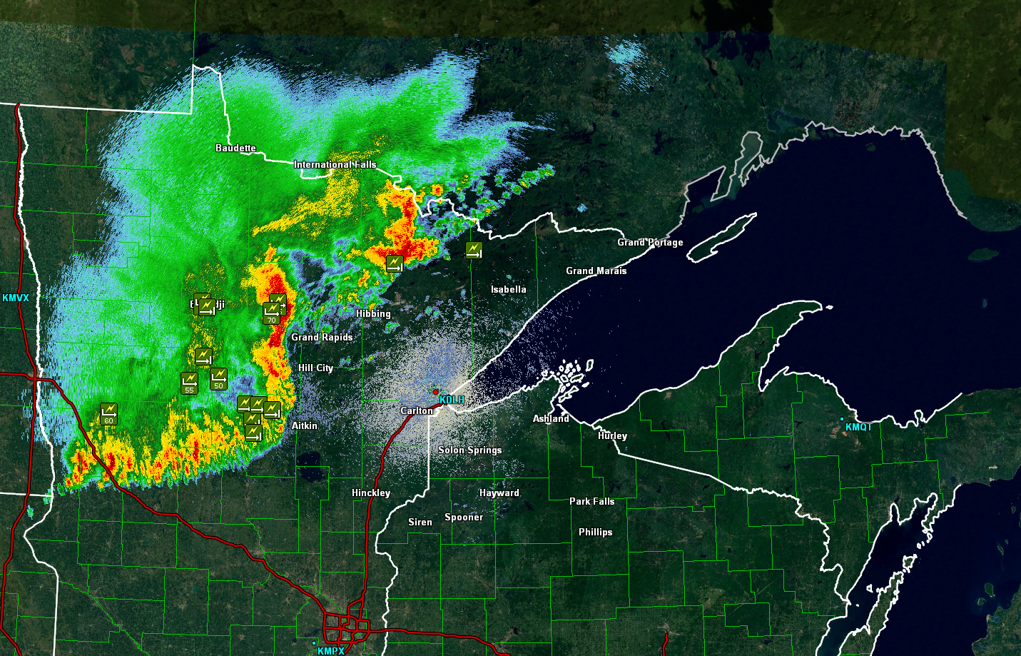
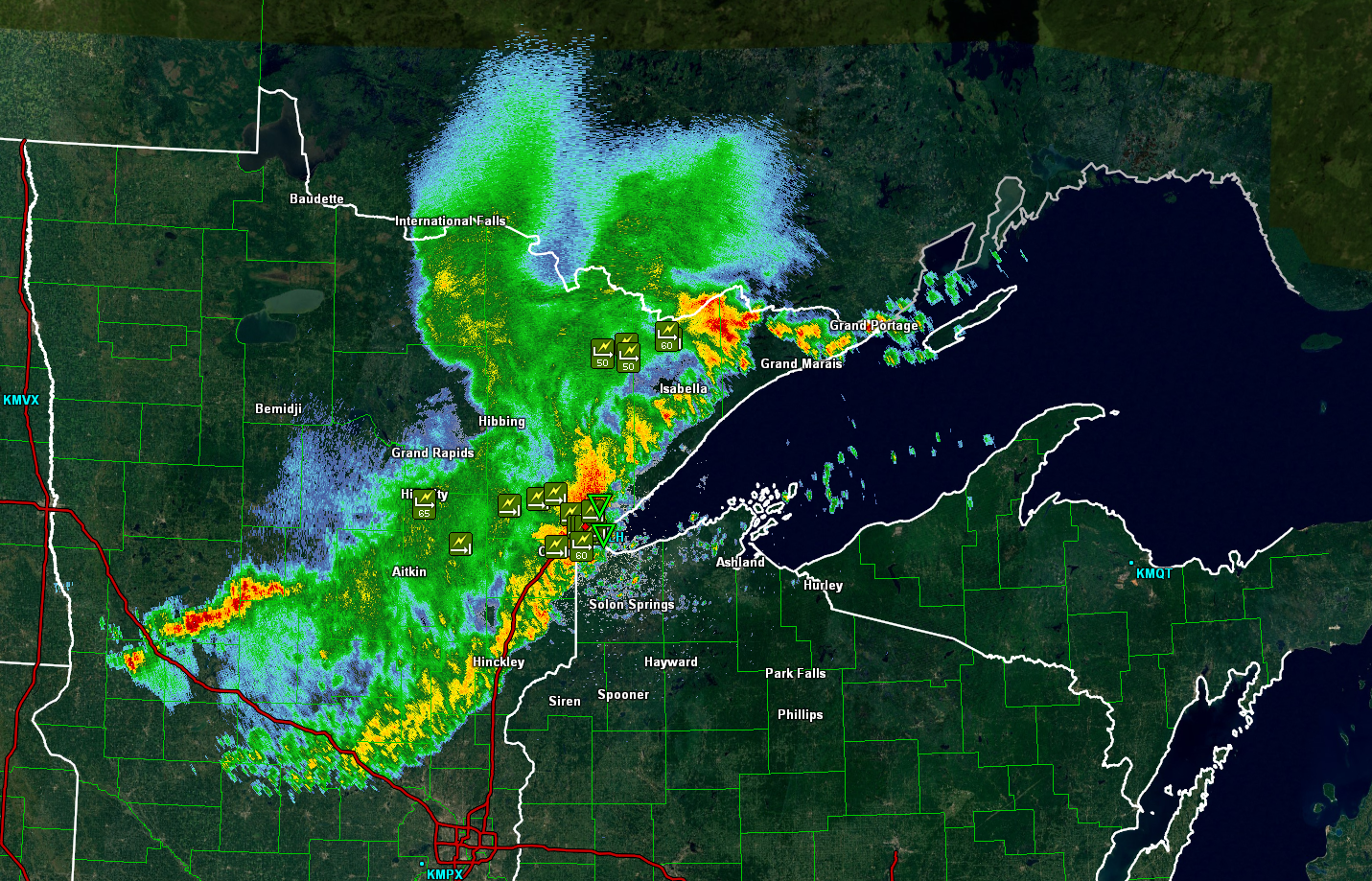
More widespread wind damage accompanied a long line of storms last night. The storms entered northeastern Minnesota late evening of July 20th and exited into eastern Wisconsin after 5:00 am the 21st. Damage was reported from the Canadian border to the Brainerd Lakes area and east across northern Wisconsin. There are reports of tress down and power outages across much of the Northland. Initial damage assessments indicate that the areas worst hit include the Winton area, the Duluth area, Aitkin and Hill City. High winds also hit Ely, MN, and areas in northwestern Wisconsin, including the Hayward and Washburn areas. Power has been out to a large part of the Duluth area. According to Minnesota Power, some areas may be without power over the weekend. Winds were measured at 100 mph in downtown Duluth and measured at 103 mph in the ship canal by a 700 foot freighter.
|
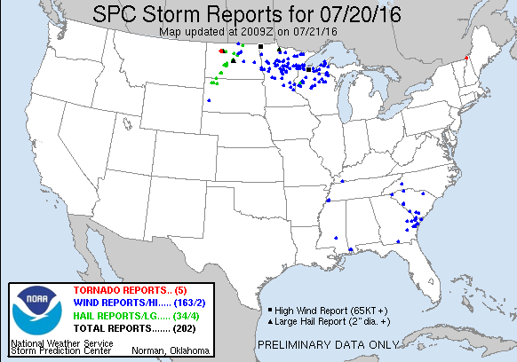 SPC Storm Reports |
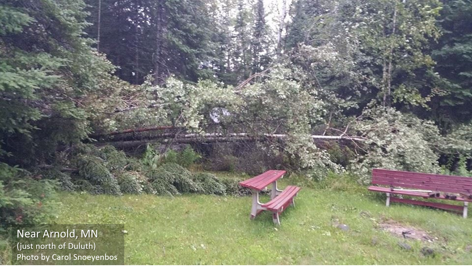
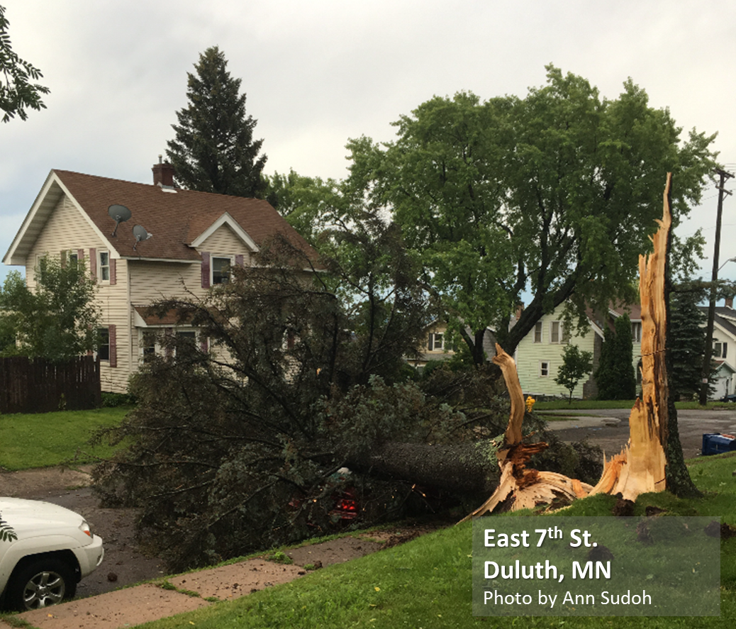
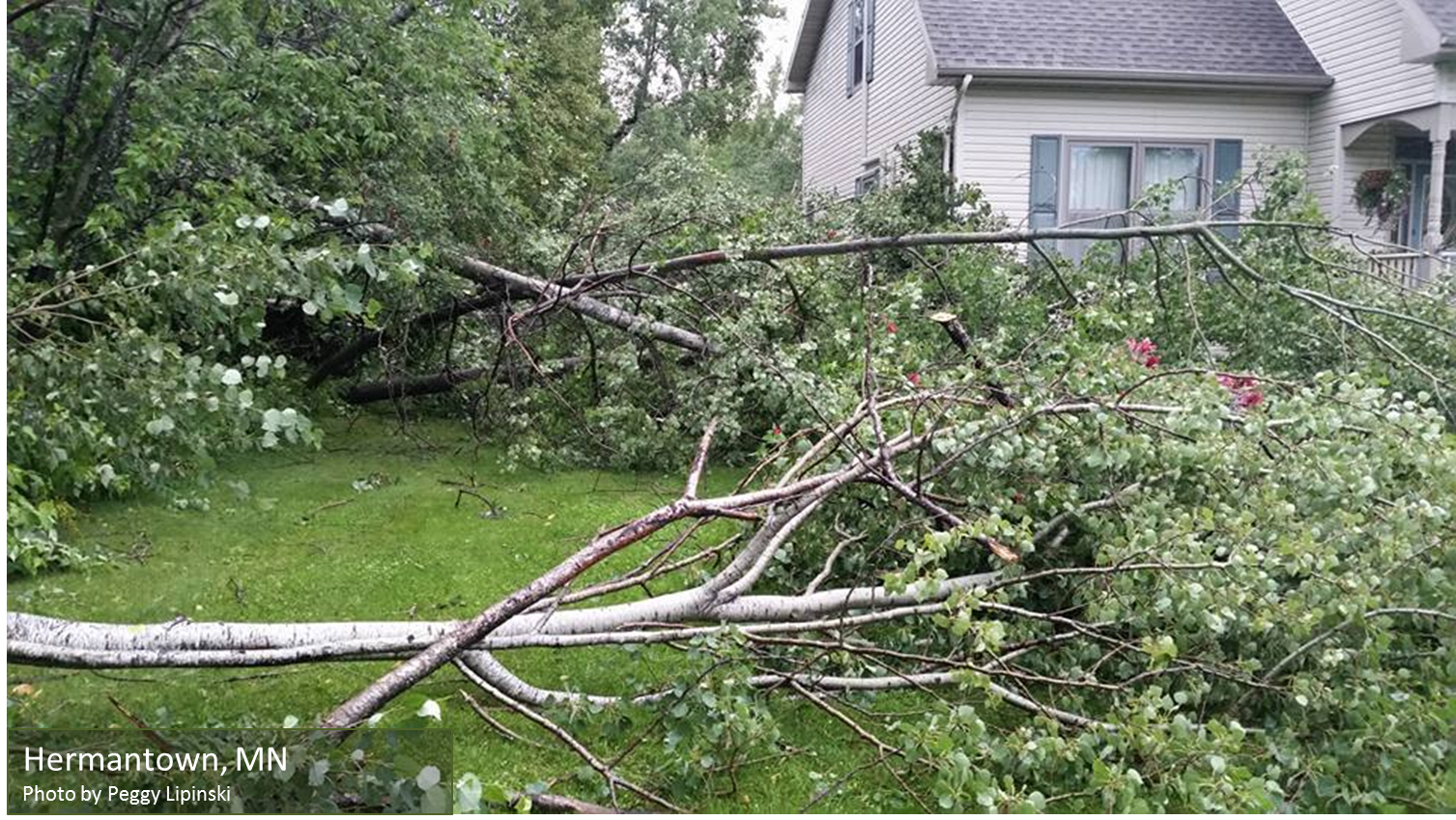
Photos:
 |
 |
 |
 |
| Near Arnold, MN |
Duluth |
Hermantown |
Caribou Lake |
 |
.jpg) |
 |
 |
| Near Tower, MN |
Near Hill City, MN |
Duluth Martin Road |
Aitkin Area (Aitkin PD) |
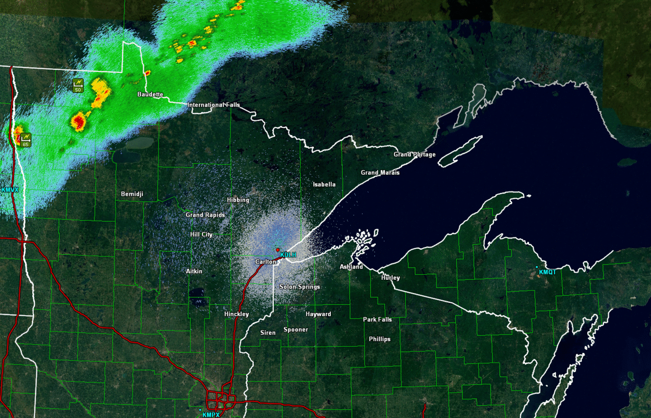
Radar:
 |
 |
 |
| Animated gif of radar Frame every 30 minutes from about 10 pm to 5 am |
1 am Radar | 2:30 am radar |
Storm Reports
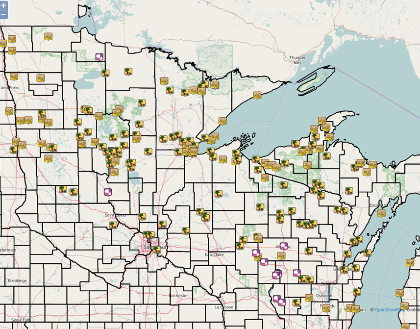 |
| Another report map Click here for interactive website |
What we have so far:
Public Information Statement
National Weather Service Duluth MN
1134 AM CDT Thu Jul 21 2016

...Here are the Strongest Measured Wind Gust Reports from the Storms
Early this Morning Across the Northland...

Location                     Speed     Time/Date       Lat/Lon
Ashland Airport              75 MPH    0429 AM 07/21   46.55N/90.92W
Duluth Airport               69 MPH    0327 AM 07/21   46.84N/92.21W
1 S Hill City                65 MPH    0307 AM 07/21   46.96N/93.60W
Fernberg Raws                62 MPH    0313 AM 07/21   47.95N/91.50W
Cass Lake DNR                61 MPH    0201 AM 07/21   47.38N/94.61W
2 SW Proctor                 61 MPH    0335 AM 07/21   46.72N/92.25W
Sky Harbor Airport           59 MPH    0353 AM 07/21   46.72N/92.04W
Washburn RAWS                59 MPH    0502 AM 07/21   46.64N/91.20W
5 SE Breezy Point            55 MPH    0203 AM 07/21   46.55N/94.17W
5 S Ely                      53 MPH    0304 AM 07/21   47.83N/91.84W
Grand Rapids Airport         53 MPH    0225 AM 07/21   47.22N/93.52W
Hinckley Airport             52 MPH    0333 AM 07/21   46.02N/92.89W
3 SW Orr                     52 MPH    0208 AM 07/21   48.02N/92.85W
Duluth RWIS                  48 MPH    0318 AM 07/21   46.77N/92.11W
4 S Emily                    47 MPH    0211 AM 07/21   46.69N/93.95W
6 WSW Ino                    46 MPH    0400 AM 07/21   46.50N/91.30W
Northome                     46 MPH    1256 AM 07/21   47.88N/94.25W
Rice Lake N.W.R.             46 MPH    0252 AM 07/21   46.54N/93.29W
5 E Seagull Lake             45 MPH    0404 AM 07/21   48.12N/90.84W
Chisholm-Hibbing Airport     45 MPH    0229 AM 07/21   47.39N/92.84W
Brainerd Airport             44 MPH    0158 AM 07/21   46.40N/94.13W
Superior Airport             44 MPH    0355 AM 07/21   46.69N/92.09W
Siren                        43 MPH    0415 AM 07/21   45.82N/92.37W
5 E Hibbing                  43 MPH    0307 AM 07/21   47.39N/92.83W
2 NNE Bigfork                43 MPH    0207 AM 07/21   47.78N/93.65W
Orr                          43 MPH    0153 AM 07/21   48.02N/92.87W
11 SSE Brule                 43 MPH    0506 AM 07/21   46.40N/91.50W
Lake Winnibigoshish          43 MPH    0200 AM 07/21   47.43N/94.05W
Makinen                      42 MPH    0330 AM 07/21   47.36N/92.36W
Silver Bay Marine            41 MPH    0400 AM 07/21   47.28N/91.26W
1 NNW Superior               40 MPH    0350 AM 07/21   46.72N/92.07W
McGregor Airport             40 MPH    0254 AM 07/21   46.62N/93.31W
7 E Effie                    39 MPH    0115 AM 07/21   47.84N/93.49W
Pine River Airport           39 MPH    0146 AM 07/21   46.73N/94.38W
2 WSW Wentworth              39 MPH    0404 AM 07/21   46.58N/91.89W
Cloquet                      38 MPH    0328 AM 07/21   46.70N/92.50W
2 WSW Castle Danger          38 MPH    0405 AM 07/21   47.09N/91.55W
2 S Chisholm                 38 MPH    0305 AM 07/21   47.45N/92.89W
3 NE Randall                 38 MPH    0406 AM 07/21   45.74N/92.80W
3 ENE Margie                 38 MPH    1236 AM 07/21   48.13N/93.88W
Eveleth-Virginia Airport     38 MPH    0253 AM 07/21   47.42N/92.50W
1 SW Saginaw                 38 MPH    0408 AM 07/21   46.84N/92.46W
12 ENE Fifield               37 MPH    0547 AM 07/21   45.93N/90.18W
8 SE French River            36 MPH    0400 AM 07/21   46.80N/91.80W
Bigfork                      36 MPH    0232 AM 07/21   47.78N/93.65W
1 WSW Maple                  33 MPH    0402 AM 07/21   46.58N/91.75W
Two Harbors                  33 MPH    0354 AM 07/21   47.05N/91.75W
7 WNW Minong                 33 MPH    0503 AM 07/21   46.14N/91.98W
International Falls          33 MPH    0119 AM 07/21   48.57N/93.40W
3 ENE South Range            33 MPH    0401 AM 07/21   46.64N/91.92W
Littlefork RAWS              33 MPH    0108 AM 07/21   48.39N/93.56W
Hayward RAWS                 32 MPH    0503 AM 07/21   46.02N/91.45W
Robinson                     32 MPH    0235 AM 07/21   47.85N/92.05W
Grand Marais Airport         31 MPH    0414 AM 07/21   47.75N/90.34W
13 NE Clear Lake             31 MPH    0339 AM 07/21   47.80N/90.95W
Walker                       31 MPH    0136 AM 07/21   47.09N/94.58W
1 NE Duluth                  31 MPH    0400 AM 07/21   46.80N/92.10W
4 W Grand Portage            30 MPH    0444 AM 07/21   47.95N/89.78W
1 N Knife River              30 MPH    0417 AM 07/21   46.97N/91.78W
16 E Buyck                   30 MPH    0304 AM 07/21   48.12N/92.16W
Hayward Airport              30 MPH    0438 AM 07/21   46.03N/91.44W
3 W Clam Lake                30 MPH    1049 AM 07/21   46.17N/90.98W
Aitkin Airport               30 MPH    0253 AM 07/21   46.55N/93.68W
The Bay Of Grand Marais      30 MPH    0447 AM 07/21   47.75N/90.34W

Observations are collected from a variety of sources with varying
equipment and exposures. Not all data listed are considered official.
 |
Media use of NWS Web News Stories is encouraged! Please acknowledge the NWS as the source of any news information accessed from this site. |
|

