
Severe thunderstorms and excessive rainfall threats continue in the Southeast through Friday. Heavy snow will continue over the higher elevations of the Central Rockies. A storm system moving over Hawaii will bring strong to severe thunderstorms, localized intense rainfall and flash flooding through Saturday. Above average high temperatures expected in California and the Pacific Northwest. Read More >
| Parker County Tornado Climatology Page 1880-Present |
| Click here to return to the North & Central TX Tornado Climatology mainpage |
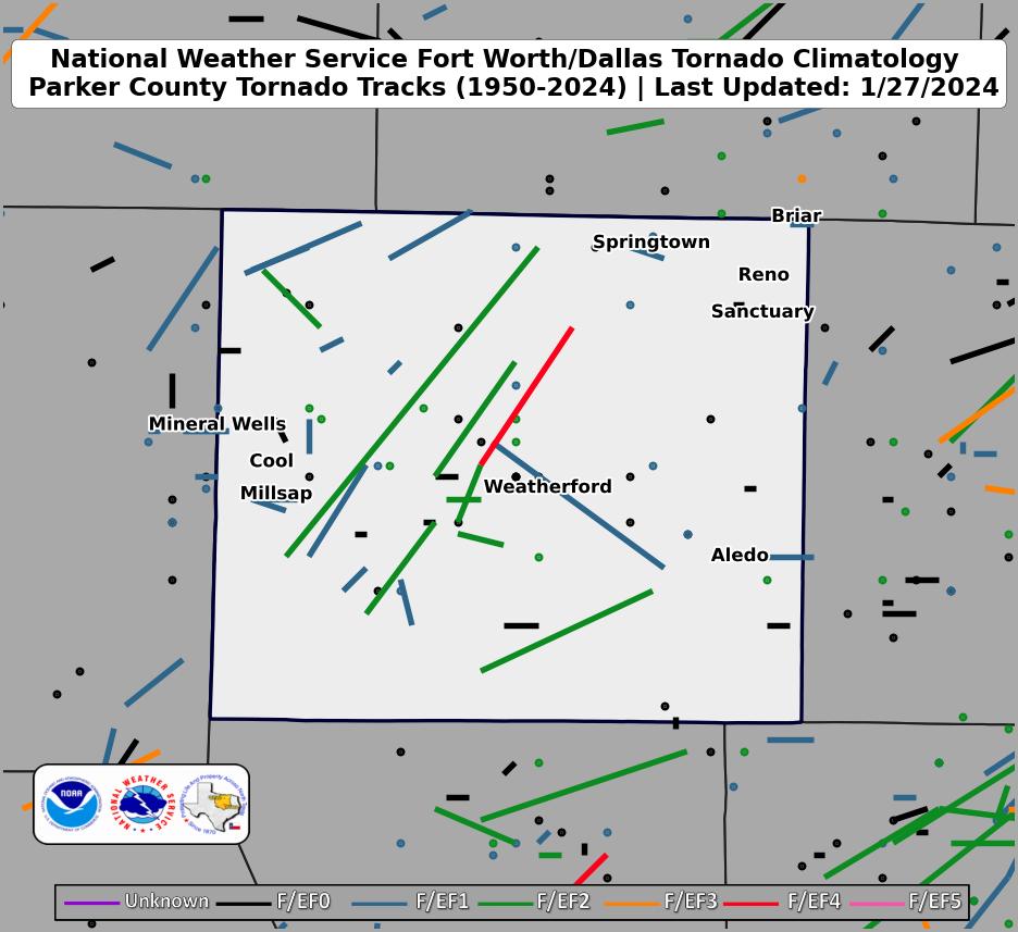 |
| Click map for larger image |
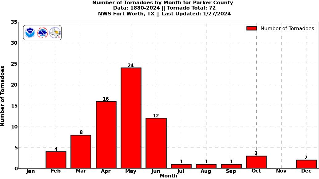
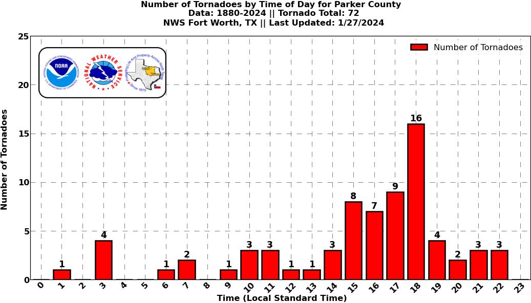
Parker County Graphical Tornado Data |
Tornadoes in Parker Co. by Year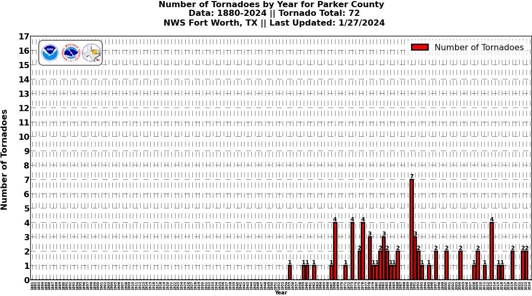 Click image for larger figure |
Tornadoes in Parker Co.
|
Tornadoes in Parker Co.
|
Tornadoes in Parker Co.
|
Tornadoes in Parker Co.
|


 Follow us on YouTube