In the north-central U.S., a strong storm will continue to bring heavy snow and gusty to high winds over parts of the northern Plains and Upper Midwest tonight before moving across the Great Lakes with heavy lake effect snow Wednesday into Thanksgiving Day. Read More >
Fort Worth/Dallas, TX
Weather Forecast Office
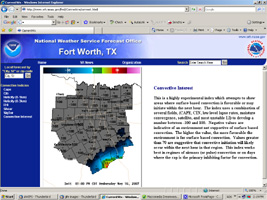
Experimental Convective Parameters For North Texas
| The National Weather Service in Fort Worth is now offering Experimental Convective Parameters on this website!
The analysis is computed using surface observation data and the latest RUC model for all upper level data. This is different from the SPC mesoanalysis web page, because no model analysis is used for the surface fields. This means our analysis is heavily weighted to the latest surface observation. Thus, some small "bulls-eye" type areas may occur if a surface observation is outlying or incorrect. Bad observations are periodically quality controlled by forecasters and removed. The advantage to this technique is that our convective parameters will have a higher resolution and be capable of rapid adjustments if the atmosphere is rapidly changing. The parameters are generated hourly, with the generation process starting around 15 minutes past the hour. The images should be available by 20 past each hour. We are currently producing the following images: |
|
Current Hazards
National Outlooks
Tropical
Local Storm Reports
Storm Reports (Graphical)
Submit Storm Report
Tornado Warnings
Severe Thunderstorm Warnings
Flash Flood Warnings
Forecasts
Forecast Discussion
Graphical Forecast
Aviation Forecasts
Fire Weather
Hazard Planner
N. Texas Convective Parameters
US Dept of Commerce
National Oceanic and Atmospheric Administration
National Weather Service
Fort Worth/Dallas, TX
3401 Northern Cross Blvd.
Fort Worth, TX 76137
817.429.2631
Comments? Questions? Please Contact Us.


